
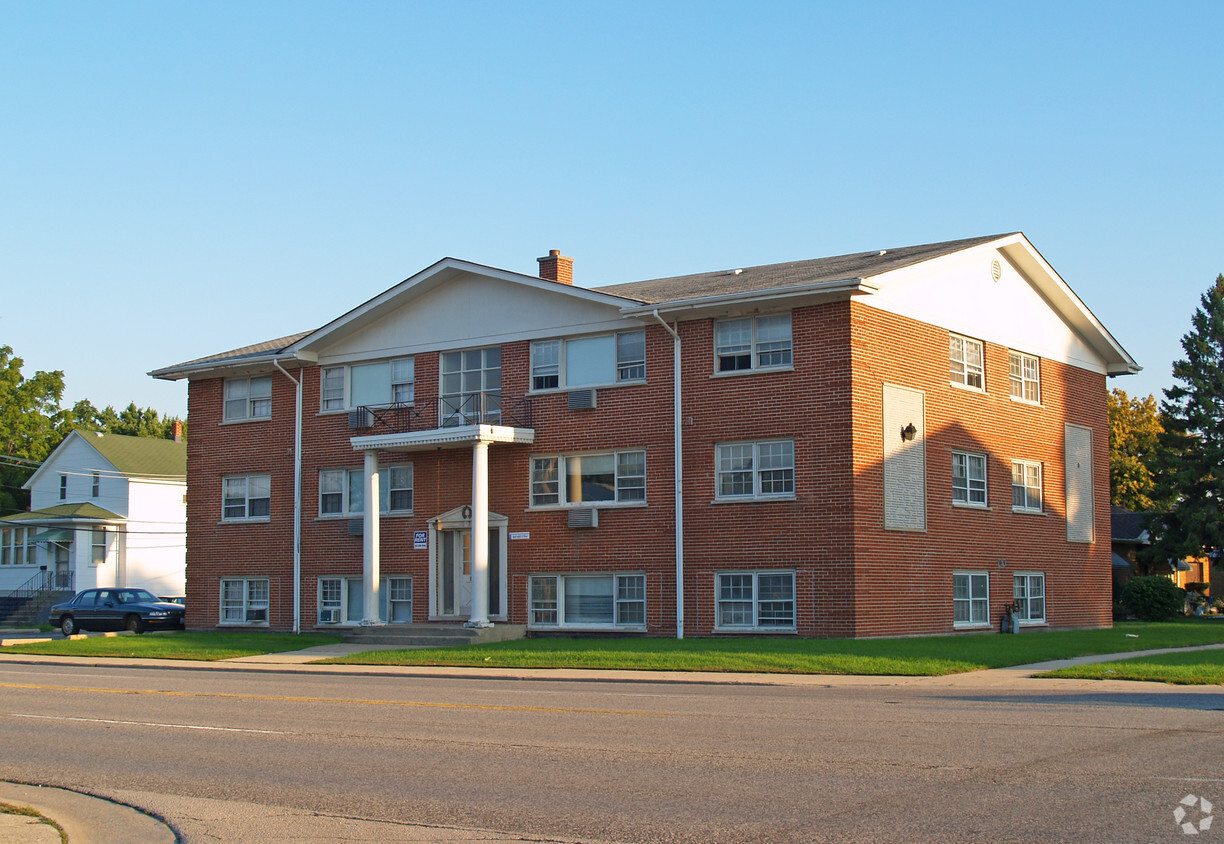
4015 Prairie Ave
4015 Prairie Ave,
Brookfield, IL 60513
$2,360 Total Monthly Price
3 Beds 12 Month Lease

Thanks for your interest in 7821 43rd St. You'll find this community in the West Cook area of Lyons. Let the leasing team show you everything this community has in store. Stop looking and get moving. Contact or stop by 7821 43rd St to schedule a tour!
7821 43Rd St is an apartment community located in Cook County and the 60534 ZIP Code. This area is served by the Lyons School District 103 attendance zone.
High Speed Internet Access
Wi-Fi
Security System
Heating
West Cook is a multicultural neighborhood south of O’Hare International Airport. Golfers in the community enjoy its numerous golf greens, including Oak Park Country Club and Edgewood Valley Country Club.
Public transit abounds in West Cook, attracting renters who wish to live outside the cities in which they work. Residents appreciate the shopping opportunities at Fashion Outlets of Chicago and North Riverside Park Mall.
The Brookfield Zoo is a fun-filled attraction in West Cook which houses hundreds of animals. Locals adore the neighborhood’s lush green spaces – many of which are in walking distance of affordable West Cook apartments. Direct access to Interstate 55 and Interstate 294 makes commuting easy, whether you’re traveling into Chicago or a neighboring state.
Learn more about living in West CookCompare neighborhood and city base rent averages by bedroom.
| West Cook | Lyons, IL | |
|---|---|---|
| Studio | $902 | - |
| 1 Bedroom | $1,120 | $980 |
| 2 Bedrooms | $1,383 | $1,274 |
| 3 Bedrooms | $1,520 | $1,112 |
| Colleges & Universities | Distance | ||
|---|---|---|---|
| Colleges & Universities | Distance | ||
| Drive: | 13 min | 6.7 mi | |
| Drive: | 14 min | 6.8 mi | |
| Drive: | 15 min | 7.3 mi | |
| Drive: | 17 min | 9.4 mi |


Transportation options available in Lyons include 54Th/Cermak Station, located 5.1 miles from 7821 43rd St. 7821 43rd St is near Chicago Midway International, located 5.1 miles or 9 minutes away, and Chicago O'Hare International, located 17.7 miles or 32 minutes away.
| Transit / Subway | Distance | ||
|---|---|---|---|
| Transit / Subway | Distance | ||
|
|
Drive: | 9 min | 5.1 mi |
|
|
Drive: | 9 min | 5.3 mi |
|
|
Drive: | 11 min | 5.6 mi |
|
|
Drive: | 11 min | 6.5 mi |
|
|
Drive: | 13 min | 7.3 mi |
| Commuter Rail | Distance | ||
|---|---|---|---|
| Commuter Rail | Distance | ||
|
|
Drive: | 4 min | 1.6 mi |
|
|
Drive: | 3 min | 1.8 mi |
|
|
Drive: | 5 min | 2.0 mi |
|
|
Drive: | 6 min | 2.3 mi |
|
|
Drive: | 5 min | 2.9 mi |
| Airports | Distance | ||
|---|---|---|---|
| Airports | Distance | ||
|
Chicago Midway International
|
Drive: | 9 min | 5.1 mi |
|
Chicago O'Hare International
|
Drive: | 32 min | 17.7 mi |
Scores provided by
Traffic
ActiveAirport
CalmBusinesses
ActiveScores provided by
HowLoud What is a Sound Score Rating? A Sound Score Rating aggregates noise caused by vehicle traffic, airplane traffic and local sources. How It WorksTime and distance from 7821 43rd St.
| Shopping Centers | Distance | ||
|---|---|---|---|
| Shopping Centers | Distance | ||
| Walk: | 11 min | 0.6 mi | |
| Walk: | 19 min | 1.0 mi | |
| Drive: | 2 min | 1.4 mi |
| Parks and Recreation | Distance | ||
|---|---|---|---|
| Parks and Recreation | Distance | ||
|
White Eagle Woods-North
|
Drive: | 2 min | 1.1 mi |
|
White Eagle Woods-South
|
Drive: | 3 min | 1.2 mi |
|
Andrew Toman Grove
|
Drive: | 6 min | 2.4 mi |
|
Brookfield Zoo
|
Drive: | 7 min | 2.9 mi |
|
Schuth's Grove / Callahan Grove
|
Drive: | 7 min | 4.2 mi |
| Hospitals | Distance | ||
|---|---|---|---|
| Hospitals | Distance | ||
| Drive: | 4 min | 2.1 mi | |
| Drive: | 9 min | 5.1 mi | |
| Drive: | 10 min | 5.3 mi |
| Military Bases | Distance | ||
|---|---|---|---|
| Military Bases | Distance | ||
| Drive: | 35 min | 22.0 mi |
What Are Walk Score®, Transit Score®, and Bike Score® Ratings?
Walk Score® measures the walkability of any address. Transit Score® measures access to public transit. Bike Score® measures the bikeability of any address.
What is a Sound Score Rating?
A Sound Score Rating aggregates noise caused by vehicle traffic, airplane traffic and local sources.

7821 43rd St
Lyons, IL 60534


