
$3,700
/ Month
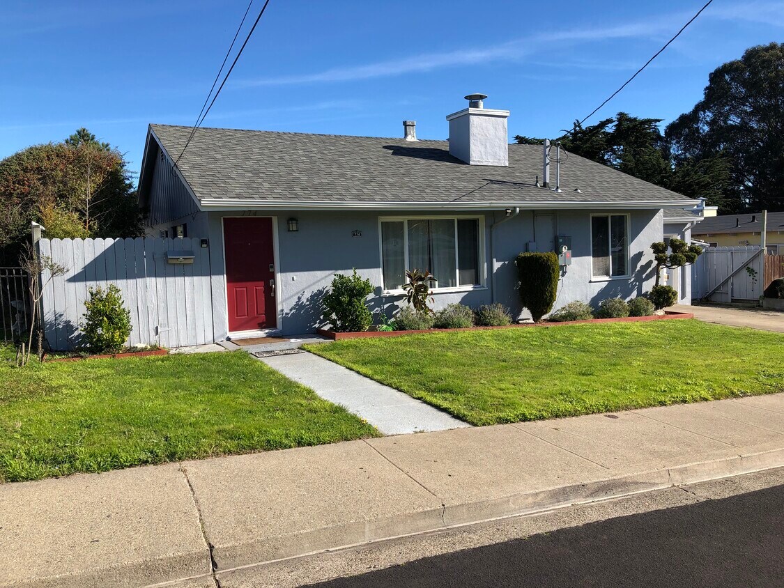
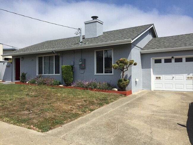
774 Camaritas Ave
South San Francisco, CA 94080
2 Weeks Ago
Favorites
774 Camaritas Ave

Favorites
Check Back Soon for Upcoming Availability
| Beds | Baths | Average SF |
|---|---|---|
| 3 Bedrooms 3 Bedrooms 3 Br | 1 Bath 1 Bath 1 Ba | 1,020 SF |
Fees and Policies
The fees below are based on community-supplied data and may exclude additional fees and utilities.
- Parking
-
Garage--
About This Property
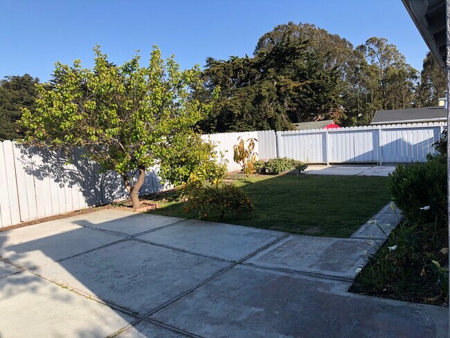
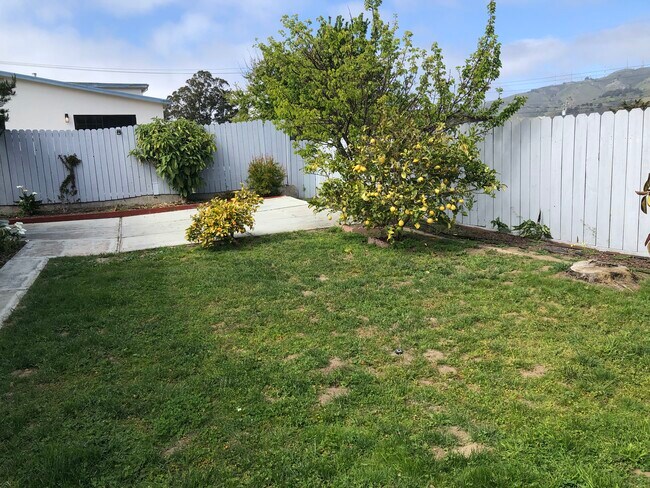
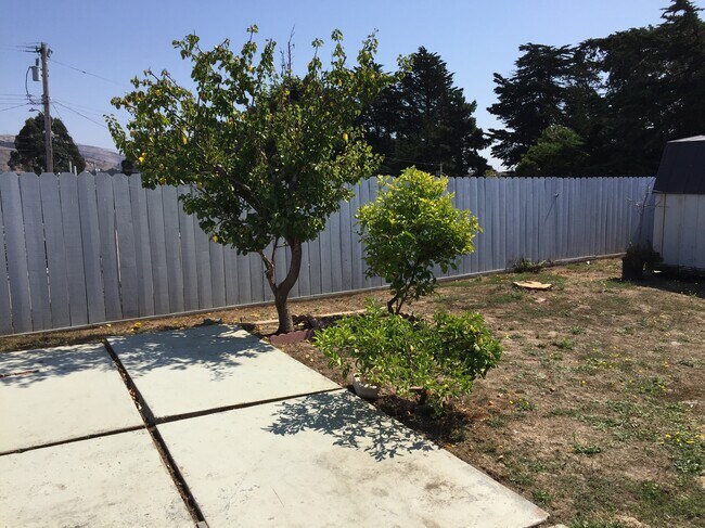
- Charming Single Family House with hill view on a private and safe neighborhood - Less than 5 mins walk to Alta Loma Park, Grocery Outlet, and Alta Loma Middle School - Less than 5 mins drive to BART station, Costco, Trader Joe's, Starbucks, Target, and 280 FWY - Buri Buri Elementary, Alta Loma Middle School and El Camino High School - Close to shops and restaurants - Large backyard - EV charging available - Ample parking spaces
774 Camaritas Ave is a house located in San Mateo County and the 94080 ZIP Code.
House Features
Washer/Dryer
Dishwasher
Granite Countertops
Microwave
- Washer/Dryer
- Smoke Free
- Cable Ready
- Tub/Shower
- Dishwasher
- Disposal
- Granite Countertops
- Kitchen
- Microwave
- Oven
- Range
- Refrigerator
- Tile Floors
- Crown Molding
- Views
- Yard
- Lawn
- Garden
Location
Get Directions
Folks in South San Francisco have easy access to The City via I-280, the 101, or BART rail service. This fact, coupled with the much lower crime rate and the area’s many excellent schools, makes South San Francisco apartments an appealing option for commuters, particularly those raising families.
Although primarily a residential community, South San Francisco does have a fairly active downtown scene, with much of the dining and entertainment centered around the intersection of Grande Avenue and Linden Avenue and shopping centers on the south side of town.
Many parks and nature preserves are scattered around the area, including the huge Sweeney Ridge and Fairway Park just to the west of the city limits. San Francisco International Airport sits directly south of town, making it highly convenient to travel anywhere.
Learn more about living in South San FranciscoBelow are rent ranges for similar nearby apartments
Amenities
- Washer/Dryer
- Smoke Free
- Cable Ready
- Tub/Shower
- Dishwasher
- Disposal
- Granite Countertops
- Kitchen
- Microwave
- Oven
- Range
- Refrigerator
- Tile Floors
- Crown Molding
- Views
- Yard
- Lawn
- Garden
Education
| Colleges & Universities | Distance | ||
|---|---|---|---|
| Colleges & Universities | Distance | ||
| Drive: | 10 min | 4.6 mi | |
| Drive: | 10 min | 5.5 mi | |
| Drive: | 10 min | 5.9 mi | |
| Drive: | 16 min | 8.1 mi |
774 Camaritas Ave is within 10 minutes or 4.6 miles from Skyline College. It is also near City College of San Francisco and San Francisco State University.
Transportation options available in South San Francisco include South San Francisco, located 0.8 mile from 774 Camaritas Ave. 774 Camaritas Ave is near San Francisco International, located 6.4 miles or 13 minutes away, and Metro Oakland International, located 30.5 miles or 43 minutes away.
| Transit / Subway | Distance | ||
|---|---|---|---|
| Transit / Subway | Distance | ||
|
|
Walk: | 15 min | 0.8 mi |
|
|
Walk: | 16 min | 0.9 mi |
|
|
Drive: | 4 min | 1.9 mi |
|
|
Drive: | 7 min | 3.5 mi |
|
|
Drive: | 7 min | 3.9 mi |
| Commuter Rail | Distance | ||
|---|---|---|---|
| Commuter Rail | Distance | ||
| Drive: | 7 min | 3.8 mi | |
| Drive: | 7 min | 3.9 mi | |
| Drive: | 13 min | 6.7 mi | |
| Drive: | 14 min | 8.6 mi | |
| Drive: | 14 min | 9.9 mi |
| Airports | Distance | ||
|---|---|---|---|
| Airports | Distance | ||
|
San Francisco International
|
Drive: | 13 min | 6.4 mi |
|
Metro Oakland International
|
Drive: | 43 min | 30.5 mi |
Time and distance from 774 Camaritas Ave.
| Shopping Centers | Distance | ||
|---|---|---|---|
| Shopping Centers | Distance | ||
| Walk: | 5 min | 0.3 mi | |
| Drive: | 3 min | 1.2 mi | |
| Drive: | 4 min | 1.3 mi |
774 Camaritas Ave has 3 shopping centers within 1.3 miles, which is about a 4-minute walk. The miles and minutes will be for the farthest away property.
| Parks and Recreation | Distance | ||
|---|---|---|---|
| Parks and Recreation | Distance | ||
|
San Bruno Mountain State Park
|
Drive: | 15 min | 6.2 mi |
|
Charles F. Hagar Planetarium
|
Drive: | 12 min | 6.2 mi |
|
San Francisco State Univ. Observatory
|
Drive: | 12 min | 6.2 mi |
|
Pacifica State Beach
|
Drive: | 12 min | 7.9 mi |
|
Candlestick Point State Recreation Area
|
Drive: | 18 min | 10.7 mi |
774 Camaritas Ave has 5 parks within 10.7 miles, including San Bruno Mountain State Park, Charles F. Hagar Planetarium, and San Francisco State Univ. Observatory.
| Hospitals | Distance | ||
|---|---|---|---|
| Hospitals | Distance | ||
| Drive: | 2 min | 1.2 mi | |
| Drive: | 4 min | 2.0 mi | |
| Drive: | 11 min | 7.6 mi |
774 Camaritas Ave has 3 hospitals within 7.6 miles, the nearest is Kaiser Foundation Hospital - South San Francisco which is 1.2 miles away and a 2 minute drive.
| Military Bases | Distance | ||
|---|---|---|---|
| Military Bases | Distance | ||
| Drive: | 23 min | 10.1 mi | |
| Drive: | 24 min | 10.7 mi |
774 Camaritas Ave is 10.1 miles from East Fort Miley, and is convenient to other military bases, including West Fort Miley.
You May Also Like
Similar Rentals Nearby


What Are Walk Score®, Transit Score®, and Bike Score® Ratings?
Walk Score® measures the walkability of any address. Transit Score® measures access to public transit. Bike Score® measures the bikeability of any address.
What is a Sound Score Rating?
A Sound Score Rating aggregates noise caused by vehicle traffic, airplane traffic and local sources

774 Camaritas Ave
South San Francisco, CA 94080