
$3,200
/ Month
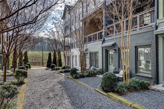
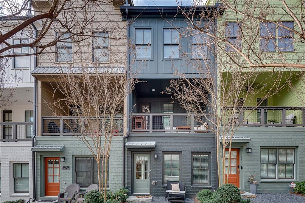
768 Aerial Way
Atlanta, GA 30316
2 Days Ago
Favorites
404-906-1022
-
Bedrooms
3
-
Bathrooms
3.5
-
Square Feet
2,160 sq ft
-
Available
Available Now
Highlights
- Open-Concept Dining Room
- Property is near public transit
- Oversized primary bedroom
- Traditional Architecture
- Outdoor Kitchen
- Stone Countertops
768 Aerial Way

Favorites
About This Home
$3,200 deposit,
Available Now
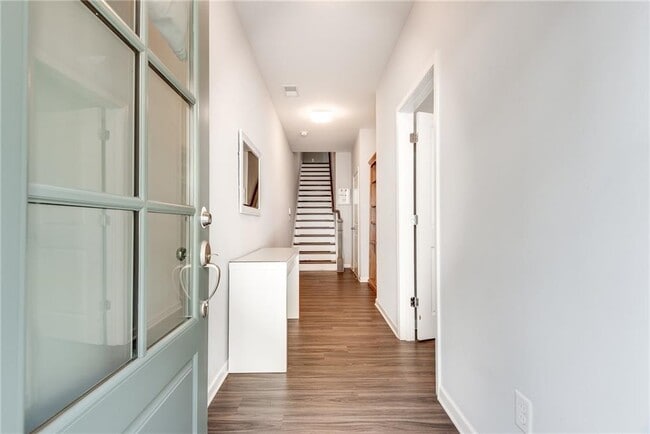
This stunning 3-bed,3.5-bath townhouse offers modern luxury just minutes from the Beltline,Grant Park,and the airport. High-end finishes,sleek countertops,and an open floor plan with a separate dining area and oversized living room make this home both stylish and functional. Each bedroom boasts its own bathroom,providing ultimate comfort and convenience. Enjoy the benefits of a 2-car garage,ample storage,and a covered porch perfect for unwinding on warm Atlanta evenings or entertaining guests. With top dining,shopping,and entertainment nearby,this is city living at its finest!
768 Aerial Way is a townhome located in Fulton County and the 30316 ZIP Code. This area is served by the Atlanta Public Schools attendance zone.
* Price shown is base rent and may not include non-optional fees and utilities. Price, availability, fees, and any applicable rent special are subject to change without notice.
* Square footage definitions vary. Displayed square footage is approximate.
Home Details
Home Type
Townhome
Year Built
Built in 2018
Attic
Pull Down Stairs to Attic
Bedrooms and Bathrooms
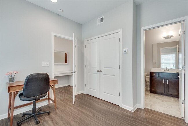
Oversized primary bedroom
Shower Only
Dual Closets
Walk-In Closet
3.5 Bathrooms
3 Bedrooms
Dual Vanity Sinks in Primary Bathroom
Home Design
Traditional Architecture
Composition Roof
Frame Construction
Home Security
Carbon Monoxide Detectors
Interior Spaces
Open-Concept Dining Room
Ceiling height of 9 feet on the lower level
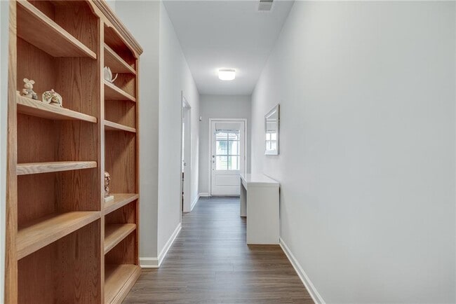
Vinyl Flooring
Roommate Plan
2,160 Sq Ft Home
3-Story Property
Kitchen
Stone Countertops
Walk-In Pantry
White Kitchen Cabinets
Open to Family Room
Breakfast Bar
Gas Oven
Gas Range
Microwave
Dishwasher
Range Hood
Disposal
Laundry
Dryer
Laundry on upper level
Washer
Listing and Financial Details
Security Deposit $3,200
12 Month Lease Term
$56 Application Fee
Assessor Parcel Number 14 0023 LL0435
Location
Property is near public transit
Property is near schools
Property is near shops
Property is near the Beltline
Lot Details
1,307 Sq Ft Lot
Level Lot
Two or More Common Walls
Property fronts a private road
Outdoor Features
Outdoor Kitchen
Covered Patio or Porch
Gazebo
Parking
1 Car Garage
Rear-Facing Garage
On-Street Parking
Schools
Parkside Elementary School
Martin L. King Jr. Middle School
Maynard Jackson High School
Utilities
Central Heating and Cooling System
High Speed Internet
Cable TV Available
Heat Pump System
Community Details
Overview
Property has a Home Owners Association
Application Fee Required
The Swift Subdivision
Pet Policy
Call for details about the types of pets allowed
Pet Deposit $250
Recreation
Park
Trails
Fees and Policies
The fees below are based on community-supplied data and may exclude additional fees and utilities.
Contact
- Listed by Andrew Gasper | ERA Foster & Bond/ERA
- Phone Number
- Contact
-
Source
 First Multiple Listing Service, Inc.
Copyright © 2025 First Multiple Listing Service, Inc. All rights reserved. All information provided by the listing agent/broker is deemed reliable but is not guaranteed and should be independently verified.
Location
Get Directions
Amenities
- Dishwasher
- Disposal
- Microwave
- Oven
- Range
- Refrigerator
Southeast Atlanta is just one of the many major neighborhoods within the sprawling Atlanta metropolitan area. This area stretches along the east side of I-75, up from Mountain View to Ormewood Park. The neighborhood boasts a diverse mix of residents and offers a variety of rentals, from single-family homes to charming apartment complexes.
Faithful to Atlanta’s reputation as a “city within a forest,” Southeast Atlanta encompasses a large number of parks and green spaces along with its tree-lined streets. Lake Charlotte Nature Preserve and South Bend Park are all popular gathering spots for a breath of fresh air. There are local watering holes and soul food restaurants that serve the area, and the Starlight Drive-In Theatre lies on the neighborhood’s east border.
With I-75 and Moreland Ave. nearby, getting into the heart of the city or other popular areas like East Atlanta is simple.
Learn more about living in Southeast Atlanta
Education
| Colleges & Universities | Distance | ||
|---|---|---|---|
| Colleges & Universities | Distance | ||
| Drive: | 7 min | 3.3 mi | |
| Drive: | 10 min | 4.8 mi | |
| Drive: | 11 min | 4.9 mi | |
| Drive: | 14 min | 5.1 mi |
768 Aerial Way is within 7 minutes or 3.3 miles from Georgia State University. It is also near Atlanta Technical College and Atlanta Metropolitan State.
Schools


Public Elementary School
Grades PK-5
563 Students
Attendance Zone
Public Middle School
Grades 6-8
818 Students
Attendance Zone
Public High School
Grades 9-12
1,474 Students
Attendance Zone
Private Elementary & Middle School
Grades K-8
13 Students
Nearby
Private Elementary, Middle & High School
Grades K-12
170 Students
Nearby
Private Elementary, Middle & High School
Grades 3-12
112 Students
Nearby
Private Elementary School
Grades PK-5
Nearby
School data provided by
 The GreatSchools Rating helps parents compare schools within a state based on a variety of school quality indicators and provides a helpful picture of how effectively each school serves all of its students. Ratings are on a scale of 1 (below average) to 10 (above average) and can include test scores, college readiness, academic progress, advanced courses, equity, discipline and attendance data. We also advise parents to visit schools, consider other information on school performance and programs, and consider family needs as part of the school selection process.
View GreatSchools Rating Methodology
Data provided by GreatSchools.org © 2025. All rights reserved.
View GreatSchools Rating Methodology
Data provided by GreatSchools.org © 2025. All rights reserved.
Transportation options available in Atlanta include King Memorial, located 2.6 miles from 768 Aerial Way. 768 Aerial Way is near Hartsfield - Jackson Atlanta International, located 9.9 miles or 18 minutes away.
| Transit / Subway | Distance | ||
|---|---|---|---|
| Transit / Subway | Distance | ||
|
|
Drive: | 6 min | 2.6 mi |
|
|
Drive: | 6 min | 2.7 mi |
|
|
Drive: | 6 min | 2.7 mi |
|
|
Drive: | 7 min | 3.1 mi |
|
|
Drive: | 7 min | 3.2 mi |
| Commuter Rail | Distance | ||
|---|---|---|---|
| Commuter Rail | Distance | ||
|
|
Drive: | 13 min | 6.6 mi |
| Airports | Distance | ||
|---|---|---|---|
| Airports | Distance | ||
|
Hartsfield - Jackson Atlanta International
|
Drive: | 18 min | 9.9 mi |
Time and distance from 768 Aerial Way.
| Shopping Centers | Distance | ||
|---|---|---|---|
| Shopping Centers | Distance | ||
| Drive: | 4 min | 1.4 mi | |
| Drive: | 4 min | 1.4 mi | |
| Drive: | 5 min | 1.4 mi |
768 Aerial Way has 3 shopping centers within 1.4 miles, which is about a 5-minute drive. The miles and minutes will be for the farthest away property.
| Parks and Recreation | Distance | ||
|---|---|---|---|
| Parks and Recreation | Distance | ||
|
Zoo Atlanta
|
Drive: | 5 min | 1.5 mi |
|
Trees Atlanta
|
Drive: | 6 min | 2.5 mi |
|
Trees Atlanta TreeHouse
|
Drive: | 7 min | 3.0 mi |
|
The Georgia Capitol Museum
|
Drive: | 7 min | 3.1 mi |
|
Park Pride
|
Drive: | 8 min | 3.6 mi |
768 Aerial Way has 5 parks within 3.6 miles, including Zoo Atlanta, Trees Atlanta, and Trees Atlanta TreeHouse.
| Hospitals | Distance | ||
|---|---|---|---|
| Hospitals | Distance | ||
| Drive: | 7 min | 3.1 mi | |
| Drive: | 7 min | 3.2 mi | |
| Drive: | 9 min | 4.1 mi |
768 Aerial Way has 3 hospitals within 4.1 miles, the nearest is Grady Memorial Hospital which is 3.1 miles away and a 7 minute drive.
| Military Bases | Distance | ||
|---|---|---|---|
| Military Bases | Distance | ||
| Drive: | 13 min | 6.0 mi | |
| Drive: | 19 min | 9.6 mi |
768 Aerial Way is 6.0 miles from Fort McPherson, and is convenient to other military bases, including Fort Gillem.
You May Also Like
Similar Rentals Nearby


What Are Walk Score®, Transit Score®, and Bike Score® Ratings?
Walk Score® measures the walkability of any address. Transit Score® measures access to public transit. Bike Score® measures the bikeability of any address.
What is a Sound Score Rating?
A Sound Score Rating aggregates noise caused by vehicle traffic, airplane traffic and local sources
768 Aerial Way
Atlanta, GA 30316