
$1,150
/ Month
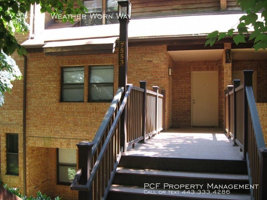
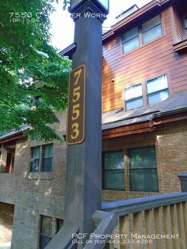
7553 Weather Worn Way
Columbia, MD 21046
2 Weeks Ago
|
Edit
Favorites
7553 Weather Worn Way

Favorites
Check Back Soon for Upcoming Availability
| Beds | Baths | Average SF |
|---|---|---|
| 1 Bedroom 1 Bedroom 1 Br | 1 Bath 1 Bath 1 Ba | — |
About This Property
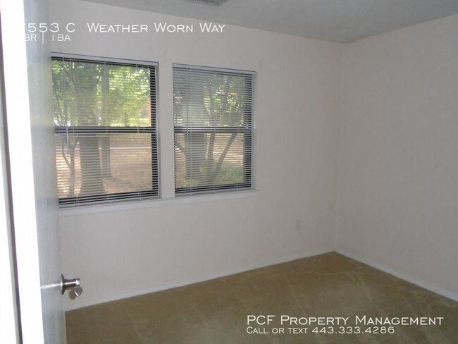
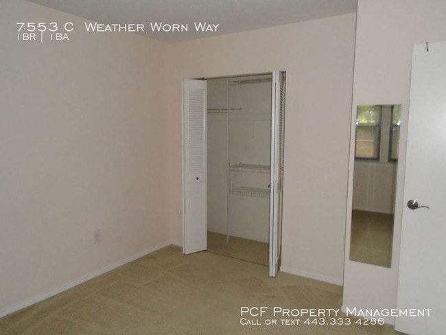
---- SCHEDULE A SHOWING ONLINE AT: showmojo.com/lt/dc8bd120f6 ---- Great location, 1 bedroom 1 bath condo...Located in the Pines at Dickinson Condominiums, walking distance to the Village of Kings Contrivance-Harris Teeter Grocery. Berber carpet. Wood burning fireplace and a large 16 x 10 private deck. Conveniently close to Rte 32 & 29, 5 miles from the Columbia Mall. Private tennis courts, neighborhood swimming pool, public basketball courts, playground, athletic field just a block away. All appliances. Will consider your small pet.No smoking. 12 Months Pool Tennis Courts
7553 Weather Worn Way is a condo located in Howard County and the 21046 ZIP Code. This area is served by the Howard County Public Schools attendance zone.
Location
Get Directions
Nestled between Baltimore and Washington DC, King’s Contrivance is Columbia’s southernmost village. Established in 1977, King’s Contrivance consists of three neighborhoods—Macgill’s Common, Huntington, and Dickinson. Each of these neighborhoods contain a community swimming pool for residents to enjoy.
Locals also gather at the King’s Contrivance Village Center, which offers an array of diverse restaurants, stores, and offices. King’s Contrivance is convenient to a number of area shopping destinations as well, including Historic Savage Mill, Laurel Shopping Center, Dobbin Center, and the landmark Mall in Columbia.
King’s Contrivance is largely residential, providing a bevy of single-family homes, townhouses, and apartments for rent. Quick access to I-95, Columbia Pike, and Patuxent Freeway connects King’s Contrivance to a wide variety of area destinations.
Learn more about living in Kings ContrivanceBelow are rent ranges for similar nearby apartments
Education
| Colleges & Universities | Distance | ||
|---|---|---|---|
| Colleges & Universities | Distance | ||
| Drive: | 12 min | 5.5 mi | |
| Drive: | 22 min | 13.6 mi | |
| Drive: | 23 min | 14.1 mi | |
| Drive: | 31 min | 18.6 mi |
7553 Weather Worn Way is within 12 minutes or 5.5 miles from Howard Community College. It is also near CCBC Cantonsville and UMBC.
Schools


Public Elementary School
Grades PK-5
489 Students
Nearby
Public Elementary School
Grades K-5
651 Students
Attendance Zone
Public Middle School
Grades 6-8
570 Students
Attendance Zone
Public High School
Grades 9-12
1,287 Students
Attendance Zone
Private Elementary, Middle & High School
Grades 4-11
71 Students
Nearby
Private Elementary, Middle & High School
Grades PK-10
181 Students
Nearby
Private Elementary & Middle School
Grades K-8
235 Students
Nearby
Private High School
Grades 9-12
406 Students
Nearby
School data provided by
 The GreatSchools Rating helps parents compare schools within a state based on a variety of school quality indicators and provides a helpful picture of how effectively each school serves all of its students. Ratings are on a scale of 1 (below average) to 10 (above average) and can include test scores, college readiness, academic progress, advanced courses, equity, discipline and attendance data. We also advise parents to visit schools, consider other information on school performance and programs, and consider family needs as part of the school selection process.
View GreatSchools Rating Methodology
Data provided by GreatSchools.org © 2025. All rights reserved.
View GreatSchools Rating Methodology
Data provided by GreatSchools.org © 2025. All rights reserved.
Transportation options available in Columbia include Dorsey, located 10.0 miles from 7553 Weather Worn Way. 7553 Weather Worn Way is near Baltimore/Washington International Thurgood Marshall, located 16.2 miles or 25 minutes away, and Ronald Reagan Washington Ntl, located 30.0 miles or 51 minutes away.
| Transit / Subway | Distance | ||
|---|---|---|---|
| Transit / Subway | Distance | ||
|
|
Drive: | 17 min | 10.0 mi |
| Commuter Rail | Distance | ||
|---|---|---|---|
| Commuter Rail | Distance | ||
|
|
Drive: | 13 min | 6.8 mi |
|
|
Drive: | 16 min | 7.7 mi |
|
|
Drive: | 16 min | 7.9 mi |
|
|
Drive: | 15 min | 7.9 mi |
| Drive: | 17 min | 10.0 mi |
| Airports | Distance | ||
|---|---|---|---|
| Airports | Distance | ||
|
Baltimore/Washington International Thurgood Marshall
|
Drive: | 25 min | 16.2 mi |
|
Ronald Reagan Washington Ntl
|
Drive: | 51 min | 30.0 mi |
Time and distance from 7553 Weather Worn Way.
| Shopping Centers | Distance | ||
|---|---|---|---|
| Shopping Centers | Distance | ||
| Walk: | 8 min | 0.5 mi | |
| Drive: | 7 min | 2.3 mi | |
| Drive: | 7 min | 2.4 mi |
7553 Weather Worn Way has 3 shopping centers within 2.4 miles, which is about a 7-minute drive. The miles and minutes will be for the farthest away property.
| Parks and Recreation | Distance | ||
|---|---|---|---|
| Parks and Recreation | Distance | ||
|
Clark's Elioak Farm
|
Drive: | 16 min | 9.2 mi |
|
Browns Bridge Recreation Area
|
Drive: | 18 min | 9.5 mi |
|
Brighton Dam's Azalea Garden
|
Drive: | 18 min | 10.4 mi |
|
Fairland Regional Park
|
Drive: | 17 min | 10.7 mi |
|
Maydale Conservation Park and Nature Center
|
Drive: | 22 min | 12.9 mi |
7553 Weather Worn Way has 5 parks within 12.9 miles, including Clark's Elioak Farm, Browns Bridge Recreation Area, and Fairland Regional Park.
| Hospitals | Distance | ||
|---|---|---|---|
| Hospitals | Distance | ||
| Drive: | 12 min | 5.7 mi | |
| Drive: | 18 min | 10.9 mi | |
| Drive: | 22 min | 14.8 mi |
7553 Weather Worn Way has 3 hospitals within 14.8 miles, the nearest is Howard County General Hospital which is 5.7 miles away and a 12 minute drive.
| Military Bases | Distance | ||
|---|---|---|---|
| Military Bases | Distance | ||
| Drive: | 19 min | 11.0 mi |
7553 Weather Worn Way is 11.0 miles and a 19 minute drive from Fort George Meade.
You May Also Like
Similar Rentals Nearby
-
-

-

-

-

-

-
1 / 36

-
-
1 / 23

-


What Are Walk Score®, Transit Score®, and Bike Score® Ratings?
Walk Score® measures the walkability of any address. Transit Score® measures access to public transit. Bike Score® measures the bikeability of any address.
What is a Sound Score Rating?
A Sound Score Rating aggregates noise caused by vehicle traffic, airplane traffic and local sources

7553 Weather Worn Way
Columbia, MD 21046