$5,200 / Month
75 S Central Ave
Quincy, MA 02170
Today
Favorites
-
Bedrooms
4
-
Bathrooms
3
-
Square Feet
2,000 sq ft
75 S Central Ave

Favorites
About This Home
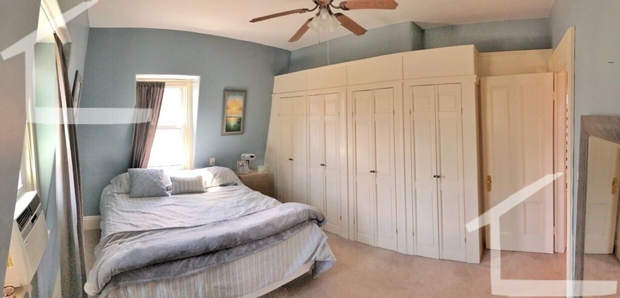
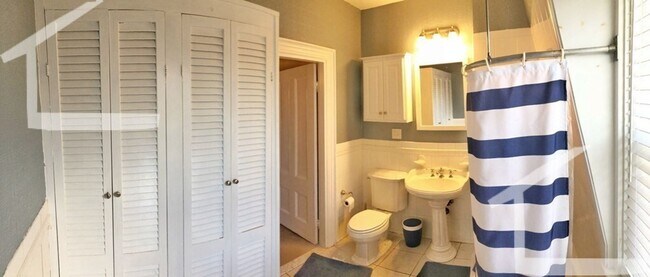
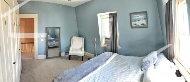
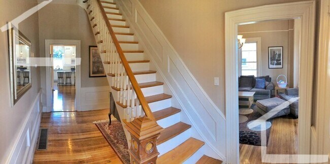
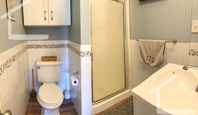
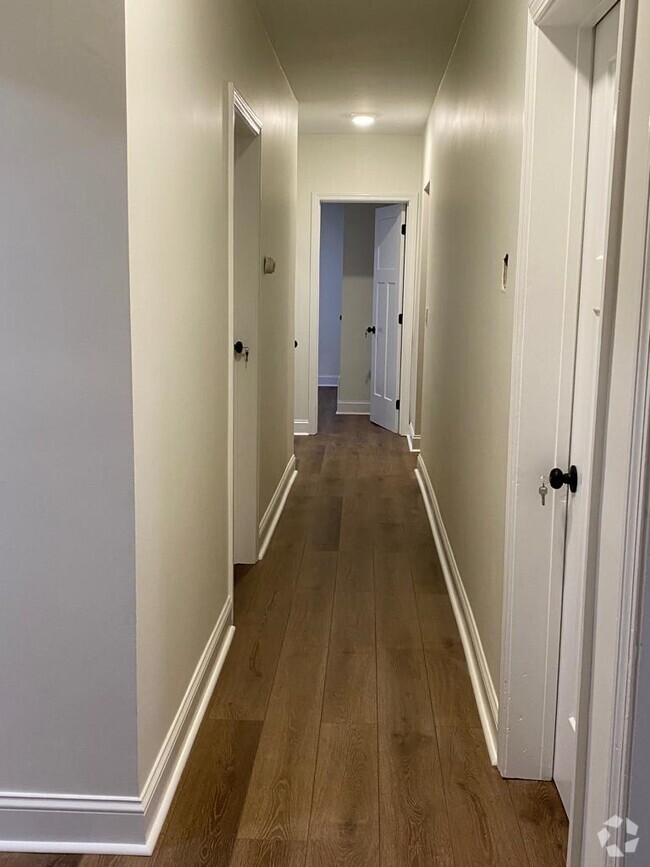
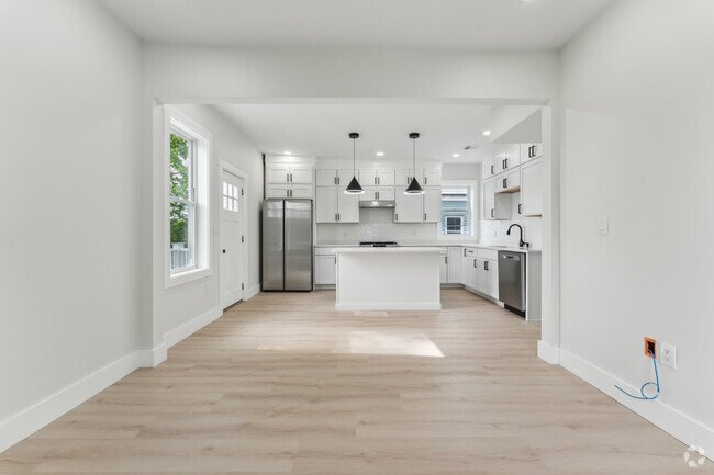
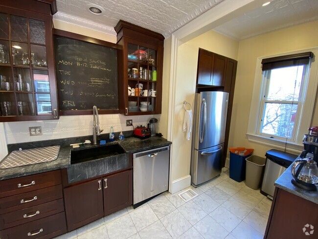
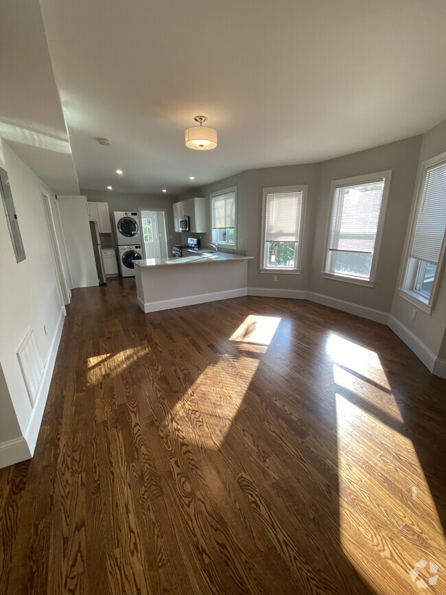
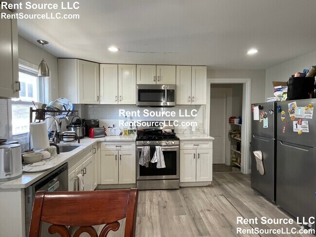
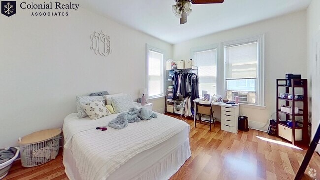
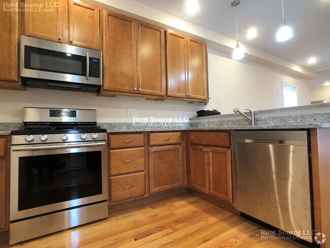
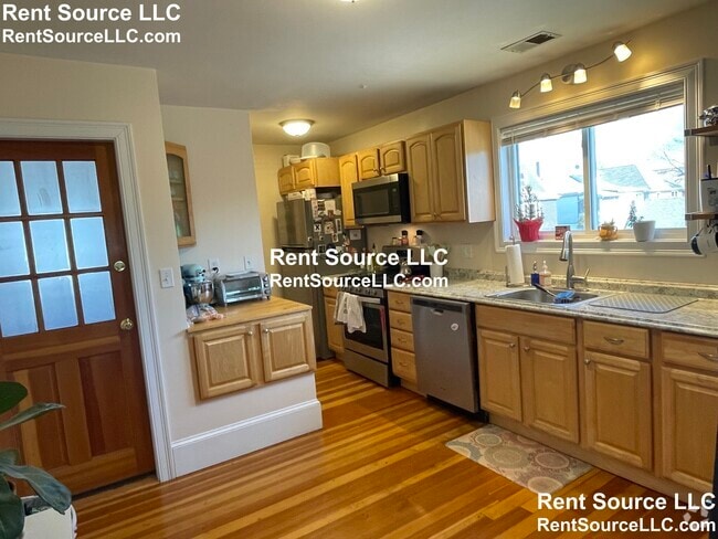
Available September 1st Huge 2 family townhouse. There is a tiny unit on the side of the house. Then the main unit has their own private backyard with a newer stone patio. Maybe post grads are allowed on a case by case scenario. Tenant's have access to 1 garage parking spot, then they also have a full private driveway exclusively to themselves (in tandem). Can easily fit 3-4 cars. The landlord used to live here and takes great pride in this house.There is free laundry in the unit. First, security, and broker fee to move in
75 S Central Ave is a condo located in Norfolk County and the 02170 ZIP Code. This area is served by the Boston Public Schools attendance zone.
* Price shown is base rent and may not include non-optional fees and utilities.
Price, availability, fees, and any applicable rent special are subject to change without notice.
* Square footage definitions vary. Displayed square footage is approximate.
Location
Get Directions
Lower Washington-Mount Hope is a walkable neighborhood about eight miles south of Boston via Interstate 93 or public transit. Despite this area’s dense population, Lower Washington-Mount Hope has many wooded areas, and large parks like Bussey Brook Meadow and Franklin Park surround the neighborhood. Along with residential neighborhoods, a few shops and eateries can be found in town along American Legion Highway. Many residents travel to the western corner of town to get to the shopping plaza off Corinth Street for all the necessities. The western part of the neighborhood is also where most of the rentals in this area are located. Apartments, condos, and townhomes ranging from moderately priced to luxury can be found here.
Learn more about living in Lower Washington-Mount Hope
Education
| Colleges & Universities | Distance | ||
|---|---|---|---|
| Colleges & Universities | Distance | ||
| Drive: | 11 min | 5.2 mi | |
| Drive: | 16 min | 6.4 mi | |
| Drive: | 15 min | 7.6 mi | |
| Drive: | 15 min | 7.8 mi |
75 S Central Ave is within 11 minutes or 5.2 miles from UMass Boston. It is also near Curry College and Northeastern University.
Schools


Public Elementary School
Grades PK-6
538 Students
Attendance Zone
Public Elementary School
Grades PK-6
114 Students
Attendance Zone
Public Middle & High School
Grades 7-12
598 Students
Attendance Zone
Public Middle & High School
Grades 6-12
871 Students
Attendance Zone
Public Middle School
Grades 6-8
133 Students
Attendance Zone
Private Elementary & Middle School
Grades PK-8
264 Students
Nearby
Private High School
Grades 9-12
Nearby
School data provided by
 The GreatSchools Rating helps parents compare schools within a state based on a variety of school quality indicators and provides a helpful picture of how effectively each school serves all of its students. Ratings are on a scale of 1 (below average) to 10 (above average) and can include test scores, college readiness, academic progress, advanced courses, equity, discipline and attendance data. We also advise parents to visit schools, consider other information on school performance and programs, and consider family needs as part of the school selection process.
View GreatSchools Rating Methodology
View GreatSchools Rating Methodology
Transportation options available in Quincy include Wollaston, located 0.7 mile from 75 S Central Ave. 75 S Central Ave is near General Edward Lawrence Logan International, located 10.5 miles or 19 minutes away.
| Transit / Subway | Distance | ||
|---|---|---|---|
| Transit / Subway | Distance | ||
|
|
Walk: | 13 min | 0.7 mi |
|
|
Drive: | 5 min | 1.8 mi |
|
|
Drive: | 6 min | 2.7 mi |
|
|
Drive: | 8 min | 3.8 mi |
|
|
Drive: | 8 min | 3.9 mi |
| Commuter Rail | Distance | ||
|---|---|---|---|
| Commuter Rail | Distance | ||
|
|
Walk: | 21 min | 1.1 mi |
|
|
Drive: | 9 min | 4.6 mi |
| Drive: | 10 min | 4.7 mi | |
|
|
Drive: | 9 min | 5.0 mi |
| Drive: | 11 min | 5.2 mi |
| Airports | Distance | ||
|---|---|---|---|
| Airports | Distance | ||
|
General Edward Lawrence Logan International
|
Drive: | 19 min | 10.5 mi |
Time and distance from 75 S Central Ave.
| Shopping Centers | Distance | ||
|---|---|---|---|
| Shopping Centers | Distance | ||
| Drive: | 4 min | 1.3 mi | |
| Drive: | 3 min | 1.3 mi | |
| Drive: | 4 min | 1.5 mi |
75 S Central Ave has 3 shopping centers within 1.5 miles, which is about a 4-minute drive. The miles and minutes will be for the farthest away property.
| Parks and Recreation | Distance | ||
|---|---|---|---|
| Parks and Recreation | Distance | ||
|
Adams National Historical Park
|
Walk: | 14 min | 0.7 mi |
|
Squantum Point Park
|
Drive: | 9 min | 3.4 mi |
|
Dorchester Shores Reservation
|
Drive: | 11 min | 5.1 mi |
|
Mass Audubon's Boston Nature Center and Wildlife Sanctuary
|
Drive: | 13 min | 6.2 mi |
|
Franklin Park Zoo
|
Drive: | 12 min | 6.8 mi |
75 S Central Ave has 5 parks within 6.8 miles, including Adams National Historical Park, Squantum Point Park, and Dorchester Shores Reservation.
| Hospitals | Distance | ||
|---|---|---|---|
| Hospitals | Distance | ||
| Drive: | 9 min | 3.8 mi | |
| Drive: | 8 min | 4.1 mi | |
| Drive: | 12 min | 6.6 mi |
75 S Central Ave has 3 hospitals within 6.6 miles, the nearest is Beth Israel Deaconess Hospital - Milton which is 3.8 miles away and a 9 minute drive.
You May Also Like
Similar Rentals Nearby
What Are Walk Score®, Transit Score®, and Bike Score® Ratings?
Walk Score® measures the walkability of any address. Transit Score® measures access to public transit. Bike Score® measures the bikeability of any address.
What is a Sound Score Rating?
A Sound Score Rating aggregates noise caused by vehicle traffic, airplane traffic and local sources

75 S Central Ave
Quincy, MA 02170