

$1,795 / Month
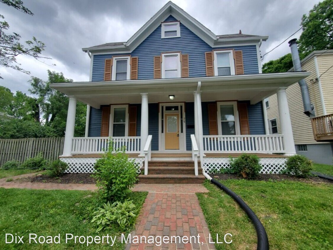
75 Hereford St
Cincinnati, OH 45216
2 Weeks Ago
Favorites
-
Bedrooms
3
-
Bathrooms
1
-
Square Feet
1,920 sq ft
75 Hereford St

Favorites
About This Home
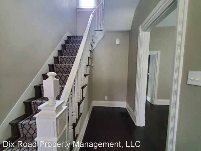
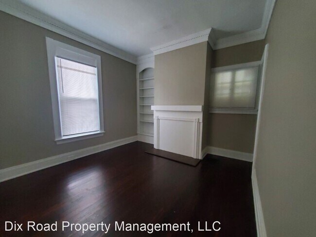
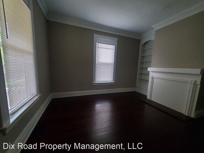
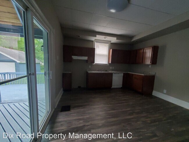
- 75 Hereford 3BR/1BA (Cincinnati) - Managed by Dix Road Property Management, LLC Apply today for our recently renovated 3BR/1BA home for rent in Cincinnati, Ohio. This beautiful home has an updated electrical and plumbing system, new flooring, a new roof, new windows, and new siding. The remodeled kitchen is equipped with a new dishwasher, a disposal, and a range hood and has separate dining. The home also has spacious bedrooms, w/d hookup, utility tub, and a full basement. Don't miss it! Apply today at **Appliances are not included but can be supplied at an additional cost** **DEPOSIT PENDING** (RLNE5722317) Other Amenities: Other (managed by dix road property management llc - don smith broker, cincinnati school district, updated electrical, updated plumbing, new roof, new windows, new siding, new flooring, new paint, updated kitchen, updated bathroom, new disposal, range hood, on street parking, separate dining, spacious bedroom, utility tub, hardwood flooring, laminate flooring, pet friendly (conditional)), Basement, Garage, Patio. Appliances: Dishwasher, Air Conditioning, Washer & Dryer Hookup. Pet policies: Small Dogs Allowed, Cats Allowed, Large Dogs Allowed.
Unique Features
- Amenities - managed by dix road property management llc - don smith broker, cincinnati school distri
75 Hereford St is a house located in Hamilton County and the 45216 ZIP Code. This area is served by the Cincinnati Public Schools attendance zone.
* Price shown is base rent and may not include non-optional fees and utilities.
Price, availability, fees, and any applicable rent special are subject to change without notice.
* Square footage definitions vary. Displayed square footage is approximate.
House Features
- Air Conditioning
- Dishwasher
Fees and Policies
The fees below are based on community-supplied data and may exclude additional fees and utilities.
- Dogs Allowed
-
Fees not specified
-
Weight limit--
-
Pet Limit--
Contact
- Listed by Dix
Location
Get Directions
Amenities
- Air Conditioning
- Dishwasher
- Amenities - managed by dix road property management llc - don smith broker, cincinnati school distri
The Hartwell neighborhood is eleven miles from Downtown Cincinnati, nestled between Interstate 75 and Route 126. First incorporated in 1876, the community has blossomed into a bustling business district, especially along Vine Street.
In addition to local companies, Vine Street is encompassed by the town community center, grocery stores, and quick-bites restaurants. Golfers living in Hartwell will appreciate the close proximity to The Wyoming Golf Club. Residents enjoy being just minutes from the Hamilton County Fairgrounds and great schools.
Hartwell residents pride themselves on their neighborhood spirit and close-knit community with neighbors.
Learn more about living in Hartwell
Education
| Colleges & Universities | Distance | ||
|---|---|---|---|
| Colleges & Universities | Distance | ||
| Drive: | 11 min | 4.1 mi | |
| Drive: | 13 min | 5.5 mi | |
| Drive: | 13 min | 5.9 mi | |
| Drive: | 15 min | 7.1 mi |
75 Hereford St is within 11 minutes or 4.1 miles from Cincinnati State, WDC. It is also near Xavier University and Univ. of Cincinnati, Blue Ash.
Schools

Public Elementary & Middle School
Grades PK-8
433 Students
Nearby
Public Elementary & Middle School
Grades 2-8
447 Students
Attendance Zone
Private Elementary, Middle & High School
Grades PK-12
289 Students
Nearby
Private Elementary & Middle School
Grades K-8
183 Students
Nearby
Private High School
Grades 9-12
1,529 Students
Nearby
School data provided by
 The GreatSchools Rating helps parents compare schools within a state based on a variety of school quality indicators and provides a helpful picture of how effectively each school serves all of its students. Ratings are on a scale of 1 (below average) to 10 (above average) and can include test scores, college readiness, academic progress, advanced courses, equity, discipline and attendance data. We also advise parents to visit schools, consider other information on school performance and programs, and consider family needs as part of the school selection process.
View GreatSchools Rating Methodology
Data provided by GreatSchools.org © 2025. All rights reserved.
View GreatSchools Rating Methodology
Data provided by GreatSchools.org © 2025. All rights reserved.
Transportation options available in Cincinnati include Brewery District Station, Elm & Henry, located 10.0 miles from 75 Hereford St. 75 Hereford St is near Cincinnati/Northern Kentucky International, located 24.0 miles or 41 minutes away.
| Transit / Subway | Distance | ||
|---|---|---|---|
| Transit / Subway | Distance | ||
| Drive: | 17 min | 10.0 mi | |
| Drive: | 17 min | 10.1 mi | |
| Drive: | 17 min | 10.2 mi | |
| Drive: | 18 min | 10.2 mi | |
| Drive: | 18 min | 10.3 mi |
| Commuter Rail | Distance | ||
|---|---|---|---|
| Commuter Rail | Distance | ||
|
|
Drive: | 17 min | 10.0 mi |
| Airports | Distance | ||
|---|---|---|---|
| Airports | Distance | ||
|
Cincinnati/Northern Kentucky International
|
Drive: | 41 min | 24.0 mi |
Time and distance from 75 Hereford St.
| Shopping Centers | Distance | ||
|---|---|---|---|
| Shopping Centers | Distance | ||
| Drive: | 6 min | 2.0 mi | |
| Drive: | 6 min | 2.2 mi | |
| Drive: | 6 min | 2.3 mi |
75 Hereford St has 3 shopping centers within 2.3 miles, which is about a 6-minute drive. The miles and minutes will be for the farthest away property.
| Parks and Recreation | Distance | ||
|---|---|---|---|
| Parks and Recreation | Distance | ||
|
Caldwell Preserve
|
Drive: | 6 min | 2.5 mi |
|
Glenwood Gardens
|
Drive: | 8 min | 3.5 mi |
|
French Park
|
Drive: | 10 min | 3.8 mi |
|
Gorman Heritage Farm
|
Drive: | 10 min | 3.9 mi |
|
Avon Woods Natural Area/Preserve
|
Drive: | 9 min | 4.6 mi |
75 Hereford St has 5 parks within 4.6 miles, including Caldwell Preserve, Glenwood Gardens, and French Park.
| Hospitals | Distance | ||
|---|---|---|---|
| Hospitals | Distance | ||
| Drive: | 4 min | 1.9 mi | |
| Drive: | 14 min | 5.2 mi | |
| Drive: | 11 min | 5.5 mi |
75 Hereford St has 3 hospitals within 5.5 miles, the nearest is Summit Behavioral Healthcare which is 1.9 miles away and a 4 minute drive.
| Military Bases | Distance | ||
|---|---|---|---|
| Military Bases | Distance | ||
| Drive: | 59 min | 45.5 mi | |
| Drive: | 66 min | 50.6 mi | |
| Drive: | 68 min | 53.9 mi |
75 Hereford St has 3 military bases within 53.9 miles, the nearest is Gentile Air Force Station which is 45.5 miles away and a 59 minute drive.
You May Also Like
Similar Rentals Nearby


What Are Walk Score®, Transit Score®, and Bike Score® Ratings?
Walk Score® measures the walkability of any address. Transit Score® measures access to public transit. Bike Score® measures the bikeability of any address.
What is a Sound Score Rating?
A Sound Score Rating aggregates noise caused by vehicle traffic, airplane traffic and local sources
75 Hereford St
Cincinnati, OH 45216