
$990
Total Monthly Price
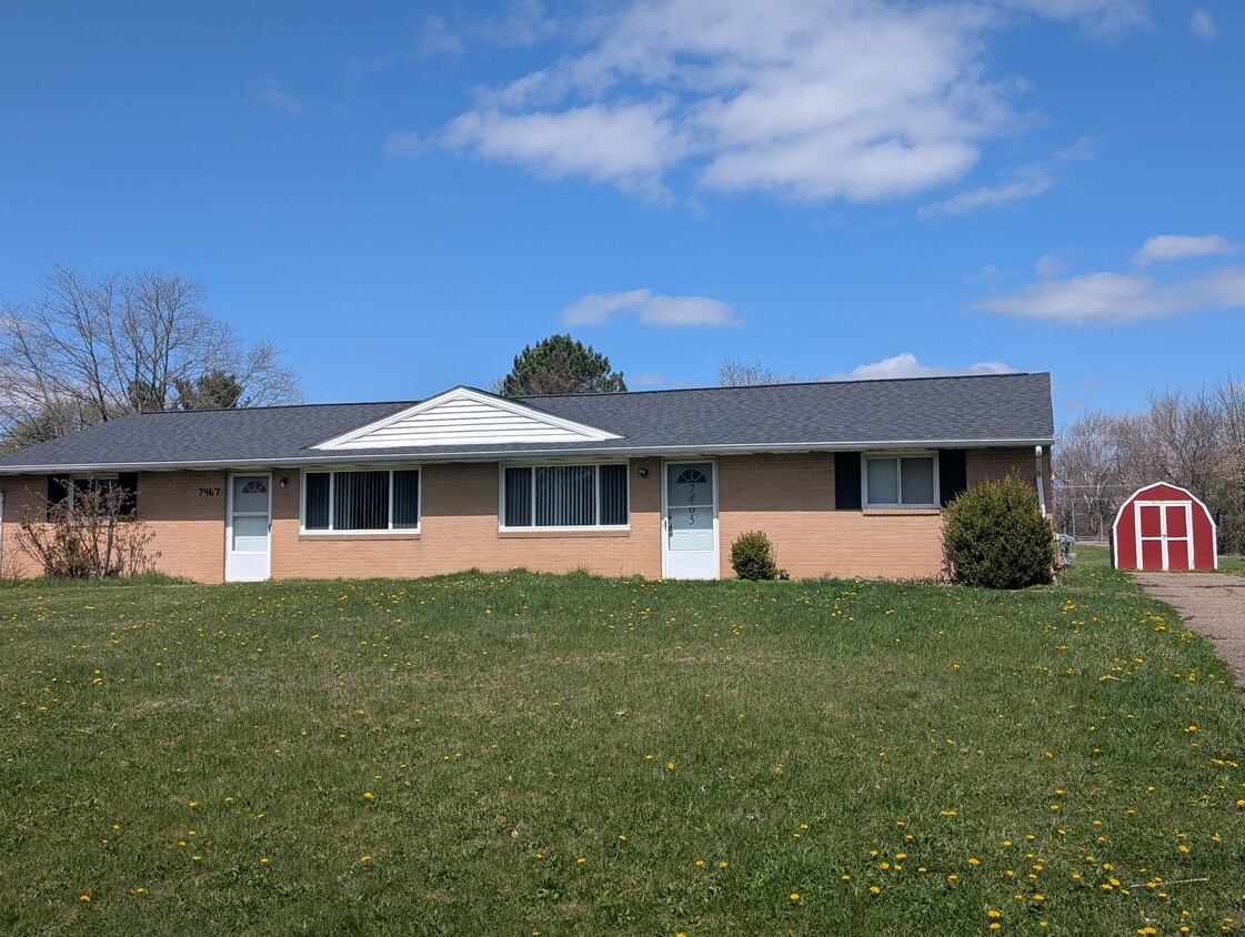
7465 Rob St NW
Massillon, OH 44646
Today
|
Edit
Favorites
-
Bedrooms
2
-
Bathrooms
1
-
Square Feet
1,664 sq ft
-
Available
Available Now
7465 Rob St NW

Favorites
About This Home
12 Month Lease,
$990 deposit,
Available Now
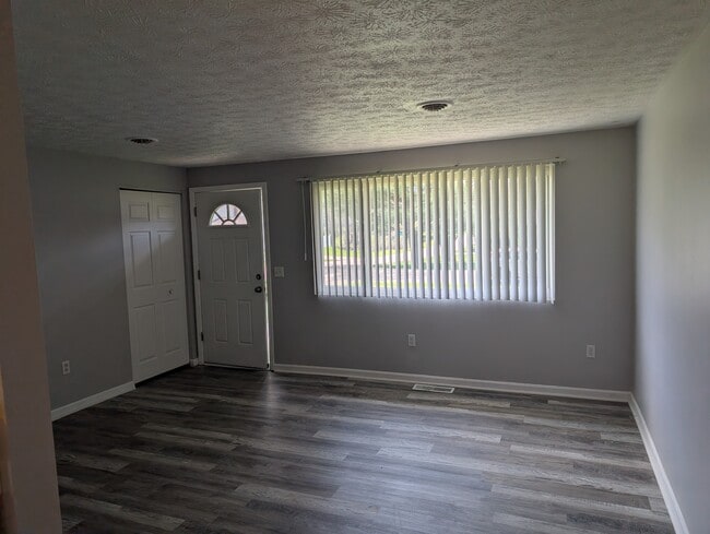
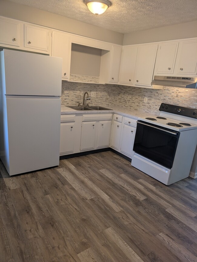
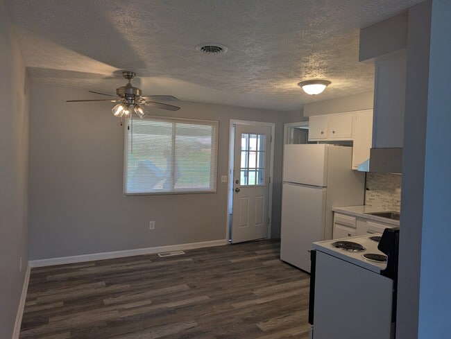
This property at 7465 Rob St NW features 2 bedrooms and 1 bathroom within a total living space of 1,664 square feet. The living room offers ample space for relaxation and entertainment, while the bathroom includes a tub/shower combination. Each bedroom is designed to accommodate various furniture arrangements and provides sufficient storage options. The property is cable-ready and includes a ceiling fan for added comfort. Additional amenities include heating and extra storage space. The exterior of the home is well-maintained, providing a welcoming appearance. This property is suitable for those seeking a functional living space with essential amenities. Great one-floor living, call today to schedule your appointment for your private tour.
7465 Rob St Nw is a townhome located in Stark County and the 44646 ZIP Code.
* Price shown is total price based on community-supplied monthly required fees. Excludes user-selected optional fees and variable or usage-based fees and required charges due at or prior to move-in or at move-out. Price, availability, fees, and any applicable rent special are subject to change without notice.
* Square footage definitions vary. Displayed square footage is approximate.
Townhome Features
Washer/Dryer Hookup
Tub/Shower
Ceiling Fans
Heating
- Washer/Dryer Hookup
- Heating
- Ceiling Fans
- Cable Ready
- Storage Space
- Tub/Shower
- Storage Space
Fees and Policies
The fees listed below are community-provided and may exclude utilities or add-ons. All payments are made directly to the property and are non-refundable unless otherwise specified.
- Parking
-
Covered--
Contact
- Contact
Location
Get Directions
Massillon sits along the Tuscarawas River in western Stark County, about eight miles west of Canton and roughly 30 miles south of Akron, occupying a steady, grounded place in northeast Ohio's landscape. The city carries a strong sense of identity rooted in its industrial past and a high school football tradition that draws intense community pride each season at Paul Brown Tiger Stadium, named after the legendary coach who got his start here. Lincoln Way serves as the central commercial corridor, anchoring everyday life with local businesses, shops, and services within a walkable stretch of the historic downtown.
The surrounding area spans around 21 square miles, offering a range of neighborhoods from tree-lined residential streets near the river to quieter pockets on the city's edges. The Massillon Museum, free to the public, reflects the city's commitment to arts and local history.
Learn more about living in Massillon
Education
| Colleges & Universities | Distance | ||
|---|---|---|---|
| Colleges & Universities | Distance | ||
| Drive: | 7 min | 3.3 mi | |
| Drive: | 9 min | 3.7 mi | |
| Drive: | 13 min | 6.7 mi | |
| Drive: | 17 min | 9.0 mi |
7465 Rob St NW is within 7 minutes or 3.3 miles from Stark State College. It is also near Kent State University, Stark and Walsh University.
Getting Around
 What do Walkability, Transit, Drivability, and Bikeability mean?
Walkability measures the walking distance to day-to-day needs.
Transit measures access to public transportation.
Drivability measures congestion, parking availability, and access to major roads.
Bikeability measures the suitability for cycling.
How It Works
What do Walkability, Transit, Drivability, and Bikeability mean?
Walkability measures the walking distance to day-to-day needs.
Transit measures access to public transportation.
Drivability measures congestion, parking availability, and access to major roads.
Bikeability measures the suitability for cycling.
How It Works
Somewhat Walkable
Walkability
30
/ 100
Minimal Public Transit
Transit
0
/ 100
Very Drivable
Drivability
80
/ 100
Fairly Bikeable
Bikeability
40
/ 100
Scores provided by
-
Soundscore™
-
/ 100
Traffic
-Airport
-Businesses
-Scores provided by
HowLoud What is a Sound Score Rating? A Sound Score Rating aggregates noise caused by vehicle traffic, airplane traffic and local sources. How It Works
Amenities
- Washer/Dryer Hookup
- Heating
- Ceiling Fans
- Cable Ready
- Storage Space
- Tub/Shower
- Storage Space
7465 Rob St NW Photos
-
Front exterior
-
-
-
-
-
-
-
-
What Are Walk Score®, Transit Score®, and Bike Score® Ratings?
Walk Score® measures the walkability of any address. Transit Score® measures access to public transit. Bike Score® measures the bikeability of any address.
What is a Sound Score Rating?
A Sound Score Rating aggregates noise caused by vehicle traffic, airplane traffic and local sources.

7465 Rob St NW
Massillon, OH 44646