
$1,900 / Month
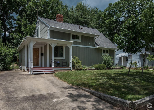
7425 Democracy Blvd
Bethesda, MD 20817
2 Weeks Ago
Favorites
7425 Democracy Blvd

Favorites
Check Back Soon for Upcoming Availability
| Beds | Baths | Average SF |
|---|---|---|
| 2 Bedrooms 2 Bedrooms 2 Br | 2 Baths 2 Baths 2 Ba | 1,241 SF |
About This Property
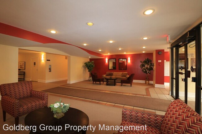
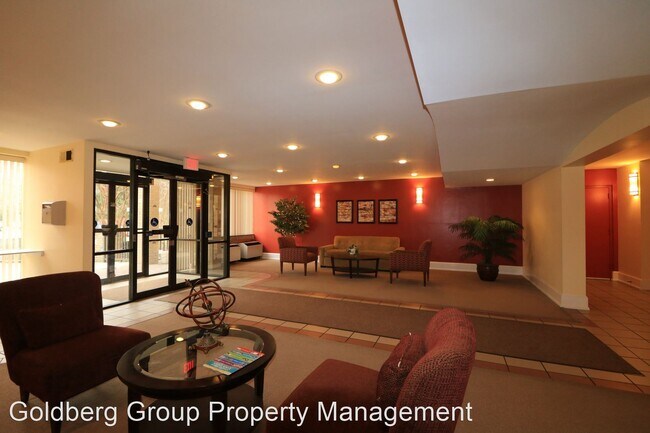
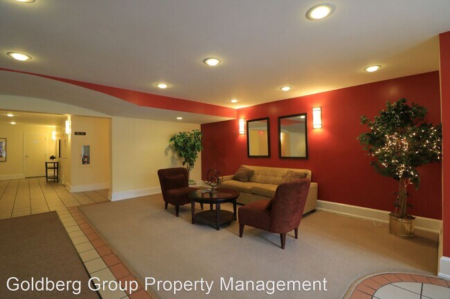
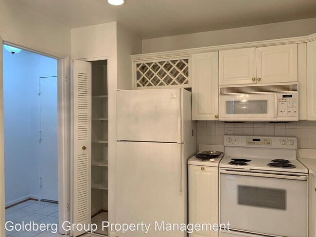
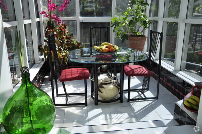
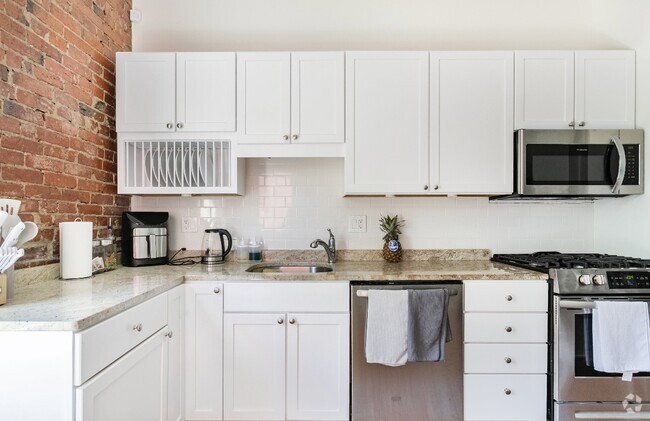
(240) 702-2600 x2604 - Spacious 2BD/2BA Condo with Balcony in Bethesda near Cabin John Park & Westfield Mall! - Beautifully updated unit with large balcony, huge bedrooms and SO MUCH closet space!! W/D in unit. Hardwood floors in living area and carpet in bedrooms. Beautiful views of green space. Newly Renovated Westfield Montgomery Mall one block away plus other great dining & shopping options. [Cheesecake Factory, Bobby's Burger Palace & new ArcLight Movie Theater!!] Maintains close proximity to major highways but feels tucked away in this quiet, secure and well-kept community. Amenities include Swimming Pool, Tennis Courts, trail access, guest parking & secure entry. (RLNE5357810)
7425 Democracy Blvd is a house located in Montgomery County and the 20817 ZIP Code. This area is served by the Montgomery County Public Schools attendance zone.
Location
Get Directions
West Bethesda is prime real estate thanks to its gorgeous surroundings and amazing homes. Draped between Cabin John Regional Park and three country clubs, West Bethesda provides a tranquil setting on the west side of I-495.
There are few schools located in the neighborhood. Coupled with the nearby highway, a morning commute from West Bethesda should be a breeze. Westfield Montgomery Mall is located just north of the neighborhood, and provides plenty of upscale shopping and dining options. The amenities at the center of Bethesda and Washington, D.C. are both nearby as well.
Learn more about living in West BethesdaBelow are rent ranges for similar nearby apartments
Education
| Colleges & Universities | Distance | ||
|---|---|---|---|
| Colleges & Universities | Distance | ||
| Drive: | 14 min | 7.4 mi | |
| Drive: | 14 min | 8.2 mi | |
| Drive: | 18 min | 9.1 mi | |
| Drive: | 20 min | 9.2 mi |
7425 Democracy Blvd is within 14 minutes or 7.4 miles from Montgomery College, Rockville. It is also near Universities at Shady Grove and American University.
Schools


Public Elementary School
Grades PK-5
810 Students
Attendance Zone
Public Middle School
Grades 6-8
1,110 Students
Attendance Zone
Public High School
Grades 9-12
2,942 Students
Attendance Zone
Private Elementary School
Grades PK-2
65 Students
Nearby
Private Elementary, Middle & High School
Grades 3-12
529 Students
Nearby
School data provided by
 The GreatSchools Rating helps parents compare schools within a state based on a variety of school quality indicators and provides a helpful picture of how effectively each school serves all of its students. Ratings are on a scale of 1 (below average) to 10 (above average) and can include test scores, college readiness, academic progress, advanced courses, equity, discipline and attendance data. We also advise parents to visit schools, consider other information on school performance and programs, and consider family needs as part of the school selection process.
View GreatSchools Rating Methodology
View GreatSchools Rating Methodology
Transportation options available in Bethesda include White Flint, located 3.8 miles from 7425 Democracy Blvd. 7425 Democracy Blvd is near Ronald Reagan Washington Ntl, located 16.9 miles or 33 minutes away, and Washington Dulles International, located 23.0 miles or 37 minutes away.
| Transit / Subway | Distance | ||
|---|---|---|---|
| Transit / Subway | Distance | ||
|
|
Drive: | 9 min | 3.8 mi |
|
|
Drive: | 9 min | 3.9 mi |
|
|
Drive: | 10 min | 4.6 mi |
|
|
Drive: | 11 min | 4.9 mi |
|
|
Drive: | 13 min | 5.4 mi |
| Commuter Rail | Distance | ||
|---|---|---|---|
| Commuter Rail | Distance | ||
|
|
Drive: | 12 min | 5.0 mi |
|
|
Drive: | 13 min | 6.6 mi |
|
|
Drive: | 14 min | 7.4 mi |
|
|
Drive: | 18 min | 9.8 mi |
|
Washington Grove
|
Drive: | 17 min | 10.1 mi |
| Airports | Distance | ||
|---|---|---|---|
| Airports | Distance | ||
|
Ronald Reagan Washington Ntl
|
Drive: | 33 min | 16.9 mi |
|
Washington Dulles International
|
Drive: | 37 min | 23.0 mi |
Time and distance from 7425 Democracy Blvd.
| Shopping Centers | Distance | ||
|---|---|---|---|
| Shopping Centers | Distance | ||
| Walk: | 7 min | 0.4 mi | |
| Drive: | 4 min | 1.2 mi | |
| Drive: | 4 min | 1.6 mi |
7425 Democracy Blvd has 3 shopping centers within 1.6 miles, which is about a 4-minute walk. The miles and minutes will be for the farthest away property.
| Parks and Recreation | Distance | ||
|---|---|---|---|
| Parks and Recreation | Distance | ||
|
McCrillis Gardens
|
Drive: | 6 min | 2.8 mi |
|
Locust Grove Nature Center
|
Drive: | 7 min | 3.4 mi |
|
Glen Echo Park
|
Drive: | 11 min | 6.3 mi |
|
George Washington Memorial Parkway/Turkey Run Park
|
Drive: | 16 min | 8.6 mi |
|
Lyndon Baines Johnson Memorial Grove
|
Drive: | 15 min | 8.7 mi |
7425 Democracy Blvd has 5 parks within 8.7 miles, including McCrillis Gardens, Locust Grove Nature Center, and Glen Echo Park.
| Hospitals | Distance | ||
|---|---|---|---|
| Hospitals | Distance | ||
| Drive: | 9 min | 3.9 mi | |
| Drive: | 10 min | 4.6 mi | |
| Drive: | 14 min | 8.5 mi |
7425 Democracy Blvd has 3 hospitals within 8.5 miles, the nearest is Suburban Hospital which is 3.9 miles away and a 9 minute drive.
| Military Bases | Distance | ||
|---|---|---|---|
| Military Bases | Distance | ||
| Drive: | 22 min | 10.8 mi |
7425 Democracy Blvd is 10.8 miles and a 22 minute drive from Naval Observatory.
You May Also Like
Similar Rentals Nearby

What Are Walk Score®, Transit Score®, and Bike Score® Ratings?
Walk Score® measures the walkability of any address. Transit Score® measures access to public transit. Bike Score® measures the bikeability of any address.
What is a Sound Score Rating?
A Sound Score Rating aggregates noise caused by vehicle traffic, airplane traffic and local sources
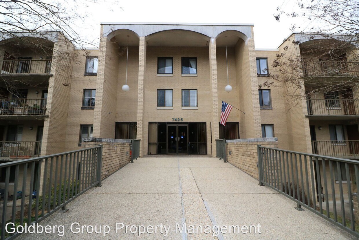
7425 Democracy Blvd
Bethesda, MD 20817