


$1,750 / Month
74 Fenway Unit B3
Boston, MA 02115
Today
Favorites
617-905-6995
-
Bedrooms
1
-
Bathrooms
1
-
Square Feet
400 sq ft
-
Available
Available Now
Highlights
- Medical Services
- Property is near public transit
- Jogging Path
- No Cooling
- Park
- Shops
74 Fenway Unit B3

Favorites
About This Home
Available Now
Near many colleges and Medical Center,Berklee College,Northeastern University,Mass College of Art,Harvard,Massachusetts Conservatory and other colleges as well as the Medical Center within walking distance this lower-level apartment which is located right on The Fenway in the heart of The Fenway area and Kenmore Square. Good size bedroom,kitchen and living room. Laundry facilities are conveniently located on the lower level near the apartment. Apartment is in a professionally managed condominium building. Convenient short walk to Boylston & Newbury Streets and the Prudential Center and shops as well as many Back Bay and South End restaurants. Public transportation readily available in the area to several locations. Good credit and references required. Easy to view with adequate notice to tenants. Broker fee equal to one month's rent to be paid by tenant. PHOTOS OF UNIT TO COME. SHOWINGS START TUESDAY,JUNE 17TH. MLS# 73390008
74 Fenway is a condo located in Suffolk County and the 02115 ZIP Code.
* Price shown is base rent and may not include non-optional fees and utilities.
Price, availability, fees, and any applicable rent special are subject to change without notice.
* Square footage definitions vary. Displayed square footage is approximate.
Home Details
Home Type
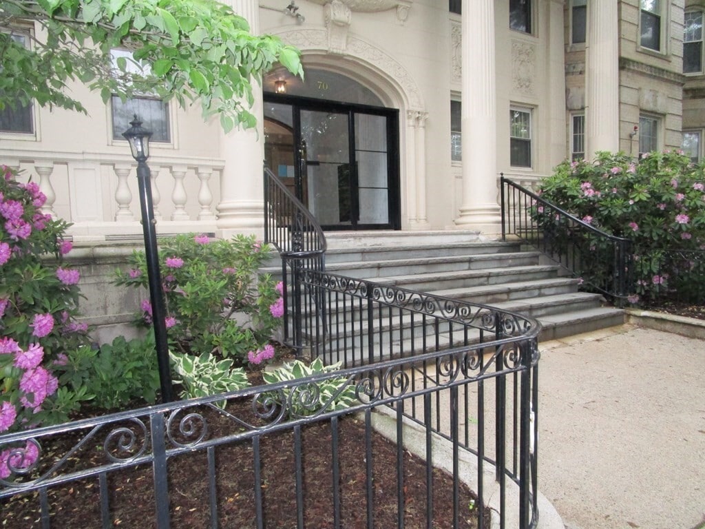
Condominium
Accessible Home Design
Entry on the 1st floor
Bedrooms and Bathrooms
1 Full Bathroom
1 Bedroom
Interior Spaces
400 Sq Ft Home
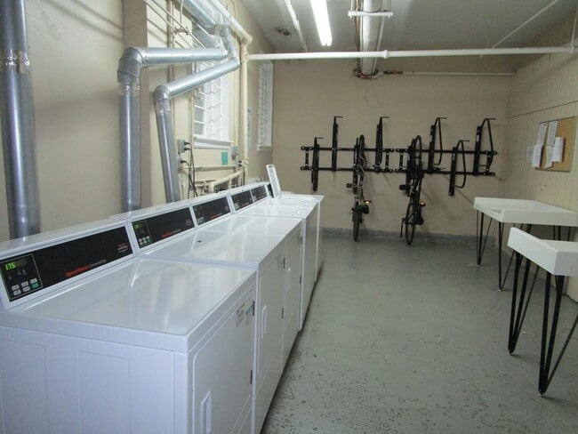
Kitchen
Range
Freezer
Disposal
Listing and Financial Details
Property Available on 9/1/23
12 Month Lease Term
Rent includes heat, hot water, water
Location
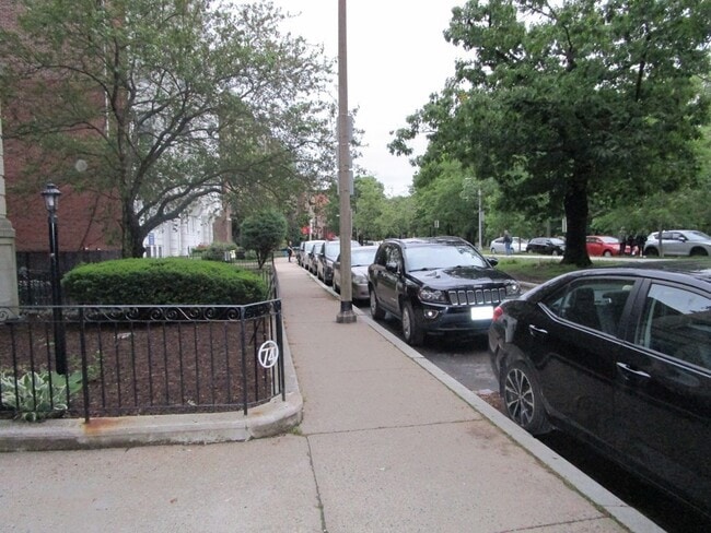
Property is near public transit
Property is near schools
Lot Details
400 Sq Ft Lot
Near Conservation Area
Utilities
No Cooling
Community Details
Amenities
Medical Services
Shops
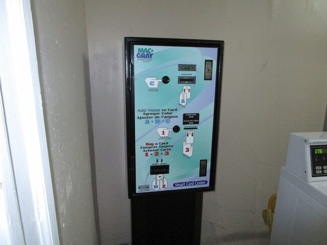
Laundry Facilities
Overview
Property has a Home Owners Association
Pet Policy
No Pets Allowed
Recreation
Jogging Path
Park
Bike Trail
Fees and Policies
The fees below are based on community-supplied data and may exclude additional fees and utilities.
Contact
- Listed by Wally Berger | Greater Boston Property Services,LLC
- Phone Number
-
Source
 MLS Property Information Network
The property listing data and information set forth herein were provided to MLS Property Information Network, Inc. from third party sources, including sellers, lessors and public records, and were compiled by MLS Property Information Network, Inc. The property listing data and information are for the personal, non-commercial use of consumers having a good faith interest in purchasing or leasing listed properties of the type displayed to them and may not be used for any purpose other than to identify prospective properties which such consumers may have a good faith interest in purchasing or leasing. MLS Property Information Network, Inc. and its subscribers disclaim any and all representations and warranties as to the accuracy of the property listing data and information set forth herein. All properties are subject to prior sale, change or withdrawal. Copyright © 2025 MLS Property Information Network, Inc. All rights reserved.
Location
Get Directions
Amenities
- Disposal
- Range
- Refrigerator
- Freezer
Tree-filled, historic, and packed with educational opportunity, there's no other neighborhood quite like Fenway. The neighborhood may be most well-known for its titular attraction, Fenway Park, home of the Boston Red Sox. However, the area is also renowned for its sprawling greenspace. The name "Fenway" refers to the neighborhood’s lush parkway and tree-filled paths that wind lazily through the area, forming part of Frederick Law Olmsted’s “Emerald Necklace Plan” (a chain of parks throughout Boston). The Fenway opened in 1876, and its route includes the Museum of Fine Arts and the Isabella Steward Gardner Museum.
Learn more about living in Fenway
Education
| Colleges & Universities | Distance | ||
|---|---|---|---|
| Colleges & Universities | Distance | ||
| Walk: | 6 min | 0.3 mi | |
| Walk: | 8 min | 0.4 mi | |
| Walk: | 10 min | 0.5 mi | |
| Walk: | 16 min | 0.9 mi |
74 Fenway Unit B3 is within 6 minutes or 0.3 mile from Northeastern University. It is also near Berklee College of Music and Wentworth Inst. of Technology.
Transportation options available in Boston include Northeastern University, located 0.3 mile from 74 Fenway Unit B3. 74 Fenway Unit B3 is near General Edward Lawrence Logan International, located 6.1 miles or 13 minutes away.
| Transit / Subway | Distance | ||
|---|---|---|---|
| Transit / Subway | Distance | ||
|
|
Walk: | 5 min | 0.3 mi |
| Walk: | 6 min | 0.4 mi | |
| Walk: | 8 min | 0.4 mi | |
| Walk: | 8 min | 0.5 mi | |
| Walk: | 9 min | 0.5 mi |
| Commuter Rail | Distance | ||
|---|---|---|---|
| Commuter Rail | Distance | ||
|
|
Walk: | 9 min | 0.5 mi |
|
|
Drive: | 6 min | 1.4 mi |
| Drive: | 5 min | 1.9 mi | |
| Drive: | 7 min | 3.7 mi | |
| Drive: | 10 min | 4.2 mi |
| Airports | Distance | ||
|---|---|---|---|
| Airports | Distance | ||
|
General Edward Lawrence Logan International
|
Drive: | 13 min | 6.1 mi |
Time and distance from 74 Fenway Unit B3.
| Shopping Centers | Distance | ||
|---|---|---|---|
| Shopping Centers | Distance | ||
| Drive: | 3 min | 1.2 mi | |
| Drive: | 8 min | 4.6 mi | |
| Drive: | 8 min | 4.8 mi |
74 Fenway Unit B3 has 3 shopping centers within 4.8 miles, which is about a 8-minute drive. The miles and minutes will be for the farthest away property.
| Parks and Recreation | Distance | ||
|---|---|---|---|
| Parks and Recreation | Distance | ||
|
Charles River Reservation
|
Drive: | 3 min | 1.1 mi |
|
Roxbury Heritage State Park
|
Drive: | 4 min | 1.5 mi |
|
Coit Observatory
|
Drive: | 3 min | 1.6 mi |
|
Boston Public Garden
|
Drive: | 5 min | 1.7 mi |
|
John Fitzgerald Kennedy National Historic Site
|
Drive: | 6 min | 2.6 mi |
74 Fenway Unit B3 has 5 parks within 2.6 miles, including Charles River Reservation, Roxbury Heritage State Park, and Coit Observatory.
| Hospitals | Distance | ||
|---|---|---|---|
| Hospitals | Distance | ||
| Walk: | 19 min | 1.0 mi | |
| Drive: | 3 min | 1.3 mi | |
| Drive: | 4 min | 1.4 mi |
74 Fenway Unit B3 has 3 hospitals within 1.4 miles, the nearest is Boston Children's Hospital which is 1.0 miles away and a 19 minute walk.
| Military Bases | Distance | ||
|---|---|---|---|
| Military Bases | Distance | ||
| Drive: | 29 min | 15.5 mi | |
| Drive: | 29 min | 15.7 mi |
74 Fenway Unit B3 is 15.5 miles from Hanscom Air Force Base, and is convenient to other military bases, including US Military Reservation.
You May Also Like
Similar Rentals Nearby


What Are Walk Score®, Transit Score®, and Bike Score® Ratings?
Walk Score® measures the walkability of any address. Transit Score® measures access to public transit. Bike Score® measures the bikeability of any address.
What is a Sound Score Rating?
A Sound Score Rating aggregates noise caused by vehicle traffic, airplane traffic and local sources
74 Fenway
Boston, MA 02115