$2,000
/ Month
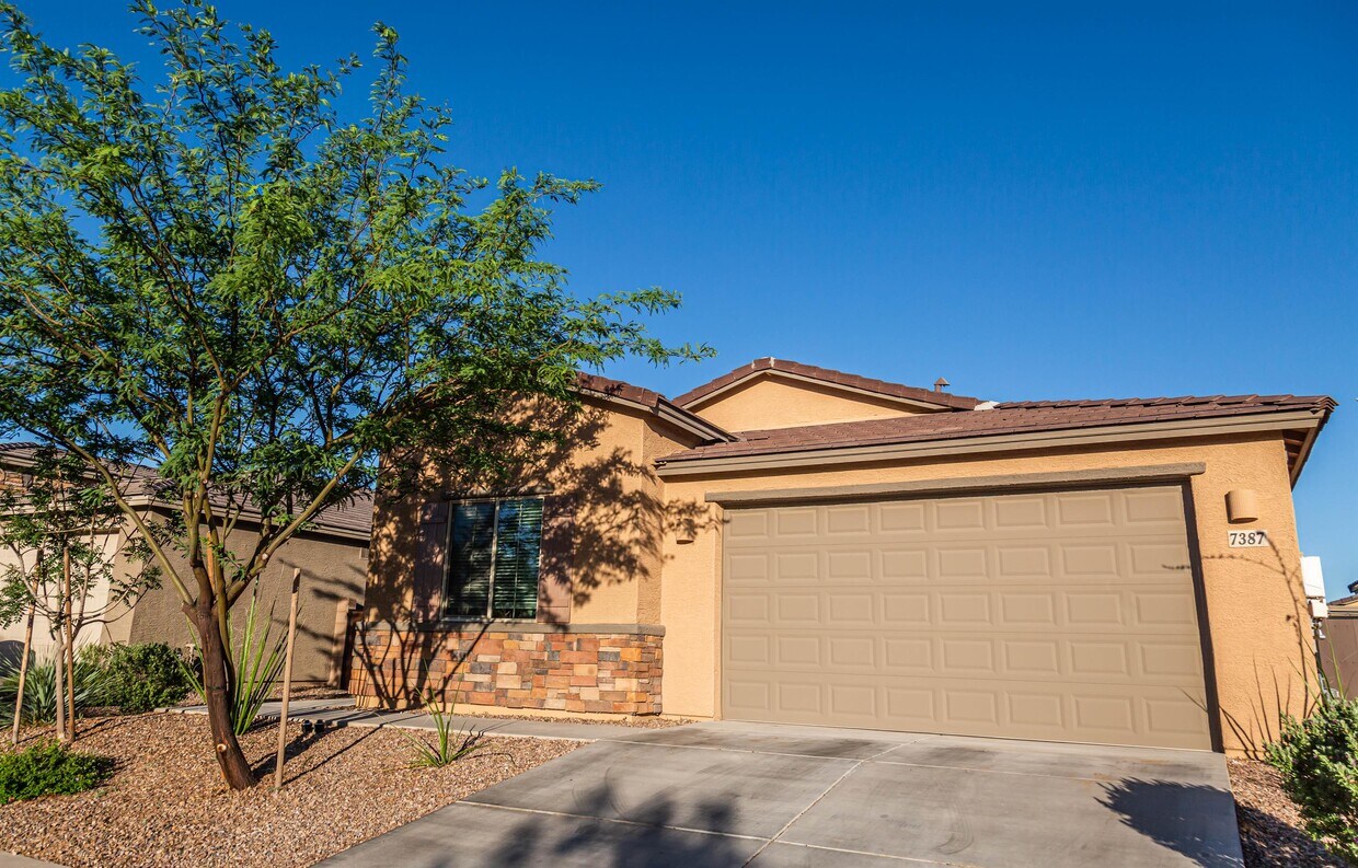
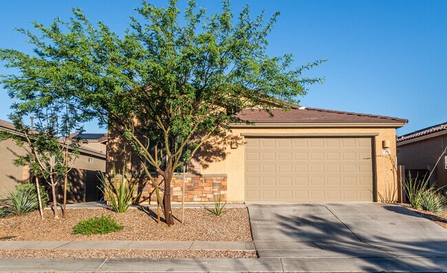
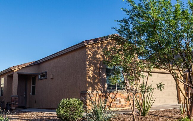
7387 S Via Plaza del Maya
Tucson, AZ 85756
4 Days Ago
|
Edit
Favorites
7387 S Via Plaza del Maya

Favorites
Check Back Soon for Upcoming Availability
| Beds | Baths | Average SF |
|---|---|---|
| 3 Bedrooms 3 Bedrooms 3 Br | 2 Baths 2 Baths 2 Ba | 1,879 SF |
About This Property
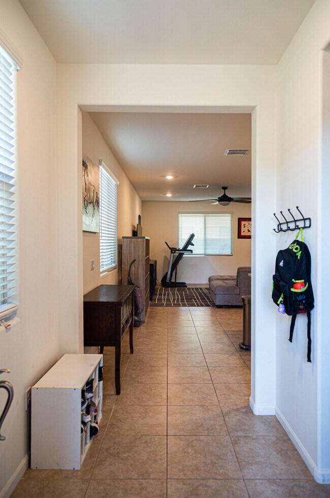
Modern, energy-efficient living awaits in this stunning 2020-built residence located at 7837 South Via Plaza Del Maya. This move-in-ready 3-bedroom, 2-bathroom home perfectly balances contemporary style with high-tech functionality, featuring a spacious open-concept Great Room and Dining area designed for seamless entertaining. The chef-inspired kitchen serves as the heart of the home, boasting elegant granite countertops, a premium gas range, and an expansive island perfect for meal prep or casual morning coffee. High 9' ceilings and faux wood blinds enhance the bright, airy atmosphere throughout. Designed for the forward-thinking homeowner, this property is a fully equipped Wi-Fi Smart Home featuring a Ring Video Doorbell Pro. Sustainability is a priority here, with owner-owned solar panels ensuring extremely minimal monthly electric bills. Additional efficiency upgrades include a 14 SEER HVAC system, insulated air ducts, dual-pane low-E vinyl windows, and LED lighting. Outside, the property offers convenience and privacy through dual side gates and a low-maintenance aesthetic. Experience the perfect blend of comfort, technology, and massive utility savings in the 85756 area. Please take note of the following requirements: Total Monthly Payment (Rent + $59.95 RBP)* *If you provide your own insurance policy, the RBP cost will be reduced by the amount of the insurance premium billed by Second Nature Insurance Services (NPN No. 20224621). - A 12-month lease is required - Tenants are responsible for paying utilities All proposed occupants over the age of 18 must submit a completed and signed application. Please ensure that all fields are filled in, as incorrect or missing information will disqualify you as a prospective renter. A $75.00 screening fee is required with each application for the purpose of running credit and eviction reports. Fees must be paid online before applications will be considered. Applicants must have a credit report that demonstrates a willingness to pay financial obligations in a timely fashion, or a FICO score of at least 625 or a favorable debt to income ratio. No records of eviction are permitted. Favorable responses from references and previous landlords are required. Applicants will be denied if they have a conviction for any type of crime that would be considered a threat to real property or the ability of other residents to peacefully enjoy the premises. Required Documents: - Picture I.D. (Driver's license, Green Card, or Passport) - Social Security - Proof of Income: Current paystubs or an official letter from your employer on company letterhead should be attached to the application. For self-employed or 1099 applicants, your last two years of tax returns are required.
7387 S Via Plaza Del Maya is a house located in Pima County and the 85756 ZIP Code. This area is served by the Vail Unified District attendance zone.
7387 S Via Plaza del Maya,
Tucson,
AZ
85756
In the city of Tucson, Ward 4 sits east of Interstate 19, with Interstate 10 running north and south through its east side. Ward 4 consists of several neighborhoods including Dietz, Groves Lincoln Park, Terra Del Sol, Civano, and Mesquite Ranch. Pima County’s Ward 4 has a variety of rentals, many of which reflect southwestern styles. Residents head to the town’s recreation center several times a week for freshly brewed coffee and potluck dinners.
Neighbors use the Valencia Library computers, meeting and study rooms, and Wi-Fi to study for exams or to read a book. Locals are sure to swing by Omar’s Hi-Way Chef Restaurant for a diner-style meal, such as fluffy pancakes, sausage, eggs, and country fried potatoes.
Learn more about living in Ward 4Below are rent ranges for similar nearby apartments
Education
| Colleges & Universities | Distance | ||
|---|---|---|---|
| Colleges & Universities | Distance | ||
| Drive: | 12 min | 5.8 mi | |
| Drive: | 21 min | 10.4 mi | |
| Drive: | 22 min | 12.8 mi | |
| Drive: | 19 min | 12.9 mi |
7387 S Via Plaza del Maya is within 12 minutes or 5.8 miles from Pima C.C., East Campus. It is also near Pima C.C., Desert Vista Campus and University of Arizona.
Schools

Public Elementary, Middle & High School
Grades K-12
620 Students
Attendance Zone
Private Elementary & Middle School
Grades PK-8
316 Students
Nearby
Private Elementary, Middle & High School
Grades K-12
61 Students
Nearby
Private Middle & High School
Grades 6-12
Nearby
School data provided by
 The GreatSchools Rating helps parents compare schools within a state based on a variety of school quality indicators and provides a helpful picture of how effectively each school serves all of its students. Ratings are on a scale of 1 (below average) to 10 (above average) and can include test scores, college readiness, academic progress, advanced courses, equity, discipline and attendance data. We also advise parents to visit schools, consider other information on school performance and programs, and consider family needs as part of the school selection process.
View GreatSchools Rating Methodology
Data provided by GreatSchools.org © 2026. All rights reserved.
View GreatSchools Rating Methodology
Data provided by GreatSchools.org © 2026. All rights reserved.
Transportation options available in Tucson include Sl/2Nd St/Cherry Av, located 12.3 miles from 7387 S Via Plaza del Maya. 7387 S Via Plaza del Maya is near Tucson International, located 7.4 miles or 14 minutes away.
| Transit / Subway | Distance | ||
|---|---|---|---|
| Transit / Subway | Distance | ||
| Drive: | 21 min | 12.3 mi |
| Commuter Rail | Distance | ||
|---|---|---|---|
| Commuter Rail | Distance | ||
|
|
Drive: | 19 min | 13.1 mi |
|
|
Drive: | 40 min | 36.2 mi |
| Airports | Distance | ||
|---|---|---|---|
| Airports | Distance | ||
|
Tucson International
|
Drive: | 14 min | 7.4 mi |
Walkability Near 7387 S Via Plaza del Maya Tucson, AZ 85756
Getting Around
 What do Walkability, Transit, Drivability, and Bikeability mean?
Walkability measures the walking distance to day-to-day needs.
Transit measures access to public transportation.
Drivability measures congestion, parking availability, and access to major roads.
Bikeability measures the suitability for cycling.
How It Works
What do Walkability, Transit, Drivability, and Bikeability mean?
Walkability measures the walking distance to day-to-day needs.
Transit measures access to public transportation.
Drivability measures congestion, parking availability, and access to major roads.
Bikeability measures the suitability for cycling.
How It Works
Not Walkable
Walkability
10
/ 100
Minimal Public Transit
Transit
0
/ 100
Exceptionally Drivable
Drivability
100
/ 100
Moderately Bikeable
Bikeability
60
/ 100
Scores provided by
-
Soundscore™
-
/ 100
Traffic
-Airport
-Businesses
-Scores provided by
HowLoud What is a Sound Score Rating? A Sound Score Rating aggregates noise caused by vehicle traffic, airplane traffic and local sources. How It WorksTime and distance from 7387 S Via Plaza del Maya.
| Shopping Centers | Distance | ||
|---|---|---|---|
| Shopping Centers | Distance | ||
| Drive: | 8 min | 4.4 mi | |
| Drive: | 10 min | 4.9 mi | |
| Drive: | 15 min | 7.5 mi |
7387 S Via Plaza del Maya has 3 shopping centers within 7.5 miles, which is about a 15-minute drive. The miles and minutes will be for the farthest away property.
| Parks and Recreation | Distance | ||
|---|---|---|---|
| Parks and Recreation | Distance | ||
|
Thomas Jay Regional Park
|
Drive: | 6 min | 3.4 mi |
|
Groves Park
|
Drive: | 11 min | 5.2 mi |
|
Escalante Park
|
Drive: | 10 min | 5.5 mi |
|
Abraham Lincoln Park and Atturbury Wash Greenway
|
Drive: | 12 min | 5.9 mi |
|
Purple Heart Park
|
Drive: | 13 min | 6.5 mi |
7387 S Via Plaza del Maya has 5 parks within 6.5 miles, including Thomas Jay Regional Park, Groves Park, and Escalante Park.
| Hospitals | Distance | ||
|---|---|---|---|
| Hospitals | Distance | ||
| Drive: | 13 min | 8.5 mi | |
| Drive: | 17 min | 9.3 mi | |
| Drive: | 19 min | 10.3 mi |
7387 S Via Plaza del Maya has 3 hospitals within 10.3 miles, the nearest is Banner - University Medical Center South Campus which is 8.5 miles away and a 13 minute drive.
| Military Bases | Distance | ||
|---|---|---|---|
| Military Bases | Distance | ||
| Drive: | 8 min | 4.4 mi | |
| Drive: | 16 min | 7.5 mi | |
| Drive: | 74 min | 62.9 mi |
7387 S Via Plaza del Maya has 3 military bases within 62.9 miles, the nearest is Davis Monthan Air Force Base which is 4.4 miles away and a 8 minute drive.
You May Also Like
Similar Rentals Nearby


What Are Walk Score®, Transit Score®, and Bike Score® Ratings?
Walk Score® measures the walkability of any address. Transit Score® measures access to public transit. Bike Score® measures the bikeability of any address.
What is a Sound Score Rating?
A Sound Score Rating aggregates noise caused by vehicle traffic, airplane traffic and local sources.

7387 S Via Plaza del Maya
Tucson, AZ 85756