

$2,150
/ Month
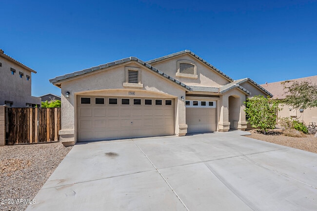
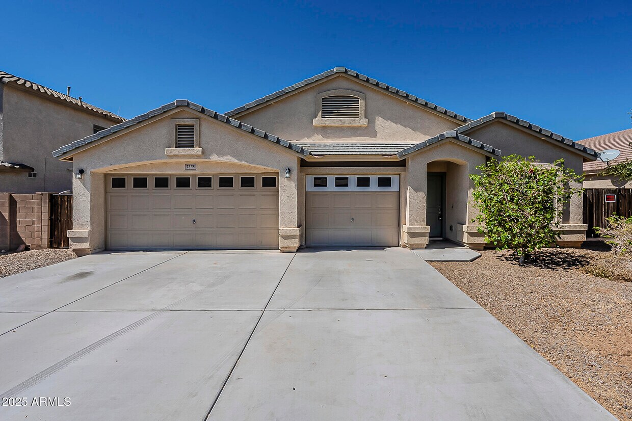
7358 N 72nd Ave
Glendale, AZ 85303
Today
Favorites
480-626-4062
-
Bedrooms
4
-
Bathrooms
2
-
Square Feet
2,134 sq ft
-
Available
Available Now
Highlights
- RV Gated
- Vaulted Ceiling
- Covered Patio or Porch
- Walk-In Pantry
- Eat-In Kitchen
- Soaking Tub
7358 N 72nd Ave

Favorites
About This Home
$2,150 deposit,
Available Now
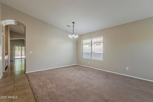
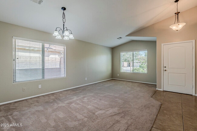
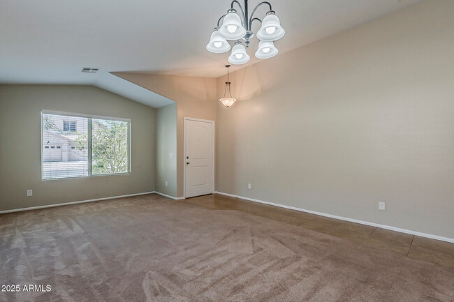
No Application Fees! Spacious 4 bedroom,2 bathroom single level Glendale home located in the Orangewood Vista Views community. This well designed floor plan includes tile and laminate flooring in all high traffic areas,two tone neutral paint,vaulted ceilings with high archways,upgraded window blinds,and ceiling fans in each room. Living spaces include a large front living room,a formal dining area,and a separate family room with direct backyard access. The oversized kitchen features an island,extended cabinet and countertop space,breakfast bar,walk-in pantry,dining area,upgraded cabinets,and all appliances. The primary suite offers a large walk-in closet,backyard access,dual sink vanity,garden tub,and a separate step-in shower. A spacious laundry room provides additional storage and a three car garage offers ample parking and convenience. The front and backyard feature easy to maintain desert landscaping. Located near Westgate Entertainment District,State Farm Stadium,Desert Diamond Arena,local parks,schools,shopping,and with convenient access to Loop 101 and US 60 for commuting throughout the Valley. All Denali Real Estate residents are automatically enrolled in the Resident Benefits Package (RBP) for $55.00/month which includes Renter's Liability Insurance,Credit Building to help boost the resident's credit scores with timely rent payments,up to $1M Identity Theft Protection,HVAC air filter delivery (for applicable properties),our best-in-class resident rewards program,and much more!
7358 N 72nd Ave is a house located in Maricopa County and the 85303 ZIP Code. This area is served by the Glendale Elementary District attendance zone.
* Price shown is base rent. Excludes user-selected optional fees and variable or usage-based fees and required charges due at or prior to move-in or at move-out. Price, availability, fees, and any applicable rent special are subject to change without notice.
* Square footage definitions vary. Displayed square footage is approximate.
Home Details
Year Built
Built in 2013
Bedrooms and Bathrooms
Primary Bathroom is a Full Bathroom
Soaking Tub
Double Vanity
2 Bathrooms
4 Bedrooms
Bathtub With Separate Shower Stall
Flooring
Tile
Carpet
Laminate
Home Design
Tile Roof
Stucco
Wood Frame Construction
Interior Spaces
Vaulted Ceiling
Ceiling Fan
2,134 Sq Ft Home
1-Story Property
Kitchen
Walk-In Pantry
Eat-In Kitchen
Breakfast Bar
Kitchen Island
Built-In Microwave
Laminate Countertops
Laundry
Laundry Room
Washer Hookup
Listing and Financial Details
Property Available on 10/3/25
$3 Move-In Fee
12-Month Minimum Lease Term
Tax Lot 17
Assessor Parcel Number 143-26-106
Lot Details
7,440 Sq Ft Lot
Desert faces the back of the property
Block Wall Fence
Outdoor Features
Covered Patio or Porch
Parking
RV Gated
3 Car Garage
Schools
Desert Spirit Elementary School
Challenger Middle School
Independence High School
Utilities
Central Air
High Speed Internet
Heating Available
Cable TV Available
Community Details
Overview
Property has a Home Owners Association
Orangewood Vista Views Subdivision
Contact
- Listed by Anthony Trujillo | Denali Real Estate,LLC
- Phone Number
- Contact
-
Source
Arizona Regional MLS
Copyright 2025 Arizona Regional MLS. All rights reserved. Information is deemed reliable but not guaranteed.
Location
Get Directions
Westside is a neighborhood within Glendale, which was voted “Arizona’s Antique Capital” by Sunset magazine and USA Today. Many higher education schools are located near Westside, including Glendale Community College, Carrington College, and Arizona State University West campus. You’ll discover numerous pocket parks in the area, plus larger ones like Glendale Heroes Regional Park and Grand Canal Linear Park. Shopping and dining destinations are plentiful, especially at Arrowhead Towne Center Mall.
Learn more about living in Westside
Education
| Colleges & Universities | Distance | ||
|---|---|---|---|
| Colleges & Universities | Distance | ||
| Drive: | 8 min | 3.1 mi | |
| Drive: | 14 min | 6.2 mi | |
| Drive: | 16 min | 7.0 mi | |
| Drive: | 17 min | 7.7 mi |
7358 N 72nd Ave is within 8 minutes or 3.1 miles from Glendale Community College. It is also near Grand Canyon University and Thunderbird, West Campus.
Schools


Public Elementary & Middle School
Grades PK-8
670 Students
Attendance Zone
Public High School
Grades 9-12
2,040 Students
Attendance Zone
Private Elementary & Middle School
Grades 3-8
Nearby
Private Elementary & Middle School
Grades PK-8
345 Students
Nearby
Private Elementary, Middle & High School
Grades 5-12
Nearby
School data provided by
 The GreatSchools Rating helps parents compare schools within a state based on a variety of school quality indicators and provides a helpful picture of how effectively each school serves all of its students. Ratings are on a scale of 1 (below average) to 10 (above average) and can include test scores, college readiness, academic progress, advanced courses, equity, discipline and attendance data. We also advise parents to visit schools, consider other information on school performance and programs, and consider family needs as part of the school selection process.
View GreatSchools Rating Methodology
Data provided by GreatSchools.org © 2025. All rights reserved.
View GreatSchools Rating Methodology
Data provided by GreatSchools.org © 2025. All rights reserved.
Transportation options available in Glendale include Glendale/19Th Ave, located 7.1 miles from 7358 N 72nd Ave. 7358 N 72nd Ave is near Phoenix Sky Harbor International, located 16.9 miles or 29 minutes away.
| Transit / Subway | Distance | ||
|---|---|---|---|
| Transit / Subway | Distance | ||
|
|
Drive: | 16 min | 7.1 mi |
|
|
Drive: | 16 min | 7.5 mi |
|
|
Drive: | 16 min | 7.6 mi |
|
|
Drive: | 16 min | 7.8 mi |
|
|
Drive: | 17 min | 7.9 mi |
| Airports | Distance | ||
|---|---|---|---|
| Airports | Distance | ||
|
Phoenix Sky Harbor International
|
Drive: | 29 min | 16.9 mi |
Time and distance from 7358 N 72nd Ave.
| Shopping Centers | Distance | ||
|---|---|---|---|
| Shopping Centers | Distance | ||
| Drive: | 3 min | 1.1 mi | |
| Drive: | 3 min | 1.1 mi | |
| Drive: | 3 min | 1.3 mi |
7358 N 72nd Ave has 3 shopping centers within 1.3 miles, which is about a 3-minute drive. The miles and minutes will be for the farthest away property.
| Parks and Recreation | Distance | ||
|---|---|---|---|
| Parks and Recreation | Distance | ||
|
El Oso Park
|
Drive: | 10 min | 4.4 mi |
|
Maryvale Park
|
Drive: | 12 min | 5.6 mi |
|
Acoma Park
|
Drive: | 18 min | 9.2 mi |
|
Conocido Park
|
Drive: | 22 min | 11.2 mi |
|
Friendship Park
|
Drive: | 22 min | 12.9 mi |
7358 N 72nd Ave has 5 parks within 12.9 miles, including El Oso Park, Maryvale Park, and Acoma Park.
| Hospitals | Distance | ||
|---|---|---|---|
| Hospitals | Distance | ||
| Drive: | 8 min | 3.9 mi | |
| Drive: | 13 min | 6.5 mi | |
| Drive: | 13 min | 7.1 mi |
7358 N 72nd Ave has 3 hospitals within 7.1 miles, the nearest is Aurora Behavioral Health System which is 3.9 miles away and a 8 minute drive.
| Military Bases | Distance | ||
|---|---|---|---|
| Military Bases | Distance | ||
| Drive: | 16 min | 8.4 mi | |
| Drive: | 30 min | 16.7 mi | |
| Drive: | 97 min | 71.3 mi |
7358 N 72nd Ave has 3 military bases within 71.3 miles, the nearest is Luke Air Force Base which is 8.4 miles away and a 16 minute drive.
You May Also Like
Similar Rentals Nearby


What Are Walk Score®, Transit Score®, and Bike Score® Ratings?
Walk Score® measures the walkability of any address. Transit Score® measures access to public transit. Bike Score® measures the bikeability of any address.
What is a Sound Score Rating?
A Sound Score Rating aggregates noise caused by vehicle traffic, airplane traffic and local sources
7358 N 72nd Ave
Glendale, AZ 85303