

$1,500
/ Month
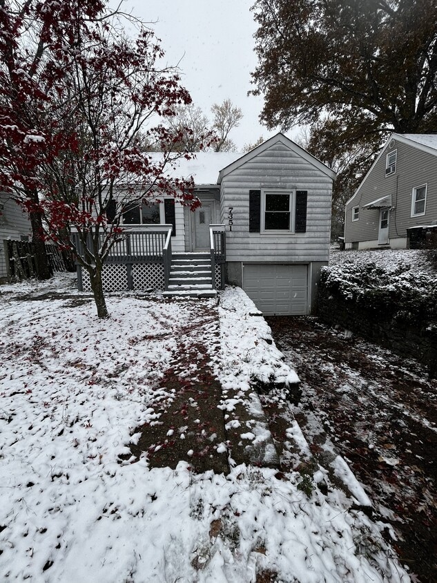
7351 Clovernook Ave
Cincinnati, OH 45231
1 Day Ago
|
Edit
Favorites
513-834-5852
-
Bedrooms
3
-
Bathrooms
1
-
Square Feet
--
-
Available
Available Now
7351 Clovernook Ave

Favorites
About This Home
$1,500 deposit,
Available Now
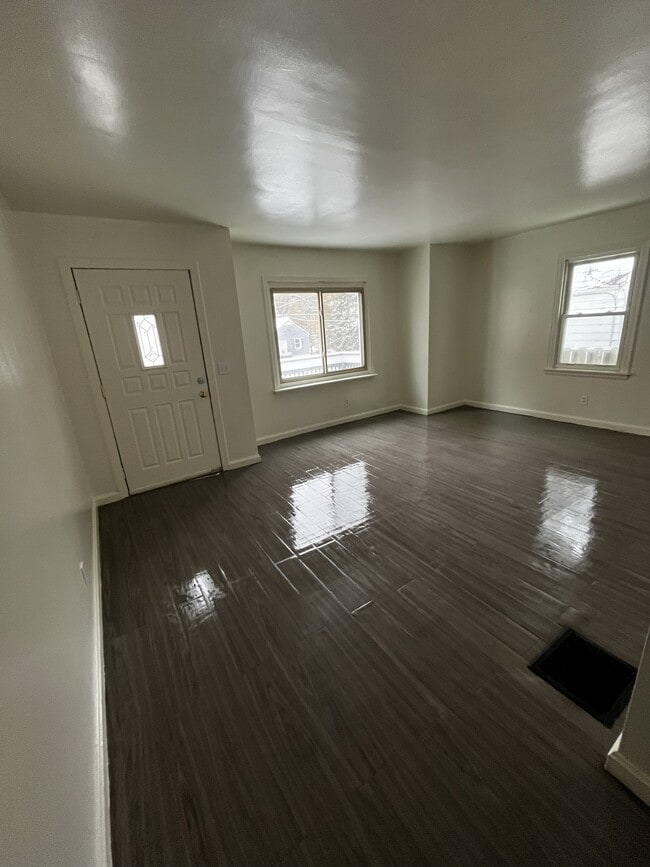
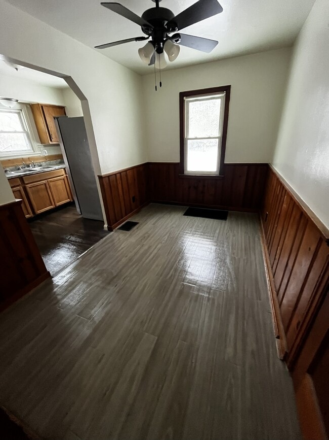
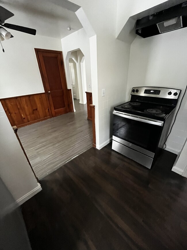
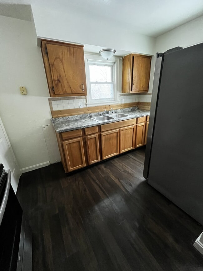
Amazing 3 bedroom, 1 bathroom house in Cincinnati. Amenities included: central air, central heat, hardwood floors, updated kitchen, updated bathroom, w/d hookup, off-street parking, and garage. No Utilities included. Is pet friendly. Date Available: Nov 13th 2025. $1,500/month rent. $1,500 security deposit required. Please submit the form on this page or contact Original Luster at to learn more. This property is managed by a responsible landlord.
7351 Clovernook Ave is a house located in Hamilton County and the 45231 ZIP Code. This area is served by the Mt Healthy City attendance zone.
* Price shown is base rent. Excludes user-selected optional fees and variable or usage-based fees and required charges due at or prior to move-in or at move-out. Price, availability, fees, and any applicable rent special are subject to change without notice.
* Square footage definitions vary. Displayed square footage is approximate.
Fees and Policies
The fees below are based on community-supplied data and may exclude additional fees and utilities.
- One-Time Basics
- Due at Move-In
- Security Deposit - Refundable$1,500
- Due at Move-In
- Dogs
- Allowed
- Cats
- Allowed
Property Fee Disclaimer: Based on community-supplied data and independent market research. Subject to change without notice. May exclude fees for mandatory or optional services and usage-based utilities.
Contact
- Listed by Original Luster
- Phone Number
- Contact
Location
Get Directions
Brentwood, a small community located in the northwestern portion of Springfield Township’s Finneytown neighborhood, sits in Hamilton County approximately 16 miles northeast of Downtown Cincinnati. Modest homes from the late 1940s line the tidy streets of the neighborhood, some with attached garages, fenced-in backyards, and private driveways.
Residents appreciate the neighborhood’s homey atmosphere, affordable housing options, and good school system. Also, State Route 126 runs through the southern portion of Brentwood, making it easy for residents to commute to and from Cincinnati.
Learn more about living in Brentwood
Education
| Colleges & Universities | Distance | ||
|---|---|---|---|
| Colleges & Universities | Distance | ||
| Drive: | 19 min | 7.7 mi | |
| Drive: | 20 min | 8.4 mi | |
| Drive: | 18 min | 10.2 mi | |
| Drive: | 20 min | 11.1 mi |
7351 Clovernook Ave is within 19 minutes or 7.7 miles from Cincinnati State. It is also near Univ. of Cincinnati, Medical and Cincinnati State, WDC.
Schools


Public Elementary School
Grades 1-6
651 Students
Attendance Zone
Public Middle School
Grades 7-8
457 Students
Attendance Zone
Public High School
Grades 9-12
828 Students
Attendance Zone
Private Elementary & Middle School
Grades K-8
141 Students
Nearby
Private Elementary & Middle School
Grades PK-8
239 Students
Nearby
Private High School
Grades 9-12
568 Students
Nearby
School data provided by
 The GreatSchools Rating helps parents compare schools within a state based on a variety of school quality indicators and provides a helpful picture of how effectively each school serves all of its students. Ratings are on a scale of 1 (below average) to 10 (above average) and can include test scores, college readiness, academic progress, advanced courses, equity, discipline and attendance data. We also advise parents to visit schools, consider other information on school performance and programs, and consider family needs as part of the school selection process.
View GreatSchools Rating Methodology
Data provided by GreatSchools.org © 2025. All rights reserved.
View GreatSchools Rating Methodology
Data provided by GreatSchools.org © 2025. All rights reserved.
Transportation options available in Cincinnati include Findlay Market-Race Station, Race & Elder, located 9.3 miles from 7351 Clovernook Ave. 7351 Clovernook Ave is near Cincinnati/Northern Kentucky International, located 25.4 miles or 47 minutes away.
| Transit / Subway | Distance | ||
|---|---|---|---|
| Transit / Subway | Distance | ||
| Drive: | 22 min | 9.3 mi | |
| Drive: | 22 min | 9.4 mi | |
| Drive: | 23 min | 9.4 mi | |
| Drive: | 23 min | 9.5 mi | |
| Drive: | 24 min | 9.8 mi |
| Commuter Rail | Distance | ||
|---|---|---|---|
| Commuter Rail | Distance | ||
|
|
Drive: | 23 min | 11.4 mi |
| Airports | Distance | ||
|---|---|---|---|
| Airports | Distance | ||
|
Cincinnati/Northern Kentucky International
|
Drive: | 47 min | 25.4 mi |
Time and distance from 7351 Clovernook Ave.
| Shopping Centers | Distance | ||
|---|---|---|---|
| Shopping Centers | Distance | ||
| Drive: | 4 min | 1.3 mi | |
| Drive: | 5 min | 1.3 mi | |
| Drive: | 6 min | 1.4 mi |
7351 Clovernook Ave has 3 shopping centers within 1.4 miles, which is about a 6-minute drive. The miles and minutes will be for the farthest away property.
| Parks and Recreation | Distance | ||
|---|---|---|---|
| Parks and Recreation | Distance | ||
|
Winton Woods Park
|
Drive: | 9 min | 3.5 mi |
|
LaBoiteaux Woods
|
Drive: | 11 min | 3.6 mi |
|
Farbach-Werner Nature Preserve
|
Drive: | 9 min | 4.3 mi |
|
Buttercup Valley
|
Drive: | 13 min | 4.7 mi |
|
Caldwell Preserve
|
Drive: | 11 min | 4.7 mi |
7351 Clovernook Ave has 5 parks within 4.7 miles, including Winton Woods Park, LaBoiteaux Woods, and Farbach-Werner Nature Preserve.
| Hospitals | Distance | ||
|---|---|---|---|
| Hospitals | Distance | ||
| Drive: | 11 min | 7.1 mi | |
| Drive: | 17 min | 7.5 mi | |
| Drive: | 18 min | 8.2 mi |
7351 Clovernook Ave has 3 hospitals within 8.2 miles, the nearest is Summit Behavioral Healthcare which is 7.1 miles away and a 11 minute drive.
| Military Bases | Distance | ||
|---|---|---|---|
| Military Bases | Distance | ||
| Drive: | 67 min | 51.4 mi | |
| Drive: | 73 min | 56.4 mi | |
| Drive: | 75 min | 59.7 mi |
7351 Clovernook Ave has 3 military bases within 59.7 miles, the nearest is Gentile Air Force Station which is 51.4 miles away and a 67 minute drive.
You May Also Like
Similar Rentals Nearby


What Are Walk Score®, Transit Score®, and Bike Score® Ratings?
Walk Score® measures the walkability of any address. Transit Score® measures access to public transit. Bike Score® measures the bikeability of any address.
What is a Sound Score Rating?
A Sound Score Rating aggregates noise caused by vehicle traffic, airplane traffic and local sources
7351 Clovernook Ave
Cincinnati, OH 45231