
$1,995
Total Monthly Price
12 Month Lease
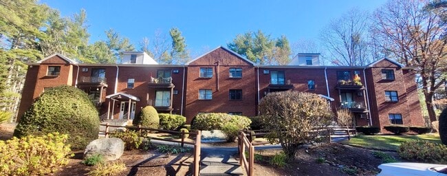
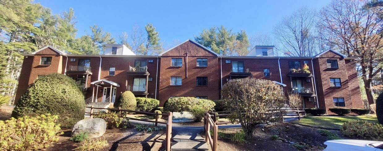
73 Liberty Square Rd Unit 18A
Boxborough, MA 01719
Favorites
-
Bedrooms
2
-
Bathrooms
1
-
Square Feet
873 sq ft
-
Available
Available Aug 7
Highlight
- Smoke Free
73 Liberty Square Rd Unit 18A

Favorites
About This Home
12 Month Lease,
$3,990 deposit,
Available Aug 7
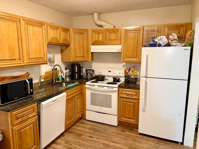
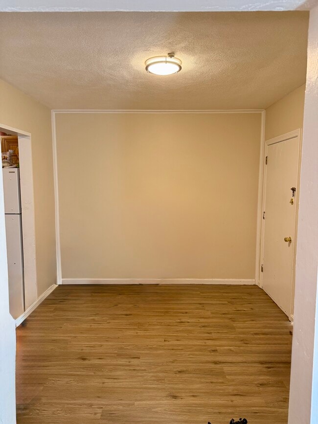
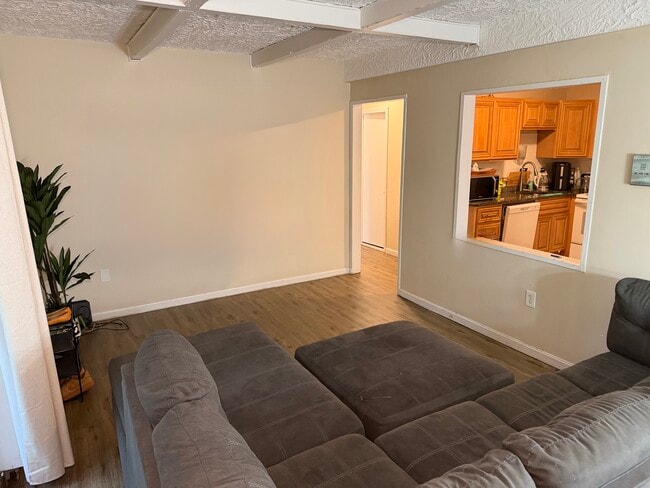
This property at 73 Liberty Square Rd offers a range of rental options with 1 to 2 bedrooms and 1 bathroom, featuring a total square footage between 640 and 874. The living spaces include a kitchen equipped with a refrigerator, range, and dishwasher, along with a comfortable living room area. Each unit includes multiple closets for ample storage, and the bathroom is designed for convenience. Additional amenities include laundry facilities, air conditioning, and instant hot water for efficiency. The exterior features a porch, providing an outdoor space for relaxation. The property is smoke-free, ensuring a healthy living environment. Rental prices are competitive for the area, reflecting the amenities and square footage offered. Interested renters are encouraged to inquire for specific unit availability and pricing.
Bright and comfortable 2-bed, 1-bath condo in a fantastic Boxborough location. This unit features a clean, well-kept kitchen with refrigerator, range, and dishwasher, and a ground-level covered porch perfect for relaxing. AC and hot water are included in the rent, and the building offers convenient on-site laundry plus additional attic storage. A quiet, well-maintained community close to commuter routes, shops, and everything Boxborough has to offer. Move-in ready and easy to love. *Please Note: If interested, an application deposit is due at the showing equivalent to one month's rent. If your application is approved this will be used as 1st month's rent, and if denied, the deposit will be returned back to you. Deposits must be check or money order only.
73 Liberty Square Rd is a condo located in Middlesex County and the 01719 ZIP Code.
* Price shown is total price based on community-supplied monthly required fees. Excludes user-selected optional fees and variable or usage-based fees and required charges due at or prior to move-in or at move-out. Price, availability, fees, and any applicable rent special are subject to change without notice.
* Square footage definitions vary. Displayed square footage is approximate.
Condo Features
Air Conditioning
Dishwasher
Refrigerator
Smoke Free
- Air Conditioning
- Smoke Free
- Dishwasher
- Kitchen
- Range
- Refrigerator
- Instant Hot Water
- Laundry Facilities
- Storage Space
- Porch
Fees and Policies
The fees listed below are community-provided and may exclude utilities or add-ons. All payments are made directly to the property and are non-refundable unless otherwise specified.
- Parking
-
Surface Lot--
Details
Utilities Included
-
Water
-
Air Conditioning
Property Information
-
4 units
Contact
- Contact
Location
Get Directions
About an hour out from Boston, in Middlesex County, is the suburban town of Boxborough. You may also see it spelled out as “Boxboro,” since government officials have adopted this spelling for its roadway signs and official documents. With its close proximity to Boston’s trendy 5-star restaurants, boutique shopping destinations, and American history artifacts, Boxborough is a great place to call home. Steele Farm is a favored spot for locals because of its breathtaking vistas, hills for sledding, and dog-friendly walking trails.
Boxborough was first inhabited by the Nipmuc and Pennacook tribes. In the 18th century, the land was then settled by farmers seeking fertile land to grow their crops. Today, farming and agriculture are still very much celebrated – every September residents gather at the harvest fair to revel the town’s legacy.
Commuting is easy for residents, thanks to I-495 and Route 111. Students in the area are serviced by the Acton-Boxborough Regional School District.
Learn more about living in Boxborough
Education
| Colleges & Universities | Distance | ||
|---|---|---|---|
| Colleges & Universities | Distance | ||
| Drive: | 34 min | 15.6 mi | |
| Drive: | 31 min | 16.0 mi | |
| Drive: | 35 min | 19.8 mi | |
| Drive: | 29 min | 20.4 mi |
73 Liberty Square Rd Unit 18A is within 34 minutes or 15.6 miles from Middlesex C.C., Bedford Campus. It is also near Framingham State College and UMass Lowell.
Getting Around
 What do Walkability, Transit, Drivability, and Bikeability mean?
Walkability measures the walking distance to day-to-day needs.
Transit measures access to public transportation.
Drivability measures congestion, parking availability, and access to major roads.
Bikeability measures the suitability for cycling.
How It Works
What do Walkability, Transit, Drivability, and Bikeability mean?
Walkability measures the walking distance to day-to-day needs.
Transit measures access to public transportation.
Drivability measures congestion, parking availability, and access to major roads.
Bikeability measures the suitability for cycling.
How It Works
Somewhat Walkable
Walkability
20
/ 100
Minimal Public Transit
Transit
0
/ 100
Exceptionally Drivable
Drivability
90
/ 100
Fairly Bikeable
Bikeability
50
/ 100
Scores provided by
-
Soundscore™
-
/ 100
Traffic
-Airport
-Businesses
-Scores provided by
HowLoud What is a Sound Score Rating? A Sound Score Rating aggregates noise caused by vehicle traffic, airplane traffic and local sources. How It Works
Amenities
- Air Conditioning
- Smoke Free
- Dishwasher
- Kitchen
- Range
- Refrigerator
- Instant Hot Water
- Laundry Facilities
- Storage Space
- Porch
73 Liberty Square Rd Unit 18A Photos
73 Liberty Square Rd
Boxborough, MA 01719