-
724 W. Roderick Ave

-
-
$1,000
/ Month
724 W Roderick Ave Unit 724 1/2
Oxnard, CA 93030
Favorites
724 W Roderick Ave Unit 724 1/2

Favorites
Check Back Soon for Upcoming Availability
| Beds | Baths | Average SF |
|---|---|---|
| Studio Studio 0 Br | 1 Bath 1 Bath 1 Ba | — |
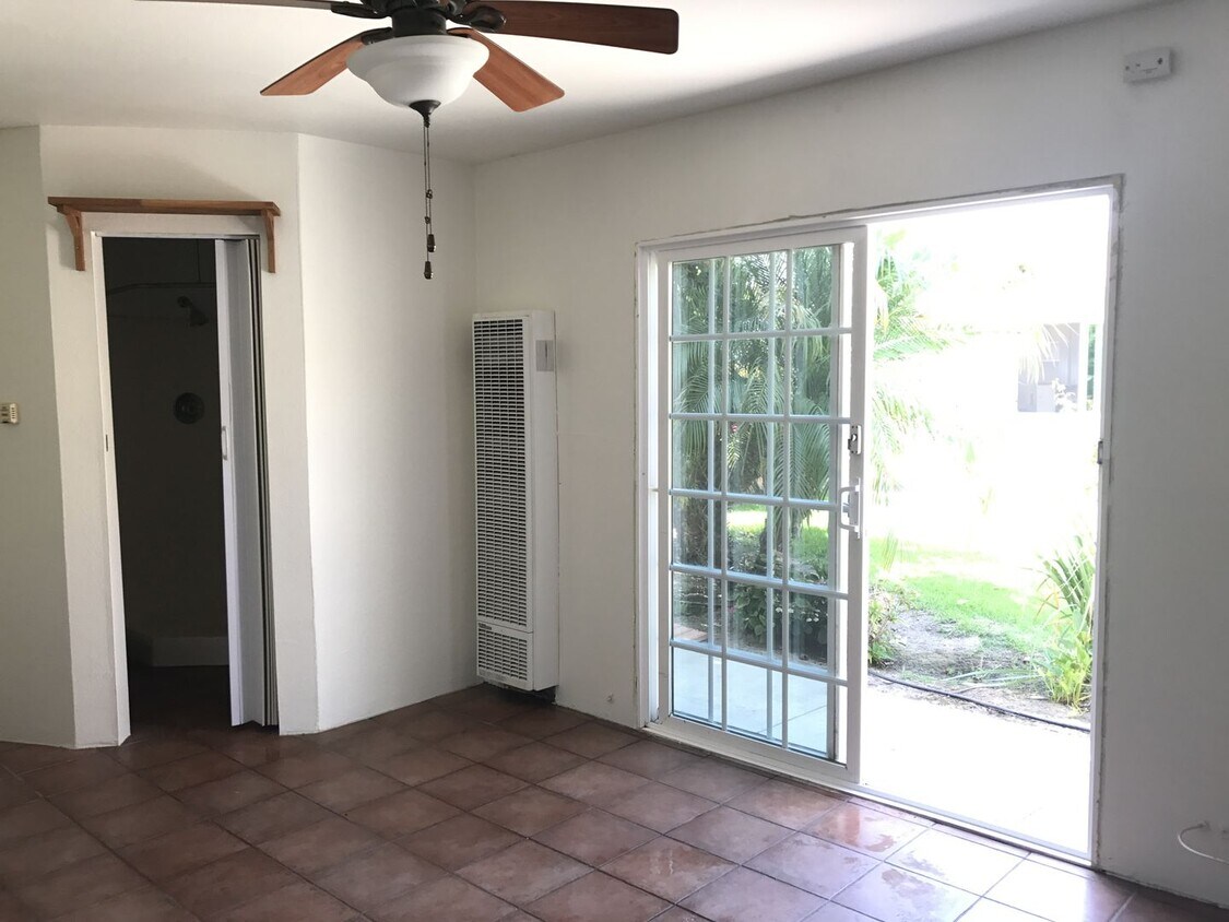
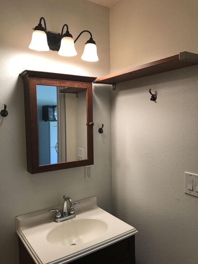
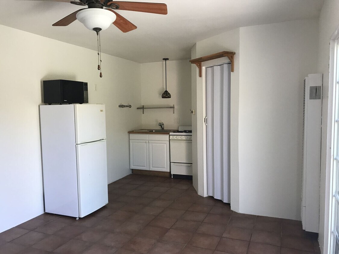
About This Property
You'll adore your new address in Oxnard, CA. This property is located at 724 W Roderick Ave in the Carriage Square area of Oxnard. With this great space, you'll feel right at home. Let us assist you! Contact us now to discuss the next steps!
724 W Roderick Ave is an apartment community located in Ventura County and the 93030 ZIP Code.
724 W Roderick Ave,
Oxnard,
CA
93030
Stretched along the Pacific Coast Highway, Carriage Square is a residential community home to a number of schools, churches, and parks. Eastwood Memorial Park inhabits the neighborhood and contains baseball diamonds, basketball courts, benches, and a playground area for enjoying outdoor recreation.
Less than two miles north of Downtown Oxnard, Carriage Square residents maintain easy access to the many restaurants, cafes, and shops as well as the seasonal festivals hosted in the downtown area. Carriage Square’s prime location and public transportation options allow for easy travels and commutes.
Learn more about living in Carriage Square
Education
| Colleges & Universities | Distance | ||
|---|---|---|---|
| Colleges & Universities | Distance | ||
| Drive: | 9 min | 4.2 mi | |
| Drive: | 15 min | 7.6 mi | |
| Drive: | 18 min | 11.4 mi | |
| Drive: | 32 min | 22.7 mi |
724 W Roderick Ave Unit 724 1/2 is within 9 minutes or 4.2 miles from Oxnard College. It is also near Ventura College and CSU Channel Islands.
Walkability Near 724 W Roderick Ave Oxnard, CA 93030
Getting Around
 What do Walkability, Transit, Drivability, and Bikeability mean?
Walkability measures the walking distance to day-to-day needs.
Transit measures access to public transportation.
Drivability measures congestion, parking availability, and access to major roads.
Bikeability measures the suitability for cycling.
How It Works
What do Walkability, Transit, Drivability, and Bikeability mean?
Walkability measures the walking distance to day-to-day needs.
Transit measures access to public transportation.
Drivability measures congestion, parking availability, and access to major roads.
Bikeability measures the suitability for cycling.
How It Works
Fairly Walkable
Walkability
50
/ 100
Some Public Transit
Transit
40
/ 100
Very Drivable
Drivability
80
/ 100
Moderately Bikeable
Bikeability
70
/ 100
Scores provided by
-
Soundscore™
-
/ 100
Traffic
-Airport
-Businesses
-Scores provided by
HowLoud What is a Sound Score Rating? A Sound Score Rating aggregates noise caused by vehicle traffic, airplane traffic and local sources. How It WorksYou May Also Like
Similar Rentals Nearby
-
-
1 Bed$2,650+2 Beds$3,150+Total Monthly PriceTotal Monthly Price NewPrices include all required monthly fees.
Pets Allowed Fitness Center Pool Dishwasher Refrigerator In Unit Washer & Dryer
-
2 Beds$3,698+3 Beds$3,900Total Monthly PriceTotal Monthly Price NewPrices include all required monthly fees.
Pets Allowed Dishwasher Refrigerator In Unit Washer & Dryer Walk-In Closets Balcony
-
-
-
-
1 Bed$2,401+2 Beds$3,141+Total Monthly PriceTotal Monthly Price NewPrices include base rent and required monthly fees of $10. Variable costs based on usage may apply.Base Rent:1 Bed$2,390+2 Beds$3,130+Specials
Fitness Center Pool Dishwasher Refrigerator In Unit Washer & Dryer Walk-In Closets
-
-
-


What Are Walk Score®, Transit Score®, and Bike Score® Ratings?
Walk Score® measures the walkability of any address. Transit Score® measures access to public transit. Bike Score® measures the bikeability of any address.
What is a Sound Score Rating?
A Sound Score Rating aggregates noise caused by vehicle traffic, airplane traffic and local sources.
724 W Roderick Ave
Oxnard, CA 93030