

$3,550 / Month
7146 Santa Isabel Cir
Buena Park, CA 90620
2 Weeks Ago
Favorites
7146 Santa Isabel Cir

Favorites
Check Back Soon for Upcoming Availability
| Beds | Baths | Average SF |
|---|---|---|
| 4 Bedrooms 4 Bedrooms 4 Br | 3 Baths 3 Baths 3 Ba | 1,194 SF |
Fees and Policies
The fees below are based on community-supplied data and may exclude additional fees and utilities.
- Parking
-
Garage--
-
Other--
Details
Utilities Included
-
Trash Removal
-
Sewer
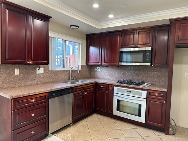
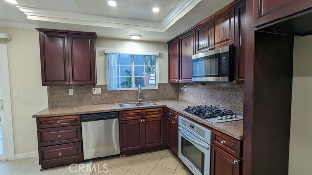
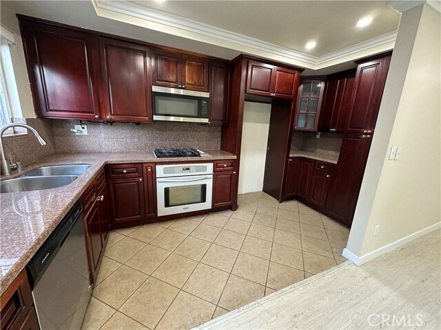
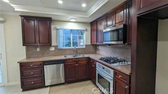
About This Property
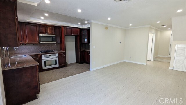
The property is in a very clean desirable area to live in, it is a friendly community, and the association has a community swimming pool available any time you like to swimmer, and a clubhouse that can be used with a reservation for a very low cost. The property is Near Knott's Berry Farm, with easy access to Freeway 91, close to banks, close to grocery stores, close to La Palma Ave. Post office (within walking distance), close to OC Public Library (within walking distance), close to Buena Terra Elementary School, close to Buena Park High School, and much more...
7146 Santa Isabel Cir is a townhome located in Orange County and the 90620 ZIP Code. This area is served by the Anaheim Union High attendance zone.
Townhome Features
Air Conditioning
Dishwasher
Microwave
Disposal
- Air Conditioning
- Heating
- Dishwasher
- Disposal
- Microwave
- Oven
- Vinyl Flooring
- Clubhouse
- Pool
- Tennis Court
- Fenced Lot
- Patio
Location
Get Directions
Regarded as both an entertainment wonderland and the birthplace of the boysenberry, Buena Park is a SoCal suburb with a fascinating story. Located just west of Anaheim, Buena Park has a rich history as a rural town that evolved into a theme park destination. Knott’s Berry Farm, Buena Park’s most renowned landmark, began as a small family-owned berry farm. Today, Knott’s Berry Farm is known as California’s first theme park, drawing visitors from all over the world to enjoy its world-class rides, interactive experiences, shows, and delectable eats.
Outside of its Entertainment Corridor (which also includes Medieval Times, Pirate’s Dinner Adventure, Teatro Martini, and Knott’s Soak City water park), Buena Park offers residents access to a host of suburban conveniences in a central locale. Shopping options abound at Buena Park Mall, in addition to nearby Amerige Heights Town Center and Los Cerritos Center. Potential for outdoor recreation is endless at Ralph B Clark Park.
Learn more about living in Buena Park
Amenities
- Air Conditioning
- Heating
- Dishwasher
- Disposal
- Microwave
- Oven
- Vinyl Flooring
- Clubhouse
- Fenced Lot
- Patio
- Pool
- Tennis Court
Expenses
Utilities Included
Trash Removal, Sewer
Included
Education
| Colleges & Universities | Distance | ||
|---|---|---|---|
| Colleges & Universities | Distance | ||
| Drive: | 5 min | 2.0 mi | |
| Drive: | 12 min | 6.5 mi | |
| Drive: | 12 min | 7.5 mi | |
| Drive: | 13 min | 8.1 mi |
7146 Santa Isabel Cir is within 5 minutes or 2.0 miles from Cypress College. It is also near Biola University and Cerritos College.
Schools


Public Elementary School
Grades K-6
524 Students
Nearby
Public Elementary School
Grades K-6
644 Students
Attendance Zone
Public Middle School
Grades 7-8
681 Students
Attendance Zone
Public High School
Grades 9-12
1,704 Students
Attendance Zone
Private Elementary School
Grades PK-3
54 Students
Nearby
Private Elementary, Middle & High School
Grades 1-12
Nearby
School data provided by
 The GreatSchools Rating helps parents compare schools within a state based on a variety of school quality indicators and provides a helpful picture of how effectively each school serves all of its students. Ratings are on a scale of 1 (below average) to 10 (above average) and can include test scores, college readiness, academic progress, advanced courses, equity, discipline and attendance data. We also advise parents to visit schools, consider other information on school performance and programs, and consider family needs as part of the school selection process.
View GreatSchools Rating Methodology
Data provided by GreatSchools.org © 2025. All rights reserved.
View GreatSchools Rating Methodology
Data provided by GreatSchools.org © 2025. All rights reserved.
Transportation options available in Buena Park include Norwalk, located 9.5 miles from 7146 Santa Isabel Cir. 7146 Santa Isabel Cir is near Long Beach (Daugherty Field), located 11.5 miles or 20 minutes away, and John Wayne/Orange County, located 20.2 miles or 26 minutes away.
| Transit / Subway | Distance | ||
|---|---|---|---|
| Transit / Subway | Distance | ||
|
|
Drive: | 13 min | 9.5 mi |
|
|
Drive: | 17 min | 11.8 mi |
| Commuter Rail | Distance | ||
|---|---|---|---|
| Commuter Rail | Distance | ||
|
|
Drive: | 8 min | 4.1 mi |
|
|
Drive: | 12 min | 7.6 mi |
|
|
Drive: | 14 min | 7.8 mi |
|
|
Drive: | 17 min | 10.6 mi |
| Drive: | 17 min | 10.8 mi |
| Airports | Distance | ||
|---|---|---|---|
| Airports | Distance | ||
|
Long Beach (Daugherty Field)
|
Drive: | 20 min | 11.5 mi |
|
John Wayne/Orange County
|
Drive: | 26 min | 20.2 mi |
Time and distance from 7146 Santa Isabel Cir.
| Shopping Centers | Distance | ||
|---|---|---|---|
| Shopping Centers | Distance | ||
| Walk: | 11 min | 0.6 mi | |
| Walk: | 11 min | 0.6 mi | |
| Walk: | 16 min | 0.8 mi |
7146 Santa Isabel Cir has 3 shopping centers within 0.8 mile, which is about a 16-minute walk. The miles and minutes will be for the farthest away property.
| Parks and Recreation | Distance | ||
|---|---|---|---|
| Parks and Recreation | Distance | ||
|
El Dorado Nature Center
|
Drive: | 14 min | 7.7 mi |
|
El Dorado East Regional Park
|
Drive: | 16 min | 8.7 mi |
|
Children's Museum at La Habra
|
Drive: | 15 min | 8.8 mi |
|
La Habra Historical Museum
|
Drive: | 15 min | 9.0 mi |
|
Earl Burns Miller Japanese Garden
|
Drive: | 18 min | 10.5 mi |
7146 Santa Isabel Cir has 5 parks within 10.5 miles, including El Dorado Nature Center, El Dorado East Regional Park, and Children's Museum at La Habra.
| Hospitals | Distance | ||
|---|---|---|---|
| Hospitals | Distance | ||
| Drive: | 4 min | 2.1 mi | |
| Drive: | 5 min | 2.6 mi | |
| Drive: | 9 min | 6.0 mi |
7146 Santa Isabel Cir has 3 hospitals within 6.0 miles, the nearest is La Palma Intercommunity Hospital which is 2.1 miles away and a 4 minute drive.
| Military Bases | Distance | ||
|---|---|---|---|
| Military Bases | Distance | ||
| Drive: | 11 min | 5.6 mi |
7146 Santa Isabel Cir is 5.6 miles and a 11 minute drive from Los Alamitos Army Airfield.
You May Also Like
Similar Rentals Nearby


What Are Walk Score®, Transit Score®, and Bike Score® Ratings?
Walk Score® measures the walkability of any address. Transit Score® measures access to public transit. Bike Score® measures the bikeability of any address.
What is a Sound Score Rating?
A Sound Score Rating aggregates noise caused by vehicle traffic, airplane traffic and local sources
7146 Santa Isabel Cir
Buena Park, CA 90620