
$450
/ Month
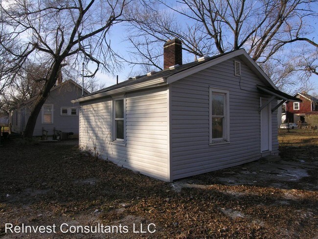
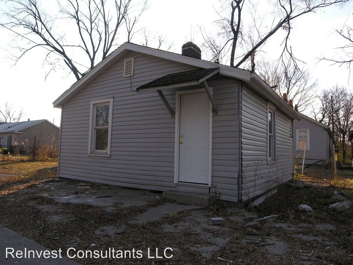
714 Maple St
Lockland, OH 45215
2 Weeks Ago
|
Edit
Favorites
714 Maple St

Favorites
Check Back Soon for Upcoming Availability
| Beds | Baths | Average SF |
|---|---|---|
| 1 Bedroom 1 Bedroom 1 Br | 1 Bath 1 Bath 1 Ba | 500 SF |
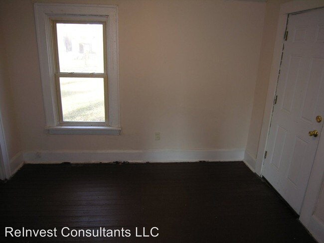
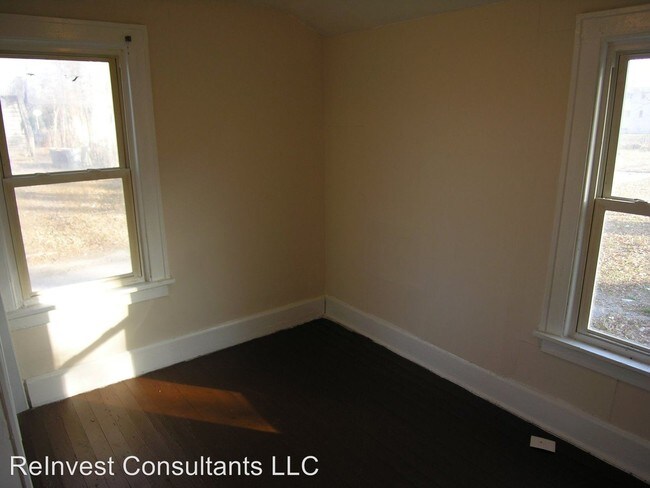
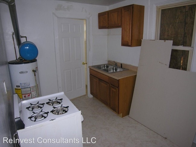
About This Property
(513) 899-1112 - 1 Bed 1 Bath home in lockland - This charming one bedroom home has an updated kitchen and bath. The house also has a yard and washer and dryer hookup. A two year lease is required. Options to purchase are available. We also do have a number of other homes available. They are listed on our website www.HeritageRent.com (RLNE5139126)
714 Maple St is an apartment community located in Hamilton County and the 45215 ZIP Code.
714 Maple St,
Lockland,
OH
45215
Education
| Colleges & Universities | Distance | ||
|---|---|---|---|
| Colleges & Universities | Distance | ||
| Drive: | 9 min | 3.4 mi | |
| Drive: | 14 min | 5.2 mi | |
| Drive: | 15 min | 7.5 mi | |
| Drive: | 17 min | 8.8 mi |
714 Maple St is within 9 minutes or 3.4 miles from Cincinnati State, WDC. It is also near Univ. of Cincinnati, Blue Ash and Xavier University.
Transportation options available in Lockland include Brewery District Station - Elm & Henry, located 11.7 miles from 714 Maple St. 714 Maple St is near Cincinnati/Northern Kentucky International, located 25.7 miles or 43 minutes away.
| Transit / Subway | Distance | ||
|---|---|---|---|
| Transit / Subway | Distance | ||
| Drive: | 19 min | 11.7 mi | |
| Drive: | 19 min | 11.7 mi | |
| Drive: | 19 min | 11.8 mi | |
| Drive: | 20 min | 11.9 mi | |
| Drive: | 20 min | 12.0 mi |
| Commuter Rail | Distance | ||
|---|---|---|---|
| Commuter Rail | Distance | ||
|
|
Drive: | 18 min | 11.6 mi |
| Airports | Distance | ||
|---|---|---|---|
| Airports | Distance | ||
|
Cincinnati/Northern Kentucky International
|
Drive: | 43 min | 25.7 mi |
Walkability Near 714 Maple St Lockland, OH 45215
Getting Around
 What do Walkability, Transit, Drivability, and Bikeability mean?
Walkability measures the walking distance to day-to-day needs.
Transit measures access to public transportation.
Drivability measures congestion, parking availability, and access to major roads.
Bikeability measures the suitability for cycling.
How It Works
What do Walkability, Transit, Drivability, and Bikeability mean?
Walkability measures the walking distance to day-to-day needs.
Transit measures access to public transportation.
Drivability measures congestion, parking availability, and access to major roads.
Bikeability measures the suitability for cycling.
How It Works
Fairly Walkable
Walkability
40
/ 100
Limited Public Transit
Transit
20
/ 100
Exceptionally Drivable
Drivability
90
/ 100
Fairly Bikeable
Bikeability
50
/ 100
Scores provided by
-
Soundscore™
-
/ 100
Traffic
-Airport
-Businesses
-Scores provided by
HowLoud What is a Sound Score Rating? A Sound Score Rating aggregates noise caused by vehicle traffic, airplane traffic and local sources. How It WorksTime and distance from 714 Maple St.
| Shopping Centers | Distance | ||
|---|---|---|---|
| Shopping Centers | Distance | ||
| Drive: | 5 min | 1.9 mi | |
| Drive: | 7 min | 3.2 mi | |
| Drive: | 8 min | 3.4 mi |
714 Maple St has 3 shopping centers within 3.4 miles, which is about a 8-minute drive. The miles and minutes will be for the farthest away property.
| Parks and Recreation | Distance | ||
|---|---|---|---|
| Parks and Recreation | Distance | ||
|
Glenwood Gardens
|
Drive: | 8 min | 2.9 mi |
|
Gorman Heritage Farm
|
Drive: | 8 min | 3.2 mi |
|
French Park
|
Drive: | 11 min | 4.0 mi |
|
Caldwell Preserve
|
Drive: | 8 min | 4.3 mi |
|
Winton Woods Park
|
Drive: | 11 min | 4.4 mi |
714 Maple St has 5 parks within 4.4 miles, including Glenwood Gardens, Gorman Heritage Farm, and Caldwell Preserve.
| Hospitals | Distance | ||
|---|---|---|---|
| Hospitals | Distance | ||
| Drive: | 7 min | 3.5 mi | |
| Drive: | 9 min | 3.8 mi | |
| Drive: | 15 min | 5.5 mi |
714 Maple St has 3 hospitals within 5.5 miles, the nearest is Summit Behavioral Healthcare which is 3.5 miles away and a 7 minute drive.
| Military Bases | Distance | ||
|---|---|---|---|
| Military Bases | Distance | ||
| Drive: | 57 min | 43.8 mi | |
| Drive: | 63 min | 48.8 mi | |
| Drive: | 65 min | 52.1 mi |
714 Maple St has 3 military bases within 52.1 miles, the nearest is Gentile Air Force Station which is 43.8 miles away and a 57 minute drive.
You May Also Like
Similar Rentals Nearby
-
-
-
-
-
-
-
-
-
-
1 Bed$1,539+2 Beds$2,039+Total Monthly PriceTotal Monthly Price NewPrices include all required monthly fees.1 Month Free
Pets Allowed Pool In Unit Washer & Dryer Clubhouse Maintenance on site Stainless Steel Appliances


What Are Walk Score®, Transit Score®, and Bike Score® Ratings?
Walk Score® measures the walkability of any address. Transit Score® measures access to public transit. Bike Score® measures the bikeability of any address.
What is a Sound Score Rating?
A Sound Score Rating aggregates noise caused by vehicle traffic, airplane traffic and local sources.
714 Maple St
Lockland, OH 45215