
$2,095
/ Month
7120 W Sunnyslope Ln
Peoria, AZ 85345
Today
|
Edit
Favorites
602-298-1161
-
Bedrooms
3
-
Bathrooms
2
-
Square Feet
1,692 sq ft
-
Available
Available Now
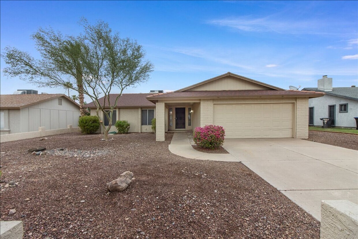
7120 W Sunnyslope Ln

Favorites
About This Home
$2,095 deposit,
Available Now
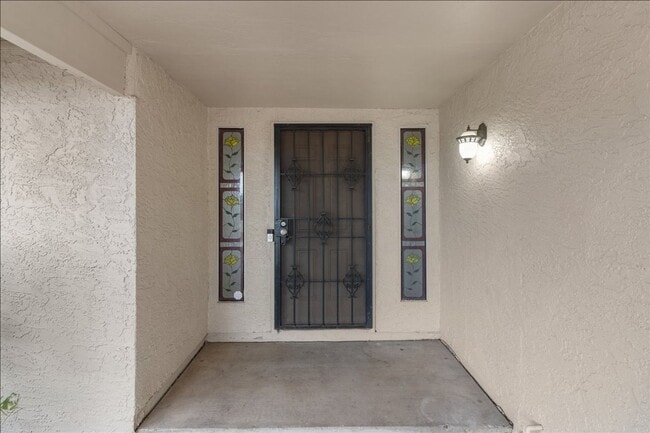
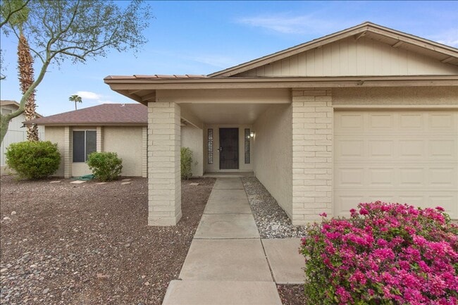
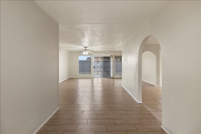
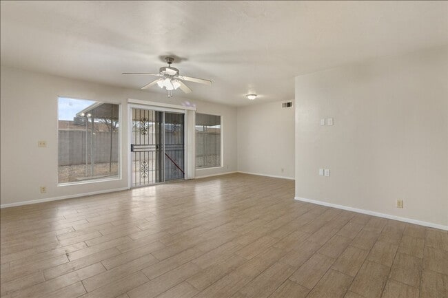
$500 Move-In Special !! Spectacular 3 bedroom, 2 bath home open floor plan. Freshly painted throughout the house including doors and closets, Newly updated kitchen with new range oven and dishwasher. Kitchen opens to spacious dining/entertainment area. Large living/family room. Double door entry into the Master bedroom with en-suite bathroom. Tile flooring throughout the home. Desert front yard landscape. Tranquil exterior setting with direct view of Sunnyslope Park, tennis courts and playground. close to schools, close to the 60 and not far from GCC.
Unique Features
- NO HOA
- Desert Front yard landscape
- Near GCC
- Close to the 60
- Near Park
7120 W Sunnyslope Ln is a house located in Maricopa County and the 85345 ZIP Code. This area is served by the Peoria Unified attendance zone.
* Price shown is base rent. Excludes user-selected optional fees and variable or usage-based fees and required charges due at or prior to move-in or at move-out. Price, availability, fees, and any applicable rent special are subject to change without notice.
* Square footage definitions vary. Displayed square footage is approximate.
Contact
- Listed by One | One Stop Realty & Property Management
- Phone Number
- Contact
Location
Get Directions
Amenities
- NO HOA
- Desert Front yard landscape
- Near GCC
- Close to the 60
- Near Park
Extending south from West Peoria Avenue to West Northern Avenue, South Peoria provides easy access to Highway 101, Peoria Town Center, Sun City, Arizona State University West Campus, and Glendale Community College. Once named one of the best places to live in the US, Peoria offers a vibrant downtown with plenty to see and do. Catch a live performance at the Center for the Performing Arts or Theater Works, cheer on local sports teams at the Peoria Sports Complex, and enjoy exploring the shops along Bell Road.
Taking full advantage of the sunshine, desert landscape, and palm trees, South Peoria’s parks provide a range of outdoor activities for residents to enjoy. Thunderbird Park provides trails for walking and biking along the canal, a playground, disc golf course, and more. Those with pets will appreciate Sunnyslope Dog Park, located at the corner of West Olive Avenue and North 71st Avenue.
Learn more about living in South Peoria
Education
| Colleges & Universities | Distance | ||
|---|---|---|---|
| Colleges & Universities | Distance | ||
| Drive: | 5 min | 1.7 mi | |
| Drive: | 12 min | 5.3 mi | |
| Drive: | 13 min | 5.9 mi | |
| Drive: | 13 min | 6.5 mi |
7120 W Sunnyslope Ln is within 5 minutes or 1.7 miles from Glendale Community College. It is also near Thunderbird, West Campus and Arizona State University, West.
Schools


Public Elementary & Middle School
Grades PK-8
451 Students
Attendance Zone
Public High School
Grades 9-12
2,007 Students
Attendance Zone
Private Elementary & Middle School
Grades 3-8
Nearby
Private Elementary, Middle & High School
Grades 5-12
Nearby
Private Elementary, Middle & High School
Grades K-12
Nearby
Private Elementary & Middle School
Grades PK-8
345 Students
Nearby
School data provided by
 The GreatSchools Rating helps parents compare schools within a state based on a variety of school quality indicators and provides a helpful picture of how effectively each school serves all of its students. Ratings are on a scale of 1 (below average) to 10 (above average) and can include test scores, college readiness, academic progress, advanced courses, equity, discipline and attendance data. We also advise parents to visit schools, consider other information on school performance and programs, and consider family needs as part of the school selection process.
View GreatSchools Rating Methodology
Data provided by GreatSchools.org © 2025. All rights reserved.
View GreatSchools Rating Methodology
Data provided by GreatSchools.org © 2025. All rights reserved.
Transportation options available in Peoria include Metro Pkwy, located 6.2 miles from 7120 W Sunnyslope Ln. 7120 W Sunnyslope Ln is near Phoenix Sky Harbor International, located 17.9 miles or 31 minutes away.
| Transit / Subway | Distance | ||
|---|---|---|---|
| Transit / Subway | Distance | ||
|
|
Drive: | 13 min | 6.2 mi |
|
|
Drive: | 13 min | 6.4 mi |
|
|
Drive: | 14 min | 6.6 mi |
|
|
Drive: | 14 min | 6.9 mi |
|
|
Drive: | 16 min | 7.9 mi |
| Airports | Distance | ||
|---|---|---|---|
| Airports | Distance | ||
|
Phoenix Sky Harbor International
|
Drive: | 31 min | 17.9 mi |
Time and distance from 7120 W Sunnyslope Ln.
| Shopping Centers | Distance | ||
|---|---|---|---|
| Shopping Centers | Distance | ||
| Walk: | 15 min | 0.8 mi | |
| Drive: | 3 min | 1.2 mi | |
| Drive: | 3 min | 1.3 mi |
7120 W Sunnyslope Ln has 3 shopping centers within 1.3 miles, which is about a 3-minute walk. The miles and minutes will be for the farthest away property.
| Parks and Recreation | Distance | ||
|---|---|---|---|
| Parks and Recreation | Distance | ||
|
El Oso Park
|
Drive: | 13 min | 6.2 mi |
|
Maryvale Park
|
Drive: | 13 min | 6.7 mi |
|
Acoma Park
|
Drive: | 15 min | 7.4 mi |
|
Challenger Space Center
|
Drive: | 16 min | 10.0 mi |
|
Conocido Park
|
Drive: | 19 min | 10.0 mi |
7120 W Sunnyslope Ln has 5 parks within 10.0 miles, including El Oso Park, Maryvale Park, and Acoma Park.
| Hospitals | Distance | ||
|---|---|---|---|
| Hospitals | Distance | ||
| Drive: | 4 min | 2.1 mi | |
| Drive: | 10 min | 4.7 mi | |
| Drive: | 13 min | 6.4 mi |
7120 W Sunnyslope Ln has 3 hospitals within 6.4 miles, the nearest is Aurora Behavioral Health System which is 2.1 miles away and a 4 minute drive.
| Military Bases | Distance | ||
|---|---|---|---|
| Military Bases | Distance | ||
| Drive: | 17 min | 9.8 mi | |
| Drive: | 31 min | 17.8 mi | |
| Drive: | 98 min | 72.8 mi |
7120 W Sunnyslope Ln has 3 military bases within 72.8 miles, the nearest is Luke Air Force Base which is 9.8 miles away and a 17 minute drive.
You May Also Like
Similar Rentals Nearby
-
-
-
1 / 47

-
1 / 30

-
-
-
-
-
-
1 / 51


What Are Walk Score®, Transit Score®, and Bike Score® Ratings?
Walk Score® measures the walkability of any address. Transit Score® measures access to public transit. Bike Score® measures the bikeability of any address.
What is a Sound Score Rating?
A Sound Score Rating aggregates noise caused by vehicle traffic, airplane traffic and local sources
7120 W Sunnyslope Ln
Peoria, AZ 85345