
Venue Residences
3688 Overland Ave,
Los Angeles, CA 90034
$2,645 - $6,995
Studio - 2 Beds
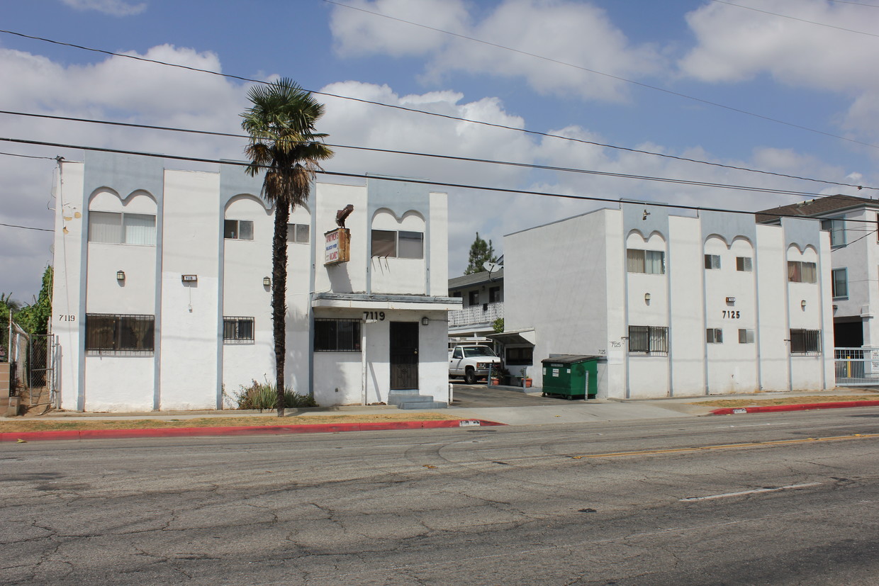
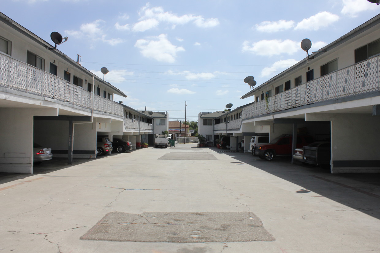
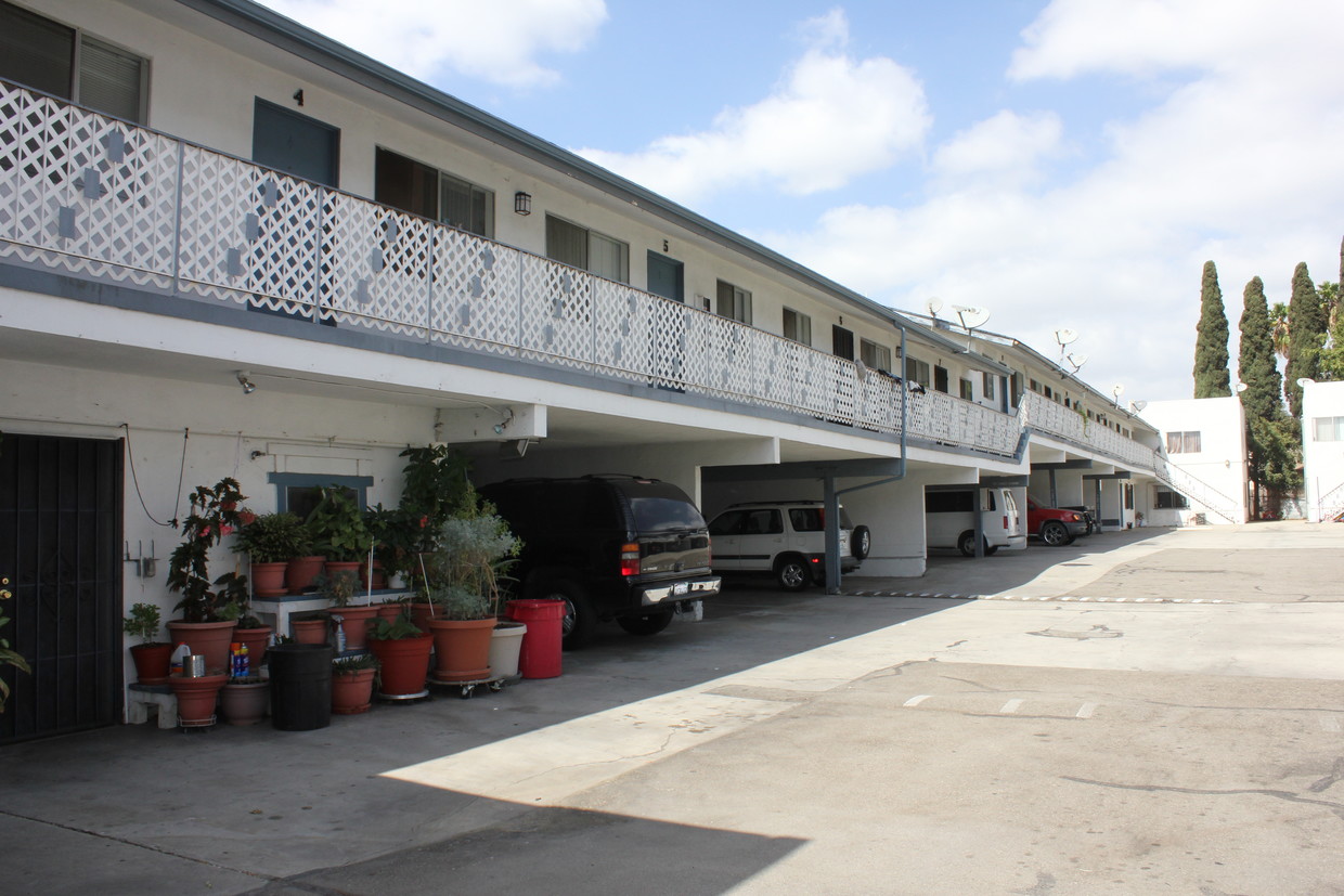
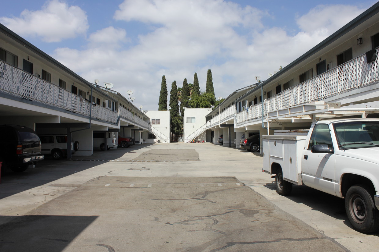
Discover your new apartment at 7119 E Gage Ave in Los Angeles, CA. You'll find this community in the Montebello area of Los Angeles. Providing 0 to 2 bedroom floor plans, your new place is ready for you. Let the leasing team show you everything this community has in store. Stop by the leasing office to talk about renting your new apartment.
7119 E Gage Ave is an apartment community located in Los Angeles County and the 90040 ZIP Code. This area is served by the Montebello Unified attendance zone.
Southeast Los Angeles is directly south of the Fashion District and east of the University of Southern California (USC). This large neighborhood is minutes from downtown Los Angeles, Hollywood, and Beverly Hills, with easy access to the 110 Freeway. This great location places you near sunny beaches, nature trails, and a bevy of leading employers. Students can access both USC and California State University Long Beach from their Southeast LA apartment.
This densely populated, diverse neighborhood features everything from food trucks and corner markets to wide sidewalks and residential areas filled with bungalows, ranch, and Spanish Colonial architecture. Southeast LA features palm trees and mountain views, tampered with gritty undertones to give it a cool, funky vibe.
As for outdoor fun, take your pick between Catalina Island, Venus Beach, or the Santa Monica Pier. Nearby, you’ll find more sunny beaches like White Point, Cabrillo, and Long Beach.
Learn more about living in Southeast Los AngelesCompare neighborhood and city base rent averages by bedroom.
| Southeast Los Angeles | Los Angeles, CA | |
|---|---|---|
| Studio | - | $1,705 |
| 1 Bedroom | $1,132 | $2,170 |
| 2 Bedrooms | $1,221 | $2,985 |
| 3 Bedrooms | $1,287 | $4,274 |
| Colleges & Universities | Distance | ||
|---|---|---|---|
| Colleges & Universities | Distance | ||
| Drive: | 12 min | 6.1 mi | |
| Drive: | 11 min | 6.3 mi | |
| Drive: | 15 min | 7.5 mi | |
| Drive: | 14 min | 8.3 mi |


Transportation options available in Los Angeles include Atlantic, located 5.4 miles from 7119 E Gage Ave. 7119 E Gage Ave is near Long Beach (Daugherty Field), located 16.2 miles or 24 minutes away, and Los Angeles International, located 21.4 miles or 31 minutes away.
| Transit / Subway | Distance | ||
|---|---|---|---|
| Transit / Subway | Distance | ||
|
|
Drive: | 10 min | 5.4 mi |
| Drive: | 9 min | 5.8 mi | |
|
|
Drive: | 10 min | 6.3 mi |
|
|
Drive: | 10 min | 7.1 mi |
|
|
Drive: | 10 min | 7.3 mi |
| Commuter Rail | Distance | ||
|---|---|---|---|
| Commuter Rail | Distance | ||
|
|
Drive: | 5 min | 1.8 mi |
|
|
Drive: | 7 min | 3.5 mi |
|
|
Drive: | 10 min | 6.7 mi |
|
|
Drive: | 17 min | 10.1 mi |
| Drive: | 18 min | 13.8 mi |
| Airports | Distance | ||
|---|---|---|---|
| Airports | Distance | ||
|
Long Beach (Daugherty Field)
|
Drive: | 24 min | 16.2 mi |
|
Los Angeles International
|
Drive: | 31 min | 21.4 mi |
Time and distance from 7119 E Gage Ave.
| Shopping Centers | Distance | ||
|---|---|---|---|
| Shopping Centers | Distance | ||
| Drive: | 4 min | 1.7 mi | |
| Drive: | 5 min | 1.8 mi | |
| Drive: | 6 min | 2.9 mi |
| Parks and Recreation | Distance | ||
|---|---|---|---|
| Parks and Recreation | Distance | ||
|
Pio Pico State Historic Park
|
Drive: | 9 min | 5.2 mi |
|
Augustus Hawkins Natural Park
|
Drive: | 13 min | 7.4 mi |
|
Whittier Narrows Nature Center
|
Drive: | 15 min | 7.5 mi |
|
Whittier Narrows Recreation Area
|
Drive: | 17 min | 7.8 mi |
|
Hollenbeck Lake
|
Drive: | 12 min | 8.5 mi |
| Hospitals | Distance | ||
|---|---|---|---|
| Hospitals | Distance | ||
| Drive: | 7 min | 3.9 mi | |
| Drive: | 9 min | 4.2 mi | |
| Drive: | 9 min | 6.4 mi |
| Military Bases | Distance | ||
|---|---|---|---|
| Military Bases | Distance | ||
| Drive: | 24 min | 16.2 mi | |
| Drive: | 28 min | 19.8 mi |
What Are Walk Score®, Transit Score®, and Bike Score® Ratings?
Walk Score® measures the walkability of any address. Transit Score® measures access to public transit. Bike Score® measures the bikeability of any address.
What is a Sound Score Rating?
A Sound Score Rating aggregates noise caused by vehicle traffic, airplane traffic and local sources

7119 E Gage Ave
Los Angeles, CA 90040


