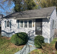
$2,800 / Month
7102 Fresno St
Capitol Heights, MD 20743
2 Weeks Ago
Favorites
7102 Fresno St

Favorites
Check Back Soon for Upcoming Availability
| Beds | Baths | Average SF |
|---|---|---|
| 4 Bedrooms 4 Bedrooms 4 Br | 2 Baths 2 Baths 2 Ba | — |
About This Property
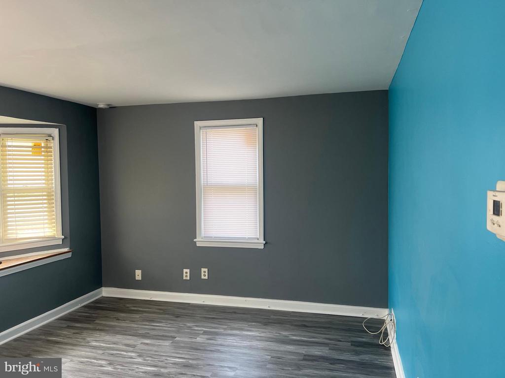
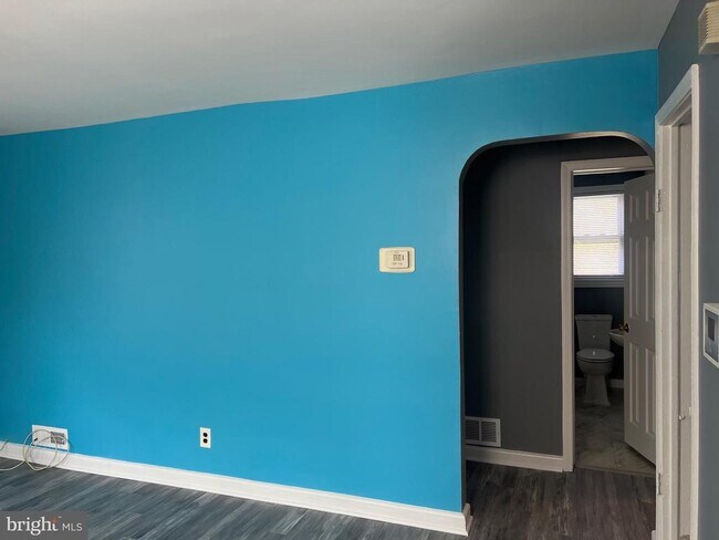
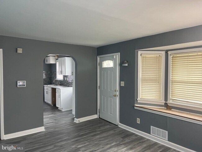
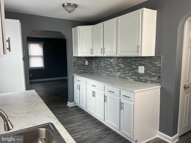
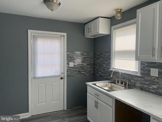
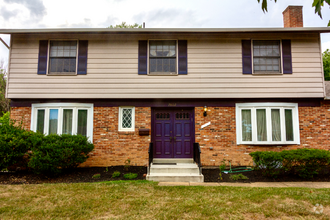
Welcome home to the updated 4 bedroom, 2 story cape cod with finished rec room in basement and raised roof. Home also features two full baths, updated kitchen with new appliances coming. Home has new carpet, luxury vinyl flooring though out home, updated kitchen with brand new appliances, freshly painted home with accent wall, rec room is freshly painting utility room floors have been painted. Laundry room with washer dryer hookup in the basement, home also has updated lighting. Home has hug yard that is ready for your landscaping ideas, patio in backyard and fully fenced. Open access to driveway that has been covered by landscaping.
7102 Fresno St is a house located in Prince George's County and the 20743 ZIP Code. This area is served by the Prince George's County Public Schools attendance zone.
House Features
- Dishwasher
- Basement
Location
Get Directions
Capitol Heights -- named for its location near Washington, DC -- provides the perfect location: near DC, near the Capital Beltway, and minutes away from FedEx Field, home of the NFL's Washington Football Team. It is also close to the Anacostia River, the United States National Arboretum, and Joint Base Anacostia-Bolling. Nearby Fort Circle Park provides Capitol Heights residents with 10 miles of hiking trails -- it is also a popular concert venue and is home to Fort Dupont Ice Rink.
Capitol Heights is a terrific location for your DC-area apartment, only about seven miles southeast of downtown. Hop on the Metro at the Capitol Heights Metro Station for a fast, car-free commute. Despite being so close to the historic sites of DC, Capitol Heights was a rural area with no paved roads or streetlights. In 1910, the 200 residents in the area named their town "Capitol Heights," but it wasn't until 1980 and the arrival of the Metro Blue Line that the town began to grow.
Learn more about living in Capitol Heights
Amenities
- Dishwasher
- Basement
Education
| Colleges & Universities | Distance | ||
|---|---|---|---|
| Colleges & Universities | Distance | ||
| Drive: | 8 min | 4.2 mi | |
| Drive: | 12 min | 6.2 mi | |
| Drive: | 13 min | 6.3 mi | |
| Drive: | 14 min | 7.8 mi |
7102 Fresno St is within 8 minutes or 4.2 miles from Univ. of Md. Univ. Coll.. It is also near Prince George's Comm. Coll. and Gallaudet University.
Schools


Public Elementary School
Grades PK-6
331 Students
Attendance Zone
Public Middle School
Grades 6-8
867 Students
Attendance Zone
Public High School
Grades 9-12
1,039 Students
Attendance Zone
Private Elementary & Middle School
Grades PK-8
222 Students
Nearby
Private High School
Grades 9-12
Nearby
School data provided by
 The GreatSchools Rating helps parents compare schools within a state based on a variety of school quality indicators and provides a helpful picture of how effectively each school serves all of its students. Ratings are on a scale of 1 (below average) to 10 (above average) and can include test scores, college readiness, academic progress, advanced courses, equity, discipline and attendance data. We also advise parents to visit schools, consider other information on school performance and programs, and consider family needs as part of the school selection process.
View GreatSchools Rating Methodology
View GreatSchools Rating Methodology
Transportation options available in Capitol Heights include Capitol Heights, Blue/Silver Line Center Platform, located 1.6 miles from 7102 Fresno St. 7102 Fresno St is near Ronald Reagan Washington Ntl, located 12.7 miles or 23 minutes away, and Baltimore/Washington International Thurgood Marshall, located 29.0 miles or 43 minutes away.
| Transit / Subway | Distance | ||
|---|---|---|---|
| Transit / Subway | Distance | ||
|
Capitol Heights, Blue/Silver Line Center Platform
|
Drive: | 3 min | 1.6 mi |
|
|
Drive: | 3 min | 1.7 mi |
|
|
Drive: | 7 min | 2.2 mi |
|
|
Drive: | 5 min | 2.7 mi |
|
|
Drive: | 9 min | 4.2 mi |
| Commuter Rail | Distance | ||
|---|---|---|---|
| Commuter Rail | Distance | ||
|
|
Drive: | 12 min | 6.5 mi |
|
|
Drive: | 13 min | 6.7 mi |
|
|
Drive: | 14 min | 6.8 mi |
|
|
Drive: | 13 min | 6.9 mi |
| Drive: | 12 min | 6.9 mi |
| Airports | Distance | ||
|---|---|---|---|
| Airports | Distance | ||
|
Ronald Reagan Washington Ntl
|
Drive: | 23 min | 12.7 mi |
|
Baltimore/Washington International Thurgood Marshall
|
Drive: | 43 min | 29.0 mi |
Time and distance from 7102 Fresno St.
| Shopping Centers | Distance | ||
|---|---|---|---|
| Shopping Centers | Distance | ||
| Walk: | 6 min | 0.3 mi | |
| Drive: | 4 min | 1.5 mi | |
| Drive: | 4 min | 1.8 mi |
7102 Fresno St has 3 shopping centers within 1.8 miles, which is about a 4-minute walk. The miles and minutes will be for the farthest away property.
| Parks and Recreation | Distance | ||
|---|---|---|---|
| Parks and Recreation | Distance | ||
|
Fort Dupont Park
|
Drive: | 9 min | 3.8 mi |
|
Walker Mill Regional Park
|
Drive: | 8 min | 4.4 mi |
|
Kingman and Heritage Island Park
|
Drive: | 8 min | 4.5 mi |
|
Bladensburg Waterfront Park
|
Drive: | 9 min | 4.9 mi |
|
National Arboretum
|
Drive: | 13 min | 6.4 mi |
7102 Fresno St has 5 parks within 6.4 miles, including Fort Dupont Park, Walker Mill Regional Park, and Kingman and Heritage Island Park.
| Hospitals | Distance | ||
|---|---|---|---|
| Hospitals | Distance | ||
| Drive: | 8 min | 4.2 mi | |
| Drive: | 17 min | 7.0 mi | |
| Drive: | 16 min | 7.2 mi |
7102 Fresno St has 3 hospitals within 7.2 miles, the nearest is University of Maryland Prince George's Hospital Center which is 4.2 miles away and a 8 minute drive.
| Military Bases | Distance | ||
|---|---|---|---|
| Military Bases | Distance | ||
| Drive: | 14 min | 6.8 mi | |
| Drive: | 16 min | 8.7 mi |
7102 Fresno St is 6.8 miles from Washington Navy Yard, and is convenient to other military bases, including US Soldiers & Airmens Home.
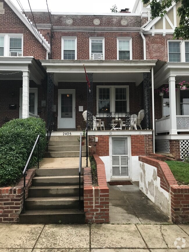
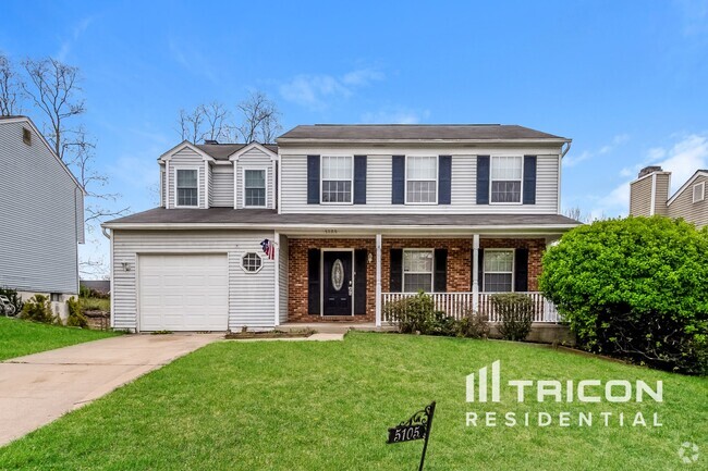
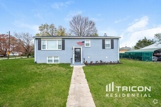
You May Also Like
Similar Rentals Nearby

What Are Walk Score®, Transit Score®, and Bike Score® Ratings?
Walk Score® measures the walkability of any address. Transit Score® measures access to public transit. Bike Score® measures the bikeability of any address.
What is a Sound Score Rating?
A Sound Score Rating aggregates noise caused by vehicle traffic, airplane traffic and local sources

7102 Fresno St
Capitol Heights, MD 20743