Urbn Edge
3510 Union St,
Flushing, NY 11354
$3,050 - $4,200 Total Monthly Price
1-2 Beds 12 Month Lease
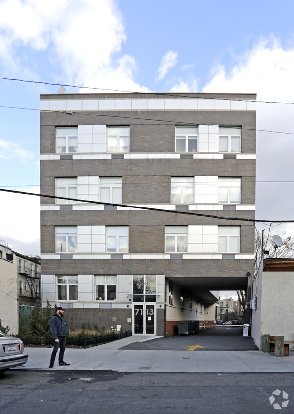
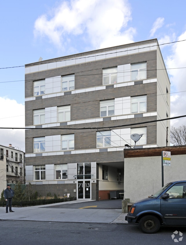
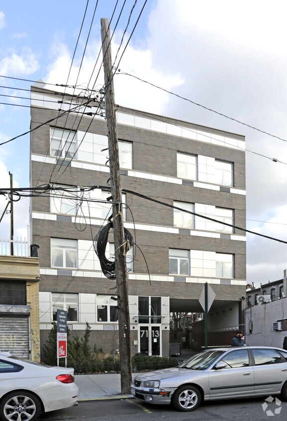
71-13 60th Ln offers a combination of comfort, style, and convenience. You'll find this community in the 11385 area of Flushing. The professional leasing team is ready to help you find your perfect home. Drop by the leasing office to discuss your new apartment and make your move to 71-13 60th Ln.
71-13 60th Ln is an apartment community located in Queens County and the 11385 ZIP Code. This area is served by the New York City Geographic District #24 attendance zone.
Air Conditioning
Refrigerator
Tub/Shower
Heating
Flushing is one of Queens' most commercially active neighborhoods, home to the fourth-largest central business district in all of New York City. Its core intersection at Main Street and Roosevelt Avenue ranks among the busiest in the city, and the energy that radiates outward from there reflects just how much this neighborhood has to offer. Anchored by Queens Botanical Garden and the sprawling Flushing Meadows–Corona Park, the area balances dense urban activity with genuine green space. The New York Mets call this neighborhood home at Citi Field, and USTA Billie Jean King National Tennis Center hosts the U.S. Open each summer nearby. Flushing dates to 1645, making it one of the oldest settlements in the region, and that deep history gives the neighborhood a sense of permanence that newer developments can't replicate.
Learn more about living in FlushingCompare neighborhood and city base rent averages by bedroom.
| Central Queens | Flushing, NY | |
|---|---|---|
| Studio | $2,218 | $1,767 |
| 1 Bedroom | $2,551 | $2,049 |
| 2 Bedrooms | $3,359 | $2,472 |
| 3 Bedrooms | $4,384 | $2,866 |
| Colleges & Universities | Distance | ||
|---|---|---|---|
| Colleges & Universities | Distance | ||
| Drive: | 11 min | 4.1 mi | |
| Drive: | 12 min | 4.2 mi | |
| Drive: | 10 min | 4.4 mi | |
| Drive: | 14 min | 5.3 mi |
The GreatSchools Rating helps parents compare schools within a state based on a variety of school quality indicators and provides a helpful picture of how effectively each school serves all of its students. Ratings are on a scale of 1 (below average) to 10 (above average) and can include test scores, college readiness, academic progress, advanced courses, equity, discipline and attendance data. We also advise parents to visit schools, consider other information on school performance and programs, and consider family needs as part of the school selection process.
Transportation options available in Flushing include Fresh Pond Road, located 0.4 mile from 71-13 60th Ln. 71-13 60th Ln is near LaGuardia, located 6.4 miles or 14 minutes away, and John F Kennedy International, located 9.9 miles or 16 minutes away.
| Transit / Subway | Distance | ||
|---|---|---|---|
| Transit / Subway | Distance | ||
|
|
Walk: | 7 min | 0.4 mi |
|
|
Walk: | 11 min | 0.6 mi |
|
|
Walk: | 12 min | 0.6 mi |
|
|
Walk: | 13 min | 0.7 mi |
|
|
Drive: | 3 min | 1.5 mi |
| Commuter Rail | Distance | ||
|---|---|---|---|
| Commuter Rail | Distance | ||
|
|
Drive: | 6 min | 2.7 mi |
|
|
Drive: | 8 min | 3.3 mi |
|
|
Drive: | 9 min | 3.7 mi |
|
|
Drive: | 8 min | 3.8 mi |
|
|
Drive: | 11 min | 4.1 mi |
| Airports | Distance | ||
|---|---|---|---|
| Airports | Distance | ||
|
LaGuardia
|
Drive: | 14 min | 6.4 mi |
|
John F Kennedy International
|
Drive: | 16 min | 9.9 mi |
Time and distance from 71-13 60th Ln.
| Shopping Centers | Distance | ||
|---|---|---|---|
| Shopping Centers | Distance | ||
| Walk: | 10 min | 0.5 mi | |
| Drive: | 3 min | 1.1 mi | |
| Drive: | 4 min | 1.7 mi |
| Parks and Recreation | Distance | ||
|---|---|---|---|
| Parks and Recreation | Distance | ||
|
Highland Park and Ridgewood Reservoir
|
Drive: | 3 min | 1.4 mi |
|
Maria Hernandez Park
|
Drive: | 4 min | 1.9 mi |
|
Highland Park Childrens Garden
|
Drive: | 5 min | 2.3 mi |
|
Forest Park - Brooklyn-Queens
|
Drive: | 5 min | 2.5 mi |
|
Juniper Valley Park
|
Drive: | 7 min | 2.6 mi |
| Hospitals | Distance | ||
|---|---|---|---|
| Hospitals | Distance | ||
| Drive: | 4 min | 1.7 mi | |
| Drive: | 6 min | 2.7 mi | |
| Drive: | 9 min | 3.4 mi |
| Military Bases | Distance | ||
|---|---|---|---|
| Military Bases | Distance | ||
| Drive: | 23 min | 9.0 mi | |
| Drive: | 29 min | 11.7 mi |
What Are Walk Score®, Transit Score®, and Bike Score® Ratings?
Walk Score® measures the walkability of any address. Transit Score® measures access to public transit. Bike Score® measures the bikeability of any address.
What is a Sound Score Rating?
A Sound Score Rating aggregates noise caused by vehicle traffic, airplane traffic and local sources.