
$3,000
/ Month
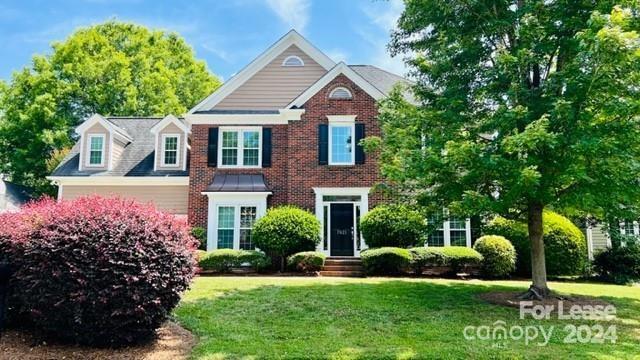
7021 Royce Ct
Charlotte, NC 28277
2 Weeks Ago
Favorites
7021 Royce Ct

Favorites
Check Back Soon for Upcoming Availability
| Beds | Baths | Average SF |
|---|---|---|
| 4 Bedrooms 4 Bedrooms 4 Br | 3.5 Baths 3.5 Baths 3.5 Ba | 2,650 SF |
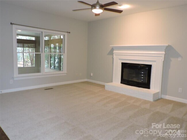
About This Property
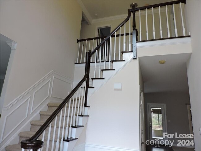
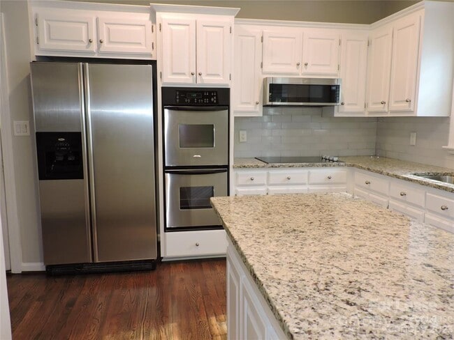
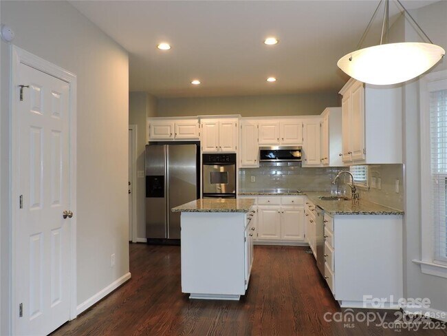
Wonderful home in great community zoned for Ardrey Kell High School ! Beautiful hardwoods,newer carpet on main,and a new washer and dryer. Open Floor Plan with Formals,White kitchen cabinets,granite and stainless steel appliances. Four bedrooms and 3 full baths. Huge sunroom that opens to flat,fenced yard with mature landscaping. Lovely yard space,cul-de-sac,two car garage. Close to Blakeney,Rea Farms,Waverly,schools,I-485.
7021 Royce Ct is a house located in Mecklenburg County and the 28277 ZIP Code. This area is served by the Charlotte-Mecklenburg attendance zone.
Location
Get Directions
Providence Crossing is a highly sought-after neighborhood in the popular South Charlotte area. Similar to many neighborhoods in South Charlotte, Providence Crossing has great schools, wooded streets, several shopping plazas with restaurants and stores, and a close-knit community. Complemented by tree-lined avenues and spacious sidewalks, Providence Crossing has moderate to upscale apartments, houses, and townhomes available for rent. In their free time, residents enjoy visiting Providence Crossing’s multiple parks, pond, and country club. The neighborhood hosts community events like summer barbecues and ice cream socials throughout the year which heightens Providence Crossing’s family-friendly feel. Providence Crossing is 15 miles south of Uptown Charlotte, so residents are just a short drive away from enjoying amenities in the heart of the city.
Learn more about living in Providence CrossingBelow are rent ranges for similar nearby apartments
| Beds | Average Size | Lowest | Typical | Premium |
|---|---|---|---|---|
| Studio Studio Studio | 607 Sq Ft | $1,500 | $1,556 | $1,575 |
| 1 Bed 1 Bed 1 Bed | 822-825 Sq Ft | $1,390 | $1,873 | $4,250 |
| 2 Beds 2 Beds 2 Beds | 1231-1233 Sq Ft | $1,674 | $2,581 | $6,202 |
| 3 Beds 3 Beds 3 Beds | 1740-1741 Sq Ft | $2,160 | $3,780 | $30,000 |
| 4 Beds 4 Beds 4 Beds | 3232 Sq Ft | $2,848 | $3,900 | $5,250 |
Education
| Colleges & Universities | Distance | ||
|---|---|---|---|
| Colleges & Universities | Distance | ||
| Drive: | 17 min | 9.6 mi | |
| Drive: | 18 min | 11.1 mi | |
| Drive: | 26 min | 14.0 mi | |
| Drive: | 26 min | 14.9 mi |
7021 Royce Ct is within 17 minutes or 9.6 miles from Central Piedmont C.C., Levine. It is also near Central Piedmont C.C., Harper and Queens University of Charlotte.
Schools


Public Elementary School
Grades PK-5
751 Students
Nearby
Public Elementary School
Grades K-5
598 Students
Nearby
Public Middle School
Grades 6-8
1,412 Students
Nearby
Public High School
Grades 9-12
3,529 Students
Attendance Zone
Private Elementary, Middle & High School
Grades PK-12
184 Students
Nearby
Private Elementary & Middle School
Grades K-8
127 Students
Nearby
Private Elementary & Middle School
Grades PK-9
178 Students
Nearby
Private Elementary School
Grades K
11 Students
Nearby
School data provided by
 The GreatSchools Rating helps parents compare schools within a state based on a variety of school quality indicators and provides a helpful picture of how effectively each school serves all of its students. Ratings are on a scale of 1 (below average) to 10 (above average) and can include test scores, college readiness, academic progress, advanced courses, equity, discipline and attendance data. We also advise parents to visit schools, consider other information on school performance and programs, and consider family needs as part of the school selection process.
View GreatSchools Rating Methodology
Data provided by GreatSchools.org © 2025. All rights reserved.
View GreatSchools Rating Methodology
Data provided by GreatSchools.org © 2025. All rights reserved.
Transportation options available in Charlotte include I-485/South Boulevard, located 8.7 miles from 7021 Royce Ct. 7021 Royce Ct is near Charlotte/Douglas International, located 18.1 miles or 29 minutes away, and Concord-Padgett Regional, located 33.6 miles or 43 minutes away.
| Transit / Subway | Distance | ||
|---|---|---|---|
| Transit / Subway | Distance | ||
|
|
Drive: | 13 min | 8.7 mi |
|
|
Drive: | 15 min | 9.6 mi |
|
|
Drive: | 16 min | 10.7 mi |
|
|
Drive: | 18 min | 11.9 mi |
| Commuter Rail | Distance | ||
|---|---|---|---|
| Commuter Rail | Distance | ||
|
|
Drive: | 30 min | 17.4 mi |
|
|
Drive: | 43 min | 33.0 mi |
| Drive: | 57 min | 44.1 mi |
| Airports | Distance | ||
|---|---|---|---|
| Airports | Distance | ||
|
Charlotte/Douglas International
|
Drive: | 29 min | 18.1 mi |
|
Concord-Padgett Regional
|
Drive: | 43 min | 33.6 mi |
Time and distance from 7021 Royce Ct.
| Shopping Centers | Distance | ||
|---|---|---|---|
| Shopping Centers | Distance | ||
| Walk: | 14 min | 0.7 mi | |
| Walk: | 14 min | 0.7 mi | |
| Walk: | 16 min | 0.8 mi |
7021 Royce Ct has 3 shopping centers within 0.8 mile, which is about a 16-minute walk. The miles and minutes will be for the farthest away property.
| Parks and Recreation | Distance | ||
|---|---|---|---|
| Parks and Recreation | Distance | ||
|
Ballantyne's Backyard
|
Drive: | 9 min | 4.1 mi |
|
Stream Park
|
Drive: | 9 min | 4.6 mi |
|
Brixham Park
|
Drive: | 10 min | 5.0 mi |
|
Marvin Efird Park
|
Drive: | 12 min | 5.5 mi |
|
Stallings Municipal Park
|
Drive: | 15 min | 9.1 mi |
7021 Royce Ct has 5 parks within 9.1 miles, including Ballantyne's Backyard, Stream Park, and Brixham Park.
| Hospitals | Distance | ||
|---|---|---|---|
| Hospitals | Distance | ||
| Drive: | 12 min | 7.6 mi | |
| Drive: | 15 min | 9.9 mi |
7021 Royce Ct is 7.6 miles from Carolinas Medical Center - Pineville, and is convenient to other hospitals, including Strategic Behavioral Center - Charlotte.
| Military Bases | Distance | ||
|---|---|---|---|
| Military Bases | Distance | ||
| Drive: | 127 min | 89.7 mi |
7021 Royce Ct is 89.7 miles and a 127 minute drive from Fort Jackson.
You May Also Like
Similar Rentals Nearby


What Are Walk Score®, Transit Score®, and Bike Score® Ratings?
Walk Score® measures the walkability of any address. Transit Score® measures access to public transit. Bike Score® measures the bikeability of any address.
What is a Sound Score Rating?
A Sound Score Rating aggregates noise caused by vehicle traffic, airplane traffic and local sources

7021 Royce Ct
Charlotte, NC 28277