

$4,500 / Month
7 Sunnyside Ave
Wellesley, MA 02482
Today
Favorites
617-407-4435
-
Bedrooms
4
-
Bathrooms
2.5
-
Square Feet
1,408 sq ft
-
Available
Available Aug 2
Highlights
- Golf Course Community
- Medical Services
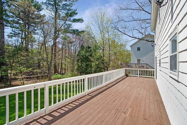
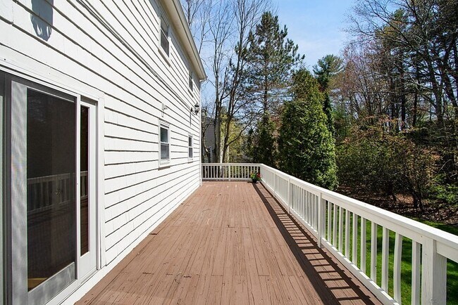
- Deck
- Wood Burning Stove
- Property is near public transit
- Wood Flooring
7 Sunnyside Ave

Favorites
About This Home
$4,600 deposit,
Available Aug 2
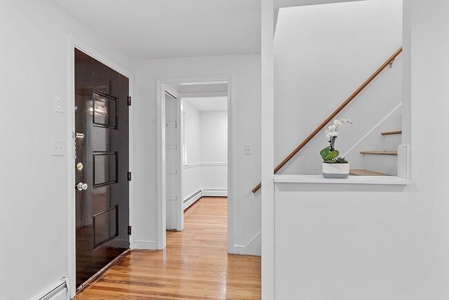
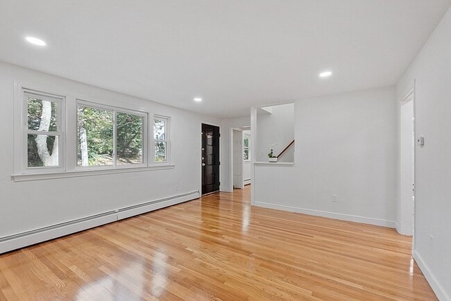
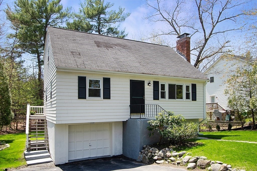
Nestled on a tranquil cul-de-sac at the Wellesley/Weston town line,this sunlit 4-bedroom Cape offers exceptional convenience with easy access to Route 9,Wellesley Center,the Commuter Rail,Fells Market,Wellesley College,Mass Pike,and the Natick Mall. Located within the sought-after Hardy School district,this home is freshly painted inside and out,featuring brand-new kitchen appliances and gleaming hardwood floors.The main level boasts an eat-in kitchen with direct access to a spacious deck,a family room,a formal dining room,and a versatile bedroom or home office. A full bath completes the first floor. Upstairs,you'll find two generously sized bedrooms—one enhanced with skylights - ample closet space,and another full bath. The walk-out lower level offers a fourth bedroom,a laundry area,a half bath,and convenient garage access.Set on a rare oversized 0.34-acre lot,the serene and private backyard is perfect for outdoor enjoyment. Additional storage is available in shed! MLS# 73376372
7 Sunnyside Ave is a house located in Norfolk County and the 02482 ZIP Code. This area is served by the Wellesley attendance zone.
* Price shown is base rent and may not include non-optional fees and utilities.
Price, availability, fees, and any applicable rent special are subject to change without notice.
* Square footage definitions vary. Displayed square footage is approximate.
Home Details
Home Type
Single Family Detached Home
Year Built
Built in 1963
Accessible Home Design
Entry on the 1st floor
Bedrooms and Bathrooms
Walk-In Closet
Primary bedroom located on second floor
2.5 Bathrooms
4 Bedrooms
Flooring
Wood
Laminate
Vinyl
Interior Spaces
Wood Burning Stove
1 Fireplace
Chair Railings
Recessed Lighting
Picture Window
1,408 Sq Ft Home
Decorative Lighting
Kitchen
Upgraded Countertops
Range
Dishwasher
Disposal
Laundry
Dryer
Laundry in Bathroom
Washer
Listing and Financial Details
Security Deposit $4,600
Property Available on 8/15/25
12 Month Lease Term
Assessor Parcel Number M:203 R:040 S:,265296
Rent includes sewer, snow removal, gardener
Location
Property is near public transit
Property is near schools
Lot Details
0.34 Acre Lot
Near Conservation Area
Outdoor Features
Deck
Balcony
Outdoor Storage
Parking
1 Car Garage
Schools
Hardy Elementary School
WMS Middle School
WHS High School
Utilities
No Cooling
High Speed Internet
Heating System Uses Natural Gas
Pellet Stove burns compressed wood to generate heat
Community Details
Amenities
Medical Services
Shops
Overview
No Home Owners Association
Pet Policy
Call for details about the types of pets allowed
Recreation
Golf Course Community
Tennis Courts
Jogging Path
Park
Fees and Policies
The fees below are based on community-supplied data and may exclude additional fees and utilities.
Pet policies are negotiable.
Contact
- Listed by Karen Kirk | Engel & Volkers Wellesley
- Phone Number
-
Source
 MLS Property Information Network
The property listing data and information set forth herein were provided to MLS Property Information Network, Inc. from third party sources, including sellers, lessors and public records, and were compiled by MLS Property Information Network, Inc. The property listing data and information are for the personal, non-commercial use of consumers having a good faith interest in purchasing or leasing listed properties of the type displayed to them and may not be used for any purpose other than to identify prospective properties which such consumers may have a good faith interest in purchasing or leasing. MLS Property Information Network, Inc. and its subscribers disclaim any and all representations and warranties as to the accuracy of the property listing data and information set forth herein. All properties are subject to prior sale, change or withdrawal. Copyright © 2025 MLS Property Information Network, Inc. All rights reserved.
Location
Get Directions
Amenities
- Dishwasher
- Disposal
- Range
- Refrigerator
- Deck
Just west of Boston and East of Worcester sits Metro West, a region that houses a group of towns and cities with significant historical backgrounds. A total of 19 municipalities make up the core of this community, but other municipalities are considered to be a part of the Interstate 495/Metro West Corridor.
Learn more about living in Metro West
Education
| Colleges & Universities | Distance | ||
|---|---|---|---|
| Colleges & Universities | Distance | ||
| Drive: | 8 min | 3.4 mi | |
| Drive: | 9 min | 4.3 mi | |
| Drive: | 12 min | 6.7 mi | |
| Drive: | 14 min | 6.8 mi |
7 Sunnyside Ave is within 8 minutes or 3.4 miles from Wellesley College. It is also near Babson College and Brandeis University.
Schools


Public Elementary School
Grades PK-3
320 Students
Nearby
Public Elementary School
Grades K-5
206 Students
Attendance Zone
Public Middle School
Grades 6-8
922 Students
Attendance Zone
Public High School
Grades 9-12
1,412 Students
Attendance Zone
Private Elementary & Middle School
Grades PK-8
185 Students
Nearby
Private Elementary School
Grades 5-6
11 Students
Nearby
Private Middle & High School
Grades 6-12
496 Students
Nearby
School data provided by
 The GreatSchools Rating helps parents compare schools within a state based on a variety of school quality indicators and provides a helpful picture of how effectively each school serves all of its students. Ratings are on a scale of 1 (below average) to 10 (above average) and can include test scores, college readiness, academic progress, advanced courses, equity, discipline and attendance data. We also advise parents to visit schools, consider other information on school performance and programs, and consider family needs as part of the school selection process.
View GreatSchools Rating Methodology
Data provided by GreatSchools.org © 2025. All rights reserved.
View GreatSchools Rating Methodology
Data provided by GreatSchools.org © 2025. All rights reserved.
Transportation options available in Wellesley include Woodland Station, located 5.8 miles from 7 Sunnyside Ave. 7 Sunnyside Ave is near General Edward Lawrence Logan International, located 19.8 miles or 32 minutes away, and Worcester Regional, located 30.7 miles or 52 minutes away.
| Transit / Subway | Distance | ||
|---|---|---|---|
| Transit / Subway | Distance | ||
|
|
Drive: | 11 min | 5.8 mi |
|
|
Drive: | 12 min | 5.9 mi |
|
|
Drive: | 12 min | 6.5 mi |
|
|
Drive: | 13 min | 7.1 mi |
|
|
Drive: | 14 min | 7.3 mi |
| Commuter Rail | Distance | ||
|---|---|---|---|
| Commuter Rail | Distance | ||
|
|
Drive: | 5 min | 2.7 mi |
|
|
Drive: | 7 min | 3.8 mi |
|
|
Drive: | 9 min | 3.9 mi |
|
|
Drive: | 7 min | 4.1 mi |
|
|
Drive: | 12 min | 6.1 mi |
| Airports | Distance | ||
|---|---|---|---|
| Airports | Distance | ||
|
General Edward Lawrence Logan International
|
Drive: | 32 min | 19.8 mi |
|
Worcester Regional
|
Drive: | 52 min | 30.7 mi |
Time and distance from 7 Sunnyside Ave.
| Shopping Centers | Distance | ||
|---|---|---|---|
| Shopping Centers | Distance | ||
| Drive: | 4 min | 2.0 mi | |
| Drive: | 4 min | 2.2 mi | |
| Drive: | 5 min | 2.6 mi |
7 Sunnyside Ave has 3 shopping centers within 2.6 miles, which is about a 5-minute drive. The miles and minutes will be for the farthest away property.
| Parks and Recreation | Distance | ||
|---|---|---|---|
| Parks and Recreation | Distance | ||
|
Whitin Observatory
|
Drive: | 6 min | 2.5 mi |
|
Wellesley College Botanic Gardens
|
Drive: | 5 min | 2.8 mi |
|
Hamlen Woods
|
Drive: | 7 min | 3.7 mi |
|
Horticultural Society at Elm Bank
|
Drive: | 13 min | 4.8 mi |
|
Cochituate State Park
|
Drive: | 17 min | 11.0 mi |
7 Sunnyside Ave has 5 parks within 11.0 miles, including Whitin Observatory, Wellesley College Botanic Gardens, and Hamlen Woods.
| Hospitals | Distance | ||
|---|---|---|---|
| Hospitals | Distance | ||
| Drive: | 10 min | 5.5 mi | |
| Drive: | 11 min | 6.2 mi | |
| Drive: | 13 min | 6.8 mi |
7 Sunnyside Ave has 3 hospitals within 6.8 miles, the nearest is Newton - Wellesley Hospital which is 5.5 miles away and a 10 minute drive.
| Military Bases | Distance | ||
|---|---|---|---|
| Military Bases | Distance | ||
| Drive: | 7 min | 3.7 mi | |
| Drive: | 25 min | 13.0 mi |
7 Sunnyside Ave is 3.7 miles from US Military Reservation, and is convenient to other military bases, including Hanscom Air Force Base.
You May Also Like
Similar Rentals Nearby


What Are Walk Score®, Transit Score®, and Bike Score® Ratings?
Walk Score® measures the walkability of any address. Transit Score® measures access to public transit. Bike Score® measures the bikeability of any address.
What is a Sound Score Rating?
A Sound Score Rating aggregates noise caused by vehicle traffic, airplane traffic and local sources
7 Sunnyside Ave
Wellesley, MA 02482