
$2,175
/ Month
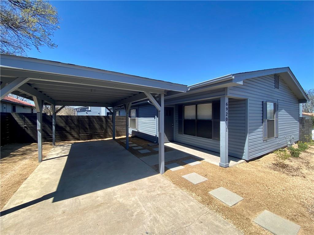
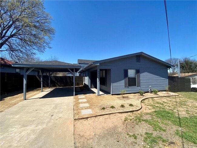
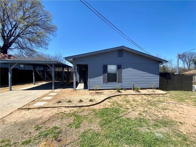
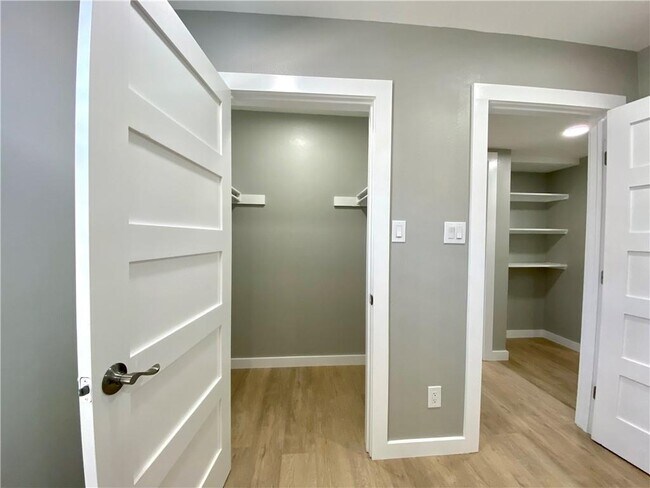
6920 Bethune Ave
Austin, TX 78752
Favorites
-
Bedrooms
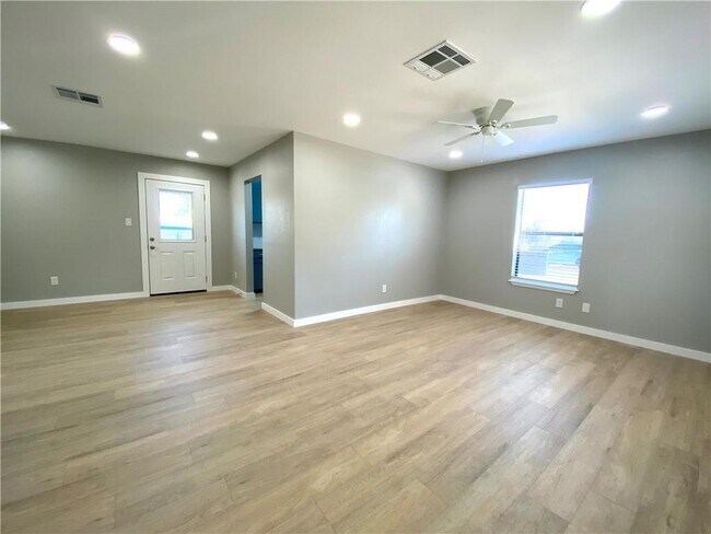
3
-
Bathrooms
2
-
Square Feet
1,174 sq ft
6920 Bethune Ave

Favorites
Contact
- Listed by Locayt
Location
Get Directions
St. Johns is a popular area that has many families settling in the area. A quiet community in the northeast area of the city, residents appreciate the relaxed pace of this locale and neighboring Coronado Hills. With many multigenerational families settling here, St. Johns hosts plenty of options for families and professionals alike.
Located just 20 minutes outside of Downtown Austin, St. Johns is surrounded by Highway 290, Highway 183, and I-35, making it perfect for commuters. There are plenty of chain restaurants that serve the area, but for a greater variety of offerings just cross the I-35 to Highland and indulge in the options along North Lamar Blvd.
Learn more about living in St Johns
Education
| Colleges & Universities | Distance | ||
|---|---|---|---|
| Colleges & Universities | Distance | ||
| Drive: | 8 min | 4.5 mi | |
| Drive: | 10 min | 6.0 mi | |
| Drive: | 11 min | 6.1 mi | |
| Drive: | 13 min | 6.4 mi |
6920 Bethune Ave is within 8 minutes or 4.5 miles from University of Texas at Austin. It is also near Austin C.C., Eastview Campus and Austin C.C., Rio Grande Campus.
Transportation options available in Austin include Highland Station, located 1.5 miles from 6920 Bethune Ave. 6920 Bethune Ave is near Austin-Bergstrom International, located 16.1 miles or 27 minutes away.
| Transit / Subway | Distance | ||
|---|---|---|---|
| Transit / Subway | Distance | ||
| Drive: | 3 min | 1.5 mi | |
| Drive: | 4 min | 1.6 mi | |
| Drive: | 9 min | 5.0 mi | |
| Drive: | 10 min | 5.3 mi | |
| Drive: | 11 min | 5.7 mi |
| Commuter Rail | Distance | ||
|---|---|---|---|
| Commuter Rail | Distance | ||
|
|
Drive: | 13 min | 7.2 mi |
|
|
Drive: | 39 min | 31.6 mi |
|
|
Drive: | 44 min | 36.4 mi |
| Airports | Distance | ||
|---|---|---|---|
| Airports | Distance | ||
|
Austin-Bergstrom International
|
Drive: | 27 min | 16.1 mi |
Getting Around
 What do Walkability, Transit, Drivability, and Bikeability mean?
Walkability measures the walking distance to day-to-day needs.
Transit measures access to public transportation.
Drivability measures congestion, parking availability, and access to major roads.
Bikeability measures the suitability for cycling.
How It Works
What do Walkability, Transit, Drivability, and Bikeability mean?
Walkability measures the walking distance to day-to-day needs.
Transit measures access to public transportation.
Drivability measures congestion, parking availability, and access to major roads.
Bikeability measures the suitability for cycling.
How It Works
Moderately Walkable
Walkability
60
/ 100
Some Public Transit
Transit
40
/ 100
Very Drivable
Drivability
80
/ 100
Fairly Bikeable
Bikeability
50
/ 100
Scores provided by
-
Soundscore™
-
/ 100
Traffic
-Airport
-Businesses
-Scores provided by
HowLoud What is a Sound Score Rating? A Sound Score Rating aggregates noise caused by vehicle traffic, airplane traffic and local sources. How It WorksTime and distance from 6920 Bethune Ave.
| Shopping Centers | Distance | ||
|---|---|---|---|
| Shopping Centers | Distance | ||
| Walk: | 11 min | 0.6 mi | |
| Walk: | 11 min | 0.6 mi | |
| Walk: | 16 min | 0.8 mi |
6920 Bethune Ave has 3 shopping centers within 0.8 mile, which is about a 16-minute walk. The miles and minutes will be for the farthest away property.
| Parks and Recreation | Distance | ||
|---|---|---|---|
| Parks and Recreation | Distance | ||
|
Elisabet Ney Museum
|
Drive: | 7 min | 3.0 mi |
|
Beverly S. Sheffield Northwest District Park
|
Drive: | 10 min | 3.6 mi |
|
Thinkery
|
Drive: | 7 min | 3.7 mi |
|
Texas Memorial Museum
|
Drive: | 8 min | 4.5 mi |
|
Jourdan-Bachman Pioneer Farms
|
Drive: | 10 min | 5.9 mi |
6920 Bethune Ave has 5 parks within 5.9 miles, including Elisabet Ney Museum, Thinkery, and Beverly S. Sheffield Northwest District Park.
| Hospitals | Distance | ||
|---|---|---|---|
| Hospitals | Distance | ||
| Drive: | 5 min | 2.2 mi | |
| Drive: | 6 min | 2.7 mi | |
| Drive: | 8 min | 3.5 mi |
6920 Bethune Ave has 3 hospitals within 3.5 miles, the nearest is Cross Creek Hospital which is 2.2 miles away and a 5 minute drive.
| Military Bases | Distance | ||
|---|---|---|---|
| Military Bases | Distance | ||
| Drive: | 84 min | 69.1 mi | |
| Drive: | 86 min | 71.3 mi | |
| Drive: | 115 min | 98.8 mi |
6920 Bethune Ave has 3 military bases within 98.8 miles, the nearest is Fort Hood which is 69.1 miles away and a 84 minute drive.
You May Also Like
Similar Rentals Nearby
-
-

-

-

-

-

-

-

-

-
 3 Beds, 3 Baths, 1,925 sq ft$4,500Total Monthly Price12 Month LeaseTotal Monthly Price NewPrices include all required monthly fees.4804 Duval Rd Unit 41
What Are Walk Score®, Transit Score®, and Bike Score® Ratings?
Walk Score® measures the walkability of any address. Transit Score® measures access to public transit. Bike Score® measures the bikeability of any address.
What is a Sound Score Rating?
A Sound Score Rating aggregates noise caused by vehicle traffic, airplane traffic and local sources.

6920 Bethune Ave
Austin, TX 78752