
$900
/ Month
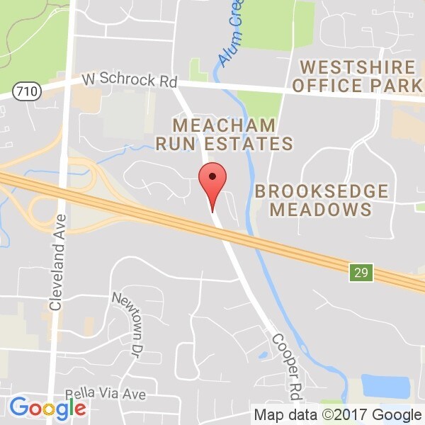
6893 Cooper Rd
Westerville, OH 43081
Favorites
6893 Cooper Rd

Favorites
Check Back Soon for Upcoming Availability
| Beds | Baths | Average SF |
|---|---|---|
| 2 Bedrooms 2 Bedrooms 2 Br | 2 Baths 2 Baths 2 Ba | — |
About This Property
---- SCHEDULE A SHOWING ONLINE AT: http://showmojo.com/lac/86fa7e609f ---- http://youtu.be/E4Id_g0i0RA. 2 bedroom, 2.5 bath, basement, Westerville schools,
6893 Cooper Rd is an apartment community located in Franklin County and the 43081 ZIP Code.
6893 Cooper Rd,
Westerville,
OH
43081
Known for its cultural diversity, Northern Woods welcomes a multi-ethnic young professional population. The neighborhood is bordered by the I-270 Outerbelt on the north and east, just 15 miles north of Columbus.
With many local businesses and restaurants, a thorough map of biking trails and a surprisingly low cost of living, Northern Woods has it all at a very affordable price. Residents also enjoy the central location of this neighborhood, allowing them to easily explore the excitement of nearby downtown Columbus.
Learn more about living in Northern WoodsBelow are rent ranges for similar nearby apartments
Education
| Colleges & Universities | Distance | ||
|---|---|---|---|
| Colleges & Universities | Distance | ||
| Drive: | 5 min | 2.6 mi | |
| Drive: | 15 min | 9.1 mi | |
| Drive: | 20 min | 12.1 mi | |
| Drive: | 19 min | 13.3 mi |
6893 Cooper Rd is within 5 minutes or 2.6 miles from Otterbein College. It is also near Ohio Dominican University and Columbus State C.C., Columbus.
Walkability Near 6893 Cooper Rd Westerville, OH 43081
Getting Around
 What do Walkability, Transit, Drivability, and Bikeability mean?
Walkability measures the walking distance to day-to-day needs.
Transit measures access to public transportation.
Drivability measures congestion, parking availability, and access to major roads.
Bikeability measures the suitability for cycling.
How It Works
What do Walkability, Transit, Drivability, and Bikeability mean?
Walkability measures the walking distance to day-to-day needs.
Transit measures access to public transportation.
Drivability measures congestion, parking availability, and access to major roads.
Bikeability measures the suitability for cycling.
How It Works
Fairly Walkable
Walkability
40
/ 100
Minimal Public Transit
Transit
10
/ 100
Exceptionally Drivable
Drivability
100
/ 100
Moderately Bikeable
Bikeability
60
/ 100
Scores provided by
-
Soundscore™
-
/ 100
Traffic
-Airport
-Businesses
-Scores provided by
HowLoud What is a Sound Score Rating? A Sound Score Rating aggregates noise caused by vehicle traffic, airplane traffic and local sources. How It WorksYou May Also Like
Similar Rentals Nearby


What Are Walk Score®, Transit Score®, and Bike Score® Ratings?
Walk Score® measures the walkability of any address. Transit Score® measures access to public transit. Bike Score® measures the bikeability of any address.
What is a Sound Score Rating?
A Sound Score Rating aggregates noise caused by vehicle traffic, airplane traffic and local sources.
6893 Cooper Rd
Westerville, OH 43081