
$2,800 / Month
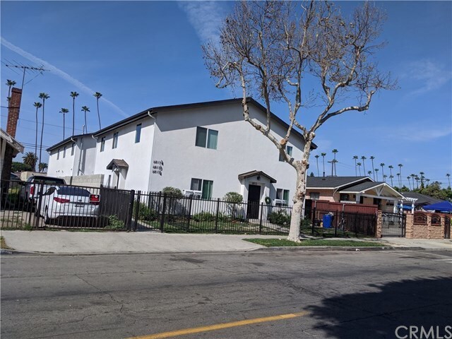
6813 Converse Ave
Los Angeles, CA 90001
2 Weeks Ago
Favorites
6813 Converse Ave

Favorites
Check Back Soon for Upcoming Availability
| Beds | Baths | Average SF |
|---|---|---|
| 4 Bedrooms 4 Bedrooms 4 Br | 3 Baths 3 Baths 3 Ba | 1,200 SF |
Location
Get Directions
Florence-Graham is an urban neighborhood about 10 miles south of Downtown Los Angeles. Most of the neighborhood is residential with a plethora of rental options. Coffee shops, restaurants, and grocers are situated throughout town while larger plazas like Plaza La Alameda are located towards the edges of the neighborhood. A few community parks equipped with walking paths, athletic fields, and courts, like Ted Watkins Memorial Park and Franklin D. Roosevelt Park, dot Florence-Graham as well.
Learn more about living in Florence-GrahamBelow are rent ranges for similar nearby apartments
Education
| Colleges & Universities | Distance | ||
|---|---|---|---|
| Colleges & Universities | Distance | ||
| Drive: | 4 min | 1.8 mi | |
| Drive: | 11 min | 6.1 mi | |
| Drive: | 10 min | 6.1 mi | |
| Drive: | 12 min | 6.5 mi |
6813 Converse Ave is within 4 minutes or 1.8 miles from UEI, Huntington Park. It is also near Los Angeles Trade-Tech and USC, University Park Campus.
Schools


Public Elementary & Middle School
Grades K-8
335 Students
Nearby
Public Elementary School
Grades K-5
628 Students
Attendance Zone
Public Middle School
Grades 6-8
876 Students
Attendance Zone
Charter High School
Grades 9-12
611 Students
Nearby
Private Elementary & Middle School
Grades PK-8
259 Students
Nearby
Private High School
Grades 9-12
284 Students
Nearby
School data provided by
 The GreatSchools Rating helps parents compare schools within a state based on a variety of school quality indicators and provides a helpful picture of how effectively each school serves all of its students. Ratings are on a scale of 1 (below average) to 10 (above average) and can include test scores, college readiness, academic progress, advanced courses, equity, discipline and attendance data. We also advise parents to visit schools, consider other information on school performance and programs, and consider family needs as part of the school selection process.
View GreatSchools Rating Methodology
Data provided by GreatSchools.org © 2025. All rights reserved.
View GreatSchools Rating Methodology
Data provided by GreatSchools.org © 2025. All rights reserved.
Transportation options available in Los Angeles include Florence Station, located 0.3 mile from 6813 Converse Ave. 6813 Converse Ave is near Los Angeles International, located 10.9 miles or 20 minutes away, and Long Beach (Daugherty Field), located 14.6 miles or 26 minutes away.
| Transit / Subway | Distance | ||
|---|---|---|---|
| Transit / Subway | Distance | ||
| Walk: | 6 min | 0.3 mi | |
| Walk: | 19 min | 1.0 mi | |
| Drive: | 3 min | 1.7 mi | |
| Drive: | 4 min | 2.3 mi | |
| Drive: | 6 min | 2.9 mi |
| Commuter Rail | Distance | ||
|---|---|---|---|
| Commuter Rail | Distance | ||
|
|
Drive: | 12 min | 6.0 mi |
| Drive: | 13 min | 6.5 mi | |
| Drive: | 15 min | 7.7 mi | |
| Drive: | 17 min | 9.2 mi | |
| Drive: | 16 min | 9.9 mi |
| Airports | Distance | ||
|---|---|---|---|
| Airports | Distance | ||
|
Los Angeles International
|
Drive: | 20 min | 10.9 mi |
|
Long Beach (Daugherty Field)
|
Drive: | 26 min | 14.6 mi |
Time and distance from 6813 Converse Ave.
| Shopping Centers | Distance | ||
|---|---|---|---|
| Shopping Centers | Distance | ||
| Walk: | 7 min | 0.4 mi | |
| Walk: | 8 min | 0.4 mi | |
| Walk: | 11 min | 0.6 mi |
6813 Converse Ave has 3 shopping centers within 0.6 mile, which is about a 11-minute walk. The miles and minutes will be for the farthest away property.
| Parks and Recreation | Distance | ||
|---|---|---|---|
| Parks and Recreation | Distance | ||
|
Augustus Hawkins Natural Park
|
Walk: | 20 min | 1.1 mi |
|
Watts Senior Center & Rose Garden
|
Drive: | 6 min | 2.6 mi |
|
Watts Towers-Rodia State Park
|
Drive: | 7 min | 3.4 mi |
|
California Science Center
|
Drive: | 10 min | 4.9 mi |
|
Exposition Park Rose Garden
|
Drive: | 10 min | 5.8 mi |
6813 Converse Ave has 5 parks within 5.8 miles, including Augustus Hawkins Natural Park, Watts Senior Center & Rose Garden, and Watts Towers-Rodia State Park.
| Hospitals | Distance | ||
|---|---|---|---|
| Hospitals | Distance | ||
| Drive: | 4 min | 2.0 mi | |
| Drive: | 8 min | 4.2 mi | |
| Drive: | 8 min | 4.9 mi |
6813 Converse Ave has 3 hospitals within 4.9 miles, the nearest is Community Hospital of Huntington Park which is 2.0 miles away and a 4 minute drive.
| Military Bases | Distance | ||
|---|---|---|---|
| Military Bases | Distance | ||
| Drive: | 18 min | 12.5 mi |
6813 Converse Ave is 12.5 miles and a 18 minute drive from Los Angeles Air Force Base.
You May Also Like
Similar Rentals Nearby


What Are Walk Score®, Transit Score®, and Bike Score® Ratings?
Walk Score® measures the walkability of any address. Transit Score® measures access to public transit. Bike Score® measures the bikeability of any address.
What is a Sound Score Rating?
A Sound Score Rating aggregates noise caused by vehicle traffic, airplane traffic and local sources

6813 Converse Ave
Los Angeles, CA 90001