
$2,000
/ Month
677 Canal St
Placerville, CA 95667
Favorites
677 Canal St

Favorites
Check Back Soon for Upcoming Availability
| Beds | Baths | Average SF |
|---|---|---|
| 2 Bedrooms 2 Bedrooms 2 Br | 1 Bath 1 Bath 1 Ba | 1,000 SF |
Fees and Policies
The fees listed below are community-provided and may exclude utilities or add-ons. All payments are made directly to the property and are non-refundable unless otherwise specified.
- Dogs Allowed
-
Fees not specified
- Cats Allowed
-
Fees not specified
About This Property
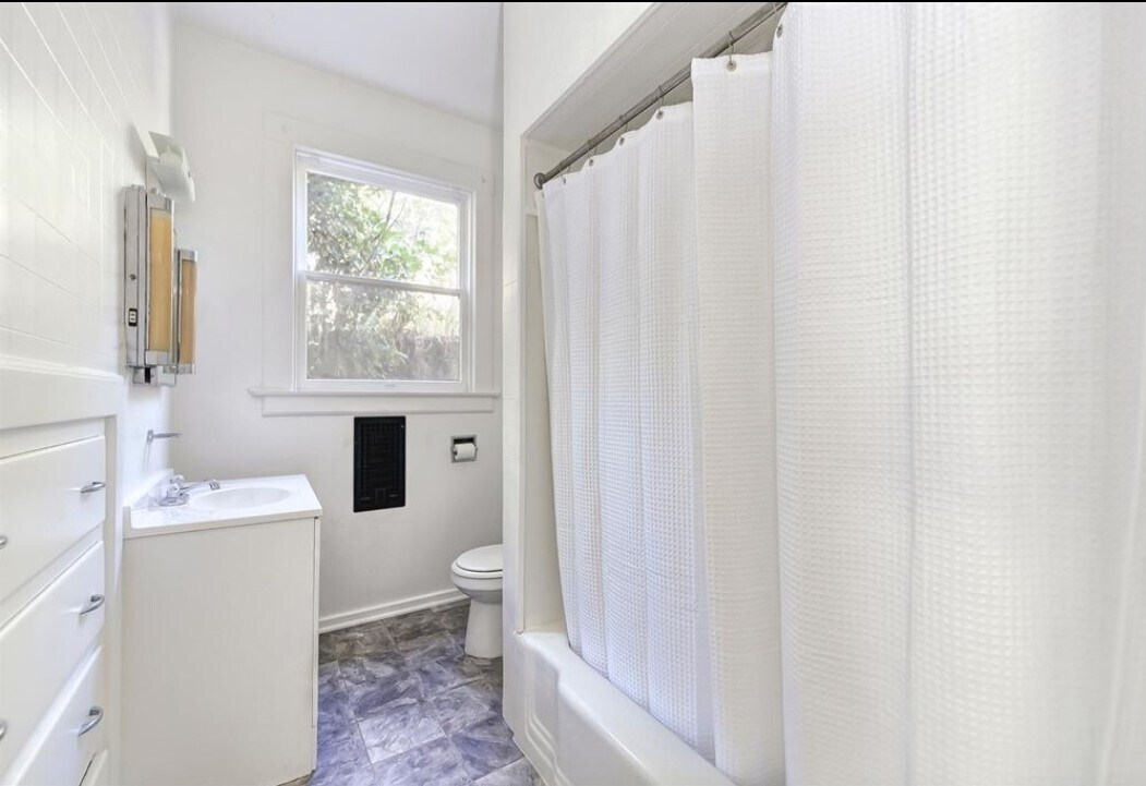
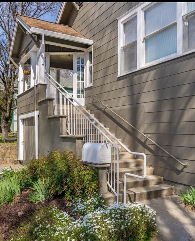
Newly upgraded 2-bedroom, 1 bathroom duplex unit comes complete with hard to find amenities such as A/C, dedicated parking and washer/dryer. This iconic and historic duplex is just a short walk to charming downtown Placerville with its antique shops, breweries, the oldest hardware store west of the Mississippi and restaurants for every taste and budget. Enjoy local wineries, farmer’s markets and the famous Apple Hill region just minutes away. This unit was recently renovated with central A/C, washer/dryer, fresh paint, new carpets and flooring and new bathroom fixtures. Located on a acre with a picture perfect covered front porch, backyard and side yard perfect for a small vegetable garden or relaxing after work with a glass of wine. In addition there are 2 uncovered parking spots per unit. South Tahoe is just an hour away. Come see what small-town living is all about!
677 Canal St is a townhome located in El Dorado County and the 95667 ZIP Code. This area is served by the Placerville Union Elementary School District attendance zone.
Townhome Features
- Washer/Dryer
- Washer/Dryer Hookup
677 Canal St,
Placerville,
CA
95667
Placerville is the county seat of El Dorado County, sitting squarely along Highway 50 between Sacramento and South Lake Tahoe, which puts two very different worlds within an hour's reach. The city earned its name from the placer mining that defined its early identity, and that Gold Rush heritage still shapes the character of downtown, where historic storefronts and local shops line streets that date back to the 1850s. Folsom Lake College operates a campus nearby in El Dorado Hills, adding an educational anchor to the area. The broader economy draws from county government, healthcare, retail, and the surrounding wine country of the Sierra Foothills, one of California's most respected wine-growing regions.
Life here feels deliberately unhurried. Neighborhoods range from compact, walkable blocks near the historic core to more spread-out residential areas on the hillsides surrounding the city.
Learn more about living in Placerville
Amenities
- Washer/Dryer
- Washer/Dryer Hookup
Education
| Colleges & Universities | Distance | ||
|---|---|---|---|
| Colleges & Universities | Distance | ||
| Drive: | 8 min | 4.7 mi | |
| Drive: | 28 min | 20.8 mi | |
| Drive: | 48 min | 34.5 mi | |
| Drive: | 50 min | 36.9 mi |
677 Canal St is within 8 minutes or 4.7 miles from Folsom Lake College, El Dorado. It is also near Folsom Lake College, Folsom and Sierra College, Rocklin Campus.
Schools


Public Elementary, Middle & High School
Grades K-12
202 Students
Nearby
Public Elementary School
Grades K-5
402 Students
Nearby
Public Middle School
Grades 6-8
431 Students
Nearby
Public High School
Grades 9-12
1,135 Students
Attendance Zone
Private Elementary, Middle & High School
Grades K-12
Nearby
Private Elementary & Middle School
Grades PK-8
159 Students
Nearby
School data provided by
 The GreatSchools Rating helps parents compare schools within a state based on a variety of school quality indicators and provides a helpful picture of how effectively each school serves all of its students. Ratings are on a scale of 1 (below average) to 10 (above average) and can include test scores, college readiness, academic progress, advanced courses, equity, discipline and attendance data. We also advise parents to visit schools, consider other information on school performance and programs, and consider family needs as part of the school selection process.
View GreatSchools Rating Methodology
Data provided by GreatSchools.org © 2026. All rights reserved.
View GreatSchools Rating Methodology
Data provided by GreatSchools.org © 2026. All rights reserved.
Walkability Near 677 Canal St Placerville, CA 95667
Getting Around
 What do Walkability, Transit, Drivability, and Bikeability mean?
Walkability measures the walking distance to day-to-day needs.
Transit measures access to public transportation.
Drivability measures congestion, parking availability, and access to major roads.
Bikeability measures the suitability for cycling.
How It Works
What do Walkability, Transit, Drivability, and Bikeability mean?
Walkability measures the walking distance to day-to-day needs.
Transit measures access to public transportation.
Drivability measures congestion, parking availability, and access to major roads.
Bikeability measures the suitability for cycling.
How It Works
Fairly Walkable
Walkability
40
/ 100
Limited Public Transit
Transit
30
/ 100
Exceptionally Drivable
Drivability
100
/ 100
Somewhat Bikeable
Bikeability
20
/ 100
Scores provided by
-
Soundscore™
-
/ 100
Traffic
-Airport
-Businesses
-Scores provided by
HowLoud What is a Sound Score Rating? A Sound Score Rating aggregates noise caused by vehicle traffic, airplane traffic and local sources. How It WorksSimilar Rentals Nearby


What Are Walk Score®, Transit Score®, and Bike Score® Ratings?
Walk Score® measures the walkability of any address. Transit Score® measures access to public transit. Bike Score® measures the bikeability of any address.
What is a Sound Score Rating?
A Sound Score Rating aggregates noise caused by vehicle traffic, airplane traffic and local sources.
677 Canal St
Placerville, CA 95667