
$4,750
Total Monthly Price
12 Month Lease
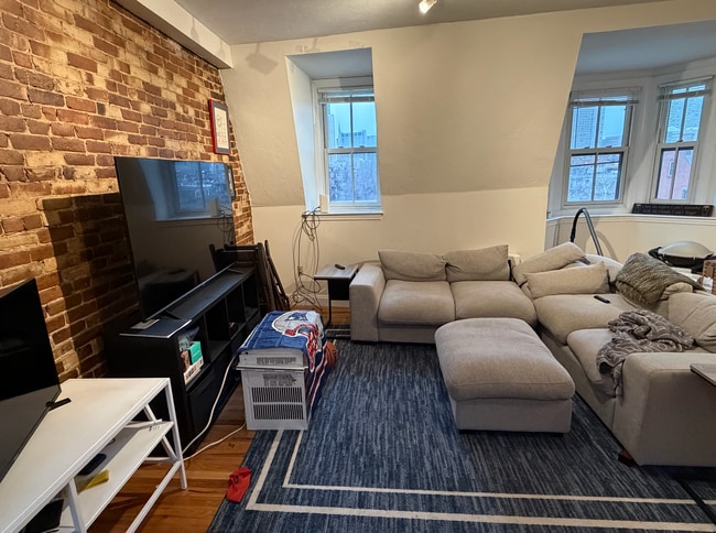
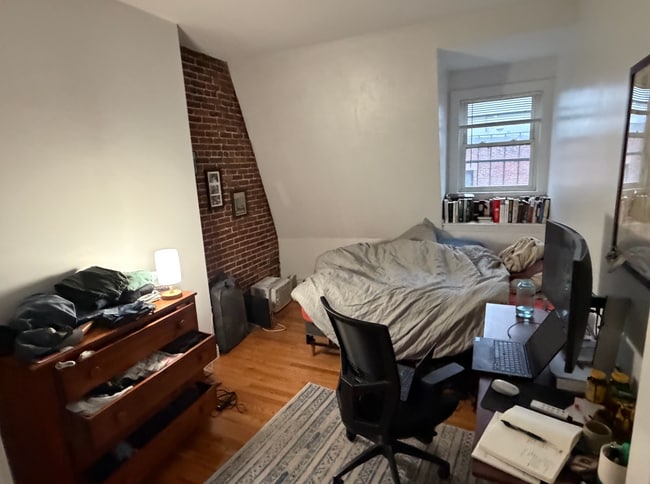
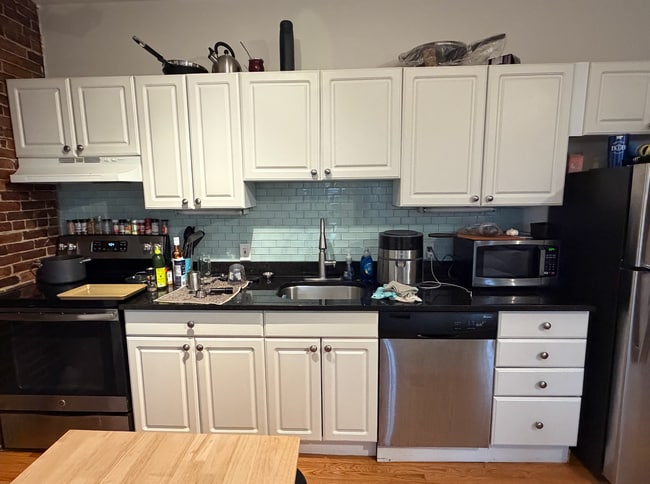
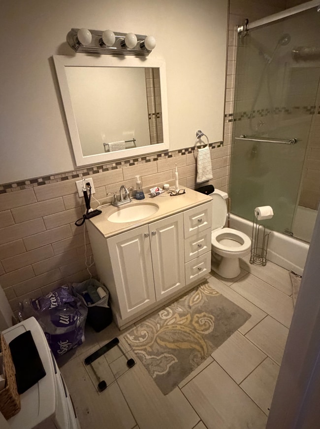
676 Tremont St
Boston, MA 02118
Today
|
Edit
Favorites
857-702-1931
-
Bedrooms
2
-
Bathrooms
1
-
Square Feet
9,999 sq ft
-
Available
Available Sep 1
Highlight
- Smoke Free
676 Tremont St

Favorites
About This Home
12 Month Lease,
$4,750 deposit,
Available Sep 1
Prime location in the heart of the desirable South End with cute cafes, trendy dining, and chic boutique shopping all minutes away! Close to Newbury Street, Prudential Center, Commonwealth Ave Mall, Kenmore Square, Boston Medical Center, Suffolk University, Copley Square, SOWA Open Market, Restaurant Row, Boston Public Library, Public Gardens, Emerson College, Symphony Hall, Hynes Convention Center, and much more! Anything not in walking distance can be easily accessed by the close by public transportation: Green Line (at Copley, Hynes) and Orange Line (at Mass Ave, Back Bay) are nearby, as well as Silver Line shuttle, many major MBTA bus routes, and Commuter Rail at Back Bay Station!
676 Tremont St is a condo located in Suffolk County and the 02118 ZIP Code.
* Price shown is total price based on community-supplied monthly required fees. Excludes user-selected optional fees and variable or usage-based fees and required charges due at or prior to move-in or at move-out. Price, availability, fees, and any applicable rent special are subject to change without notice.
* Square footage definitions vary. Displayed square footage is approximate.
Condo Features
- Smoke Free
- Dishwasher
- Laundry Facilities
Fees and Policies
The fees listed below are community-provided and may exclude utilities or add-ons. All payments are made directly to the property and are non-refundable unless otherwise specified. Use the Cost Calculator to determine costs based on your needs.
- Parking
-
Surface Lot$250/mo
Details
Utilities Included
-
Water
-
Heat
-
Sewer
Contact
- Phone Number
- Contact
Location
Get Directions
Boston is the iconic capital and largest city of Massachusetts, known for its historical significance, top-notch culinary scene, and beautiful Bayfront views. Nestled on Massachusetts Bay, Boston is home to numerous universities including Harvard University, Boston College, Northeastern University, the University of Massachusetts-Boston, the Berklee College of Music, and the Benjamin Franklin Institute of Technology. In fact, there are 54 colleges and universities in the Boston area, dating all the way back to 1636 when Harvard was established.
Boston played a crucial role in the American Revolution, being the site of major events like the Boston Massacre and the Boston Tea Party. This city is filled with historic sites, landmarks, and architecture like the Boston Common, the first park in the country, dating back to 1624. Locals frequent Freedom Trail for its walking park that begins at the park and leads past several historic sites, including Paul Revere’s House and Faneuil Hall.
Learn more about living in Boston
Education
| Colleges & Universities | Distance | ||
|---|---|---|---|
| Colleges & Universities | Distance | ||
| Walk: | 12 min | 0.6 mi | |
| Walk: | 15 min | 0.8 mi | |
| Drive: | 4 min | 1.4 mi | |
| Drive: | 5 min | 1.7 mi |
676 Tremont St is within 12 minutes or 0.6 mile from Berklee College of Music. It is also near Northeastern University and Tufts University, Boston.
Transportation options available in Boston include Prudential Station, located 0.4 mile from 676 Tremont St. 676 Tremont St is near General Edward Lawrence Logan International, located 5.1 miles or 11 minutes away.
| Transit / Subway | Distance | ||
|---|---|---|---|
| Transit / Subway | Distance | ||
|
|
Walk: | 8 min | 0.4 mi |
|
|
Walk: | 10 min | 0.5 mi |
|
|
Walk: | 11 min | 0.6 mi |
|
|
Walk: | 14 min | 0.7 mi |
|
|
Walk: | 16 min | 0.9 mi |
| Commuter Rail | Distance | ||
|---|---|---|---|
| Commuter Rail | Distance | ||
|
|
Drive: | 5 min | 1.1 mi |
| Drive: | 3 min | 1.4 mi | |
|
|
Drive: | 4 min | 1.6 mi |
|
|
Drive: | 4 min | 1.9 mi |
|
|
Drive: | 8 min | 4.2 mi |
| Airports | Distance | ||
|---|---|---|---|
| Airports | Distance | ||
|
General Edward Lawrence Logan International
|
Drive: | 11 min | 5.1 mi |
Getting Around
 What do Walkability, Transit, Drivability, and Bikeability mean?
Walkability measures the walking distance to day-to-day needs.
Transit measures access to public transportation.
Drivability measures congestion, parking availability, and access to major roads.
Bikeability measures the suitability for cycling.
How It Works
What do Walkability, Transit, Drivability, and Bikeability mean?
Walkability measures the walking distance to day-to-day needs.
Transit measures access to public transportation.
Drivability measures congestion, parking availability, and access to major roads.
Bikeability measures the suitability for cycling.
How It Works
Exceptionally Walkable
Walkability
100
/ 100
Exceptional Public Transit
Transit
100
/ 100
Fairly Drivable
Drivability
40
/ 100
Exceptionally Bikeable
Bikeability
90
/ 100
Scores provided by
Busy
Soundscore™
67
/ 100
Traffic
ActiveAirport
CalmBusinesses
BusyScores provided by
HowLoud What is a Sound Score Rating? A Sound Score Rating aggregates noise caused by vehicle traffic, airplane traffic and local sources. How It WorksTime and distance from 676 Tremont St.
| Shopping Centers | Distance | ||
|---|---|---|---|
| Shopping Centers | Distance | ||
| Drive: | 4 min | 1.7 mi | |
| Drive: | 10 min | 5.2 mi | |
| Drive: | 10 min | 5.4 mi |
676 Tremont St has 3 shopping centers within 5.4 miles, which is about a 10-minute drive. The miles and minutes will be for the farthest away property.
| Parks and Recreation | Distance | ||
|---|---|---|---|
| Parks and Recreation | Distance | ||
|
Roxbury Heritage State Park
|
Drive: | 3 min | 1.4 mi |
|
Boston Public Garden
|
Drive: | 5 min | 1.7 mi |
|
Charles River Reservation
|
Drive: | 5 min | 1.9 mi |
|
Boston African American National Historic Site
|
Drive: | 6 min | 2.1 mi |
|
Boston Children's Museum
|
Drive: | 5 min | 2.4 mi |
676 Tremont St has 5 parks within 2.4 miles, including Boston Public Garden, Roxbury Heritage State Park, and Boston African American National Historic Site.
| Hospitals | Distance | ||
|---|---|---|---|
| Hospitals | Distance | ||
| Walk: | 8 min | 0.4 mi | |
| Walk: | 11 min | 0.6 mi | |
| Drive: | 3 min | 1.1 mi |
676 Tremont St has 3 hospitals within 1.1 miles, the nearest is Dr. Solomon Carter Fuller Mental Health Center which is 0.4 mile away and a 8 minute walk.
| Military Bases | Distance | ||
|---|---|---|---|
| Military Bases | Distance | ||
| Drive: | 31 min | 16.1 mi |
676 Tremont St is 16.1 miles and a 31 minute drive from Hanscom Air Force Base.
Amenities
- Smoke Free
- Dishwasher
- Laundry Facilities
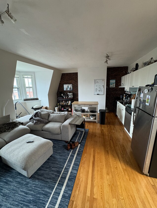
676 Tremont St Photos
What Are Walk Score®, Transit Score®, and Bike Score® Ratings?
Walk Score® measures the walkability of any address. Transit Score® measures access to public transit. Bike Score® measures the bikeability of any address.
What is a Sound Score Rating?
A Sound Score Rating aggregates noise caused by vehicle traffic, airplane traffic and local sources.
676 Tremont St
Boston, MA 02118