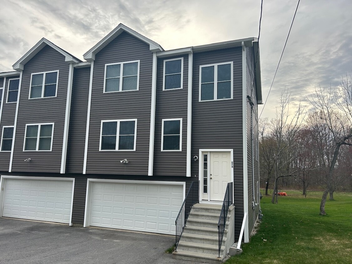
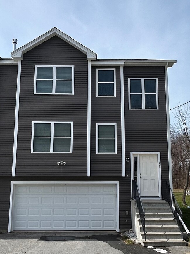
676 Burncoat St
Worcester, MA 01606
-
Bedrooms
3
-
Bathrooms
3.5
-
Square Feet
2,136 sq ft
-
Available
Available Mar 1
Highlights
- Pets Allowed
- Double Vanities

676 Burncoat St is a house located in Worcester County and the 01606 ZIP Code. This area is served by the Worcester attendance zone.
House Features
Washer/Dryer
High Speed Internet Access
Tub/Shower
Ceiling Fans
- High Speed Internet Access
- Washer/Dryer
- Heating
- Ceiling Fans
- Cable Ready
- Storage Space
- Double Vanities
- Tub/Shower
- Handrails
Fees and Policies
The fees listed below are community-provided and may exclude utilities or add-ons. All payments are made directly to the property and are non-refundable unless otherwise specified.
- Dogs Allowed
-
Fees not specified
- Cats Allowed
-
Fees not specified
- Parking
-
Garage--
Details
Property Information
-
Built in 2019
Contact
- Listed by Alex S
- Phone Number
- Contact
Worcester combines urban living with historic New England character. The "Heart of the Commonwealth" features housing options ranging from the city's signature triple-decker homes to apartment communities throughout its neighborhoods. Currently, renters can expect to pay around $1,758 for a one-bedroom apartment, with rental rates showing a moderate increase of 2.9% over the past year. Popular areas include the Canal District, with its restaurant and entertainment scene, and the Shrewsbury Street corridor, known for its Italian heritage. Worcester is home to several higher education institutions, including the College of the Holy Cross, Worcester Polytechnic Institute, and Clark University.
The city offers numerous parks and green spaces, including the historic Elm Park, designed by Frederick Law Olmsted in 1854. The 549-acre Green Hill Park provides recreational facilities, while Lake Quinsigamond is a destination for rowing and boating enthusiasts.
Learn more about living in Worcester| Colleges & Universities | Distance | ||
|---|---|---|---|
| Colleges & Universities | Distance | ||
| Drive: | 5 min | 1.7 mi | |
| Drive: | 9 min | 4.7 mi | |
| Drive: | 10 min | 4.9 mi | |
| Drive: | 13 min | 5.6 mi |


View GreatSchools Rating Methodology
Data provided by GreatSchools.org © 2026. All rights reserved.
- High Speed Internet Access
- Washer/Dryer
- Heating
- Ceiling Fans
- Cable Ready
- Storage Space
- Double Vanities
- Tub/Shower
- Handrails
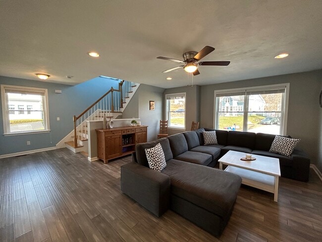
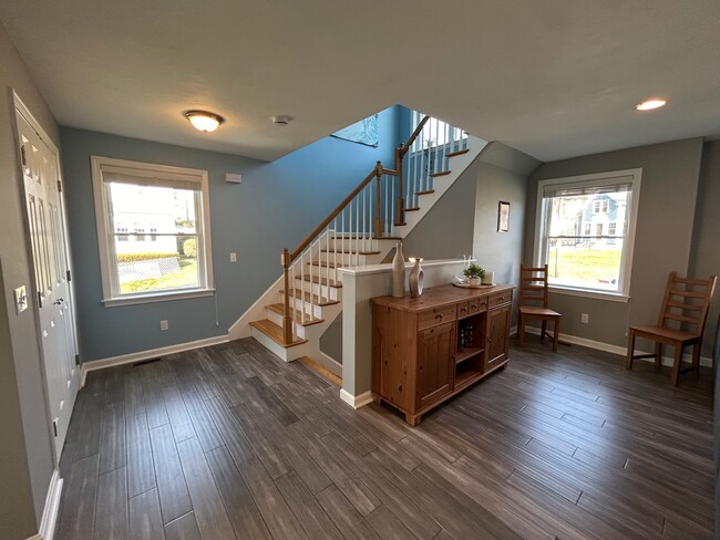
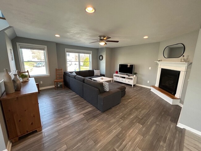
676 Burncoat St Photos
What Are Walk Score®, Transit Score®, and Bike Score® Ratings?
Walk Score® measures the walkability of any address. Transit Score® measures access to public transit. Bike Score® measures the bikeability of any address.
What is a Sound Score Rating?
A Sound Score Rating aggregates noise caused by vehicle traffic, airplane traffic and local sources

676 Burncoat St
Worcester, MA 01606