
Presidential Towers
555 W Madison St,
Chicago, IL 60661
$1,620 - $9,400
Studio - 2 Beds
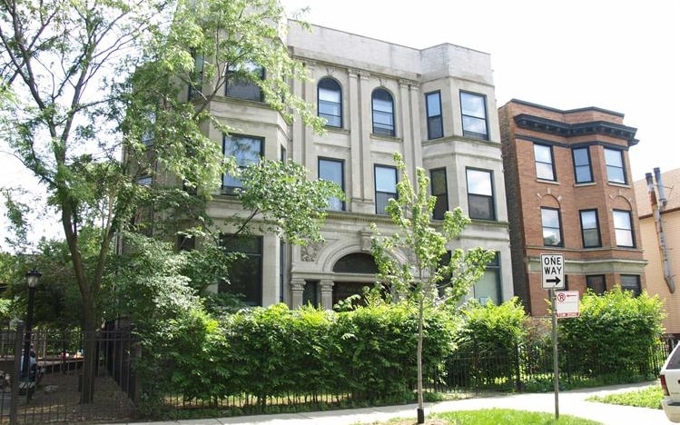
This AMAZING 2 Bed/ 1 Bath unit is located in Lakeview. It's a 10 minute walk to the Addison Red Line and Belmont Brown/Purple/Red Line Stations, as well as being a 15 minute walk to Wrigley Field. Address: 675 W RoscoeAvailable: February 1st or SoonerPrice: $1,995Features:Large Living RoomSpacious KitchenStainless Steel Appliances2 Queen Sized BedroomsHardwood FloorsCentral Air/HeatWasher/Dryer IN UNITNo Security DepositContact: Alex KushenAKushen@Peakproperties.bizPeak Properties
673-75 W. Roscoe St. is an apartment community located in Cook County and the 60657 ZIP Code. This area is served by the Chicago Public Schools attendance zone.
Unique Features
Heating
Oven
Range
Kitchen
If you love baseball — particularly if you love the Chicago Cubs — there's only one neighborhood for you: Lakeview! Bordering Lake Michigan on the north side of Chicago directly above Lincoln Park, Lakeview houses one of Chicago’s most popular destinations: Wrigley Field. Originally built in 1914 for Federal League’s Chicago Whales, Wrigley Field is one the oldest still-operating stadiums in the MLB. It was renamed Wrigley Field in 1926 by then-owner William Wrigley Jr., a chewing gum manufacturer.
Of course, there's more to Lakeview than baseball. From the luxury high-rise apartments along Lake Shore Drive to the tree-filled streets and single-family homes in Graceland West, there's something for everyone in Lakeview. This large neighborhood consists of several smaller enclaves, including Wrigleyville, Boystown, and North Halsted. Lakeview features several theaters, such as the Music Box Theater and the Playground Theater, as well as music venues and shops.
Learn more about living in Lakeview| Colleges & Universities | Distance | ||
|---|---|---|---|
| Colleges & Universities | Distance | ||
| Drive: | 3 min | 1.8 mi | |
| Drive: | 4 min | 1.8 mi | |
| Drive: | 6 min | 2.7 mi | |
| Drive: | 6 min | 3.2 mi |


Transportation options available in Chicago include Addison Station (Red Line), located 0.5 mile from 673-75 W. Roscoe St.. 673-75 W. Roscoe St. is near Chicago Midway International, located 14.7 miles or 26 minutes away, and Chicago O'Hare International, located 14.9 miles or 25 minutes away.
| Transit / Subway | Distance | ||
|---|---|---|---|
| Transit / Subway | Distance | ||
|
|
Walk: | 10 min | 0.5 mi |
|
|
Walk: | 10 min | 0.6 mi |
|
|
Walk: | 15 min | 0.8 mi |
|
|
Walk: | 20 min | 1.0 mi |
|
|
Walk: | 20 min | 1.1 mi |
| Commuter Rail | Distance | ||
|---|---|---|---|
| Commuter Rail | Distance | ||
|
|
Drive: | 6 min | 2.7 mi |
|
|
Drive: | 6 min | 2.9 mi |
|
|
Drive: | 10 min | 4.5 mi |
| Drive: | 8 min | 4.7 mi | |
|
|
Drive: | 10 min | 5.0 mi |
| Airports | Distance | ||
|---|---|---|---|
| Airports | Distance | ||
|
Chicago Midway International
|
Drive: | 26 min | 14.7 mi |
|
Chicago O'Hare International
|
Drive: | 25 min | 14.9 mi |
Time and distance from 673-75 W. Roscoe St..
| Shopping Centers | Distance | ||
|---|---|---|---|
| Shopping Centers | Distance | ||
| Walk: | 4 min | 0.2 mi | |
| Walk: | 8 min | 0.4 mi | |
| Walk: | 8 min | 0.4 mi |
| Parks and Recreation | Distance | ||
|---|---|---|---|
| Parks and Recreation | Distance | ||
|
Notebaert Nature Museum
|
Drive: | 4 min | 1.9 mi |
|
Lincoln Park
|
Drive: | 4 min | 2.0 mi |
|
Oz Park
|
Drive: | 4 min | 2.0 mi |
|
Lincoln Park Zoo
|
Drive: | 4 min | 2.0 mi |
|
Wrightwood Park
|
Drive: | 5 min | 2.4 mi |
| Hospitals | Distance | ||
|---|---|---|---|
| Hospitals | Distance | ||
| Walk: | 13 min | 0.7 mi | |
| Walk: | 16 min | 0.9 mi | |
| Drive: | 3 min | 1.4 mi |
| Military Bases | Distance | ||
|---|---|---|---|
| Military Bases | Distance | ||
| Drive: | 33 min | 22.6 mi |
What Are Walk Score®, Transit Score®, and Bike Score® Ratings?
Walk Score® measures the walkability of any address. Transit Score® measures access to public transit. Bike Score® measures the bikeability of any address.
What is a Sound Score Rating?
A Sound Score Rating aggregates noise caused by vehicle traffic, airplane traffic and local sources

673-675 W Roscoe St
Chicago, IL 60657


