
Venue Residences
3688 Overland Ave,
Los Angeles, CA 90034
$2,625 - $5,650
Studio - 2 Beds
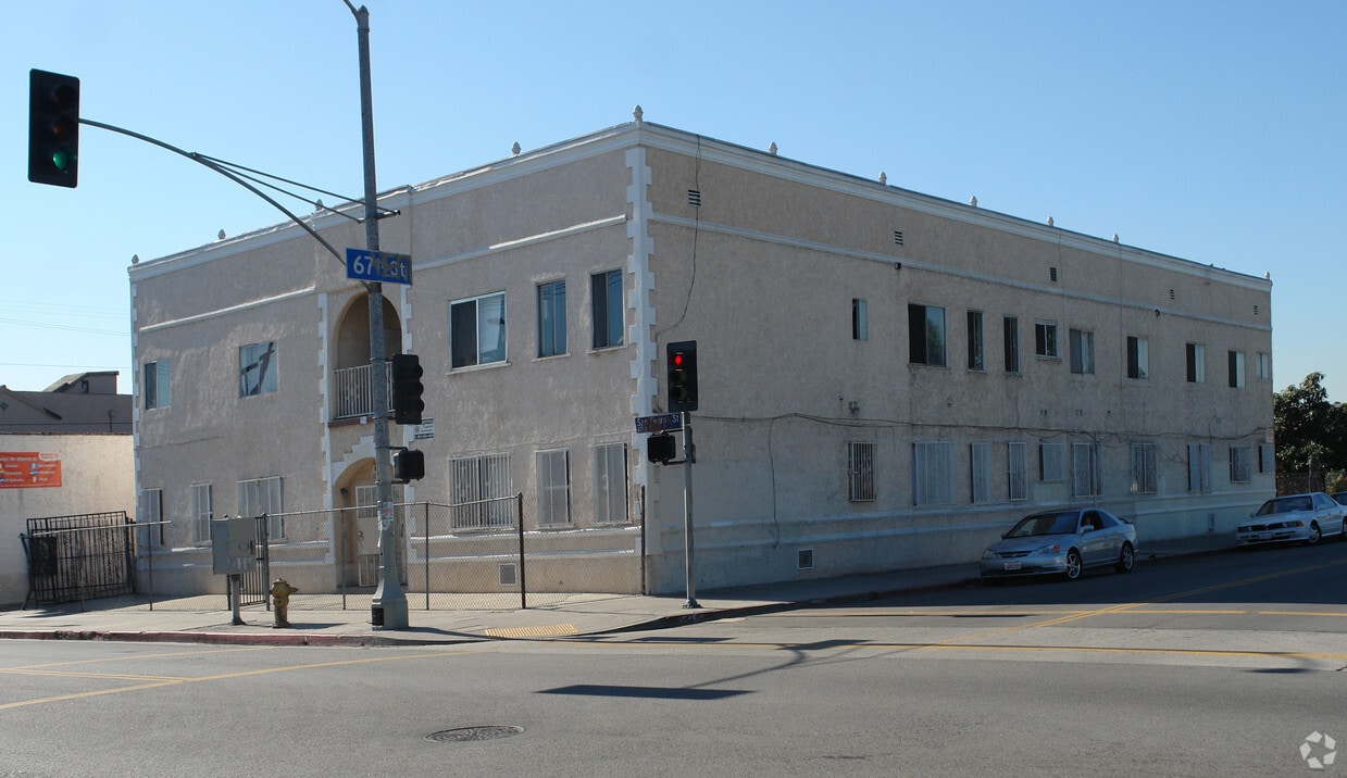
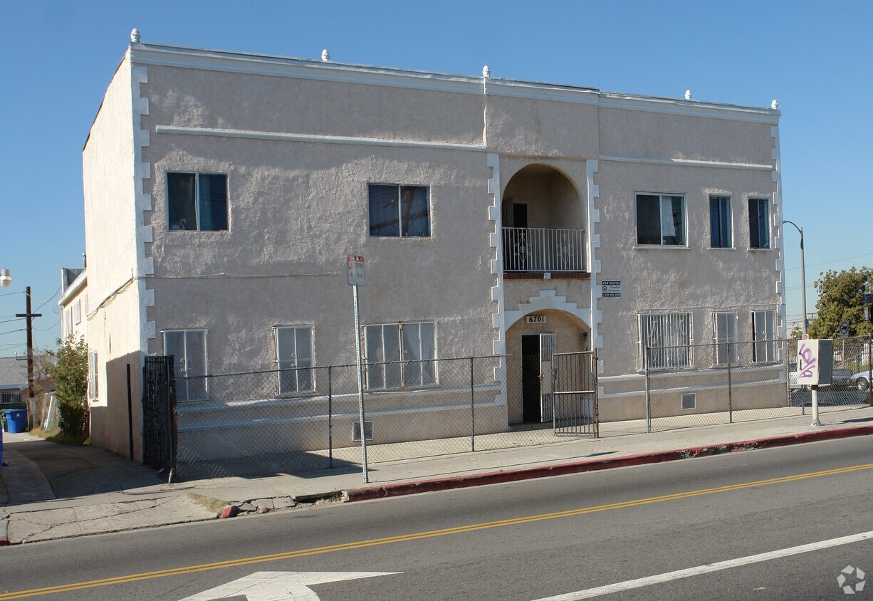

At 6701 S San Pedro St in Los Angeles, experience stylish living. The address for this community is in the 90003 area of Los Angeles. Be sure to come for a visit to see the current floorplan options. The professional community team is waiting to show you all that this community has in store. Get a head start on your move right now. Contact or stop by the 6701 S San Pedro St leasing office to find out current pricing.
6701 S San Pedro St is an apartment community located in Los Angeles County and the 90003 ZIP Code. This area is served by the Los Angeles Unified Rocp School District attendance zone.
Bounded by Interstate 110 to the west, Canndu/Avalon Gardens is a buzzing residential community approximately eight miles south of Downtown Los Angeles. Along the way, you’ll pass Exposition Park, the Natural Historic Museum of Los Angeles County, and the University of Southern California. This area sits near Huntington Park and provides renters with affordable housing options, a quick commute into the heart of the city, and walkable avenues. A variety of public schools, small businesses, retailers, and conveniences are spread throughout the area, but Canndu/Avalon Gardens is mainly residential. Apartments, houses, condos, and townhomes are available for rent and range from affordable to upscale, so there’s something for everyone.
Learn more about living in Canndu/Avalon GardensCompare neighborhood and city base rent averages by bedroom.
| Canndu/Avalon Gardens | Los Angeles, CA | |
|---|---|---|
| Studio | $1,168 | $1,709 |
| 1 Bedroom | $937 | $2,184 |
| 2 Bedrooms | $1,318 | $3,019 |
| 3 Bedrooms | $1,739 | $4,340 |
| Colleges & Universities | Distance | ||
|---|---|---|---|
| Colleges & Universities | Distance | ||
| Drive: | 6 min | 3.2 mi | |
| Drive: | 8 min | 4.6 mi | |
| Drive: | 7 min | 4.6 mi | |
| Drive: | 9 min | 5.0 mi |


Transportation options available in Los Angeles include Florence Station, located 1.9 miles from 6701 S San Pedro St. 6701 S San Pedro St is near Los Angeles International, located 9.6 miles or 18 minutes away, and Long Beach (Daugherty Field), located 17.8 miles or 25 minutes away.
| Transit / Subway | Distance | ||
|---|---|---|---|
| Transit / Subway | Distance | ||
|
|
Drive: | 4 min | 1.9 mi |
|
|
Drive: | 5 min | 2.4 mi |
|
|
Drive: | 5 min | 2.9 mi |
|
|
Drive: | 6 min | 3.4 mi |
|
|
Drive: | 7 min | 4.3 mi |
| Commuter Rail | Distance | ||
|---|---|---|---|
| Commuter Rail | Distance | ||
|
|
Drive: | 12 min | 8.0 mi |
|
|
Drive: | 14 min | 8.1 mi |
|
|
Drive: | 17 min | 9.1 mi |
|
|
Drive: | 19 min | 10.5 mi |
| Drive: | 16 min | 12.0 mi |
| Airports | Distance | ||
|---|---|---|---|
| Airports | Distance | ||
|
Los Angeles International
|
Drive: | 18 min | 9.6 mi |
|
Long Beach (Daugherty Field)
|
Drive: | 25 min | 17.8 mi |
Scores provided by
Traffic
-Airport
-Businesses
-Scores provided by
HowLoud What is a Sound Score Rating? A Sound Score Rating aggregates noise caused by vehicle traffic, airplane traffic and local sources. How It WorksTime and distance from 6701 S San Pedro St.
| Shopping Centers | Distance | ||
|---|---|---|---|
| Shopping Centers | Distance | ||
| Walk: | 15 min | 0.8 mi | |
| Walk: | 19 min | 1.0 mi | |
| Drive: | 2 min | 1.1 mi |
| Parks and Recreation | Distance | ||
|---|---|---|---|
| Parks and Recreation | Distance | ||
|
Augustus Hawkins Natural Park
|
Drive: | 4 min | 2.1 mi |
|
California Science Center
|
Drive: | 7 min | 3.5 mi |
|
Watts Senior Center & Rose Garden
|
Drive: | 7 min | 3.8 mi |
|
Natural History Museum of LA County
|
Drive: | 7 min | 4.2 mi |
|
Exposition Park Rose Garden
|
Drive: | 7 min | 4.4 mi |
| Hospitals | Distance | ||
|---|---|---|---|
| Hospitals | Distance | ||
| Drive: | 6 min | 3.4 mi | |
| Drive: | 8 min | 5.2 mi | |
| Drive: | 9 min | 5.2 mi |
| Military Bases | Distance | ||
|---|---|---|---|
| Military Bases | Distance | ||
| Drive: | 16 min | 11.1 mi | |
| Drive: | 27 min | 19.7 mi | |
| Drive: | 30 min | 21.9 mi |
What Are Walk Score®, Transit Score®, and Bike Score® Ratings?
Walk Score® measures the walkability of any address. Transit Score® measures access to public transit. Bike Score® measures the bikeability of any address.
What is a Sound Score Rating?
A Sound Score Rating aggregates noise caused by vehicle traffic, airplane traffic and local sources.

6701 S San Pedro St
Los Angeles, CA 90003


