
eaves West Valley
700 S Saratoga Ave,
San Jose, CA 95129
Studio - 2 Beds $2,010 - $3,695
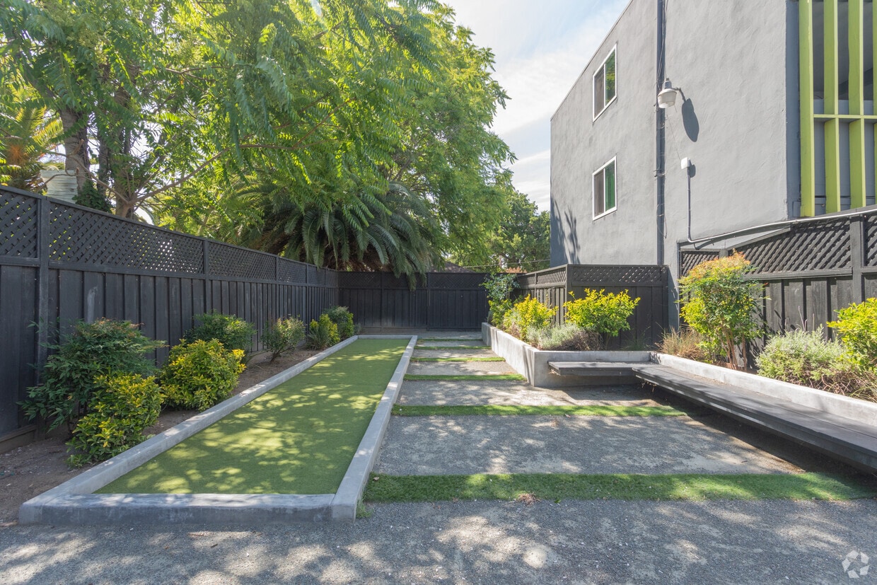

*Remodeled units *Updated Appliances *Bocce Ball Court *Picnic Area & BBQ
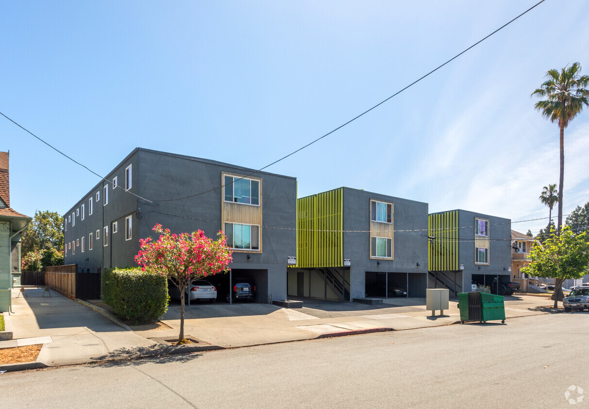
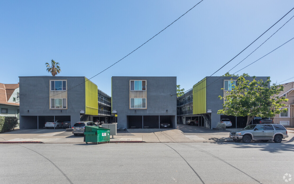
670-686 S. 8th is an apartment community located in Santa Clara County and the 95112 ZIP Code. This area is served by the San Jose Unified attendance zone.
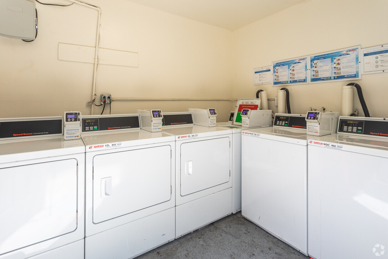
Laundry Facilities
Recycling
Grill
Bicycle Storage
Dishwasher
High Speed Internet Access
Granite Countertops
Refrigerator
Sun is the perfect neighborhood for students, professionals, city lovers, and art aficionados. Nestled right next to bustling Downtown San Jose and south of San Jose State University, Sun is a highly walkable neighborhood. William Street anchors the neighborhood with tons of diverse restaurants along the road while the namesake park offers residents a breath of fresh air.
With close proximity to the heart of the city, Sun affords residents quick access to premiere entertainment venues, galleries, museums, breweries, pubs, eateries, and more. Admire one-of-a-kind art pieces at the San Jose Institute of Contemporary Art, catch a show at the California Theater, and devour all-you-can-eat barbecue at Taurinus Brazilian Steak House. Sun is also convenient to the Happy Hollow Park and Zoo. Essentially, the Sun neighborhood allows you to enjoy all the wonders of city life in a low-key environment.
Learn more about living in Sun| Colleges & Universities | Distance | ||
|---|---|---|---|
| Colleges & Universities | Distance | ||
| Walk: | 12 min | 0.6 mi | |
| Drive: | 7 min | 3.7 mi | |
| Drive: | 12 min | 5.1 mi | |
| Drive: | 16 min | 8.8 mi |


Transportation options available in San Jose include Paseo De San Antonio Station Southbound, located 1.0 mile from 670-686 S. 8th. 670-686 S. 8th is near Norman Y Mineta San Jose International, located 4.5 miles or 10 minutes away, and Metro Oakland International, located 38.8 miles or 49 minutes away.
| Transit / Subway | Distance | ||
|---|---|---|---|
| Transit / Subway | Distance | ||
|
|
Walk: | 18 min | 1.0 mi |
| Walk: | 20 min | 1.0 mi | |
|
|
Walk: | 20 min | 1.1 mi |
|
|
Drive: | 3 min | 1.1 mi |
|
|
Drive: | 4 min | 1.3 mi |
| Commuter Rail | Distance | ||
|---|---|---|---|
| Commuter Rail | Distance | ||
| Drive: | 5 min | 1.7 mi | |
| Drive: | 5 min | 1.8 mi | |
| Drive: | 5 min | 2.0 mi | |
| Drive: | 5 min | 2.0 mi | |
| Drive: | 5 min | 2.0 mi |
| Airports | Distance | ||
|---|---|---|---|
| Airports | Distance | ||
|
Norman Y Mineta San Jose International
|
Drive: | 10 min | 4.5 mi |
|
Metro Oakland International
|
Drive: | 49 min | 38.8 mi |
Time and distance from 670-686 S. 8th.
| Shopping Centers | Distance | ||
|---|---|---|---|
| Shopping Centers | Distance | ||
| Walk: | 15 min | 0.8 mi | |
| Walk: | 18 min | 1.0 mi | |
| Drive: | 4 min | 1.3 mi |
| Parks and Recreation | Distance | ||
|---|---|---|---|
| Parks and Recreation | Distance | ||
|
Happy Hollow Park & Zoo
|
Drive: | 3 min | 1.1 mi |
|
Children's Discovery Museum of San Jose
|
Drive: | 3 min | 1.2 mi |
|
The Tech Museum of Innovation
|
Drive: | 3 min | 1.2 mi |
|
Japanese Friendship Garden Regional Park
|
Drive: | 4 min | 1.3 mi |
|
Guadalupe River Park and Gardens
|
Drive: | 4 min | 1.4 mi |
| Hospitals | Distance | ||
|---|---|---|---|
| Hospitals | Distance | ||
| Drive: | 6 min | 3.9 mi | |
| Drive: | 7 min | 4.1 mi | |
| Drive: | 12 min | 8.5 mi |
| Military Bases | Distance | ||
|---|---|---|---|
| Military Bases | Distance | ||
| Drive: | 21 min | 14.0 mi |
What Are Walk Score®, Transit Score®, and Bike Score® Ratings?
Walk Score® measures the walkability of any address. Transit Score® measures access to public transit. Bike Score® measures the bikeability of any address.
What is a Sound Score Rating?
A Sound Score Rating aggregates noise caused by vehicle traffic, airplane traffic and local sources

670-686 S 8th St
San Jose, CA 95112


