

$15,900
/ Month
67 Via Los Altos
Tiburon, CA 94920
Today
Favorites
310-953-1775
-
Bedrooms
5
-
Bathrooms
5.5
-
Square Feet
4,428 sq ft
-
Available
Available Now
Highlights
- Views of San Francisco
- Bay View
- Fireplace in Primary Bedroom
- 3 Fireplaces
- 2 Car Direct Access Garage
- Central Heating and Cooling System
67 Via Los Altos

Favorites
About This Home
Available Now
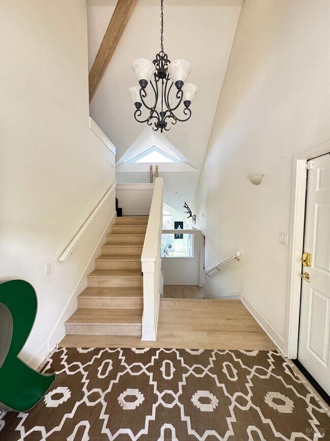
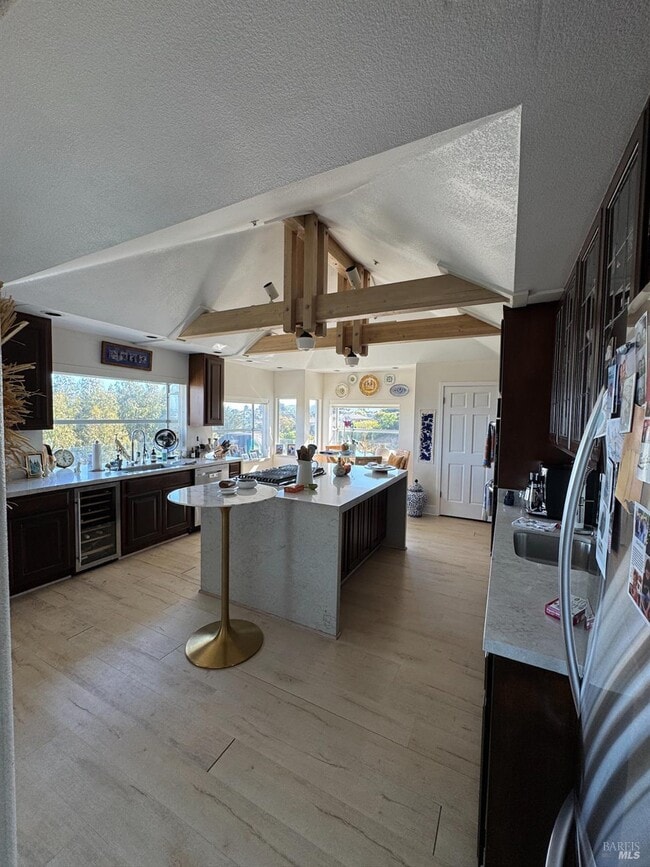
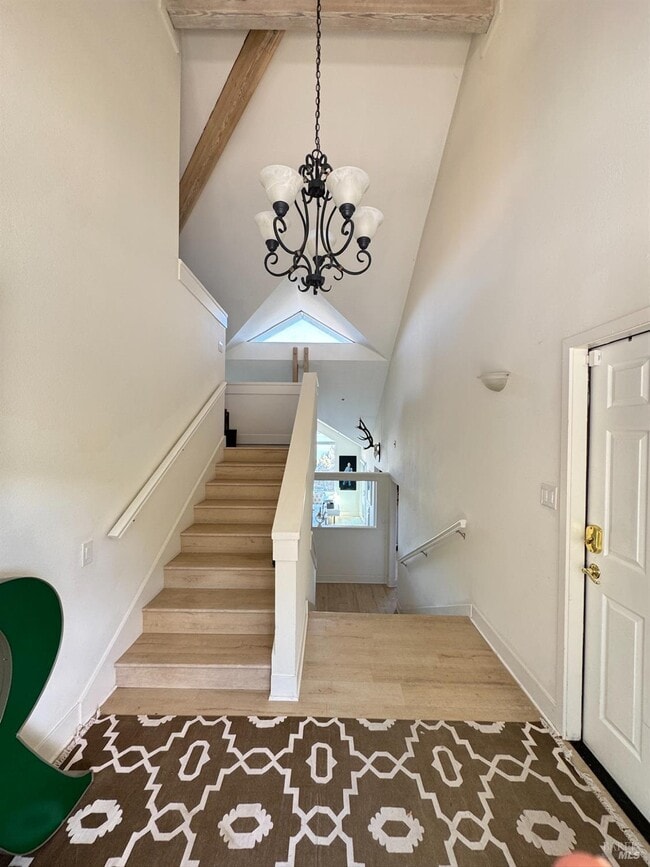
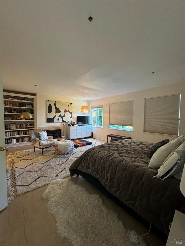
The only property in the area with an indoor poolenjoy year-round swimming! Each bedroom offers stunning views. South-southeast facing with sweeping vistas of the San Francisco skyline, Belvedere Island in the foreground, and the Bay Bridge. Recently renovated throughout including windows, landscaping and pool refinish. MLS#325070296
67 Via Los Altos is a house located in Marin County and the 94920 ZIP Code. This area is served by the Reed Union Elementary attendance zone.
* Price shown is base rent. Excludes user-selected optional fees and variable or usage-based fees and required charges due at or prior to move-in or at move-out. Price, availability, fees, and any applicable rent special are subject to change without notice.
* Square footage definitions vary. Displayed square footage is approximate.
Home Details
Home Type
Single Family Detached Home
Year Built
Built in 1989
Bedrooms and Bathrooms
Fireplace in Primary Bedroom
5.5 Bathrooms
5 Bedrooms
Home Security
Prewired Security
Interior Spaces
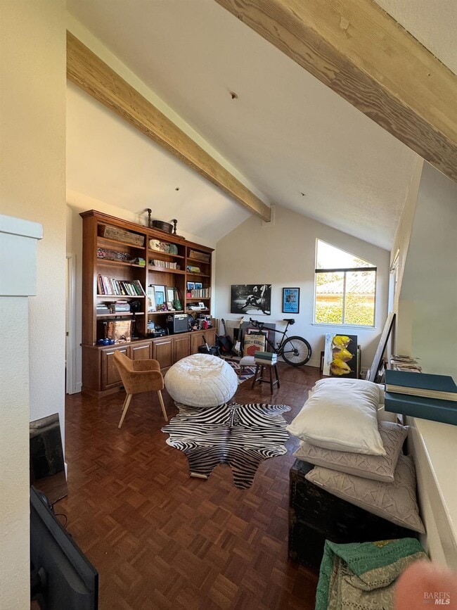
3 Fireplaces
Family Room
4,428 Sq Ft Home
4-Story Property
Gas Log Fireplace
Laundry
Dryer
Washer
Listing and Financial Details
Security Deposit $15,900
Assessor Parcel Number 034-330-07
Lot Details
0.48 Acre Lot
Artificial Turf
Backyard Sprinklers
Parking
2 Car Direct Access Garage
Front Facing Garage
4 Open Parking Spaces
Garage Door Opener
Utilities
Central Heating and Cooling System
Cable TV Available
Internet Available
Natural Gas Connected
Heating System Uses Gas
Septic Pump
Views
San Francisco
Bay
Panoramic
City
Hills
Community Details
Fees and Policies
The fees below are based on community-supplied data and may exclude additional fees and utilities.
- Parking
-
Covered--
-
Other--
-
Garage--
Contact
- Listed by Nima Safapour | Caerus Investment Group, Inc.
- Phone Number
- Contact
-
Source
 BAREIS MLS ®
Copyright 2025, Bay Area Real Estate Information Services, Inc. All Rights Reserved.
Location
Get Directions
Amenities
- High Speed Internet Access
Tiburon is a small suburban community occupying most of the namesake Tiburon Peninsula on the north side of San Francisco Bay. Most of the town is composed of residential neighborhoods, with upscale apartments and houses dominating the rental market. Angel Island sits just offshore, putting one of the region’s most distinctive nature preserves just a short ferry ride away. Ferry service also connects Tiburon to Fisherman’s Wharf, the Financial District, and AT&T Park in San Francisco, giving you an alternative to driving (and parking) when you want to hop down to the city.
Learn more about living in Tiburon
Education
| Colleges & Universities | Distance | ||
|---|---|---|---|
| Colleges & Universities | Distance | ||
| Drive: | 14 min | 7.6 mi | |
| Drive: | 22 min | 12.4 mi | |
| Drive: | 23 min | 12.7 mi | |
| Drive: | 26 min | 14.0 mi |
67 Via Los Altos is within 14 minutes or 7.6 miles from Dominican Univ. of Ca. It is also near UC San Francisco, Mount Zion and Academy of Art University.
Schools


Public Elementary School
Grades K-5
253 Students
Nearby
Public Elementary School
Grades K-2
335 Students
Attendance Zone
Public Elementary School
Grades 3-5
303 Students
Attendance Zone
Public Middle School
Grades 6-8
385 Students
Attendance Zone
Public High School
Grades 9-12
1,862 Students
Attendance Zone
Private Elementary & Middle School
Grades PK-8
283 Students
Nearby
Private Elementary & Middle School
Grades K-8
53 Students
Nearby
Private High School
Grades 9-12
772 Students
Nearby
School data provided by
 The GreatSchools Rating helps parents compare schools within a state based on a variety of school quality indicators and provides a helpful picture of how effectively each school serves all of its students. Ratings are on a scale of 1 (below average) to 10 (above average) and can include test scores, college readiness, academic progress, advanced courses, equity, discipline and attendance data. We also advise parents to visit schools, consider other information on school performance and programs, and consider family needs as part of the school selection process.
View GreatSchools Rating Methodology
Data provided by GreatSchools.org © 2025. All rights reserved.
View GreatSchools Rating Methodology
Data provided by GreatSchools.org © 2025. All rights reserved.
Transportation options available in Tiburon include Hyde And Bay, located 12.8 miles from 67 Via Los Altos. 67 Via Los Altos is near San Francisco International, located 27.3 miles or 46 minutes away, and Metro Oakland International, located 34.4 miles or 49 minutes away.
| Transit / Subway | Distance | ||
|---|---|---|---|
| Transit / Subway | Distance | ||
|
|
Drive: | 23 min | 12.8 mi |
|
|
Drive: | 23 min | 12.8 mi |
|
|
Drive: | 24 min | 12.9 mi |
|
|
Drive: | 24 min | 13.2 mi |
|
|
Drive: | 24 min | 13.3 mi |
| Commuter Rail | Distance | ||
|---|---|---|---|
| Commuter Rail | Distance | ||
| Drive: | 10 min | 4.9 mi | |
| Drive: | 12 min | 6.8 mi | |
| Drive: | 16 min | 10.2 mi | |
| Drive: | 24 min | 14.5 mi | |
| Drive: | 29 min | 15.2 mi |
| Airports | Distance | ||
|---|---|---|---|
| Airports | Distance | ||
|
San Francisco International
|
Drive: | 46 min | 27.3 mi |
|
Metro Oakland International
|
Drive: | 49 min | 34.4 mi |
Time and distance from 67 Via Los Altos.
| Shopping Centers | Distance | ||
|---|---|---|---|
| Shopping Centers | Distance | ||
| Walk: | 13 min | 0.7 mi | |
| Drive: | 5 min | 1.6 mi | |
| Drive: | 9 min | 4.0 mi |
67 Via Los Altos has 3 shopping centers within 4.0 miles, which is about a 9-minute walk. The miles and minutes will be for the farthest away property.
| Parks and Recreation | Distance | ||
|---|---|---|---|
| Parks and Recreation | Distance | ||
|
Richardson Bay Audubon Center
|
Drive: | 4 min | 1.1 mi |
|
Ring Mountain Preserve
|
Drive: | 11 min | 4.1 mi |
|
Old Saint Hilary's Open Space Preserve
|
Drive: | 10 min | 4.4 mi |
|
Paradise Beach County Park
|
Drive: | 12 min | 4.5 mi |
|
Bay Model Visitor Center
|
Drive: | 11 min | 5.4 mi |
67 Via Los Altos has 5 parks within 5.4 miles, including Richardson Bay Audubon Center, Ring Mountain Preserve, and Old Saint Hilary's Open Space Preserve.
| Hospitals | Distance | ||
|---|---|---|---|
| Hospitals | Distance | ||
| Drive: | 13 min | 6.2 mi | |
| Drive: | 18 min | 10.6 mi | |
| Drive: | 25 min | 13.6 mi |
67 Via Los Altos has 3 hospitals within 13.6 miles, the nearest is MarinHealth Medical Center which is 6.2 miles away and a 13 minute drive.
| Military Bases | Distance | ||
|---|---|---|---|
| Military Bases | Distance | ||
| Drive: | 24 min | 12.2 mi | |
| Drive: | 25 min | 12.6 mi | |
| Drive: | 37 min | 19.3 mi |
67 Via Los Altos has 3 military bases within 19.3 miles, the nearest is East Fort Miley which is 12.2 miles away and a 24 minute drive.
You May Also Like
Similar Rentals Nearby


What Are Walk Score®, Transit Score®, and Bike Score® Ratings?
Walk Score® measures the walkability of any address. Transit Score® measures access to public transit. Bike Score® measures the bikeability of any address.
What is a Sound Score Rating?
A Sound Score Rating aggregates noise caused by vehicle traffic, airplane traffic and local sources
67 Via Los Altos
Tiburon, CA 94920