

$1,250
/ Month
67 Misty Forest Dr
Phenix City, AL 36869
Favorites
67 Misty Forest Dr

Favorites
Check Back Soon for Upcoming Availability
| Beds | Baths | Average SF |
|---|---|---|
| 4 Bedrooms 4 Bedrooms 4 Br | 2 Baths 2 Baths 2 Ba | 1,788 SF |
Fees and Policies
The fees listed below are community-provided and may exclude utilities or add-ons. All payments are made directly to the property and are non-refundable unless otherwise specified.
- Dogs Allowed
-
Fees not specified
-
Weight limit--
-
Pet Limit--
About This Property
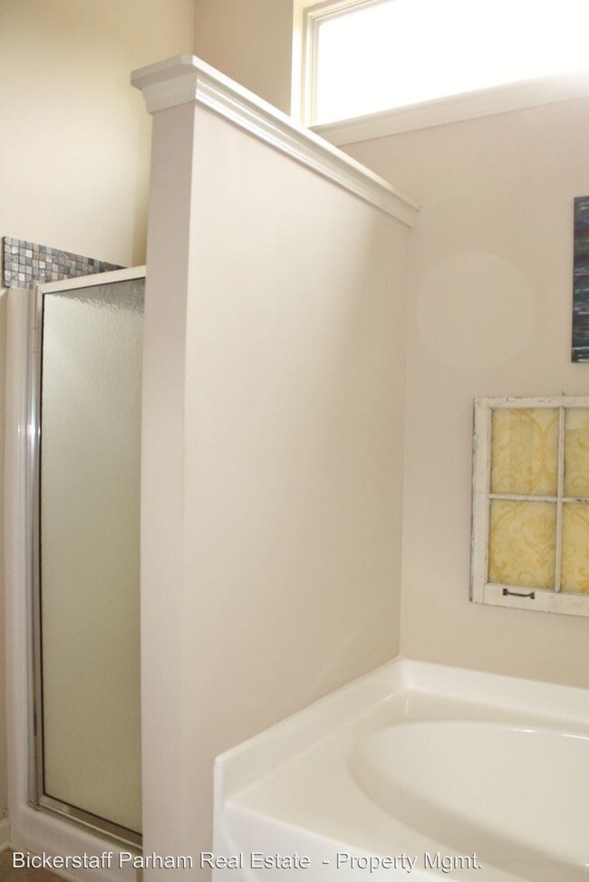
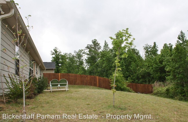
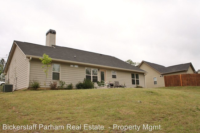
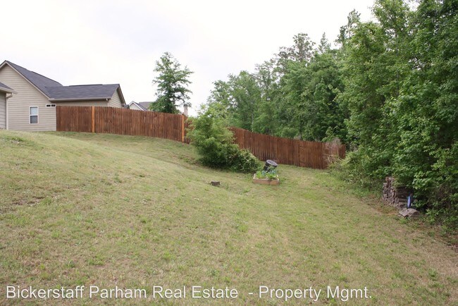
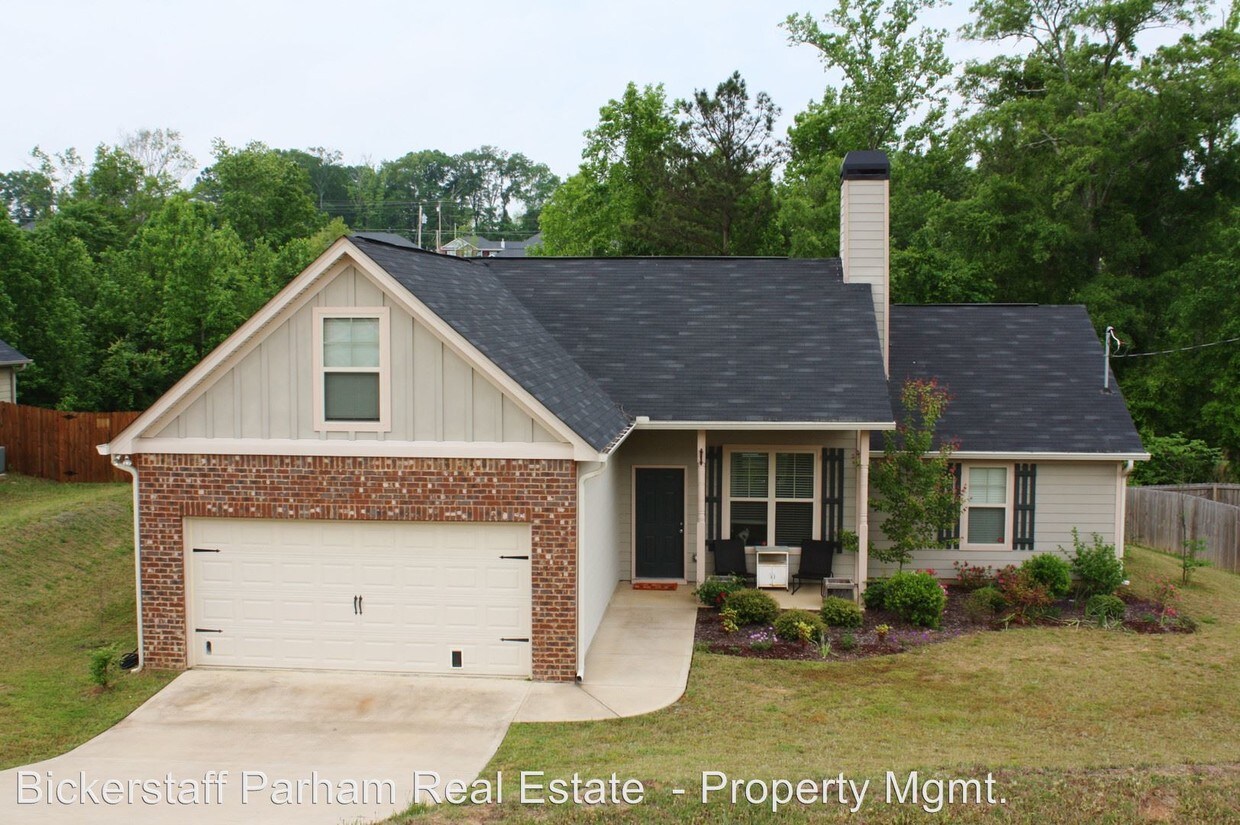
(706) 653-1999 x210 - Misty Forest Subdivision! - Convenient living just minutes from Fort Benning, Downtown and Columbus. This beautiful 4 Bedroom 2 Baths home located in Misty Forest Neighborhood in Phenix City is offering a fully equipped Kitchen with stainless steal appliances, vaulted ceilings in Living Room and Master Bedroom, Master Bathroom with separate soaking tub and shower, and double vanity, split floor-plan, bonus Bedroom upstairs, Laundry Room - washer & dryer inluded, attached 2-car Garage and a large Back Yard with a Patio. This is the perfect home for your family.Small Pets Only,Show By Appointment with BPRE and Notify Tenant,Available with 1 Week Notice Directions: On US-280 West, take the US-431 S ramp to Eufaula/Dothan/Phenix Industrial Park/Chattahoochee Valley Community College/Troy University, turn left onto Martin Luther King Jr Pkwy N, slight left onto AL-165 S/Fort Mitchell Rd Continue to follow AL-165 S, turn right onto Silver Leaf Dr, continue onto Misty Forest Dr, Destination will be on the left. (RLNE3992984) Pet policies - Small Dogs Allowed, Cats Allowed.
67 Misty Forest Dr is a house located in Russell County and the 36869 ZIP Code. This area is served by the Russell County School District attendance zone.
67 Misty Forest Dr,
Phenix City,
AL
36869
Phenix City sits on the Alabama side of the Chattahoochee River, directly across from Columbus, Georgia, and the two cities function as one interconnected metro area. That relationship gives Phenix City residents access to a much larger job market, including Fort Moore, one of the country's largest Army installations just outside Columbus, along with healthcare systems, retail corridors, and Columbus State University. The city even observes Eastern Time rather than Central, reflecting just how closely its daily rhythms align with its Georgia neighbor. Closer to home, tree-lined streets and quiet residential pockets define much of the landscape, with the downtown riverfront area offering a more active, walkable scene. Housing options range from traditional single-family rental homes and townhomes to smaller apartment communities that tend to offer more square footage than comparable options in larger metros.
Learn more about living in Phenix City
Education
| Colleges & Universities | Distance | ||
|---|---|---|---|
| Colleges & Universities | Distance | ||
| Drive: | 8 min | 3.6 mi | |
| Drive: | 13 min | 7.4 mi | |
| Drive: | 23 min | 12.4 mi | |
| Drive: | 60 min | 41.4 mi |
67 Misty Forest Dr is within 8 minutes or 3.6 miles from Chattahoochee Valley C.C.. It is also near Columbus State, River Park and Columbus State Univ., Main.
Schools


Public Elementary School
Grades PK-5
263 Students
Nearby
Public Elementary School
Grades PK-5
392 Students
Nearby
Public Middle School
Grades 6-8
Nearby
Public High School
Grades 9-12
1,014 Students
Attendance Zone
Private Elementary, Middle & High School
Grades K-12
11 Students
Nearby
Private Elementary School
Grades PK-5
Nearby
School data provided by
 The GreatSchools Rating helps parents compare schools within a state based on a variety of school quality indicators and provides a helpful picture of how effectively each school serves all of its students. Ratings are on a scale of 1 (below average) to 10 (above average) and can include test scores, college readiness, academic progress, advanced courses, equity, discipline and attendance data. We also advise parents to visit schools, consider other information on school performance and programs, and consider family needs as part of the school selection process.
View GreatSchools Rating Methodology
Data provided by GreatSchools.org © 2026. All rights reserved.
View GreatSchools Rating Methodology
Data provided by GreatSchools.org © 2026. All rights reserved.
Walkability Near 67 Misty Forest Dr Phenix City, AL 36869
Getting Around
 What do Walkability, Transit, Drivability, and Bikeability mean?
Walkability measures the walking distance to day-to-day needs.
Transit measures access to public transportation.
Drivability measures congestion, parking availability, and access to major roads.
Bikeability measures the suitability for cycling.
How It Works
What do Walkability, Transit, Drivability, and Bikeability mean?
Walkability measures the walking distance to day-to-day needs.
Transit measures access to public transportation.
Drivability measures congestion, parking availability, and access to major roads.
Bikeability measures the suitability for cycling.
How It Works
Not Walkable
Walkability
10
/ 100
Exceptionally Drivable
Drivability
90
/ 100
Somewhat Bikeable
Bikeability
20
/ 100
Scores provided by
-
Soundscore™
-
/ 100
Traffic
-Airport
-Businesses
-Scores provided by
HowLoud What is a Sound Score Rating? A Sound Score Rating aggregates noise caused by vehicle traffic, airplane traffic and local sources. How It WorksYou May Also Like
Similar Rentals Nearby
-
-

-

-

-
 4 Beds, 3 Baths, 2,290 sq ft$2,000Total Monthly PriceTotal Monthly Price NewPrices include all required monthly fees.2905 7th St
 -

-

-

-

-

What Are Walk Score®, Transit Score®, and Bike Score® Ratings?
Walk Score® measures the walkability of any address. Transit Score® measures access to public transit. Bike Score® measures the bikeability of any address.
What is a Sound Score Rating?
A Sound Score Rating aggregates noise caused by vehicle traffic, airplane traffic and local sources.
67 Misty Forest Dr
Phenix City, AL 36869