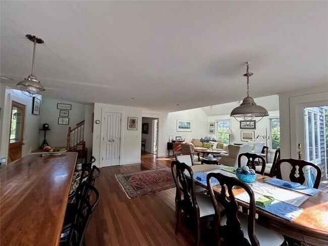
67 High St
Jamestown, RI 02835
-
Bedrooms
3
-
Bathrooms
2
-
Square Feet
1,754 sq ft

About This Home
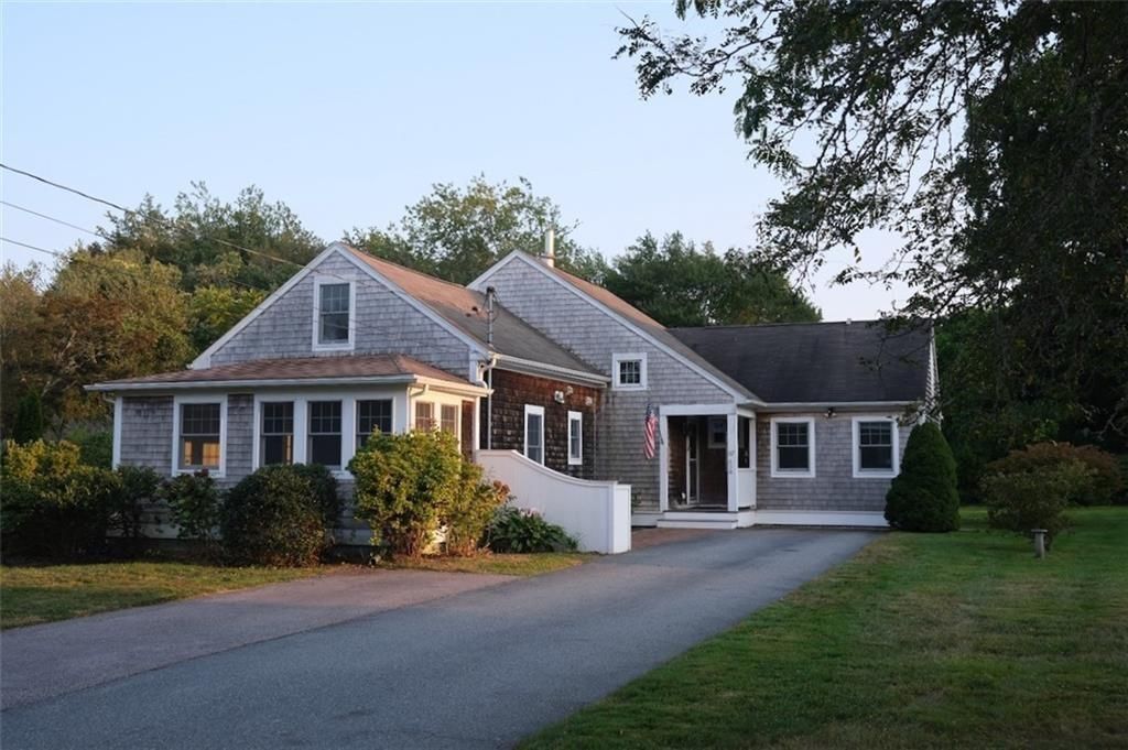
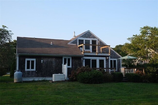
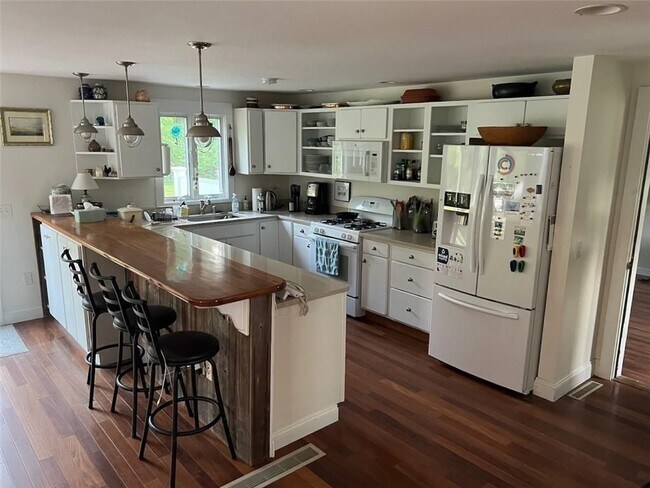
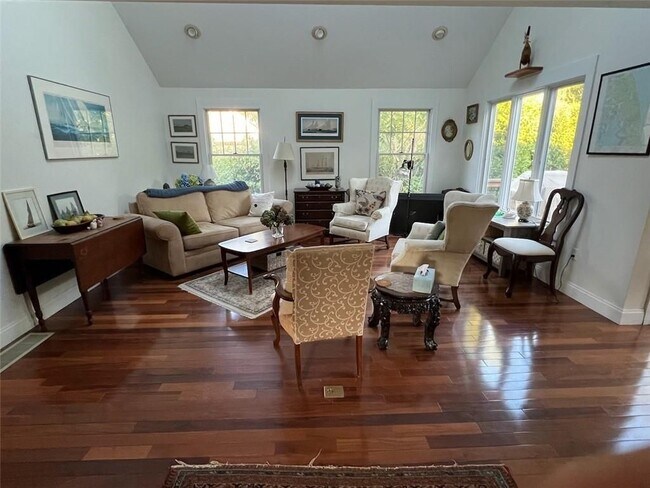
Furnished, 3 bedroom cottage in Jamestown Village. Walk to all amenities. Property is well maintained with decks and spacious yard. Kitchen and bathrooms all updated, laundry on the first floor. Available November, 2026 until May 31, 2027.
67 High St is a condo located in Newport County and the 02835 ZIP Code.
Fees and Policies
The fees listed below are community-provided and may exclude utilities or add-ons. All payments are made directly to the property and are non-refundable unless otherwise specified.
- Parking
-
Other--Assigned Parking
Details
Lease Options
-
Month to Month
Contact
- Website View Property Website
-
Source

| Colleges & Universities | Distance | ||
|---|---|---|---|
| Colleges & Universities | Distance | ||
| Drive: | 12 min | 6.0 mi | |
| Drive: | 16 min | 7.0 mi | |
| Drive: | 17 min | 9.2 mi | |
| Drive: | 28 min | 14.7 mi |
Transportation options available in Jamestown include Quonset Point Pier, Quonset Point, Ri, located 14.4 miles from 67 High St. 67 High St is near Rhode Island Tf Green International, located 25.8 miles or 41 minutes away.
| Transit / Subway | Distance | ||
|---|---|---|---|
| Transit / Subway | Distance | ||
| Drive: | 26 min | 14.4 mi |
| Commuter Rail | Distance | ||
|---|---|---|---|
| Commuter Rail | Distance | ||
| Drive: | 19 min | 11.6 mi | |
|
|
Drive: | 31 min | 16.0 mi |
| Drive: | 36 min | 23.9 mi | |
|
|
Drive: | 46 min | 31.3 mi |
|
|
Drive: | 52 min | 37.1 mi |
| Airports | Distance | ||
|---|---|---|---|
| Airports | Distance | ||
|
Rhode Island Tf Green International
|
Drive: | 41 min | 25.8 mi |
Scores provided by
 What do Walkability, Transit, Drivability, and Bikeability mean?
Walkability measures the walking distance to day-to-day needs.
Transit measures access to public transportation.
Drivability measures congestion, parking availability, and access to major roads.
Bikeability measures the suitability for cycling.
How It Works
What do Walkability, Transit, Drivability, and Bikeability mean?
Walkability measures the walking distance to day-to-day needs.
Transit measures access to public transportation.
Drivability measures congestion, parking availability, and access to major roads.
Bikeability measures the suitability for cycling.
How It Works
Traffic
-Airport
-Businesses
-Scores provided by
HowLoud What is a Sound Score Rating? A Sound Score Rating aggregates noise caused by vehicle traffic, airplane traffic and local sources. How It WorksTime and distance from 67 High St.
| Shopping Centers | Distance | ||
|---|---|---|---|
| Shopping Centers | Distance | ||
| Drive: | 11 min | 5.3 mi | |
| Drive: | 11 min | 5.3 mi | |
| Drive: | 11 min | 5.5 mi |
| Parks and Recreation | Distance | ||
|---|---|---|---|
| Parks and Recreation | Distance | ||
|
Fort Wetherill State Park
|
Walk: | 20 min | 1.1 mi |
|
Beavertail State Park
|
Drive: | 9 min | 3.4 mi |
|
Old Colony and Newport Scenic Railroad
|
Drive: | 10 min | 5.1 mi |
|
Fort Adams State Park
|
Drive: | 20 min | 8.4 mi |
|
Brenton Point State Park
|
Drive: | 19 min | 8.4 mi |
| Hospitals | Distance | ||
|---|---|---|---|
| Hospitals | Distance | ||
| Drive: | 11 min | 5.3 mi | |
| Drive: | 25 min | 16.1 mi |
| Military Bases | Distance | ||
|---|---|---|---|
| Military Bases | Distance | ||
| Drive: | 25 min | 14.3 mi | |
| Drive: | 77 min | 53.0 mi | |
| Drive: | 77 min | 54.5 mi |
You May Also Like
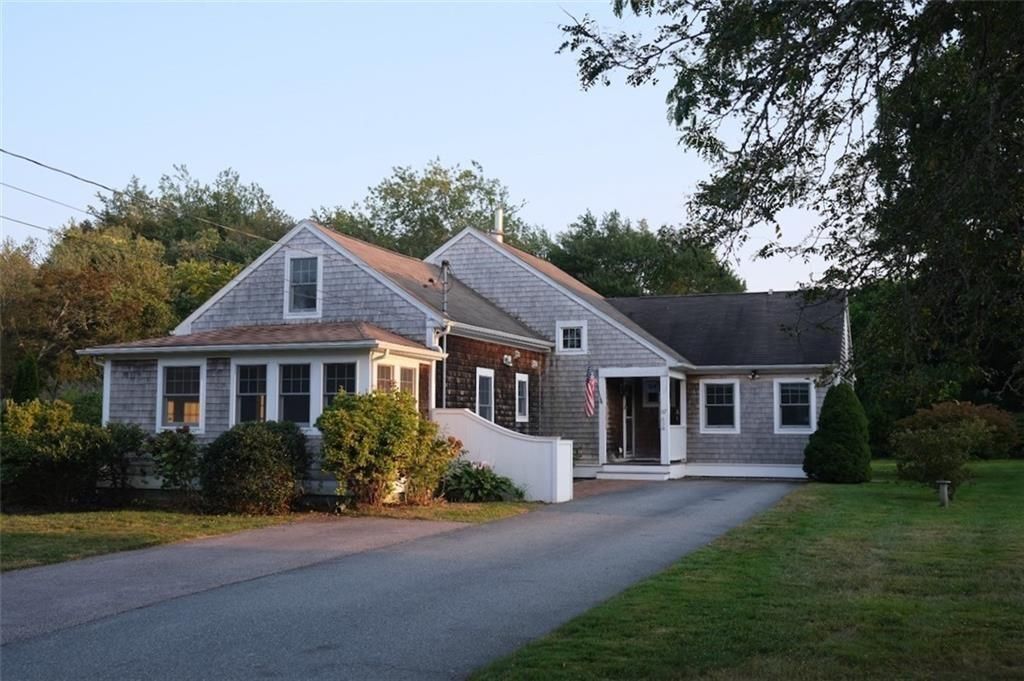
67 High St
Jamestown, RI 02835