
$2,000
Total Monthly Price
67 Burrell St
Roxbury, MA 02119
Favorites
67 Burrell St

Favorites
Check Back Soon for Upcoming Availability
| Beds | Baths | Average SF |
|---|---|---|
| 3 Bedrooms 3 Bedrooms 3 Br | 1 Bath 1 Bath 1 Ba | — |
About This Property
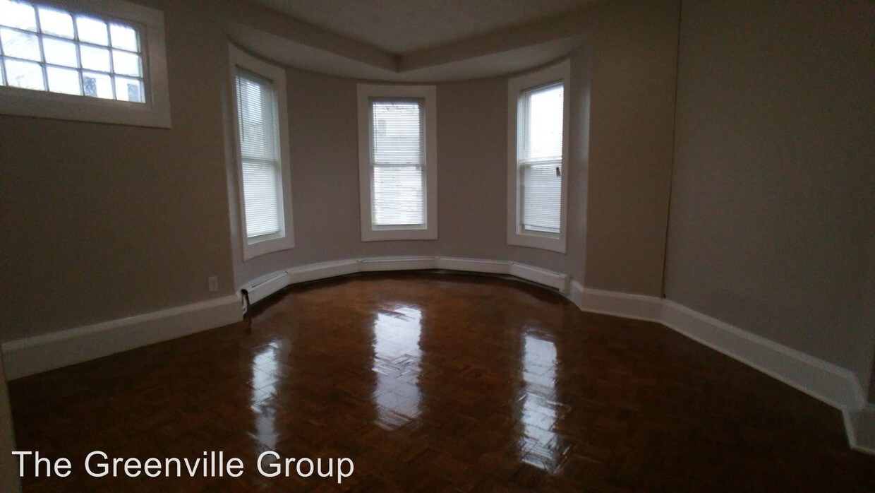
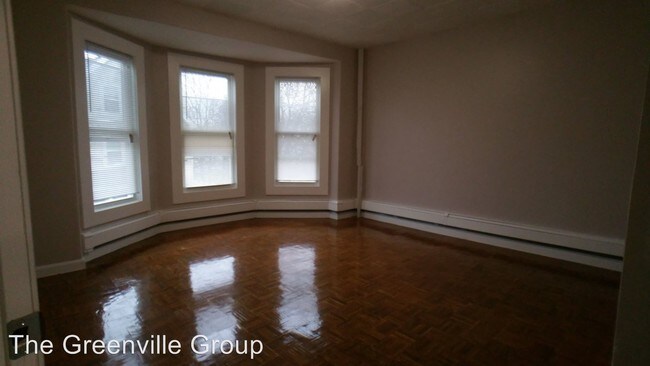
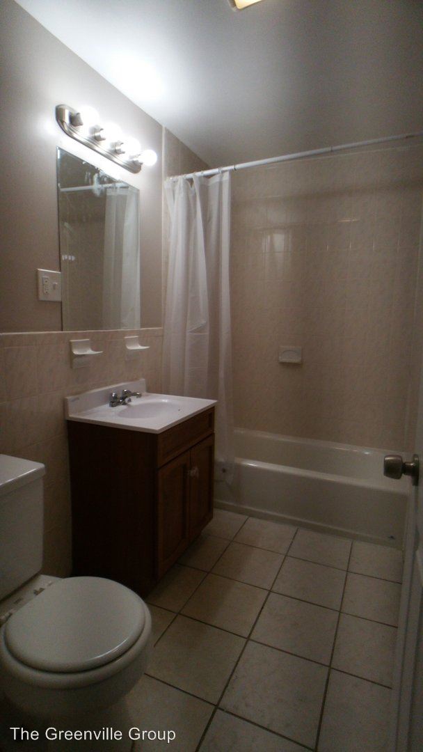
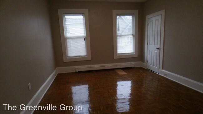
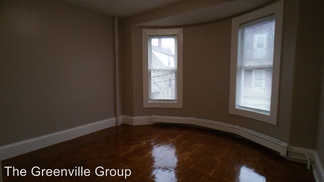
(617) 524-2988 - $2,200 – 3 Bed/ 1 Bath apartment in Roxbury minutes from public transit - Prime location: Intimate and quiet 3 bedrooms 1-bathroom apartment in Roxbury. Sandwiched between Dudley St. and Mass Ave. the apartment is conveniently located near public transport, with buses traveling to Copley Sq., Fields Corner, Forest Hills, JFK, Ruggles, Franklin Park, and Harbor Point/Umass. The commuter rail’s Fairmont and Franklin lines can be found at nearby Newmarket Station. Convenience is only steps away as the apartment is only half a mile from the South Bay Shopping plaza and area restaurants. Freshly painted, hardwood floor throughout, fridge and stove in kitchen. $2,200/month, first month and full security deposit required. Utilities NOT included. Section 8 welcomed. For more information or to schedule a showing, call Greenville Group at 617-524-2988 (RLNE2891164) Pet policies - Small Dogs Allowed, Cats Allowed.
67 Burrell St is a condo located in Suffolk County and the 02119 ZIP Code. This area is served by the Boston Public Schools attendance zone.
67 Burrell St,
Roxbury,
MA
02119
Less than four miles outside of Downtown Boston sits Dudley-Brunswick King. Full of non-profit organizations committed to advancing the community, Dudley-Brunswick King is home to the Food Project, CommonWealth Kitchen, Project Hope, and the Dudley Street Neighborhood Initiative.
Dudley-Brunswick King residents enjoy access to cultural and educational venues such as the Boston Public Library and Oodua African Movie Center. There are a number of parks and green spaces in Dudley-Brunswick King including Clifford Playground, Mary Hannon Park, Ceylon Park, Brunswick-King Play Area, Dacia/Woodcliff Streets Garden, and multiple community gardens sponsored by the Food Project. Boston’s biggest park, Franklin Park, is also nearby and contains numerous amenities.
Convenient to the MBTA Commuter Rail, bus routes, and major highways as well as Boston Logan International Airport, Dudley-Brunswick King allows for easy commutes and travels.
Learn more about living in Dudley-Brunswick KingBelow are rent ranges for similar nearby apartments
| Beds | Average Size | Lowest | Typical | Premium |
|---|---|---|---|---|
| Studio Studio Studio | 1584-1586 Sq Ft | $2,125 | $2,426 | $3,240 |
| 1 Bed 1 Bed 1 Bed | 2038 Sq Ft | $2,000 | $2,573 | $3,700 |
| 2 Beds 2 Beds 2 Beds | 3577 Sq Ft | $2,200 | $2,836 | $3,800 |
| 3 Beds 3 Beds 3 Beds | 2702-2703 Sq Ft | $2,400 | $3,266 | $4,895 |
| 4 Beds 4 Beds 4 Beds | 3205 Sq Ft | $3,200 | $3,914 | $6,000 |
Education
| Colleges & Universities | Distance | ||
|---|---|---|---|
| Colleges & Universities | Distance | ||
| Drive: | 5 min | 2.0 mi | |
| Drive: | 6 min | 2.1 mi | |
| Drive: | 6 min | 2.2 mi | |
| Drive: | 5 min | 2.2 mi |
67 Burrell St is within 6 minutes or 2.2 miles from Northeastern University. It is also near Wentworth Inst. of Technology and UMass Boston.
Schools


Public Elementary School
Grades PK-5
256 Students
Attendance Zone
Public Elementary School
Grades PK-5
230 Students
Attendance Zone
Public Middle & High School
Grades 6-12
526 Students
Attendance Zone
Public Middle & High School
Grades 6-12
1,669 Students
Attendance Zone
Public Middle & High School
Grades 6-12
565 Students
Attendance Zone
Public High School
Grades 9-12
1,024 Students
Attendance Zone
Private Elementary School
Grades PK-5
128 Students
Nearby
Private Middle School
Grades 6-8
Nearby
Private High School
Grades 9-12
200 Students
Nearby
School data provided by
 The GreatSchools Rating helps parents compare schools within a state based on a variety of school quality indicators and provides a helpful picture of how effectively each school serves all of its students. Ratings are on a scale of 1 (below average) to 10 (above average) and can include test scores, college readiness, academic progress, advanced courses, equity, discipline and attendance data. We also advise parents to visit schools, consider other information on school performance and programs, and consider family needs as part of the school selection process.
View GreatSchools Rating Methodology
Data provided by GreatSchools.org © 2026. All rights reserved.
View GreatSchools Rating Methodology
Data provided by GreatSchools.org © 2026. All rights reserved.
Transportation options available in Roxbury include Andrew Station, located 1.4 miles from 67 Burrell St. 67 Burrell St is near General Edward Lawrence Logan International, located 5.6 miles or 12 minutes away.
| Transit / Subway | Distance | ||
|---|---|---|---|
| Transit / Subway | Distance | ||
|
|
Drive: | 3 min | 1.4 mi |
|
|
Drive: | 4 min | 1.8 mi |
|
|
Drive: | 4 min | 1.8 mi |
|
|
Drive: | 5 min | 2.1 mi |
|
|
Drive: | 5 min | 2.4 mi |
| Commuter Rail | Distance | ||
|---|---|---|---|
| Commuter Rail | Distance | ||
| Walk: | 8 min | 0.5 mi | |
|
|
Walk: | 11 min | 0.6 mi |
|
|
Drive: | 4 min | 1.5 mi |
| Drive: | 4 min | 2.0 mi | |
|
|
Drive: | 6 min | 2.4 mi |
| Airports | Distance | ||
|---|---|---|---|
| Airports | Distance | ||
|
General Edward Lawrence Logan International
|
Drive: | 12 min | 5.6 mi |
Walkability Near 67 Burrell St Roxbury, MA 02119
Getting Around
 What do Walkability, Transit, Drivability, and Bikeability mean?
Walkability measures the walking distance to day-to-day needs.
Transit measures access to public transportation.
Drivability measures congestion, parking availability, and access to major roads.
Bikeability measures the suitability for cycling.
How It Works
What do Walkability, Transit, Drivability, and Bikeability mean?
Walkability measures the walking distance to day-to-day needs.
Transit measures access to public transportation.
Drivability measures congestion, parking availability, and access to major roads.
Bikeability measures the suitability for cycling.
How It Works
Exceptionally Walkable
Walkability
100
/ 100
Strong Public Transit
Transit
80
/ 100
Fairly Drivable
Drivability
40
/ 100
Moderately Bikeable
Bikeability
70
/ 100
Scores provided by
-
Soundscore™
-
/ 100
Traffic
-Airport
-Businesses
-Scores provided by
HowLoud What is a Sound Score Rating? A Sound Score Rating aggregates noise caused by vehicle traffic, airplane traffic and local sources. How It WorksTime and distance from 67 Burrell St.
| Shopping Centers | Distance | ||
|---|---|---|---|
| Shopping Centers | Distance | ||
| Walk: | 13 min | 0.7 mi | |
| Drive: | 3 min | 1.2 mi | |
| Drive: | 4 min | 1.6 mi |
67 Burrell St has 3 shopping centers within 1.6 miles, which is about a 4-minute drive. The miles and minutes will be for the farthest away property.
| Parks and Recreation | Distance | ||
|---|---|---|---|
| Parks and Recreation | Distance | ||
|
Roxbury Heritage State Park
|
Drive: | 4 min | 1.5 mi |
|
Dorchester Shores Reservation
|
Drive: | 5 min | 2.2 mi |
|
Lower Neponset River Trail
|
Drive: | 4 min | 2.3 mi |
|
Franklin Park Zoo
|
Drive: | 4 min | 2.3 mi |
|
Boston Public Garden
|
Drive: | 8 min | 3.0 mi |
67 Burrell St has 5 parks within 3.0 miles, including Roxbury Heritage State Park, Lower Neponset River Trail, and Franklin Park Zoo.
| Hospitals | Distance | ||
|---|---|---|---|
| Hospitals | Distance | ||
| Drive: | 2 min | 1.2 mi | |
| Drive: | 3 min | 1.3 mi | |
| Drive: | 6 min | 2.5 mi |
67 Burrell St has 3 hospitals within 2.5 miles, the nearest is Boston Medical Center which is 1.2 miles away and a 2 minute drive.
| Military Bases | Distance | ||
|---|---|---|---|
| Military Bases | Distance | ||
| Drive: | 32 min | 16.9 mi | |
| Drive: | 33 min | 17.4 mi | |
| Drive: | 37 min | 22.2 mi |
67 Burrell St has 3 military bases within 22.2 miles, the nearest is US Military Reservation which is 16.9 miles away and a 32 minute drive.
You May Also Like
Similar Rentals Nearby
-
-

-
 3 Beds$4,170Total Monthly Price12 Month LeaseTotal Monthly Price NewPrices include all required monthly fees.Condo for Rent
 -

-

-

-
 5 Beds$5,700Total Monthly Price12 Month LeaseTotal Monthly Price NewPrices include all required monthly fees.Condo for Rent
 -

-

-

What Are Walk Score®, Transit Score®, and Bike Score® Ratings?
Walk Score® measures the walkability of any address. Transit Score® measures access to public transit. Bike Score® measures the bikeability of any address.
What is a Sound Score Rating?
A Sound Score Rating aggregates noise caused by vehicle traffic, airplane traffic and local sources.

67 Burrell St
Roxbury, MA 02119