
Ronald & Gunnison
4747 N Ronald St,
Harwood Heights, IL 60706
$1,500 - $1,975
1-2 Beds


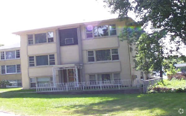
Very nice STUDIO apartment located on 1st floor. Living room and eat-in kitchen, one bathroom. Rent $800 includes heat, hot water, cooking gas and one parking space on the lot. Plenty of parking space also available in front of the building. Laundry room on premises. Building faces the Ridgemoore Country Club golf course. Sorry NO PETS. Non-SMOKING. Wright College is just a short walk away. Minutes from the Blue Line train and the Kennedy Expressway (I-90). Requires $800 Security Deposit. Available April 1, 2021. Call 847-925-8745.
6621 W Norwood Ct is an apartment community located in Cook County and the 60706 ZIP Code. This area is served by the Union Ridge School District 86 attendance zone.
Air Conditioning
Tile Floors
Smoke Free
Carpet
Harwood Heights is a small, self-governing village in Cook County that forms a quiet enclave completely surrounded by the city of Chicago. Covering just one square mile and home to roughly 9,000 residents, it carries the feel of a tight-knit suburb while sitting about 20 minutes northwest of the Loop via the Kennedy Expressway. The village has charted an independent course since the 1940s, when Chicago declined to annex it, and that spirit of self-determination still shapes its identity today. Norridge, its closest neighbor, shares the same enclave and offers additional retail and dining along the Harlem Avenue corridor.
Housing in Harwood Heights skews toward well-maintained apartment communities, with a mix of mid-rise buildings and garden-style units that reflect the area's postwar growth era.
Learn more about living in Harwood Heights| Colleges & Universities | Distance | ||
|---|---|---|---|
| Colleges & Universities | Distance | ||
| Walk: | 7 min | 0.4 mi | |
| Drive: | 12 min | 4.7 mi | |
| Drive: | 11 min | 5.2 mi | |
| Drive: | 13 min | 6.0 mi |


Transportation options available in Harwood Heights include Jefferson Park Station, located 3.0 miles from 6621 W Norwood Ct. 6621 W Norwood Ct is near Chicago O'Hare International, located 7.9 miles or 15 minutes away, and Chicago Midway International, located 14.5 miles or 27 minutes away.
| Transit / Subway | Distance | ||
|---|---|---|---|
| Transit / Subway | Distance | ||
|
|
Drive: | 6 min | 3.0 mi |
|
|
Drive: | 8 min | 4.0 mi |
|
|
Drive: | 8 min | 4.2 mi |
|
|
Drive: | 9 min | 5.1 mi |
|
|
Drive: | 12 min | 6.3 mi |
| Commuter Rail | Distance | ||
|---|---|---|---|
| Commuter Rail | Distance | ||
|
|
Drive: | 5 min | 2.6 mi |
|
|
Drive: | 6 min | 2.9 mi |
|
|
Drive: | 6 min | 2.9 mi |
|
|
Drive: | 6 min | 3.1 mi |
|
|
Drive: | 7 min | 3.8 mi |
| Airports | Distance | ||
|---|---|---|---|
| Airports | Distance | ||
|
Chicago O'Hare International
|
Drive: | 15 min | 7.9 mi |
|
Chicago Midway International
|
Drive: | 27 min | 14.5 mi |
Scores provided by
Traffic
-Airport
-Businesses
-Scores provided by
HowLoud What is a Sound Score Rating? A Sound Score Rating aggregates noise caused by vehicle traffic, airplane traffic and local sources. How It WorksTime and distance from 6621 W Norwood Ct.
| Shopping Centers | Distance | ||
|---|---|---|---|
| Shopping Centers | Distance | ||
| Walk: | 11 min | 0.6 mi | |
| Walk: | 15 min | 0.8 mi | |
| Walk: | 17 min | 0.9 mi |
| Parks and Recreation | Distance | ||
|---|---|---|---|
| Parks and Recreation | Distance | ||
|
Portage Park
|
Drive: | 4 min | 1.9 mi |
|
Oriole Park
|
Drive: | 7 min | 2.5 mi |
|
Norwood Park
|
Drive: | 6 min | 2.5 mi |
|
Riis Park
|
Drive: | 9 min | 3.2 mi |
|
Indian Road Woods
|
Drive: | 10 min | 4.8 mi |
| Hospitals | Distance | ||
|---|---|---|---|
| Hospitals | Distance | ||
| Walk: | 9 min | 0.5 mi | |
| Drive: | 5 min | 2.6 mi | |
| Drive: | 7 min | 2.8 mi |
| Military Bases | Distance | ||
|---|---|---|---|
| Military Bases | Distance | ||
| Drive: | 24 min | 15.4 mi | |
| Drive: | 41 min | 26.1 mi | |
| Drive: | 52 min | 31.2 mi |
What Are Walk Score®, Transit Score®, and Bike Score® Ratings?
Walk Score® measures the walkability of any address. Transit Score® measures access to public transit. Bike Score® measures the bikeability of any address.
What is a Sound Score Rating?
A Sound Score Rating aggregates noise caused by vehicle traffic, airplane traffic and local sources.
6621 W Norwood Ct
Harwood Heights, IL 60706


