
$1,650
/ Month
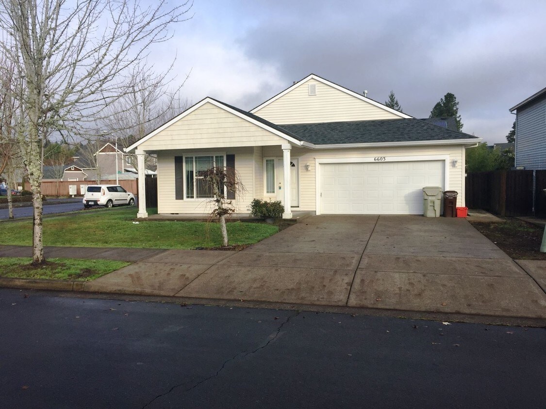
6603 SE Ariel St
Hillsboro, OR 97123
2 Weeks Ago
Favorites
6603 SE Ariel St

Favorites
Check Back Soon for Upcoming Availability
| Beds | Baths | Average SF |
|---|---|---|
| 3 Bedrooms 3 Bedrooms 3 Br | 2 Baths 2 Baths 2 Ba | 1,566 SF |
About This Property
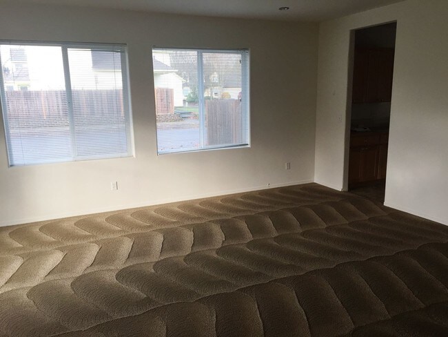
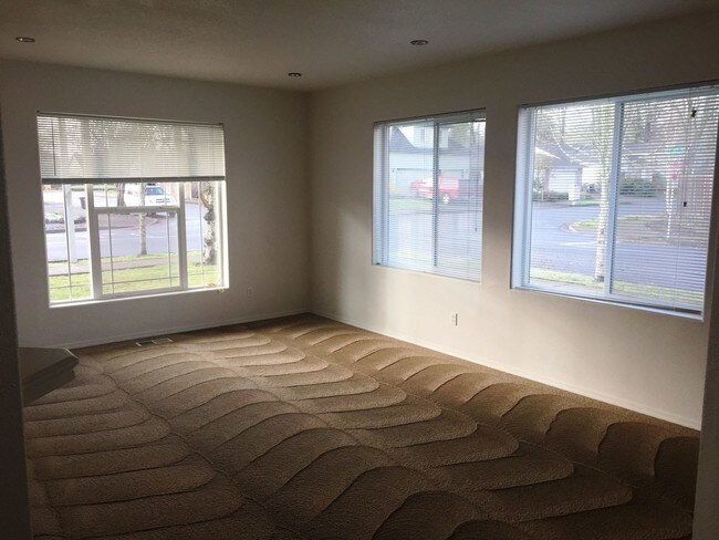
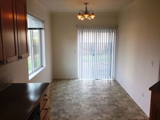
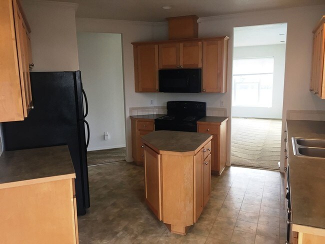
(503) 928-3874 - One level - vaulted ceilings house in Hillsboro - County: Washington Lease Terms: One year lease Date Available for Viewing (subject to change): Heat: gas No Utilities included in rent Year Built: 2003 Levels: One level Floor plan - Kitchen, living room and family room, bedrooms down hallway. Amenities: One level home, Gas heat. back patio, washer/dryer hookup inside Garage: Two car garage Fenced backyard Vehicle Restrictions: RV or boat parking not permitted. Schools: Imlay, Brown, Century PET POLICY: No pets. Directions: Corneilus Pass Rd, South on Borwick, L on Century, L on Ariel St. **Please review our application process and screening criteria at http://www.mcneeley.com/rental_listings and click on the "Applicants" tab. All application fees are nonrefundable (unless a previous applicant is approved) so please read our screening criteria carefully before applying. INFORMATION NOT GUARANTEED AND SHOULD BE VERIFIED. SQUARE FOOTAGE IS APPROXIMATE & MAY INCLUDE BOTH FINISHED & UNFINISHED AREAS. SCHOOL AVAILABILITY SUBJECT TO CHANGE. (RLNE3750099)
6603 SE Ariel St is a house located in Washington County and the 97123 ZIP Code. This area is served by the Hillsboro School District 1j attendance zone.
Location
Get Directions
Hillsboro, Oregon, lies tucked away in the Tualatin Valley, along Highway 26, about 20 miles from Portland. Hillsboro attracts residents and visitors alike with its lush Northwest scenery, its proximity to both Portland and natural wonders like Mount Saint Helens, the Tillamook State Forest and the Oregon Coast. You'll find Hillsboro to be a very low-key respite to the larger and denser Portland.
Southeast Hillsboro contains mostly residencies and some small business along its main artery, the Highway 8. Unlike the area's more urban neighbors, Southeast Hillsboro's blocks contain just as many open fields and agriculture as they do houses. Open spaces abound in this neighborhood. Like many of Portland's suburbs, Hillsboro contains numerous technology manufacturers. Intel's has numerous factories and campuses in the suburbs west of Portland, including in Hillsboro.
Learn more about living in Southeast HillsboroBelow are rent ranges for similar nearby apartments
Education
| Colleges & Universities | Distance | ||
|---|---|---|---|
| Colleges & Universities | Distance | ||
| Drive: | 7 min | 2.7 mi | |
| Drive: | 10 min | 4.2 mi | |
| Drive: | 15 min | 6.8 mi | |
| Drive: | 25 min | 11.1 mi |
6603 SE Ariel St is within 7 minutes or 2.7 miles from Oregon Health & Sci., West. It is also near Pacific Univ. Oregon, Hillsb. and Portland C.C., Rock Creek.
Schools


Public Elementary & Middle School
Grades PK-8
887 Students
Nearby
Public Elementary School
Grades K-6
468 Students
Attendance Zone
Public Middle School
Grades 7-8
722 Students
Attendance Zone
Public High School
Grades 9-12
1,551 Students
Attendance Zone
Private Elementary, Middle & High School
Grades PK-12
377 Students
Nearby
Private Elementary, Middle & High School
Grades PK-10
213 Students
Nearby
School data provided by
 The GreatSchools Rating helps parents compare schools within a state based on a variety of school quality indicators and provides a helpful picture of how effectively each school serves all of its students. Ratings are on a scale of 1 (below average) to 10 (above average) and can include test scores, college readiness, academic progress, advanced courses, equity, discipline and attendance data. We also advise parents to visit schools, consider other information on school performance and programs, and consider family needs as part of the school selection process.
View GreatSchools Rating Methodology
Data provided by GreatSchools.org © 2025. All rights reserved.
View GreatSchools Rating Methodology
Data provided by GreatSchools.org © 2025. All rights reserved.
Transportation options available in Hillsboro include Orenco/Nw 231St Avenue, located 1.8 miles from 6603 SE Ariel St. 6603 SE Ariel St is near Portland International, located 26.5 miles or 43 minutes away.
| Transit / Subway | Distance | ||
|---|---|---|---|
| Transit / Subway | Distance | ||
|
|
Drive: | 4 min | 1.8 mi |
|
|
Drive: | 4 min | 1.9 mi |
|
|
Drive: | 5 min | 2.3 mi |
|
|
Drive: | 6 min | 2.7 mi |
|
|
Drive: | 8 min | 3.6 mi |
| Commuter Rail | Distance | ||
|---|---|---|---|
| Commuter Rail | Distance | ||
|
|
Drive: | 14 min | 6.6 mi |
|
|
Drive: | 18 min | 9.5 mi |
|
|
Drive: | 24 min | 12.6 mi |
|
|
Drive: | 25 min | 14.1 mi |
|
|
Drive: | 27 min | 16.2 mi |
| Airports | Distance | ||
|---|---|---|---|
| Airports | Distance | ||
|
Portland International
|
Drive: | 43 min | 26.5 mi |
Time and distance from 6603 SE Ariel St.
| Shopping Centers | Distance | ||
|---|---|---|---|
| Shopping Centers | Distance | ||
| Walk: | 12 min | 0.6 mi | |
| Walk: | 15 min | 0.8 mi | |
| Walk: | 15 min | 0.8 mi |
6603 SE Ariel St has 3 shopping centers within 0.8 mile, which is about a 15-minute walk. The miles and minutes will be for the farthest away property.
| Parks and Recreation | Distance | ||
|---|---|---|---|
| Parks and Recreation | Distance | ||
|
Rood Bridge Park & Rhododendron Garden
|
Drive: | 7 min | 3.6 mi |
|
Tualatin Hills Nature Park
|
Drive: | 10 min | 5.0 mi |
|
Tualatin Hills Nature Center
|
Drive: | 11 min | 5.0 mi |
|
Jenkins Estate
|
Drive: | 11 min | 5.1 mi |
|
Jackson Bottom Wetlands Preserve
|
Drive: | 14 min | 6.6 mi |
6603 SE Ariel St has 5 parks within 6.6 miles, including Rood Bridge Park & Rhododendron Garden, Tualatin Hills Nature Center, and Tualatin Hills Nature Park.
| Hospitals | Distance | ||
|---|---|---|---|
| Hospitals | Distance | ||
| Drive: | 7 min | 3.4 mi | |
| Drive: | 10 min | 4.3 mi | |
| Drive: | 15 min | 7.3 mi |
6603 SE Ariel St has 3 hospitals within 7.3 miles, the nearest is Kaiser Foundation Hospital - Westside which is 3.4 miles away and a 7 minute drive.
| Military Bases | Distance | ||
|---|---|---|---|
| Military Bases | Distance | ||
| Drive: | 39 min | 22.3 mi | |
| Drive: | 63 min | 37.6 mi |
6603 SE Ariel St is 22.3 miles from Portland Airport Air Guard Station, and is convenient to other military bases, including Camp Bonneville Military Reservation.
You May Also Like
Similar Rentals Nearby


What Are Walk Score®, Transit Score®, and Bike Score® Ratings?
Walk Score® measures the walkability of any address. Transit Score® measures access to public transit. Bike Score® measures the bikeability of any address.
What is a Sound Score Rating?
A Sound Score Rating aggregates noise caused by vehicle traffic, airplane traffic and local sources

6603 SE Ariel St
Hillsboro, OR 97123