

$1,250
/ Month
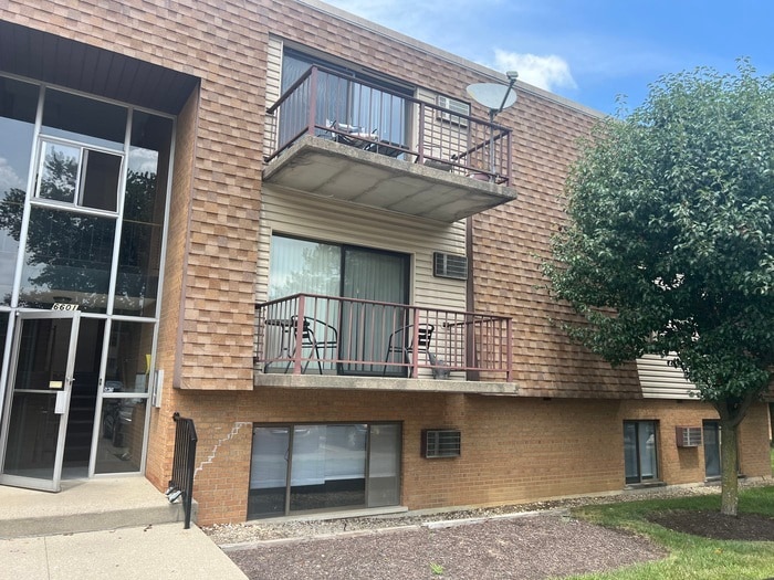
6601 Hearne Rd Unit 64
Cincinnati, OH 45248
Today
Favorites
513-854-6868
-
Bedrooms
2
-
Bathrooms
1.5
-
Square Feet
920 sq ft
-
Available
Available Now
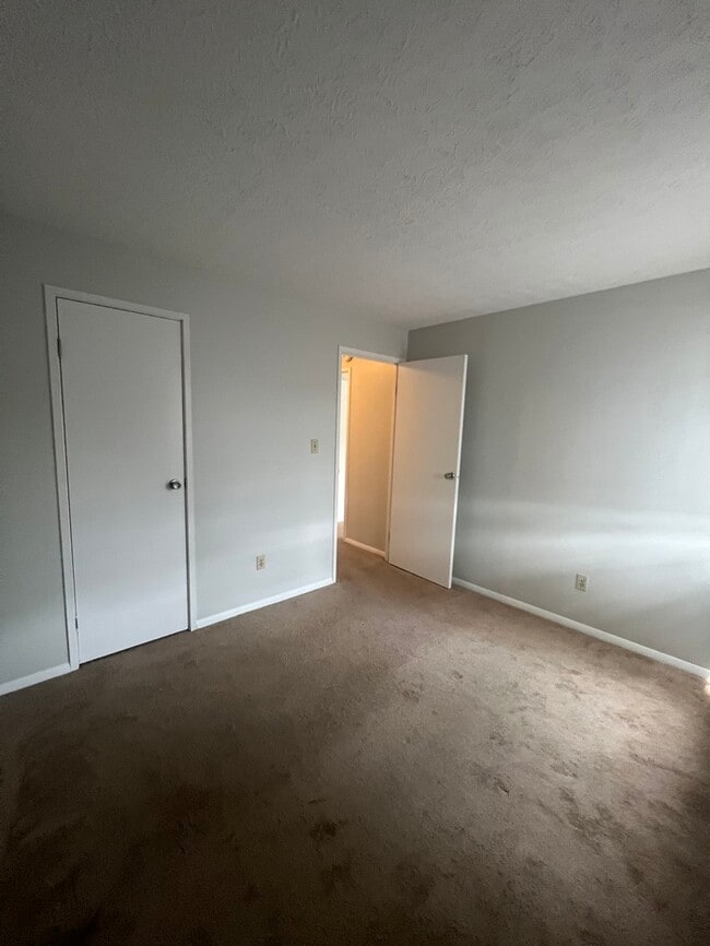
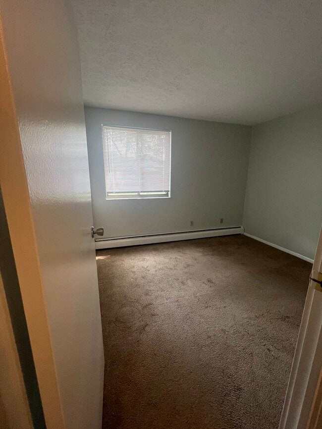
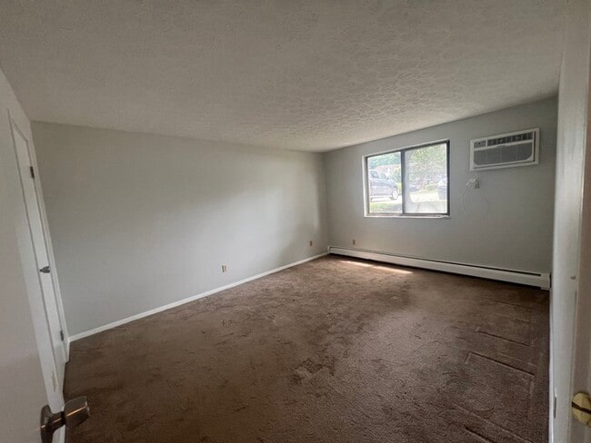
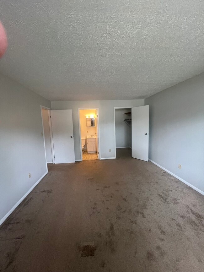
6601 Hearne Rd Unit 64

Favorites
About This Home
Available Now
Contact us to schedule a showing.
6601 Hearne Rd is a condo located in Hamilton County and the 45248 ZIP Code.
* Price shown is base rent and may not include non-optional fees and utilities. Price, availability, fees, and any applicable rent special are subject to change without notice.
* Square footage definitions vary. Displayed square footage is approximate.
Contact
- Listed by Briskman Real Estate (Mason, OH)
- Phone Number
- Contact
Location
Get Directions
Located 15 miles from downtown, the neighborhood of Dent lies on Cincinnati's west side. Dent shares the rolling, wooded hills and farming heritage of other neighborhoods in Green Township, and many families have called the neighborhood home for generations.
With easy access to nearby highways as well as proximity to excellent parks and schools, Dent attracts families and commuters alike. Although the neighborhood itself includes few restaurants and stores, adjacent communities of Bridgetown and Monfort Heights provide plenty of additional options for entertainment and dining.
Learn more about living in Dent
Education
| Colleges & Universities | Distance | ||
|---|---|---|---|
| Colleges & Universities | Distance | ||
| Drive: | 19 min | 8.1 mi | |
| Drive: | 18 min | 10.2 mi | |
| Drive: | 18 min | 11.5 mi | |
| Drive: | 19 min | 12.0 mi |
6601 Hearne Rd Unit 64 is within 19 minutes or 8.1 miles from College of Mount St. Joseph. It is also near Cincinnati State and University of Cincinnati.
Transportation options available in Cincinnati include Brewery District Station, Elm & Henry, located 12.3 miles from 6601 Hearne Rd Unit 64. 6601 Hearne Rd Unit 64 is near Cincinnati/Northern Kentucky International, located 26.3 miles or 42 minutes away.
| Transit / Subway | Distance | ||
|---|---|---|---|
| Transit / Subway | Distance | ||
| Drive: | 19 min | 12.3 mi | |
| Drive: | 19 min | 12.3 mi | |
| Drive: | 19 min | 12.4 mi | |
| Drive: | 19 min | 12.5 mi | |
| Drive: | 19 min | 12.6 mi |
| Commuter Rail | Distance | ||
|---|---|---|---|
| Commuter Rail | Distance | ||
|
|
Drive: | 18 min | 12.2 mi |
| Airports | Distance | ||
|---|---|---|---|
| Airports | Distance | ||
|
Cincinnati/Northern Kentucky International
|
Drive: | 42 min | 26.3 mi |
Time and distance from 6601 Hearne Rd Unit 64.
| Shopping Centers | Distance | ||
|---|---|---|---|
| Shopping Centers | Distance | ||
| Drive: | 4 min | 1.6 mi | |
| Drive: | 6 min | 2.3 mi | |
| Drive: | 6 min | 2.4 mi |
6601 Hearne Rd Unit 64 has 3 shopping centers within 2.4 miles, which is about a 6-minute drive. The miles and minutes will be for the farthest away property.
| Parks and Recreation | Distance | ||
|---|---|---|---|
| Parks and Recreation | Distance | ||
|
Mitchell Memorial Forest
|
Drive: | 5 min | 2.0 mi |
|
Cincinnati Astronomical Society
|
Drive: | 10 min | 3.6 mi |
|
Mt. Airy Forest
|
Drive: | 12 min | 6.4 mi |
|
Fernbank Park
|
Drive: | 18 min | 6.9 mi |
|
Farbach-Werner Nature Preserve
|
Drive: | 15 min | 9.2 mi |
6601 Hearne Rd Unit 64 has 5 parks within 9.2 miles, including Mitchell Memorial Forest, Cincinnati Astronomical Society, and Mt. Airy Forest.
| Hospitals | Distance | ||
|---|---|---|---|
| Hospitals | Distance | ||
| Drive: | 9 min | 4.9 mi | |
| Drive: | 16 min | 10.8 mi | |
| Drive: | 19 min | 12.0 mi |
6601 Hearne Rd Unit 64 has 3 hospitals within 12.0 miles, the nearest is Mercy Health - West Hospital which is 4.9 miles away and a 9 minute drive.
| Military Bases | Distance | ||
|---|---|---|---|
| Military Bases | Distance | ||
| Drive: | 73 min | 56.9 mi | |
| Drive: | 79 min | 62.0 mi | |
| Drive: | 81 min | 65.3 mi |
6601 Hearne Rd Unit 64 has 3 military bases within 65.3 miles, the nearest is Gentile Air Force Station which is 56.9 miles away and a 73 minute drive.
You May Also Like
Similar Rentals Nearby
-
-

-

-

-
 $1,5502 Beds, 1 Bath, 1,500 sq ftApartment for Rent
 -
 $2,4955 Beds, 1.5 Baths, 1,700 sq ftApartment for Rent
 -
 $1,6004 Beds, 2 Baths, 1,400 sq ftApartment for Rent
 -
 $1,6004 Beds, 1 Bath, 1,300 sq ftApartment for Rent
 -

-
 $1,2952 Beds, 2 Baths, 990 sq ftApartment for Rent
What Are Walk Score®, Transit Score®, and Bike Score® Ratings?
Walk Score® measures the walkability of any address. Transit Score® measures access to public transit. Bike Score® measures the bikeability of any address.
What is a Sound Score Rating?
A Sound Score Rating aggregates noise caused by vehicle traffic, airplane traffic and local sources
6601 Hearne Rd
Cincinnati, OH 45248