
The Fay San Jose
10 E Reed St,
San Jose, CA 95112
$2,547 - $4,655
Studio - 2 Beds
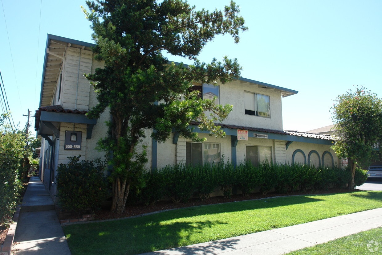
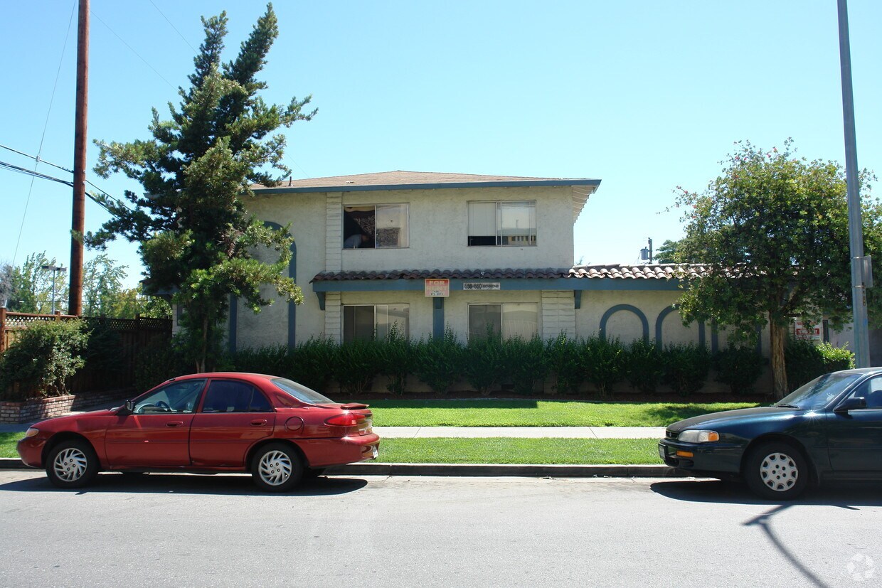

Consider living at 658-660 Richmond Avenue. This community can be found on Richmond Ave in the 95128 area of San Jose. From amenities to availability, the leasing team is ready to help you find the perfect new apartment. Come for a visit to see the current floorplan options. Stop by the leasing office to schedule your tour.
658-660 Richmond Avenue is an apartment community located in Santa Clara County and the 95128 ZIP Code. This area is served by the Campbell Union attendance zone.
Air Conditioning
Heating
Garden
Lawn
Rose Glen is a terrific neighborhood – filled with trees and well-kept houses and offering spectacular mountain views. It has a suburban vibe – so much so that you may forget that Downtown San Jose is only about three miles northeast. Rose Glen offers easy access to I-280 for fast commutes into the city for work or for fun. The city is home to such landmarks as the Tech Museum of Innovation, the San Jose Convention Center, and the Children’s Discovery Museum of San Jose.
San Jose City College, situated in the northwest corner of Rose Glen, was founded in 1921. The college offers two-year degrees as well as some technical and certificate programs. The Santa Clara Valley Medical Center is located just outside the neighborhood, bordering it along Bascom Avenue. Some shops, businesses, and restaurants are located along Bascom Avenue, and the popular Westfield Valley Fair shopping mall is adjacent to the neighborhood.
Learn more about living in Rose GlenCompare neighborhood and city base rent averages by bedroom.
| Rose Glen | San Jose, CA | |
|---|---|---|
| Studio | $1,945 | $2,308 |
| 1 Bedroom | $2,243 | $2,642 |
| 2 Bedrooms | $2,051 | $3,288 |
| 3 Bedrooms | $2,710 | $4,082 |
| Colleges & Universities | Distance | ||
|---|---|---|---|
| Colleges & Universities | Distance | ||
| Walk: | 16 min | 0.8 mi | |
| Drive: | 9 min | 4.0 mi | |
| Drive: | 9 min | 4.3 mi | |
| Drive: | 17 min | 8.6 mi |


Transportation options available in San Jose include Fruitdale Station, located 0.6 mile from 658-660 Richmond Avenue. 658-660 Richmond Avenue is near Norman Y Mineta San Jose International, located 4.5 miles or 9 minutes away, and Metro Oakland International, located 38.3 miles or 48 minutes away.
| Transit / Subway | Distance | ||
|---|---|---|---|
| Transit / Subway | Distance | ||
|
|
Walk: | 11 min | 0.6 mi |
|
|
Drive: | 2 min | 1.1 mi |
|
|
Drive: | 3 min | 1.3 mi |
|
|
Drive: | 5 min | 2.3 mi |
|
|
Drive: | 5 min | 2.6 mi |
| Commuter Rail | Distance | ||
|---|---|---|---|
| Commuter Rail | Distance | ||
| Drive: | 5 min | 2.4 mi | |
| Drive: | 5 min | 2.5 mi | |
| Drive: | 5 min | 2.5 mi | |
| Drive: | 6 min | 3.1 mi | |
| Drive: | 7 min | 3.5 mi |
| Airports | Distance | ||
|---|---|---|---|
| Airports | Distance | ||
|
Norman Y Mineta San Jose International
|
Drive: | 9 min | 4.5 mi |
|
Metro Oakland International
|
Drive: | 48 min | 38.3 mi |
Time and distance from 658-660 Richmond Avenue.
| Shopping Centers | Distance | ||
|---|---|---|---|
| Shopping Centers | Distance | ||
| Walk: | 13 min | 0.7 mi | |
| Walk: | 13 min | 0.7 mi | |
| Drive: | 3 min | 1.1 mi |
| Parks and Recreation | Distance | ||
|---|---|---|---|
| Parks and Recreation | Distance | ||
|
Guadalupe River Park and Gardens
|
Drive: | 4 min | 2.4 mi |
|
Children's Discovery Museum of San Jose
|
Drive: | 5 min | 2.5 mi |
|
McEnery Park
|
Drive: | 5 min | 2.6 mi |
|
Orchard City Green
|
Drive: | 5 min | 3.0 mi |
|
The Tech Museum of Innovation
|
Drive: | 6 min | 3.0 mi |
| Hospitals | Distance | ||
|---|---|---|---|
| Hospitals | Distance | ||
| Walk: | 14 min | 0.7 mi | |
| Drive: | 10 min | 5.5 mi | |
| Drive: | 9 min | 5.8 mi |
| Military Bases | Distance | ||
|---|---|---|---|
| Military Bases | Distance | ||
| Drive: | 22 min | 14.6 mi |
What Are Walk Score®, Transit Score®, and Bike Score® Ratings?
Walk Score® measures the walkability of any address. Transit Score® measures access to public transit. Bike Score® measures the bikeability of any address.
What is a Sound Score Rating?
A Sound Score Rating aggregates noise caused by vehicle traffic, airplane traffic and local sources


