
$2,595
/ Month
6560 Oakcreek Way
Citrus Heights, CA 95621
Today
Favorites
916-520-6391
-
Bedrooms
4
-
Bathrooms
2
-
Square Feet
1,620 sq ft
-
Available
Available Nov 1
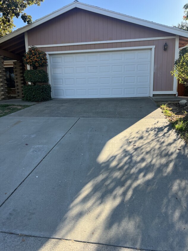
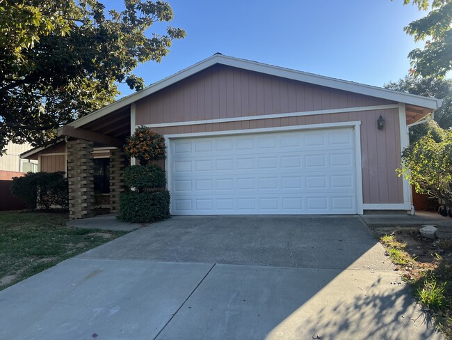
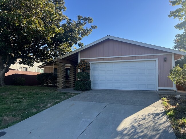
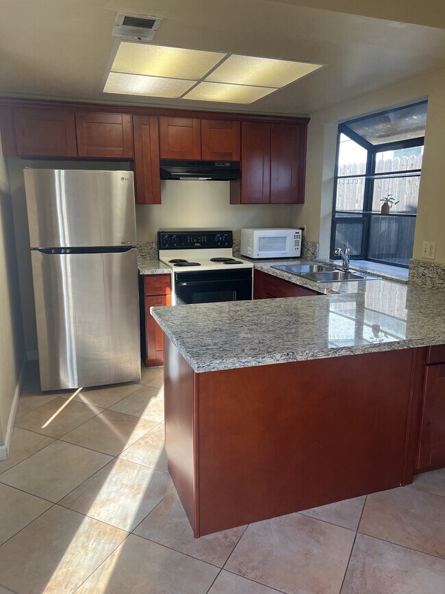
6560 Oakcreek Way

Favorites
About This Home
$2,595 deposit,
Available Nov 1
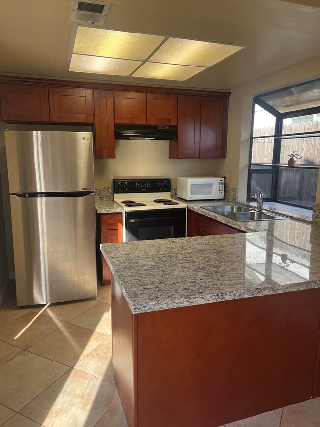
Spacious 4 bedroom, 2 bath, single story home with 2-car garage, laundry hook-up's, a private back yard, and more. Enjoy a separate living, family room, dining area, and kitchen nook. Master bedroom comes with a large master closet and back yard access. Easy access to shopping, schools, parks, restaurants and Highway 80.
6560 Oakcreek Way is a house located in Sacramento County and the 95621 ZIP Code. This area is served by the San Juan Unified attendance zone.
* Price shown is base rent. Excludes user-selected optional fees and variable or usage-based fees and required charges due at or prior to move-in or at move-out. Price, availability, fees, and any applicable rent special are subject to change without notice.
* Square footage definitions vary. Displayed square footage is approximate.
Contact
- Listed by Contact
- Phone Number
- Contact
Location
Get Directions
Defined by sun-drenched neighborhoods, tree-lined streets, and lacy palm trees against bright blue sky, Citrus Heights is a beautiful suburban city just 14 miles northeast of Downtown Sacramento. Citrus Heights residents enjoy easy access to I-80, for quick trips to Sacramento or northeast to Roseville, home of the Westfield Galleria at Roseville. Folsom Lake, a popular resort area, is minutes east of Citrus Heights.
Apartments in Citrus Heights provide a quieter option to city living while still being well within reach of everything this busy area has to offer -- including California State University, Sacramento, the Sacramento Zoo, and Sacramento International Airport. But as a busy city with plenty of businesses, shops, restaurants, and entertainment of its own, you'll find plenty to do closer to home. Go shopping at the Sunrise Mall, visit Rusch Park, home of the Historic Rusch Home and Gardens, and spend the afternoon golfing at Foothill Golf Center.
Learn more about living in Citrus Heights
Education
| Colleges & Universities | Distance | ||
|---|---|---|---|
| Colleges & Universities | Distance | ||
| Drive: | 9 min | 3.5 mi | |
| Drive: | 17 min | 10.7 mi | |
| Drive: | 24 min | 11.4 mi | |
| Drive: | 21 min | 13.2 mi |
6560 Oakcreek Way is within 9 minutes or 3.5 miles from American River College. It is also near Sierra College, Rocklin Campus and Folsom Lake College, Folsom.
Schools


Public Elementary School
Grades K-3
372 Students
Nearby
Public Elementary School
Grades K-5
331 Students
Attendance Zone
Public Middle School
Grades 6-8
605 Students
Attendance Zone
Public High School
Grades 9-12
559 Students
Attendance Zone
Private Elementary & Middle School
Grades 1-8
Nearby
Private Elementary School
Grades PK-1
Nearby
Private Elementary, Middle & High School
Grades 3-12
Nearby
School data provided by
 The GreatSchools Rating helps parents compare schools within a state based on a variety of school quality indicators and provides a helpful picture of how effectively each school serves all of its students. Ratings are on a scale of 1 (below average) to 10 (above average) and can include test scores, college readiness, academic progress, advanced courses, equity, discipline and attendance data. We also advise parents to visit schools, consider other information on school performance and programs, and consider family needs as part of the school selection process.
View GreatSchools Rating Methodology
Data provided by GreatSchools.org © 2025. All rights reserved.
View GreatSchools Rating Methodology
Data provided by GreatSchools.org © 2025. All rights reserved.
Transportation options available in Citrus Heights include Watt/I-80, located 5.6 miles from 6560 Oakcreek Way. 6560 Oakcreek Way is near Sacramento International, located 20.7 miles or 29 minutes away.
| Transit / Subway | Distance | ||
|---|---|---|---|
| Transit / Subway | Distance | ||
|
|
Drive: | 8 min | 5.6 mi |
|
|
Drive: | 10 min | 6.8 mi |
|
|
Drive: | 10 min | 6.9 mi |
| Drive: | 10 min | 7.4 mi | |
|
|
Drive: | 13 min | 7.4 mi |
| Commuter Rail | Distance | ||
|---|---|---|---|
| Commuter Rail | Distance | ||
|
|
Drive: | 14 min | 6.4 mi |
|
|
Drive: | 15 min | 9.9 mi |
| Drive: | 18 min | 14.1 mi | |
| Drive: | 28 min | 22.1 mi | |
|
|
Drive: | 29 min | 22.1 mi |
| Airports | Distance | ||
|---|---|---|---|
| Airports | Distance | ||
|
Sacramento International
|
Drive: | 29 min | 20.7 mi |
Time and distance from 6560 Oakcreek Way.
| Shopping Centers | Distance | ||
|---|---|---|---|
| Shopping Centers | Distance | ||
| Walk: | 9 min | 0.5 mi | |
| Walk: | 14 min | 0.7 mi | |
| Walk: | 18 min | 1.0 mi |
6560 Oakcreek Way has 3 shopping centers within 1.0 mile, which is about a 18-minute walk. The miles and minutes will be for the farthest away property.
| Parks and Recreation | Distance | ||
|---|---|---|---|
| Parks and Recreation | Distance | ||
|
Jensen Botanical Gardens
|
Drive: | 8 min | 4.6 mi |
|
Aerospace Museum of California
|
Drive: | 11 min | 5.6 mi |
|
Lower Sunrise Recreational Area
|
Drive: | 13 min | 6.6 mi |
|
Effie Yeaw Nature Center
|
Drive: | 14 min | 6.7 mi |
|
Rossmoor Bar County Park
|
Drive: | 15 min | 7.9 mi |
6560 Oakcreek Way has 5 parks within 7.9 miles, including Jensen Botanical Gardens, Effie Yeaw Nature Center, and Aerospace Museum of California.
| Hospitals | Distance | ||
|---|---|---|---|
| Hospitals | Distance | ||
| Walk: | 18 min | 0.9 mi | |
| Drive: | 8 min | 4.2 mi | |
| Drive: | 12 min | 8.0 mi |
6560 Oakcreek Way has 3 hospitals within 8.0 miles, the nearest is Mercy San Juan Medical Center which is 0.9 mile away and a 18 minute walk.
| Military Bases | Distance | ||
|---|---|---|---|
| Military Bases | Distance | ||
| Drive: | 18 min | 7.5 mi |
6560 Oakcreek Way is 7.5 miles and a 18 minute drive from McClellan Air Force Base.
You May Also Like
Similar Rentals Nearby


What Are Walk Score®, Transit Score®, and Bike Score® Ratings?
Walk Score® measures the walkability of any address. Transit Score® measures access to public transit. Bike Score® measures the bikeability of any address.
What is a Sound Score Rating?
A Sound Score Rating aggregates noise caused by vehicle traffic, airplane traffic and local sources

6560 Oakcreek Way
Citrus Heights, CA 95621