
$1,595
/ Month
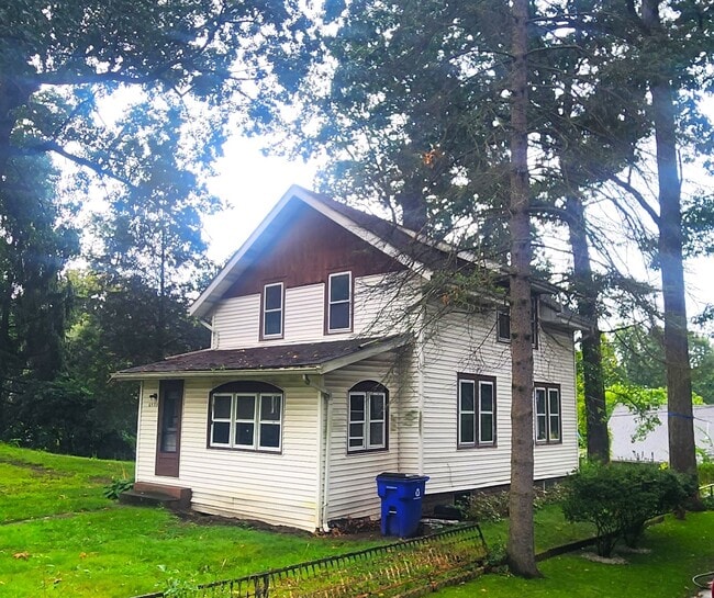
6539 Crystal Ave
Kent, OH 44240
Favorites
6539 Crystal Ave

Favorites
Check Back Soon for Upcoming Availability
| Beds | Baths | Average SF |
|---|---|---|
| 3 Bedrooms 3 Bedrooms 3 Br | 1 Bath 1 Bath 1 Ba | 1,350 SF |
Fees and Policies
The fees listed below are community-provided and may exclude utilities or add-ons. All payments are made directly to the property and are non-refundable unless otherwise specified.
-
Dogs
-
Allowed
-
-
Cats
-
Allowed
-
Property Fee Disclaimer: Based on community-supplied data and independent market research. Subject to change without notice. May exclude fees for mandatory or optional services and usage-based utilities.
About This Property
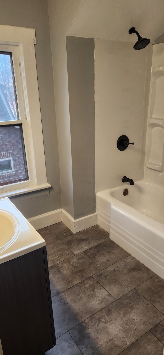
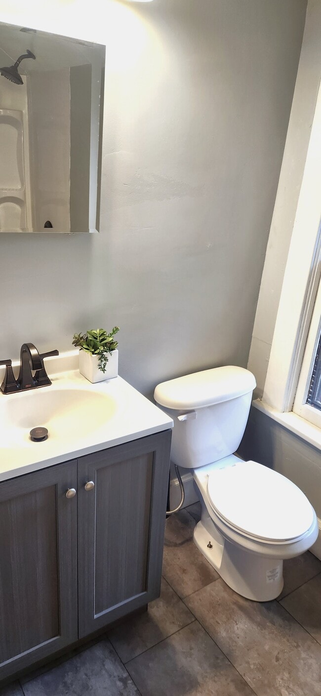
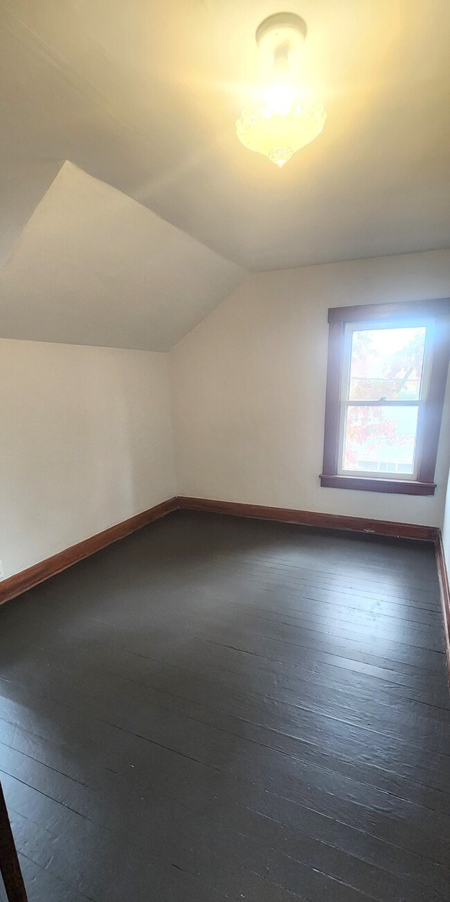
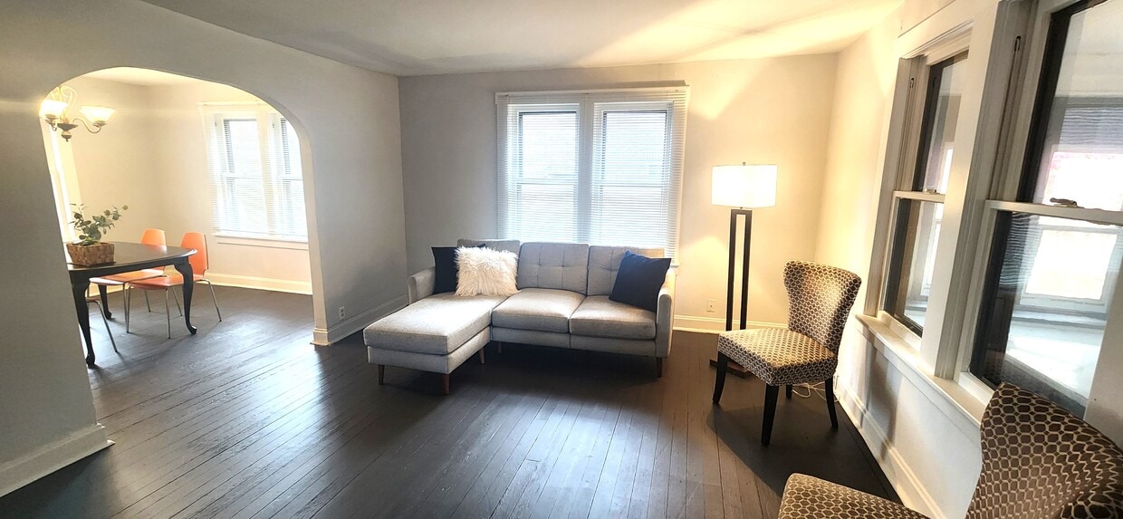
Newly renovated, spacious home - 3 bedrooms, 1 bath in Brady Lake.- close to Kent State campus, Ravenna, Streetsboro- quiet, tree nestled lot, steps to lake and park- ample parking- living room, dining room, eat-in kitchen, enclosed porch- hardwood floors- yard- available for immediate occupancyBackground check and credit history will be required. If students parents must cosign lease.
6539 Crystal Ave is a house located in Portage County and the 44240 ZIP Code. This area is served by the Kent City School District attendance zone.
6539 Crystal Ave,
Kent,
OH
44240
Kent, Ohio carries the unmistakable pulse of a college town rooted in real history, sitting along the Cuyahoga River in the heart of Portage County. Kent State University anchors daily life here, drawing a steady mix of students, educators, and healthcare workers who all call this compact, 10-square-mile city home. Originally settled in 1805 as Franklin Mills, the city grew around water-powered industry and canal trade before evolving into the academic and cultural hub it is today. Kent State's May 4 memorial remains one of the most significant historical sites in the country, a reminder that this small city has carried genuine weight in American history.
Neighborhoods close to campus offer walkable streets lined with locally owned shops and coffee houses, while areas farther from the university feel quieter and more residential.
Learn more about living in Kent
Education
| Colleges & Universities | Distance | ||
|---|---|---|---|
| Colleges & Universities | Distance | ||
| Drive: | 9 min | 2.9 mi | |
| Drive: | 30 min | 18.0 mi | |
| Drive: | 43 min | 23.8 mi | |
| Drive: | 44 min | 25.1 mi |
6539 Crystal Ave is within 9 minutes or 2.9 miles from Kent State University. It is also near University of Akron and Walsh University.
Schools


Public Elementary School
Grades PK-5
442 Students
Nearby
Public Elementary School
Grades K-5
359 Students
Attendance Zone
Public Middle School
Grades 6-8
616 Students
Attendance Zone
Public High School
Grades 9-12
1,101 Students
Attendance Zone
Private Elementary, Middle & High School
Grades PK-12
Nearby
Private Elementary School
Grades PK-5
Nearby
Private Elementary & Middle School
Grades K-8
206 Students
Nearby
School data provided by
 The GreatSchools Rating helps parents compare schools within a state based on a variety of school quality indicators and provides a helpful picture of how effectively each school serves all of its students. Ratings are on a scale of 1 (below average) to 10 (above average) and can include test scores, college readiness, academic progress, advanced courses, equity, discipline and attendance data. We also advise parents to visit schools, consider other information on school performance and programs, and consider family needs as part of the school selection process.
View GreatSchools Rating Methodology
Data provided by GreatSchools.org © 2026. All rights reserved.
View GreatSchools Rating Methodology
Data provided by GreatSchools.org © 2026. All rights reserved.
Walkability Near 6539 Crystal Ave Kent, OH 44240
Getting Around
 What do Walkability, Transit, Drivability, and Bikeability mean?
Walkability measures the walking distance to day-to-day needs.
Transit measures access to public transportation.
Drivability measures congestion, parking availability, and access to major roads.
Bikeability measures the suitability for cycling.
How It Works
What do Walkability, Transit, Drivability, and Bikeability mean?
Walkability measures the walking distance to day-to-day needs.
Transit measures access to public transportation.
Drivability measures congestion, parking availability, and access to major roads.
Bikeability measures the suitability for cycling.
How It Works
Somewhat Walkable
Walkability
20
/ 100
Minimal Public Transit
Transit
10
/ 100
Very Drivable
Drivability
80
/ 100
Fairly Bikeable
Bikeability
40
/ 100
Scores provided by
-
Soundscore™
-
/ 100
Traffic
-Airport
-Businesses
-Scores provided by
HowLoud What is a Sound Score Rating? A Sound Score Rating aggregates noise caused by vehicle traffic, airplane traffic and local sources. How It WorksYou May Also Like
Similar Rentals Nearby


What Are Walk Score®, Transit Score®, and Bike Score® Ratings?
Walk Score® measures the walkability of any address. Transit Score® measures access to public transit. Bike Score® measures the bikeability of any address.
What is a Sound Score Rating?
A Sound Score Rating aggregates noise caused by vehicle traffic, airplane traffic and local sources.
6539 Crystal Ave
Kent, OH 44240