
$900
/ Month
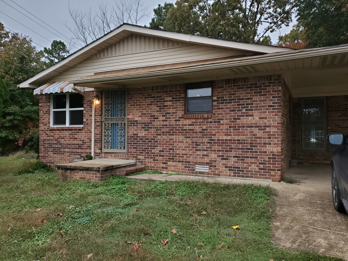
6517 W Kingshighway
Paragould, AR 72450
Favorites
6517 W Kingshighway

Favorites
Check Back Soon for Upcoming Availability
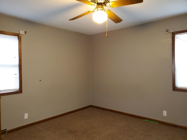
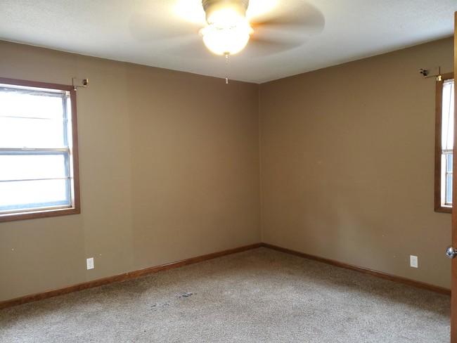
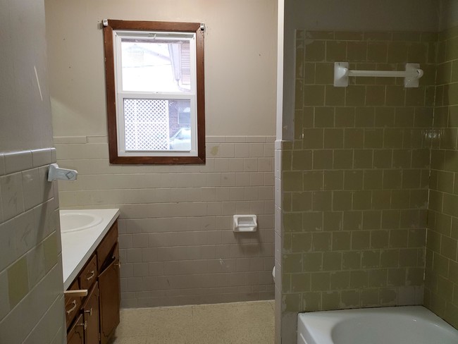
| Beds | Baths | Average SF |
|---|---|---|
| 3 Bedrooms 3 Bedrooms 3 Br | 1.5 Baths 1.5 Baths 1.5 Ba | 1,312 SF |
Fees and Policies
The fees listed below are community-provided and may exclude utilities or add-ons. All payments are made directly to the property and are non-refundable unless otherwise specified.
- Parking
-
Covered--
About This Property
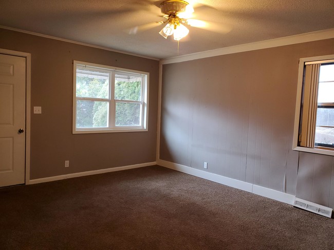
PENDING!!! Great home on the west side of town. This 3 bed 1 3/4 bath home is on the edge of town. It has gas heat and water heater. Pet-friendly with restrictions $300 non-refundable pet fee plus $20.00 a month extra in rent. This is not HUD approved.
6517 W Kingshighway is a house located in Greene County and the 72450 ZIP Code. This area is served by the Greene Co. Tech School Dist. attendance zone.
House Features
- Washer/Dryer Hookup
- Air Conditioning
- Range
6517 W Kingshighway,
Paragould,
AR
72450
Amenities
- Washer/Dryer Hookup
- Air Conditioning
- Range
Education
| Colleges & Universities | Distance | ||
|---|---|---|---|
| Colleges & Universities | Distance | ||
| Drive: | 31 min | 21.6 mi |
6517 W Kingshighway is within 31 minutes or 21.6 miles from Arkansas State University.
Schools


Public Elementary School
Grades PK-5
456 Students
Nearby
Public Elementary School
Grades K-5
489 Students
Nearby
Public Elementary & High School
Grades K-5 & 9-12
504 Students
Nearby
Public Middle School
Grades 6-8
524 Students
Nearby
Public Middle School
Grades 6-8
508 Students
Nearby
Public High School
Grades 9-12
860 Students
Attendance Zone
Private Elementary, Middle & High School
Grades PK-12
313 Students
Nearby
School data provided by
 The GreatSchools Rating helps parents compare schools within a state based on a variety of school quality indicators and provides a helpful picture of how effectively each school serves all of its students. Ratings are on a scale of 1 (below average) to 10 (above average) and can include test scores, college readiness, academic progress, advanced courses, equity, discipline and attendance data. We also advise parents to visit schools, consider other information on school performance and programs, and consider family needs as part of the school selection process.
View GreatSchools Rating Methodology
Data provided by GreatSchools.org © 2026. All rights reserved.
View GreatSchools Rating Methodology
Data provided by GreatSchools.org © 2026. All rights reserved.
Walkability Near 6517 W Kingshighway Paragould, AR 72450
Getting Around
 What do Walkability, Transit, Drivability, and Bikeability mean?
Walkability measures the walking distance to day-to-day needs.
Transit measures access to public transportation.
Drivability measures congestion, parking availability, and access to major roads.
Bikeability measures the suitability for cycling.
How It Works
What do Walkability, Transit, Drivability, and Bikeability mean?
Walkability measures the walking distance to day-to-day needs.
Transit measures access to public transportation.
Drivability measures congestion, parking availability, and access to major roads.
Bikeability measures the suitability for cycling.
How It Works
Not Walkable
Walkability
10
/ 100
Exceptionally Drivable
Drivability
100
/ 100
Not Bikeable
Bikeability
10
/ 100
Scores provided by
-
Soundscore™
-
/ 100
Traffic
-Airport
-Businesses
-Scores provided by
HowLoud What is a Sound Score Rating? A Sound Score Rating aggregates noise caused by vehicle traffic, airplane traffic and local sources. How It WorksYou May Also Like
Similar Rentals Nearby
-
-

-

-

-

-

-

-

-

-
 4 Beds, 3 Baths, 2,205 sq ft$2,500Total Monthly PriceTotal Monthly Price NewPrices include all required monthly fees.4009 Stoke Dr
What Are Walk Score®, Transit Score®, and Bike Score® Ratings?
Walk Score® measures the walkability of any address. Transit Score® measures access to public transit. Bike Score® measures the bikeability of any address.
What is a Sound Score Rating?
A Sound Score Rating aggregates noise caused by vehicle traffic, airplane traffic and local sources.

6517 W Kingshighway
Paragould, AR 72450