
Vida By Gomes
34-40 Hudson St,
Newark, NJ 07103
$1,995 - $2,300
1-3 Beds
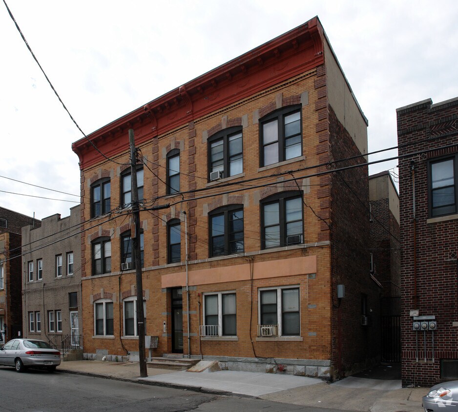
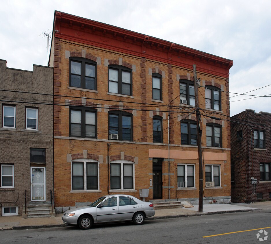

Experience Newark living at 65 Malvern St. These apartments are located in Newark on Malvern St.. The community staff is ready and waiting for you to come by to check us out. Be sure to check out the current floorplan options. Contact us or stop by today.
65 Malvern St is an apartment community located in Essex County and the 07105 ZIP Code. This area is served by the The Newark Public School District attendance zone.
Living in Newark combines urban convenience with deep cultural heritage. The city's neighborhoods each offer distinct housing options, from historic brownstones in the North Ward to contemporary apartments in Downtown. The Ironbound district showcases Portuguese and Brazilian influences through its restaurants and shops. Current rental trends show moderate increases, with average rents ranging from $1,328 for studios to $2,064 for three-bedroom units, representing slight year-over-year changes between -0.2% and 1.1%.
Branch Brook Park, featuring North America's largest collection of cherry blossom trees, provides residents with 360 acres of recreational space. The New Jersey Performing Arts Center hosts world-class performances throughout the year, while The Newark Museum of Art houses extensive American art collections.
Learn more about living in NewarkCompare neighborhood and city base rent averages by bedroom.
| South Ironbound | Newark, NJ | |
|---|---|---|
| Studio | $2,208 | $1,361 |
| 1 Bedroom | $2,230 | $1,601 |
| 2 Bedrooms | $2,654 | $1,995 |
| 3 Bedrooms | - | $2,080 |
| Colleges & Universities | Distance | ||
|---|---|---|---|
| Colleges & Universities | Distance | ||
| Drive: | 4 min | 1.8 mi | |
| Drive: | 4 min | 2.1 mi | |
| Drive: | 5 min | 2.3 mi | |
| Drive: | 13 min | 6.1 mi |


Transportation options available in Newark include Military Park, located 1.6 miles from 65 Malvern St. 65 Malvern St is near Newark Liberty International, located 3.4 miles or 6 minutes away, and LaGuardia, located 22.7 miles or 40 minutes away.
| Transit / Subway | Distance | ||
|---|---|---|---|
| Transit / Subway | Distance | ||
|
|
Drive: | 3 min | 1.6 mi |
|
|
Drive: | 4 min | 1.8 mi |
|
|
Drive: | 4 min | 2.0 mi |
|
|
Drive: | 4 min | 2.1 mi |
|
|
Drive: | 5 min | 2.2 mi |
| Commuter Rail | Distance | ||
|---|---|---|---|
| Commuter Rail | Distance | ||
|
|
Drive: | 3 min | 1.2 mi |
|
|
Drive: | 4 min | 1.5 mi |
|
|
Drive: | 6 min | 3.1 mi |
|
|
Drive: | 8 min | 3.3 mi |
|
|
Drive: | 8 min | 3.3 mi |
| Airports | Distance | ||
|---|---|---|---|
| Airports | Distance | ||
|
Newark Liberty International
|
Drive: | 6 min | 3.4 mi |
|
LaGuardia
|
Drive: | 40 min | 22.7 mi |
Scores provided by
Traffic
-Airport
-Businesses
-Scores provided by
HowLoud What is a Sound Score Rating? A Sound Score Rating aggregates noise caused by vehicle traffic, airplane traffic and local sources. How It WorksTime and distance from 65 Malvern St.
| Shopping Centers | Distance | ||
|---|---|---|---|
| Shopping Centers | Distance | ||
| Drive: | 4 min | 1.3 mi | |
| Drive: | 4 min | 1.4 mi | |
| Drive: | 4 min | 1.9 mi |
| Parks and Recreation | Distance | ||
|---|---|---|---|
| Parks and Recreation | Distance | ||
|
Newark Museum and Dreyfuss Planetarium
|
Drive: | 4 min | 2.0 mi |
|
Branch Brook Park
|
Drive: | 9 min | 4.1 mi |
|
Kearny Marsh
|
Drive: | 10 min | 4.1 mi |
|
Stephen Gregg Park
|
Drive: | 12 min | 6.8 mi |
|
G. Thomas DiDomenico Park
|
Drive: | 15 min | 8.2 mi |
| Hospitals | Distance | ||
|---|---|---|---|
| Hospitals | Distance | ||
| Drive: | 4 min | 2.1 mi | |
| Drive: | 6 min | 2.6 mi | |
| Drive: | 7 min | 3.5 mi |
| Military Bases | Distance | ||
|---|---|---|---|
| Military Bases | Distance | ||
| Drive: | 12 min | 7.2 mi | |
| Drive: | 24 min | 14.8 mi | |
| Drive: | 29 min | 16.9 mi |
What Are Walk Score®, Transit Score®, and Bike Score® Ratings?
Walk Score® measures the walkability of any address. Transit Score® measures access to public transit. Bike Score® measures the bikeability of any address.
What is a Sound Score Rating?
A Sound Score Rating aggregates noise caused by vehicle traffic, airplane traffic and local sources.


