$2,950 / Month
65 Burbank St
Boston, MA 02115
2 Weeks Ago
Favorites
-
Bedrooms
1
-
Bathrooms
1
-
Square Feet
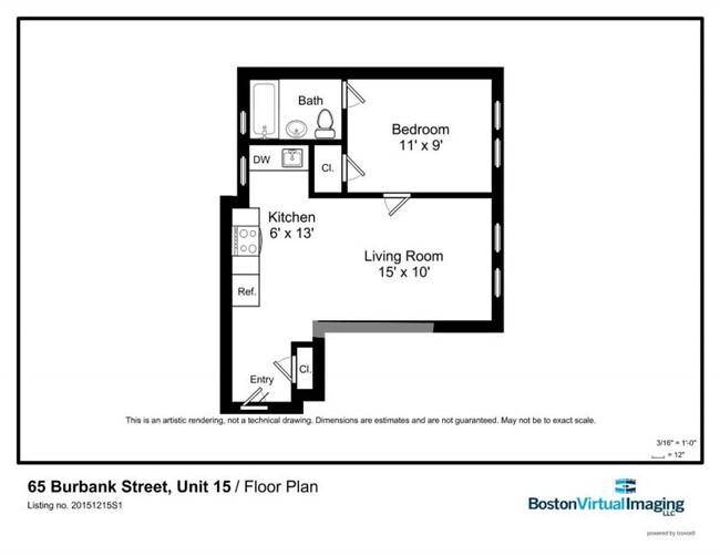
500 sq ft
65 Burbank St

Favorites
About This Home
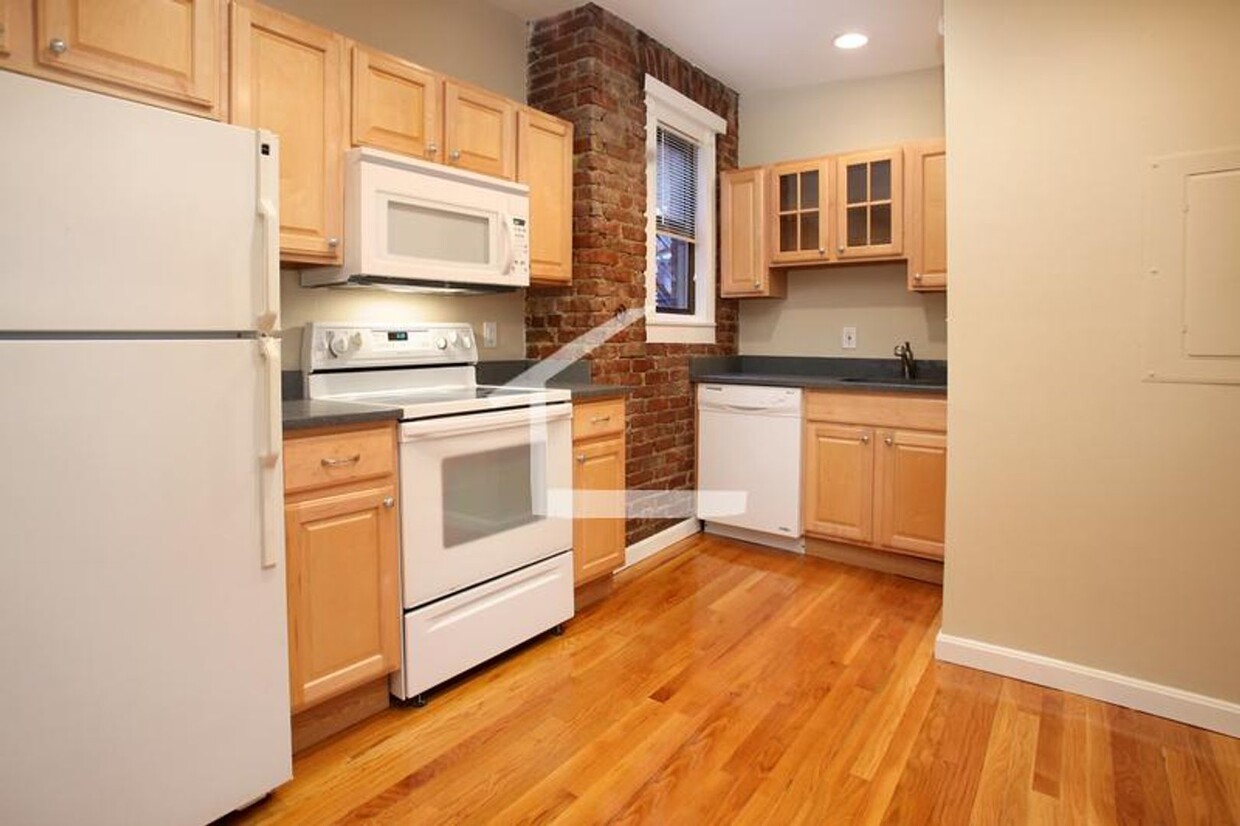
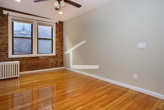
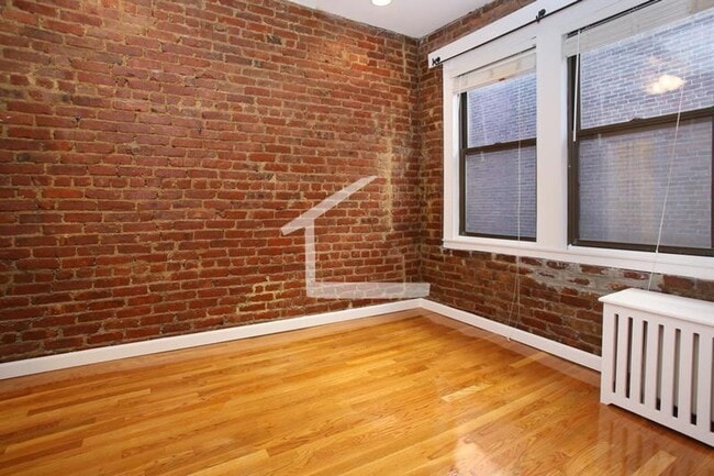
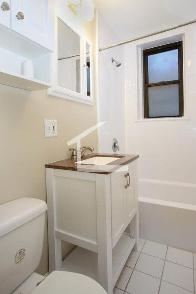
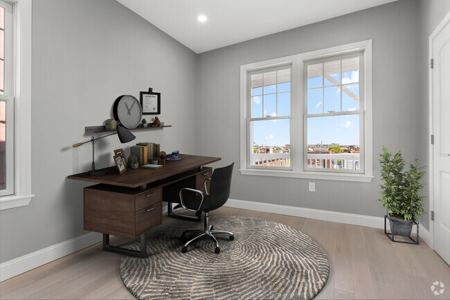
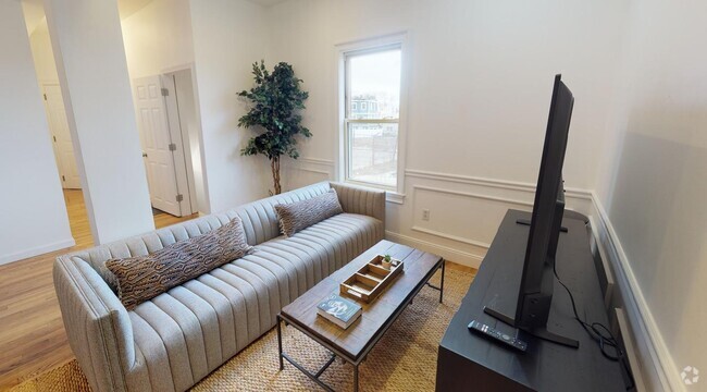
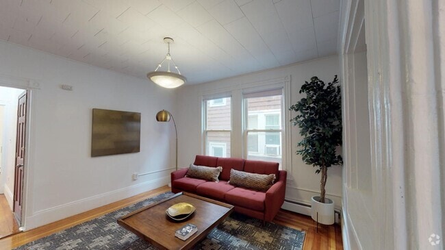
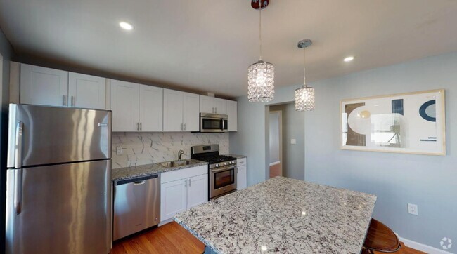
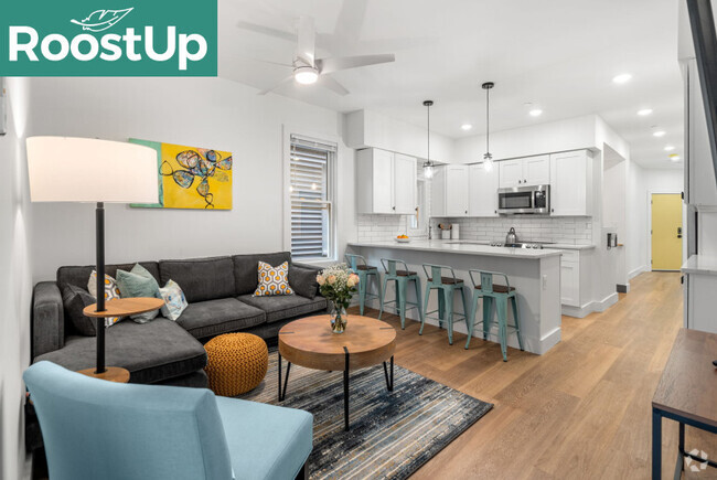
Available SEPTEMBER 1 Charming 1BR apartment in a great location for Northeastern and Berklee! Convenient to public transit, restaurants, grocery stores, parks, cafes, museums, nightlife and more! Unit features: -Hardwood floors -Heat & hot water included -Spacious kitchen with dishwasher, disposal -Large living room with exposed brick -Bedroom will easily fit a full or queen bed -Modern full bath -Ceiling fans and closets in each room -Laundry on site -Students welcome with qualified co-signers
65 Burbank St is a condo located in Suffolk County and the 02115 ZIP Code.
* Price shown is base rent and may not include non-optional fees and utilities.
Price, availability, fees, and any applicable rent special are subject to change without notice.
* Square footage definitions vary. Displayed square footage is approximate.
Location
Get Directions
Tree-filled, historic, and packed with educational opportunity, there's no other neighborhood quite like Fenway. The neighborhood may be most well-known for its titular attraction, Fenway Park, home of the Boston Red Sox. However, the area is also renowned for its sprawling greenspace. The name "Fenway" refers to the neighborhood’s lush parkway and tree-filled paths that wind lazily through the area, forming part of Frederick Law Olmsted’s “Emerald Necklace Plan” (a chain of parks throughout Boston). The Fenway opened in 1876, and its route includes the Museum of Fine Arts and the Isabella Steward Gardner Museum.
Learn more about living in Fenway
Education
| Colleges & Universities | Distance | ||
|---|---|---|---|
| Colleges & Universities | Distance | ||
| Walk: | 4 min | 0.2 mi | |
| Walk: | 11 min | 0.6 mi | |
| Walk: | 16 min | 0.8 mi | |
| Drive: | 4 min | 1.3 mi |
65 Burbank St is within 4 minutes or 0.2 mile from Berklee College of Music. It is also near Northeastern University and Wentworth Inst. of Technology.
Transportation options available in Boston include Hynes Convention Center Station, located 0.3 mile from 65 Burbank St. 65 Burbank St is near General Edward Lawrence Logan International, located 6.3 miles or 14 minutes away.
| Transit / Subway | Distance | ||
|---|---|---|---|
| Transit / Subway | Distance | ||
|
|
Walk: | 5 min | 0.3 mi |
|
|
Walk: | 6 min | 0.3 mi |
|
|
Walk: | 9 min | 0.5 mi |
|
|
Walk: | 10 min | 0.5 mi |
|
|
Walk: | 10 min | 0.5 mi |
| Commuter Rail | Distance | ||
|---|---|---|---|
| Commuter Rail | Distance | ||
|
|
Drive: | 3 min | 1.2 mi |
|
|
Drive: | 6 min | 1.3 mi |
|
|
Drive: | 6 min | 2.1 mi |
| Drive: | 5 min | 2.1 mi | |
|
|
Drive: | 6 min | 3.5 mi |
| Airports | Distance | ||
|---|---|---|---|
| Airports | Distance | ||
|
General Edward Lawrence Logan International
|
Drive: | 14 min | 6.3 mi |
Time and distance from 65 Burbank St.
| Shopping Centers | Distance | ||
|---|---|---|---|
| Shopping Centers | Distance | ||
| Walk: | 9 min | 0.5 mi | |
| Drive: | 7 min | 4.5 mi | |
| Drive: | 8 min | 4.7 mi |
65 Burbank St has 3 shopping centers within 4.7 miles, which is about a 8-minute walk. The miles and minutes will be for the farthest away property.
| Parks and Recreation | Distance | ||
|---|---|---|---|
| Parks and Recreation | Distance | ||
|
Charles River Reservation
|
Drive: | 2 min | 1.1 mi |
|
Coit Observatory
|
Drive: | 3 min | 1.5 mi |
|
Boston Public Garden
|
Drive: | 5 min | 1.6 mi |
|
Boston African American National Historic Site
|
Drive: | 6 min | 2.0 mi |
|
Roxbury Heritage State Park
|
Drive: | 6 min | 2.0 mi |
65 Burbank St has 5 parks within 2.0 miles, including Charles River Reservation, Boston Public Garden, and Coit Observatory.
| Hospitals | Distance | ||
|---|---|---|---|
| Hospitals | Distance | ||
| Drive: | 3 min | 1.3 mi | |
| Drive: | 4 min | 1.6 mi | |
| Drive: | 4 min | 1.6 mi |
65 Burbank St has 3 hospitals within 1.6 miles, the nearest is Beth Israel Deaconess Medical Center which is 1.3 miles away and a 3 minute drive.
| Military Bases | Distance | ||
|---|---|---|---|
| Military Bases | Distance | ||
| Drive: | 28 min | 15.4 mi | |
| Drive: | 29 min | 17.5 mi |
65 Burbank St is 15.4 miles from Hanscom Air Force Base, and is convenient to other military bases, including US Military Reservation.
You May Also Like
Similar Rentals Nearby

What Are Walk Score®, Transit Score®, and Bike Score® Ratings?
Walk Score® measures the walkability of any address. Transit Score® measures access to public transit. Bike Score® measures the bikeability of any address.
What is a Sound Score Rating?
A Sound Score Rating aggregates noise caused by vehicle traffic, airplane traffic and local sources

65 Burbank St
Boston, MA 02115