


$1,300
/ Month
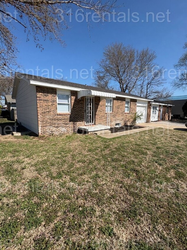
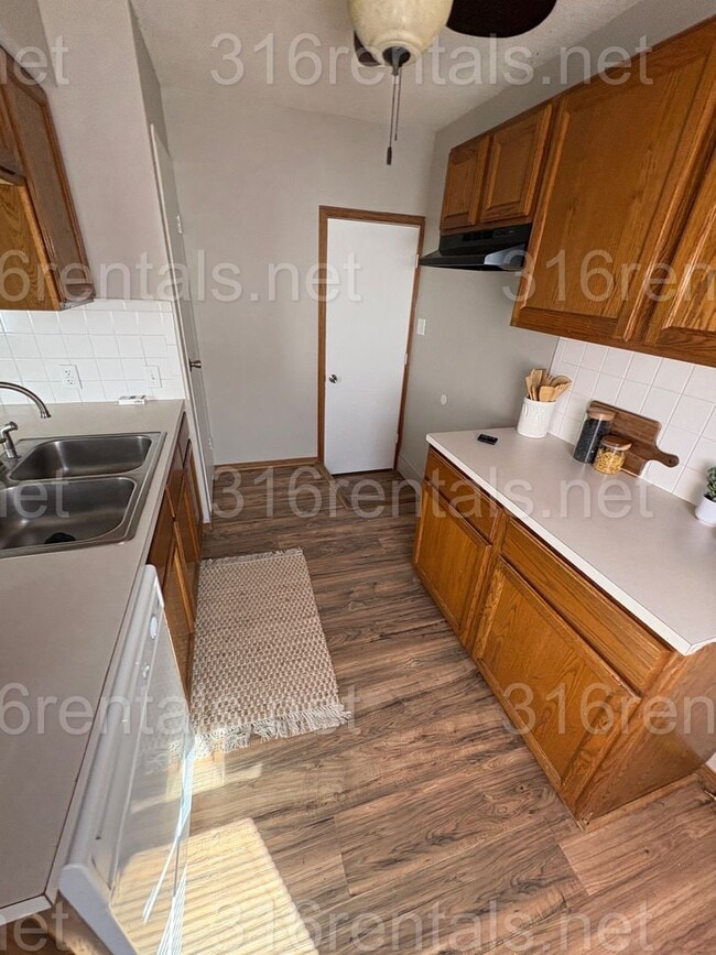
6446 Mabel St Unit 6446 S Mabel St
Wichita, KS 67217
Today
|
Edit
Favorites
316-869-6449
-
Bedrooms
4
-
Bathrooms
2
-
Square Feet
1,792 sq ft
-
Available
Available Now
6446 Mabel St Unit 6446 S Mabel St

Favorites
Contact
- Listed by 316 Rentals | 316 Rentals
- Phone Number
- Contact
Location
Get Directions
Wichita, the largest city in Kansas, combines metropolitan living with Midwestern hospitality. Located along the Arkansas River, this community celebrates its aviation heritage while offering diverse rental options. Current rental trends show one-bedroom apartments averaging $799, while two-bedroom units average $1,005. The rental market includes downtown loft apartments in converted warehouses and residential communities in established neighborhoods like College Hill and Riverside. Old Town, housed in restored 19th-century buildings, features local shops and entertainment venues.
As the "Air Capital of the World," Wichita maintains strong ties to aerospace manufacturing through major employers like Textron Aviation and Spirit AeroSystems. The city's outdoor spaces include the expansive Riverside Park and the Sedgwick County Zoo. Wichita State University enhances the northeast area with educational and cultural opportunities.
Learn more about living in Wichita
Education
| Colleges & Universities | Distance | ||
|---|---|---|---|
| Colleges & Universities | Distance | ||
| Drive: | 18 min | 10.0 mi | |
| Drive: | 17 min | 11.2 mi | |
| Drive: | 21 min | 13.1 mi | |
| Drive: | 41 min | 34.8 mi |
6446 Mabel St Unit 6446 S Mabel St is within 18 minutes or 10.0 miles from Friends University. It is also near Newman University and Wichita State University.
Getting Around
 What do Walkability, Transit, Drivability, and Bikeability mean?
Walkability measures the walking distance to day-to-day needs.
Transit measures access to public transportation.
Drivability measures congestion, parking availability, and access to major roads.
Bikeability measures the suitability for cycling.
How It Works
What do Walkability, Transit, Drivability, and Bikeability mean?
Walkability measures the walking distance to day-to-day needs.
Transit measures access to public transportation.
Drivability measures congestion, parking availability, and access to major roads.
Bikeability measures the suitability for cycling.
How It Works
Somewhat Walkable
Walkability
20
/ 100
Minimal Public Transit
Transit
0
/ 100
Exceptionally Drivable
Drivability
100
/ 100
Fairly Bikeable
Bikeability
40
/ 100
Scores provided by
Calm
Soundscore™
84
/ 100
Traffic
CalmAirport
CalmBusinesses
CalmScores provided by
HowLoud What is a Sound Score Rating? A Sound Score Rating aggregates noise caused by vehicle traffic, airplane traffic and local sources. How It WorksYou May Also Like
Similar Rentals Nearby


What Are Walk Score®, Transit Score®, and Bike Score® Ratings?
Walk Score® measures the walkability of any address. Transit Score® measures access to public transit. Bike Score® measures the bikeability of any address.
What is a Sound Score Rating?
A Sound Score Rating aggregates noise caused by vehicle traffic, airplane traffic and local sources.

6446 Mabel St
Wichita, KS 67217