
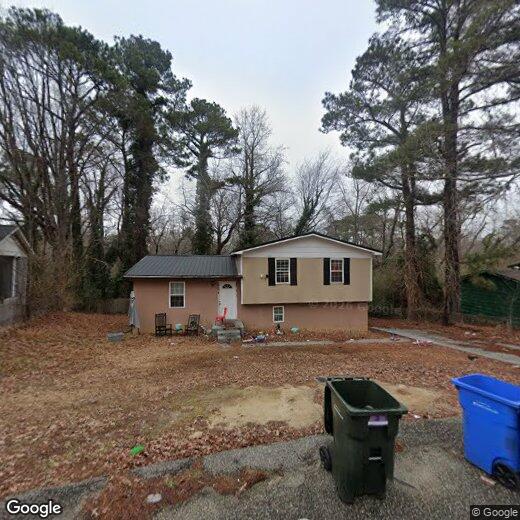
6430 Ginger Cir
6430 Ginger Cir
Fayetteville, NC 28314
Favorites
6430 Ginger Cir

Favorites
Check Back Soon for Upcoming Availability
| Beds | Baths | Average SF |
|---|---|---|
| 5 Bedrooms 5 Bedrooms 5 Br | 2 Baths 2 Baths 2 Ba | — |
6430 Ginger Cir,
Fayetteville,
NC
28314
Fayetteville sits along the Cape Fear River as one of North Carolina's largest cities, shaped in large part by its deep connection to Fort Liberty, the massive U.S. Army installation that anchors the local economy and gives the city a pulse unlike most places its size. That military presence fuels a steady demand for housing, healthcare, and retail, while Fayetteville Regional Airport and the All American Freeway keep the city well-connected to the broader region. Fayetteville has earned the All-America City Award from the National Civic League four times, a distinction that reflects genuine civic investment rather than just a slogan.
Neighborhoods here run the full spectrum. Haymount draws renters with its tree-lined historic streets and classic architecture, while Downtown offers a more walkable, urban setting near the Airborne and Special Operations Museum and Segra Stadium.
Learn more about living in Fayetteville
Education
| Colleges & Universities | Distance | ||
|---|---|---|---|
| Colleges & Universities | Distance | ||
| Drive: | 11 min | 6.5 mi | |
| Drive: | 14 min | 9.1 mi | |
| Drive: | 20 min | 12.0 mi | |
| Drive: | 61 min | 39.0 mi |
6430 Ginger Cir is within 11 minutes or 6.5 miles from Fayetteville Tech. Comm. Coll.. It is also near Fayetteville State University and Methodist University.
Walkability Near 6430 Ginger Cir Fayetteville, NC 28314
Getting Around
 What do Walkability, Transit, Drivability, and Bikeability mean?
Walkability measures the walking distance to day-to-day needs.
Transit measures access to public transportation.
Drivability measures congestion, parking availability, and access to major roads.
Bikeability measures the suitability for cycling.
How It Works
What do Walkability, Transit, Drivability, and Bikeability mean?
Walkability measures the walking distance to day-to-day needs.
Transit measures access to public transportation.
Drivability measures congestion, parking availability, and access to major roads.
Bikeability measures the suitability for cycling.
How It Works
Fairly Walkable
Walkability
40
/ 100
Very Drivable
Drivability
80
/ 100
Somewhat Bikeable
Bikeability
30
/ 100
Scores provided by
-
Soundscore™
-
/ 100
Traffic
-Airport
-Businesses
-Scores provided by
HowLoud What is a Sound Score Rating? A Sound Score Rating aggregates noise caused by vehicle traffic, airplane traffic and local sources. How It WorksYou May Also Like
Similar Rentals Nearby


What Are Walk Score®, Transit Score®, and Bike Score® Ratings?
Walk Score® measures the walkability of any address. Transit Score® measures access to public transit. Bike Score® measures the bikeability of any address.
What is a Sound Score Rating?
A Sound Score Rating aggregates noise caused by vehicle traffic, airplane traffic and local sources.
6430 Ginger Cir
Fayetteville, NC 28314