

$4,400
/ Month
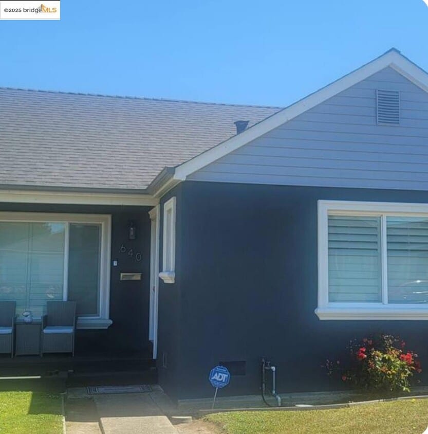
640 Myrtle Ave
South San Francisco, CA 94080
Today
|
Edit
Favorites
510-388-6780
-
Bedrooms
3
-
Bathrooms
1
-
Square Feet
1,140 sq ft
-
Available
Available Nov 6
640 Myrtle Ave

Favorites
About This Home
Available Nov 6
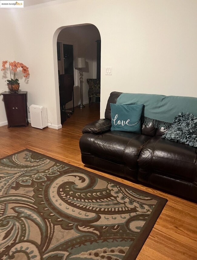
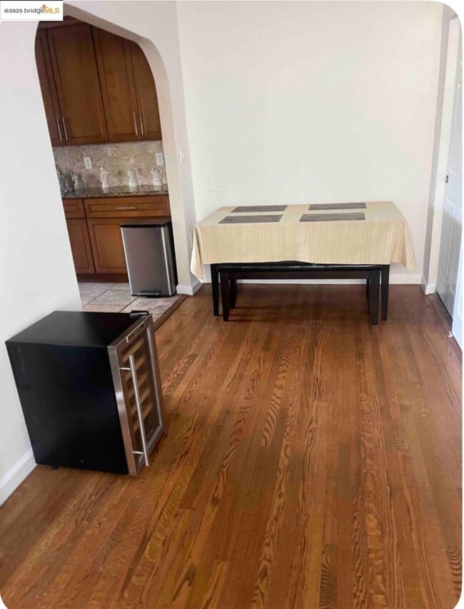
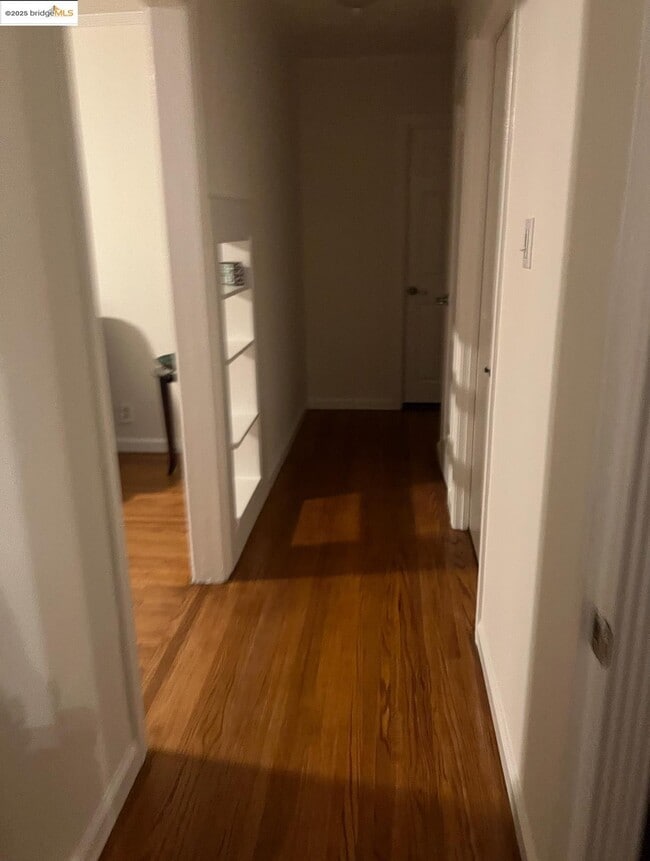
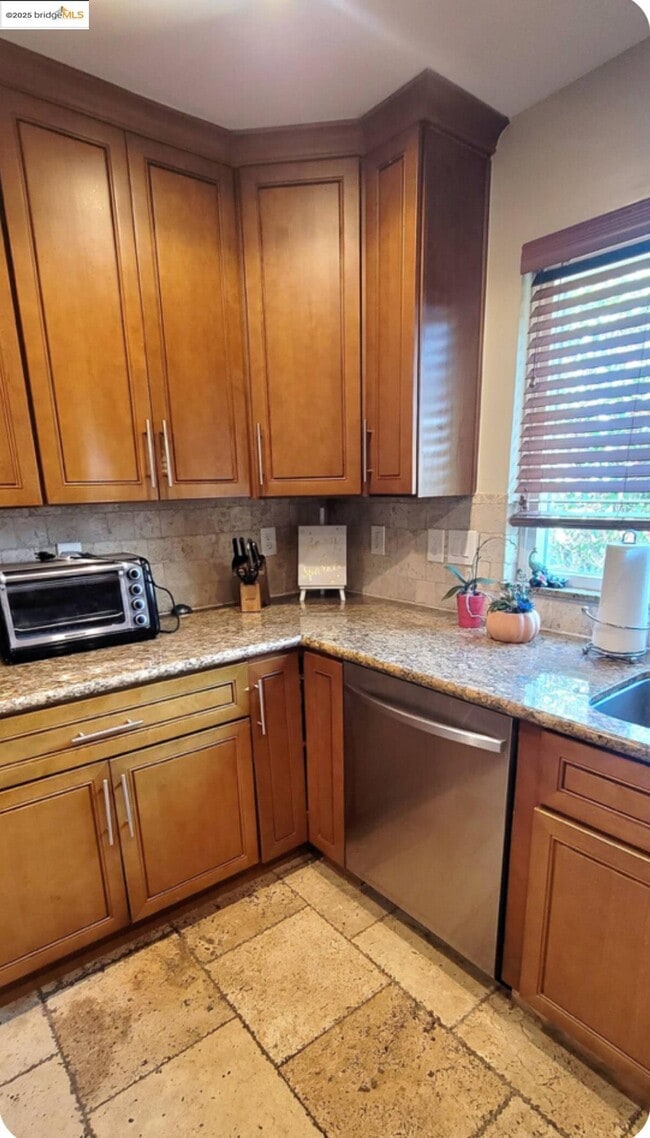
Charming 3-Bedroom Home in the Heart of South San Francisco. Welcome to 640 Myrtle Ave,a beautifully maintained 3-bedroom,1-bathroom home offering classic style,comfort,and unbeatable convenience. Step inside to discover gleaming hardwood floors throughout,complemented by tile flooring in the kitchen and bathroom. The updated kitchen features granite countertops,and abundance of cabinets. The kitchen provides both elegance and functionality — perfect for everyday living or hosting family and friends. Enjoy your own private backyard oasis,ideal for relaxing,or hosting weekend barbecues. Located just blocks away from Orange Park,one of South San Francisco’s largest recreational areas,you’ll enjoy access to a swimming pool,sports fields,tennis courts,a sculpture garden,and more — all open to the public. This home is also conveniently close to Grand Avenue shopping,offering local cafes,restaurants,and boutique stores,as well as The Shops at Tanforan mall. Close to beautiful walking trails,and easy access to BART and Caltrain for a quick commute throughout the Bay Area. Experience the perfect blend of charm,comfort,and location — your next home awaits!
640 Myrtle Ave is a house located in San Mateo County and the 94080 ZIP Code. This area is served by the South San Francisco Unified attendance zone.
* Price shown is base rent. Excludes user-selected optional fees and variable or usage-based fees and required charges due at or prior to move-in or at move-out. Price, availability, fees, and any applicable rent special are subject to change without notice.
* Square footage definitions vary. Displayed square footage is approximate.
House Features
- Washer/Dryer Hookup
- Heating
Contact
- Listed by Curtis Estes | Growing Needs Real Estate
- Phone Number
- Contact
-
Source
 bridgeMLS
Copyright© 2025 Bay East, Contra Costa, bridgeMLS. All rights reserved. All information provided by the listing agent/broker is deemed reliable but is not guaranteed and should be independently verified.
Location
Get Directions
Amenities
- Washer/Dryer Hookup
- Heating
Folks in South San Francisco have easy access to The City via I-280, the 101, or BART rail service. This fact, coupled with the much lower crime rate and the area’s many excellent schools, makes South San Francisco apartments an appealing option for commuters, particularly those raising families.
Although primarily a residential community, South San Francisco does have a fairly active downtown scene, with much of the dining and entertainment centered around the intersection of Grande Avenue and Linden Avenue and shopping centers on the south side of town.
Many parks and nature preserves are scattered around the area, including the huge Sweeney Ridge and Fairway Park just to the west of the city limits. San Francisco International Airport sits directly south of town, making it highly convenient to travel anywhere.
Learn more about living in South San Francisco
Education
| Colleges & Universities | Distance | ||
|---|---|---|---|
| Colleges & Universities | Distance | ||
| Drive: | 9 min | 4.4 mi | |
| Drive: | 14 min | 7.5 mi | |
| Drive: | 14 min | 7.9 mi | |
| Drive: | 20 min | 10.1 mi |
640 Myrtle Ave is within 9 minutes or 4.4 miles from Skyline College. It is also near City College of San Francisco and San Francisco State University.
Schools


Public Elementary School
Grades K-5
306 Students
Attendance Zone
Public Elementary School
Grades K-5
Nearby
Public Middle School
Grades 6-8
628 Students
Attendance Zone
Public High School
Grades 9-12
1,280 Students
Attendance Zone
Private Elementary & Middle School
Grades K-8
266 Students
Nearby
Private Elementary, Middle & High School
Grades 1-12
Nearby
Private Elementary & Middle School
Grades PK-8
129 Students
Nearby
School data provided by
 The GreatSchools Rating helps parents compare schools within a state based on a variety of school quality indicators and provides a helpful picture of how effectively each school serves all of its students. Ratings are on a scale of 1 (below average) to 10 (above average) and can include test scores, college readiness, academic progress, advanced courses, equity, discipline and attendance data. We also advise parents to visit schools, consider other information on school performance and programs, and consider family needs as part of the school selection process.
View GreatSchools Rating Methodology
Data provided by GreatSchools.org © 2025. All rights reserved.
View GreatSchools Rating Methodology
Data provided by GreatSchools.org © 2025. All rights reserved.
Transportation options available in South San Francisco include San Bruno Station, located 1.3 miles from 640 Myrtle Ave. 640 Myrtle Ave is near San Francisco International, located 4.7 miles or 11 minutes away, and Metro Oakland International, located 29.7 miles or 44 minutes away.
| Transit / Subway | Distance | ||
|---|---|---|---|
| Transit / Subway | Distance | ||
|
|
Drive: | 4 min | 1.3 mi |
|
|
Drive: | 4 min | 1.7 mi |
|
|
Drive: | 4 min | 1.8 mi |
| Drive: | 7 min | 3.2 mi | |
|
|
Drive: | 7 min | 3.5 mi |
| Commuter Rail | Distance | ||
|---|---|---|---|
| Commuter Rail | Distance | ||
| Drive: | 4 min | 2.0 mi | |
| Drive: | 5 min | 2.2 mi | |
| Drive: | 10 min | 6.2 mi | |
| Drive: | 11 min | 6.4 mi | |
| Drive: | 11 min | 7.2 mi |
| Airports | Distance | ||
|---|---|---|---|
| Airports | Distance | ||
|
San Francisco International
|
Drive: | 11 min | 4.7 mi |
|
Metro Oakland International
|
Drive: | 44 min | 29.7 mi |
Time and distance from 640 Myrtle Ave.
| Shopping Centers | Distance | ||
|---|---|---|---|
| Shopping Centers | Distance | ||
| Walk: | 10 min | 0.5 mi | |
| Walk: | 13 min | 0.7 mi | |
| Walk: | 16 min | 0.8 mi |
640 Myrtle Ave has 3 shopping centers within 0.8 mile, which is about a 16-minute walk. The miles and minutes will be for the farthest away property.
| Parks and Recreation | Distance | ||
|---|---|---|---|
| Parks and Recreation | Distance | ||
|
Candlestick Point State Recreation Area
|
Drive: | 15 min | 7.3 mi |
|
Bayside Park
|
Drive: | 11 min | 7.4 mi |
|
Pacifica State Beach
|
Drive: | 14 min | 7.5 mi |
|
San Bruno Mountain State Park
|
Drive: | 18 min | 7.9 mi |
|
Charles F. Hagar Planetarium
|
Drive: | 15 min | 8.2 mi |
640 Myrtle Ave has 5 parks within 8.2 miles, including San Bruno Mountain State Park, Charles F. Hagar Planetarium, and Bayside Park.
| Hospitals | Distance | ||
|---|---|---|---|
| Hospitals | Distance | ||
| Drive: | 2 min | 1.2 mi | |
| Drive: | 8 min | 4.0 mi | |
| Drive: | 9 min | 4.9 mi |
640 Myrtle Ave has 3 hospitals within 4.9 miles, the nearest is Kaiser Foundation Hospital - South San Francisco which is 1.2 miles away and a 2 minute drive.
| Military Bases | Distance | ||
|---|---|---|---|
| Military Bases | Distance | ||
| Drive: | 27 min | 12.1 mi | |
| Drive: | 27 min | 12.7 mi |
640 Myrtle Ave is 12.1 miles from East Fort Miley, and is convenient to other military bases, including West Fort Miley.
You May Also Like
Similar Rentals Nearby


What Are Walk Score®, Transit Score®, and Bike Score® Ratings?
Walk Score® measures the walkability of any address. Transit Score® measures access to public transit. Bike Score® measures the bikeability of any address.
What is a Sound Score Rating?
A Sound Score Rating aggregates noise caused by vehicle traffic, airplane traffic and local sources
640 Myrtle Ave
South San Francisco, CA 94080