
636 S Burnside
636 S Burnside,
Los Angeles,
CA
90036
-
Monthly Rent
$1,695 - $1,995
-
Bedrooms
Studio - 1 bd
-
Bathrooms
1 ba
-
Square Feet
450 - 575 sq ft

Charming, renovated 1930's historic brick building in the heart of Miracle Mile – easy walk to everything! Bright units all have central A/C, high ceilings, tons of closet space, modern, full, eat-in kitchens. This unit have beautiful hardwood Douglas fur floors, built-in desk/vanity. Laundry facility on site. Easy walk to museums, The Grove, Farmer's Market and Trader Joe's, Whole Foods, Pan Pacific Park along with plenty of local restaurants, shops and nightlife. Clean, quiet, non-smoking building. On-site management. Permit parking. Cats only - sorry, no dogs. Square foot estimated.
Highlights
- Walker's Paradise
- High Ceilings
- Fireplace
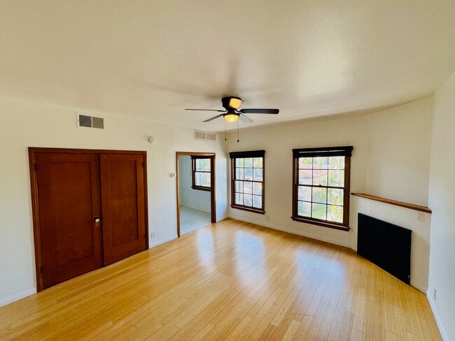
- Hardwood Floors
Pricing & Floor Plans
-
Unit #404price $1,695square feet 450availibility Soon
-
Unit #407price $1,795square feet 450availibility Soon
-
Unit 208price $1,795square feet 450availibility Soon
-
Unit 308price $1,795square feet 575availibility Soon
-
Unit 105price $1,995square feet 575availibility Soon
-
Unit #404price $1,695square feet 450availibility Soon
-
Unit #407price $1,795square feet 450availibility Soon
-
Unit 208price $1,795square feet 450availibility Soon
-
Unit 308price $1,795square feet 575availibility Soon
-
Unit 105price $1,995square feet 575availibility Soon
Fees and Policies
The fees listed below are community-provided and may exclude utilities or add-ons. All payments are made directly to the property and are non-refundable unless otherwise specified. Use the Cost Calculator to determine costs based on your needs.
-
One-Time Basics
-
Due at Move-In
-
Moveout- Cleaning FeeCharged per unit.$150
-
-
Due at Move-In
Pet policies are negotiable.
-
Street Parking
Property Fee Disclaimer: Based on community-supplied data and independent market research. Subject to change without notice. May exclude fees for mandatory or optional services and usage-based utilities.
Details
Utilities Included
-
Water
-
Trash Removal
-
Sewer
-
Air Conditioning
Property Information
-
Built in 1930
-
32 units/4 stories
About 636 S Burnside
Charming, renovated 1930's historic brick building in the heart of Miracle Mile – easy walk to everything! Bright units all have central A/C, high ceilings, tons of closet space, modern, full, eat-in kitchens. This unit have beautiful hardwood Douglas fur floors, built-in desk/vanity. Laundry facility on site. Easy walk to museums, The Grove, Farmer's Market and Trader Joe's, Whole Foods, Pan Pacific Park along with plenty of local restaurants, shops and nightlife. Clean, quiet, non-smoking building. On-site management. Permit parking. Cats only - sorry, no dogs. Square foot estimated.
636 S Burnside is an apartment community located in Los Angeles County and the 90036 ZIP Code. This area is served by the Los Angeles Unified attendance zone.
Unique Features
- Washer And Dryer Available In The Buildi
- Ask About Our Move In Special.
Contact
Community Amenities
- Laundry Facilities
Apartment Features
Air Conditioning
Dishwasher
Hardwood Floors
Refrigerator
- Air Conditioning
- Heating
- Ceiling Fans
- Smoke Free
- Cable Ready
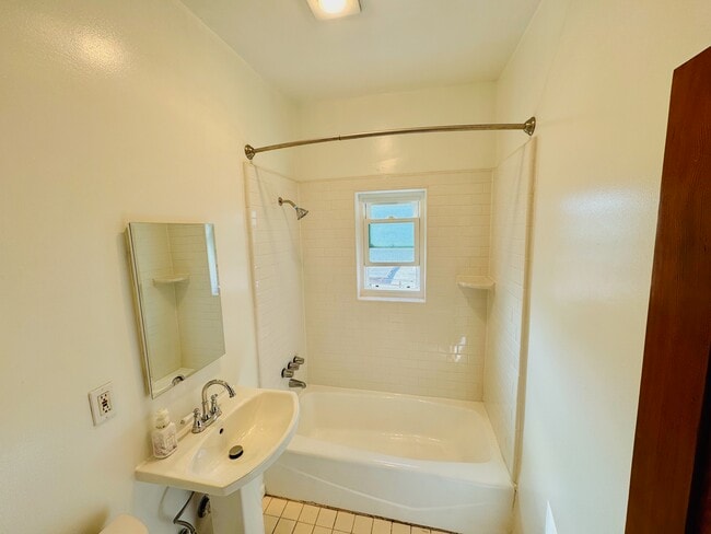
- Tub/Shower
- Fireplace
- Intercom
- Dishwasher
- Disposal
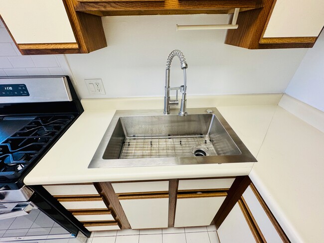
- Stainless Steel Appliances
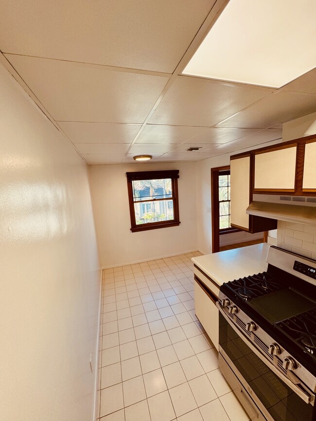
- Eat-in Kitchen
- Kitchen
- Range
- Refrigerator
- Hardwood Floors
- High Ceilings
Originally developed to appeal to people driving down Wilshire Boulevard, Miracle Mile is a vibrant community brimming with retail offerings. Despite its design for automotive traffic, Miracle Mile accommodates pedestrians as well with paved sidewalks and wide walkways.
In addition to an array of apartments available for rent, Miracle Mile is home to exciting districts like Museum Row and Museum Square. Renting an apartment in Miracle Mile affords residents quick access to the cultural attractions in Museum Row as well as the restaurants, shops, bars, and entertainment venues that populate Museum Square. The La Brea Tar Pits and Museum, Los Angeles County Museum of Art, and Petersen Automotive Museum are all part of Museum Row.
Learn more about living in Miracle MileCompare neighborhood and city base rent averages by bedroom.
| Miracle Mile | Los Angeles, CA | |
|---|---|---|
| Studio | $1,933 | $1,712 |
| 1 Bedroom | $2,507 | $2,173 |
| 2 Bedrooms | $3,333 | $3,000 |
| 3 Bedrooms | $4,789 | $4,252 |
- Laundry Facilities
- Washer And Dryer Available In The Buildi
- Ask About Our Move In Special.
- Air Conditioning
- Heating
- Ceiling Fans
- Smoke Free
- Cable Ready
- Tub/Shower
- Fireplace
- Intercom
- Dishwasher
- Disposal
- Stainless Steel Appliances
- Eat-in Kitchen
- Kitchen
- Range
- Refrigerator
- Hardwood Floors
- High Ceilings
| Monday | 12am - 12am |
|---|---|
| Tuesday | 12am - 12am |
| Wednesday | 12am - 12am |
| Thursday | 12am - 12am |
| Friday | 12am - 12am |
| Saturday | 12am - 12am |
| Sunday | 12am - 12am |
| Colleges & Universities | Distance | ||
|---|---|---|---|
| Colleges & Universities | Distance | ||
| Drive: | 8 min | 3.2 mi | |
| Drive: | 9 min | 3.7 mi | |
| Drive: | 10 min | 4.0 mi | |
| Drive: | 11 min | 4.8 mi |


View GreatSchools Rating Methodology
Data provided by GreatSchools.org © 2026. All rights reserved.
Transportation options available in Los Angeles include Wilshire/Western Station, located 2.5 miles from 636 S Burnside. 636 S Burnside is near Los Angeles International, located 10.5 miles or 22 minutes away, and Bob Hope, located 11.7 miles or 25 minutes away.
| Transit / Subway | Distance | ||
|---|---|---|---|
| Transit / Subway | Distance | ||
|
|
Drive: | 6 min | 2.5 mi |
|
|
Drive: | 7 min | 3.0 mi |
|
|
Drive: | 7 min | 3.2 mi |
|
|
Drive: | 8 min | 3.3 mi |
|
|
Drive: | 9 min | 3.9 mi |
| Commuter Rail | Distance | ||
|---|---|---|---|
| Commuter Rail | Distance | ||
|
|
Drive: | 17 min | 7.9 mi |
|
|
Drive: | 19 min | 8.1 mi |
|
|
Drive: | 20 min | 8.9 mi |
|
|
Drive: | 20 min | 9.6 mi |
|
|
Drive: | 22 min | 10.5 mi |
| Airports | Distance | ||
|---|---|---|---|
| Airports | Distance | ||
|
Los Angeles International
|
Drive: | 22 min | 10.5 mi |
|
Bob Hope
|
Drive: | 25 min | 11.7 mi |
Time and distance from 636 S Burnside.
| Shopping Centers | Distance | ||
|---|---|---|---|
| Shopping Centers | Distance | ||
| Walk: | 7 min | 0.4 mi | |
| Walk: | 10 min | 0.5 mi | |
| Walk: | 11 min | 0.6 mi |
| Parks and Recreation | Distance | ||
|---|---|---|---|
| Parks and Recreation | Distance | ||
|
La Brea Tar Pits
|
Walk: | 9 min | 0.5 mi |
|
Zimmer Children's Museum
|
Drive: | 4 min | 1.5 mi |
|
Runyon Canyon
|
Drive: | 9 min | 3.3 mi |
|
MacArthur Park Lake
|
Drive: | 11 min | 4.3 mi |
|
Kenneth Hahn State Recreation Area
|
Drive: | 14 min | 5.0 mi |
| Hospitals | Distance | ||
|---|---|---|---|
| Hospitals | Distance | ||
| Drive: | 3 min | 1.2 mi | |
| Drive: | 4 min | 1.5 mi | |
| Drive: | 6 min | 2.4 mi |
| Military Bases | Distance | ||
|---|---|---|---|
| Military Bases | Distance | ||
| Drive: | 22 min | 12.1 mi |
636 S Burnside Photos
-
636 S Burnside
-
Large windows and fireplace
-
New Stainless single basin
-
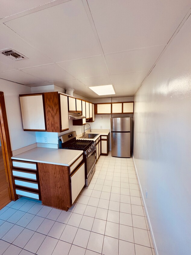
New Stainless Range
-
Newly Renovated Bathroom
-
second closet
-
First Closet
-
-
coat closet and ceiling fan
While 636 S Burnside does not provide in‑unit laundry, on‑site laundry facilities are available for shared resident use.
Select utilities are included in rent at 636 S Burnside, including water, trash removal, sewer, and air conditioning. Residents are responsible for any other utilities not listed.
Parking is available at 636 S Burnside. Contact this property for details.
636 S Burnside has studios to one-bedroom with rent ranges from $1,695/mo. to $1,995/mo.
636 S Burnside does not allow pets, though service animals are always welcome in accordance with applicable laws.
A good rule of thumb is to spend no more than 30% of your gross income on rent. Based on the lowest available rent of $1,695 for a studio, you would need to earn about $67,800 per year to qualify. Want to double-check your budget? Calculate how much rent you can afford with our Rent Affordability Calculator.
636 S Burnside is not currently offering any rent specials. Check back soon, as promotions change frequently.
While 636 S Burnside does not offer Matterport 3D tours, renters can request a tour directly through our online platform.
What Are Walk Score®, Transit Score®, and Bike Score® Ratings?
Walk Score® measures the walkability of any address. Transit Score® measures access to public transit. Bike Score® measures the bikeability of any address.
What is a Sound Score Rating?
A Sound Score Rating aggregates noise caused by vehicle traffic, airplane traffic and local sources
636 S Burnside
Los Angeles, CA 90036
Property Manager Responded