
Venue Residences
3688 Overland Ave,
Los Angeles, CA 90034
$2,625 - $5,650
Studio - 2 Beds

Section 8 applicants Welcome!! " Two and Three bedrooms available. large units with tile floors, nice kitchen counters , few units bathroom have been fully renovated. Units come with fan on each room, spacious closet in bedroom and hallway. Convenient location walking distances to transportation, schools, 10 minutes driving to LAX airport. Views available all day and weekends, Call Diana at (to confirm your appointment .
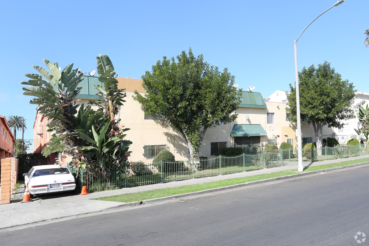
6329 10th Ave is an apartment community located in Los Angeles County and the 90043 ZIP Code. This area is served by the Los Angeles Unified Rocp School District attendance zone.
Tile Floors
Security System
Smoke Free
Oven
Found in the Inglewood area of Los Angeles County, Park Mesa spans nearly three square miles between Downtown Los Angeles, which is 11 miles east, and Los Angeles International Airport, six miles west.
Park Mesa Heights hosts a variety of events and festivals. Inglewood's annual Dr. Martin Luther King Jr. Day Celebration brings residents out to commemorate, while the Slauson Indoor Swap Meet draws bargain hunters. With L.A. beaches lining the Pacific Ocean just eight miles away, Park Mesa Heights provides coastal breezes and easy access to sand and surf.
Learn more about living in Park Mesa HeightsCompare neighborhood and city base rent averages by bedroom.
| Park Mesa Heights | Los Angeles, CA | |
|---|---|---|
| Studio | $1,383 | $1,710 |
| 1 Bedroom | $1,448 | $2,182 |
| 2 Bedrooms | $1,890 | $3,017 |
| 3 Bedrooms | $2,218 | $4,322 |
| Colleges & Universities | Distance | ||
|---|---|---|---|
| Colleges & Universities | Distance | ||
| Drive: | 10 min | 5.0 mi | |
| Drive: | 10 min | 5.6 mi | |
| Drive: | 12 min | 5.7 mi | |
| Drive: | 11 min | 6.7 mi |


Transportation options available in Los Angeles include Hyde Park Station, located 0.6 mile from 6329 10th Ave. 6329 10th Ave is near Los Angeles International, located 6.4 miles or 13 minutes away, and Bob Hope, located 18.5 miles or 32 minutes away.
| Transit / Subway | Distance | ||
|---|---|---|---|
| Transit / Subway | Distance | ||
| Walk: | 11 min | 0.6 mi | |
| Drive: | 3 min | 1.3 mi | |
| Drive: | 3 min | 1.7 mi | |
| Drive: | 3 min | 2.0 mi | |
| Drive: | 5 min | 2.2 mi |
| Commuter Rail | Distance | ||
|---|---|---|---|
| Commuter Rail | Distance | ||
|
|
Drive: | 16 min | 10.0 mi |
|
|
Drive: | 18 min | 10.2 mi |
|
|
Drive: | 22 min | 12.1 mi |
| Drive: | 19 min | 14.1 mi | |
|
|
Drive: | 22 min | 14.7 mi |
| Airports | Distance | ||
|---|---|---|---|
| Airports | Distance | ||
|
Los Angeles International
|
Drive: | 13 min | 6.4 mi |
|
Bob Hope
|
Drive: | 32 min | 18.5 mi |
Scores provided by
Traffic
-Airport
-Businesses
-Scores provided by
HowLoud What is a Sound Score Rating? A Sound Score Rating aggregates noise caused by vehicle traffic, airplane traffic and local sources. How It WorksTime and distance from 6329 10th Ave.
| Shopping Centers | Distance | ||
|---|---|---|---|
| Shopping Centers | Distance | ||
| Walk: | 12 min | 0.6 mi | |
| Drive: | 4 min | 1.8 mi |
| Parks and Recreation | Distance | ||
|---|---|---|---|
| Parks and Recreation | Distance | ||
|
Natural History Museum of LA County
|
Drive: | 9 min | 4.8 mi |
|
Kenneth Hahn State Recreation Area
|
Drive: | 12 min | 4.9 mi |
|
Exposition Park Rose Garden
|
Drive: | 9 min | 4.9 mi |
|
California Science Center
|
Drive: | 10 min | 5.1 mi |
|
Augustus Hawkins Natural Park
|
Drive: | 9 min | 5.2 mi |
| Hospitals | Distance | ||
|---|---|---|---|
| Hospitals | Distance | ||
| Drive: | 7 min | 3.4 mi | |
| Drive: | 11 min | 6.5 mi | |
| Drive: | 12 min | 7.3 mi |
| Military Bases | Distance | ||
|---|---|---|---|
| Military Bases | Distance | ||
| Drive: | 13 min | 7.3 mi | |
| Drive: | 31 min | 21.9 mi | |
| Drive: | 34 min | 24.2 mi |
Pets Allowed In Unit Washer & Dryer Maintenance on site Heat Controlled Access Elevator
What Are Walk Score®, Transit Score®, and Bike Score® Ratings?
Walk Score® measures the walkability of any address. Transit Score® measures access to public transit. Bike Score® measures the bikeability of any address.
What is a Sound Score Rating?
A Sound Score Rating aggregates noise caused by vehicle traffic, airplane traffic and local sources.
6329 10th Ave
Los Angeles, CA 90043


