
Presidential Towers
555 W Madison St,
Chicago, IL 60661
$1,690 - $6,604
Studio - 2 Beds
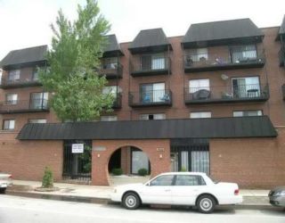
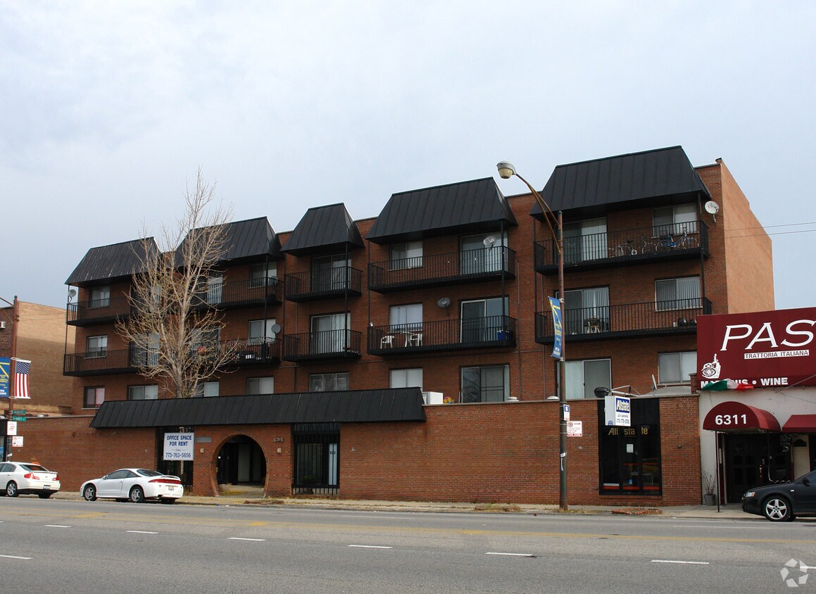
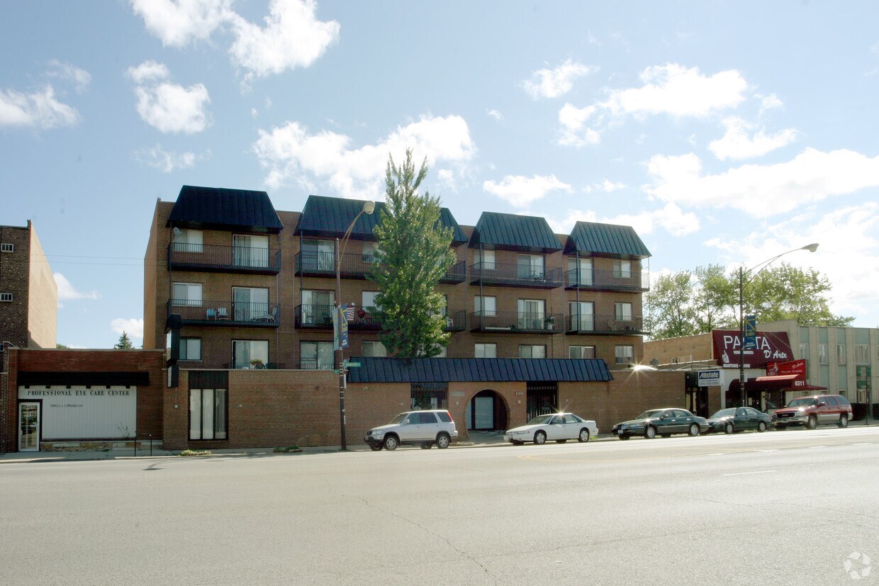

Experience a new place to live at 6313 N Milwaukee Ave in Chicago. The location in Chicago's 60646 area has much to offer its residents. Make sure you to check out the current floorplan options. The professional leasing team is ready and waiting for you to come by for a tour. Drop by 6313 N Milwaukee Ave today.
6313 N Milwaukee Ave is an apartment community located in Cook County and the 60646 ZIP Code. This area is served by the Chicago Public Schools attendance zone.
The community of Norwood Park encompasses a handful of green spaces and parks, like Oriole Park. Residents enjoy this park because of its thoughtful amenities such as a playground, splash pool, athletic fields and facilities. During the Memorial Day holiday weekend, a large parade is held by the community – a tradition going on 90+ years!
Norwood Park’s historic district is the home of Chicago’s oldest dwelling, the Noble-Seymour-Crippen House. Golf enthusiasts will appreciate the proximity to Edgebrook Golf Course. There’s a diverse selection of restaurants located throughout Norwood Park, and residents are comforted by the accessibility to subway stations and Interstate 90. The Fashion Outlets of Chicago and O’Hare International Airport are both a short distance away.
Learn more about living in Norwood ParkCompare neighborhood and city base rent averages by bedroom.
| Norwood Park | Chicago, IL | |
|---|---|---|
| Studio | $850 | $1,658 |
| 1 Bedroom | $983 | $2,054 |
| 2 Bedrooms | $1,194 | $2,599 |
| 3 Bedrooms | - | $3,112 |
| Colleges & Universities | Distance | ||
|---|---|---|---|
| Colleges & Universities | Distance | ||
| Drive: | 8 min | 3.0 mi | |
| Drive: | 7 min | 3.5 mi | |
| Drive: | 9 min | 4.7 mi | |
| Drive: | 10 min | 5.4 mi |


Transportation options available in Chicago include Jefferson Park Station, located 3.0 miles from 6313 N Milwaukee Ave. 6313 N Milwaukee Ave is near Chicago O'Hare International, located 7.5 miles or 14 minutes away, and Chicago Midway International, located 15.8 miles or 29 minutes away.
| Transit / Subway | Distance | ||
|---|---|---|---|
| Transit / Subway | Distance | ||
|
|
Drive: | 6 min | 3.0 mi |
|
|
Drive: | 7 min | 3.7 mi |
|
|
Drive: | 7 min | 3.7 mi |
|
|
Drive: | 9 min | 5.7 mi |
|
|
Drive: | 11 min | 6.4 mi |
| Commuter Rail | Distance | ||
|---|---|---|---|
| Commuter Rail | Distance | ||
|
|
Drive: | 4 min | 1.4 mi |
|
|
Drive: | 3 min | 1.4 mi |
|
|
Drive: | 4 min | 2.1 mi |
|
|
Drive: | 4 min | 2.3 mi |
|
|
Drive: | 5 min | 2.5 mi |
| Airports | Distance | ||
|---|---|---|---|
| Airports | Distance | ||
|
Chicago O'Hare International
|
Drive: | 14 min | 7.5 mi |
|
Chicago Midway International
|
Drive: | 29 min | 15.8 mi |
Scores provided by
Traffic
-Airport
-Businesses
-Scores provided by
HowLoud What is a Sound Score Rating? A Sound Score Rating aggregates noise caused by vehicle traffic, airplane traffic and local sources. How It WorksTime and distance from 6313 N Milwaukee Ave.
| Shopping Centers | Distance | ||
|---|---|---|---|
| Shopping Centers | Distance | ||
| Walk: | 2 min | 0.1 mi | |
| Walk: | 15 min | 0.8 mi | |
| Drive: | 4 min | 1.4 mi |
| Parks and Recreation | Distance | ||
|---|---|---|---|
| Parks and Recreation | Distance | ||
|
Caldwell Woods
|
Walk: | 4 min | 0.2 mi |
|
Norwood Park
|
Drive: | 4 min | 1.4 mi |
|
Bunker Hill / Clayton Smith Preserves
|
Drive: | 4 min | 2.0 mi |
|
Indian Road Woods
|
Drive: | 4 min | 2.2 mi |
|
Laramie Park
|
Drive: | 5 min | 2.5 mi |
| Hospitals | Distance | ||
|---|---|---|---|
| Hospitals | Distance | ||
| Drive: | 5 min | 2.4 mi | |
| Drive: | 8 min | 3.3 mi | |
| Drive: | 8 min | 3.9 mi |
| Military Bases | Distance | ||
|---|---|---|---|
| Military Bases | Distance | ||
| Drive: | 22 min | 15.4 mi | |
| Drive: | 38 min | 27.3 mi | |
| Drive: | 44 min | 29.2 mi |
What Are Walk Score®, Transit Score®, and Bike Score® Ratings?
Walk Score® measures the walkability of any address. Transit Score® measures access to public transit. Bike Score® measures the bikeability of any address.
What is a Sound Score Rating?
A Sound Score Rating aggregates noise caused by vehicle traffic, airplane traffic and local sources.

6313 N Milwaukee Ave
Chicago, IL 60646


